Jefferson Parish (French: Paroisse de Jefferson; Spanish: Parroquia de Jefferson) is a parish in the U.S. state of Louisiana. As of the 2020 census, the population was 440,781. Its parish seat is Gretna, its largest community is Metairie, and its largest incorporated city is Kenner. Jefferson Parish is included in the Greater New Orleans area.
| Name: | Jefferson Parish |
|---|---|
| FIPS code: | 22-051 |
| State: | Louisiana |
| Founded: | February 11, 1825 |
| Named for: | Thomas Jefferson |
| Seat: | Gretna |
| Total Area: | 665 sq mi (1,720 km²) |
| Land Area: | 296 sq mi (770 km²) |
| Total Population: | 440,781 |
| Population Density: | 1,489.125/sq mi (574.954/km²) |
| Time zone: | UTC−6 (Central) |
| Summer Time Zone (DST): | UTC−5 (CDT) |
| Website: | www.jeffparish.net |
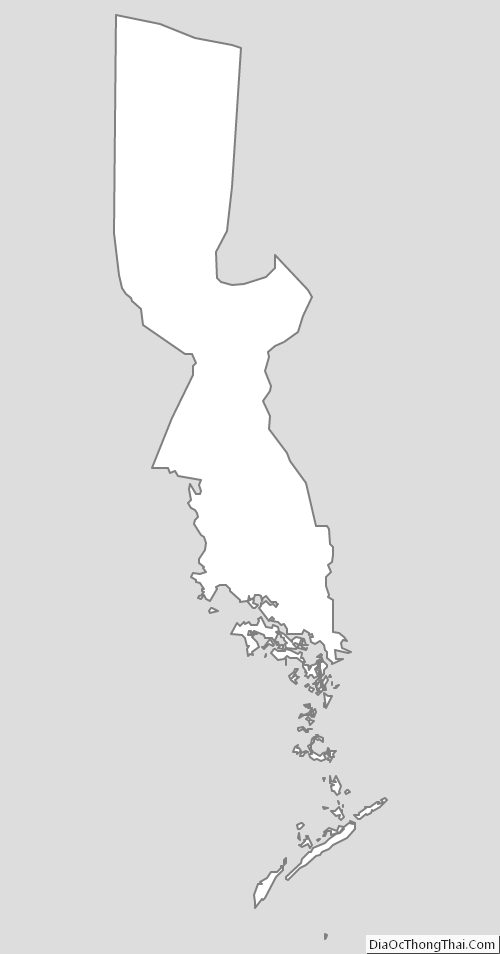
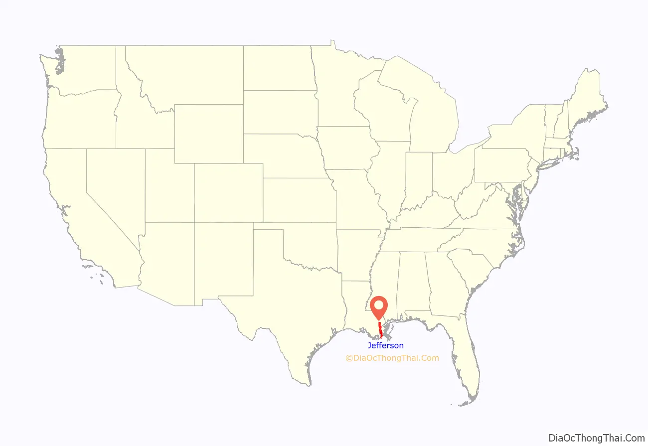
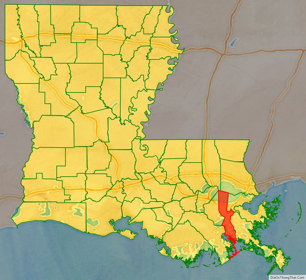
Jefferson Parish location map. Where is Jefferson Parish?
History
1825 to 1940
Jefferson Parish was named in honor of U.S. President Thomas Jefferson of Virginia when the parish was established by the Louisiana Legislature on February 11, 1825, a year before Jefferson died. A bronze statue of Jefferson stands at the entrance of the General Government Complex on Derbigny Street in Gretna. The parish seat was in the city of Lafayette, until that area was annexed by New Orleans in 1852. In that year the parish government moved to Carrollton, where it remained for twenty-two years.
Originally, this parish was larger than it is today, running from Felicity Street in New Orleans to the St. Charles Parish line. However, as New Orleans grew, it absorbed the cities of Lafayette, Jefferson City, Carrollton, and several unincorporated areas (faubourgs). These became part of Orleans Parish. The present borders between Jefferson Parish and Orleans Parish were set in 1874. The Jefferson Parish seat was moved to Gretna at the same time. (The historic city of Lafayette in Jefferson Parish, as it was recorded in U.S. census records until 1870, should not be confused with Lafayette, Louisiana, in Lafayette Parish.)
1940 to 2000
From the 1940s to the 1970s, Jefferson’s population swelled with an influx of middle-class white families from Orleans Parish. The parish’s population doubled in size from 1940 to 1950 and again from 1950 to 1960 as the parents behind the post–World War II baby boom, profiting from rising living standards and dissatisfied with their old neighborhoods, chose relocation to new neighborhoods of detached single-family housing. By the 1960s, rising racial tensions in New Orleans complicated the impetus behind the migration, as many new arrivals sought not only more living space but also residence in a political jurisdiction independent from New Orleans proper.
The earliest postwar subdivisions were developed on the Eastbank of Jefferson Parish (“East Jefferson”) along the pre-existing Jefferson Highway and Airline Highway routes, often relatively far-removed from the New Orleans city line, as land prices were lower further away from New Orleans and land assembly was easier. The completion of Veterans Highway in the late 1950s, following a route parallel to Airline but further north, stimulated more development. The arrival of I-10 in the early 1960s resulted in the demolition of some homes in the Old Metairie neighborhood, where development began in the 1920s, but resulted in even easier access to suburban East Jefferson.
In the portion of Jefferson Parish on the Westbank of the Mississippi River (“West Jefferson”), large-scale suburban development commenced with the completion, in 1958, of the Greater New Orleans Bridge crossing the Mississippi River at downtown New Orleans. Terrytown, within the city limits of Gretna, was the first large subdivision to be developed. Subsequent development has been extensive, taking place within Harvey, Marrero, Westwego and Avondale.
Similar to the development trajectory observed by other U.S. suburban areas, Jefferson began to enjoy a significant employment base by the 1970s and 1980s, shedding its earlier role as a simple bedroom community. In East Jefferson, the Causeway Boulevard corridor grew into a commercial office node, while the Elmwood neighborhood developed as a center for light manufacturing and distribution. By the mid-1990s, Jefferson Parish was exhibiting some of the symptoms presented by inner-ring suburbs throughout the United States. Median household income growth slowed, even trailing income growth rates in New Orleans proper, such that the inner city began to narrow the gap in median household income, a gap at its widest at the time of the 1980 census. St. Tammany Parish and, to a lesser extent, St. Charles Parish began to attract migrants from New Orleans, and increasingly even from Jefferson Parish itself. These trends were catalyzed by Hurricane Katrina, which destroyed much of New Orleans’ low-income housing and propelled further numbers of lower-income individuals into Jefferson Parish.
Despite these challenges, Jefferson Parish still contains the largest number of middle class residents in metropolitan New Orleans and acts as the retail hub for the entire metro area.
Hurricane Katrina (2005)
Even though Jefferson Parish was affected by Hurricane Katrina, it has rebounded more quickly than Orleans Parish, since the devastation was not as severe. The parish has a current population of 432,000, which is 15,000 fewer people than was recorded by the 2000 U.S. census. New Orleans’ Katrina-provoked population loss has resulted in Jefferson Parish becoming the second most populous parish behind East Baton Rouge Parish, center of the Baton Rouge metropolitan area.
With the landfall of Hurricane Katrina on August 29, 2005, Jefferson Parish took a hard hit. On the East Bank, widespread flooding occurred, especially in the eastern part of the parish, as well as much wind damage. Schools also were reported to have been severely damaged. On the West Bank, there was little to no flooding, though there was still much wind damage. As a result, the Jefferson Parish Council temporarily moved the parish government to Baton Rouge. Evacuees of Jefferson Parish were told that they could expect to be able to go back to their homes starting Monday, September 5, 2005, between the hours of 6 a.m. CDT and 6 p.m. CDT, but would have to return to their places of evacuation because life in the area was not sustainable. There were no open grocery stores or gas stations, and almost the entire parish had no electric, water, or sewerage services. Moreover, evacuations out of New Orleans were continuing to be staged from the heart of Metairie at the intersection of Interstate 10 and Causeway Boulevard, and traffic throughout the area was primarily restricted to emergency and utility vehicles.
On September 4, Jefferson Parish President Aaron Broussard broke down on Meet the Press
By the following weekend, the local electrical utility, Entergy, had restored power to large swaths of Jefferson Parish, and the parish public works department had restored water and sewer service to most of the areas with power. East Jefferson General Hospital never ceased operation, even through the storm. Nevertheless, Mr. Broussard continued to discourage residents from returning until all major streets were clear of downed trees, powerlines and major debris. The parish’s initial focus was on helping businesses through the “Jumpstart Jefferson” program that allowed business operators into the parish before residents. Nevertheless, some independent-minded residents began moving back into the parish even before Broussard issued a formal “all-clear”, and some gas stations, grocery stores, restaurants and a Home Depot were in operation during this time.
Broussard’s report of the events he discussed on Meet the Press have subsequently proven to be inaccurate. The son of the drowned woman was later identified as Thomas Rodrigue, who replied, “No, no, that’s not true,” when told of Broussard’s account. An MSNBC interview with the man revealed that Rodrigue tried to contact his mother at the St. Rita nursing home on the days before the storm – Saturday, August 27 and Sunday, August 28, not Monday through Friday as Broussard had claimed—to encourage the home to evacuate. They did not, resulting in the deaths by drowning of more than 30 other residents.
Crucially, Jefferson’s levees and floodwalls did not fail in the wake of Katrina, enabling floodwaters to be rapidly pumped out. As of October 2006, Jefferson Parish had, in effect, completely rebounded from Hurricane Katrina, while far more damaged Orleans Parish continued recovering at a slower rate. Estimates of Jefferson Parish’s population ranged from 420,000 to 440,000, and this figure was expected to continue to rise as evacuated residents from Orleans Parish returned to metropolitan New Orleans.
Flooding on the east bank has been frequently attributed to the decision by parish leadership to deactivate the stormwater pumping systems and evacuate the operators during the storm. Katrina’s substantial storm surge may have swamped even operating pumping stations but Broussard’s activation of the parish’s “Doomsday Plan” is the most frequently cited reason for the flooding in all areas of the east bank except Old Metairie and parts of Harahan. Pump operators were evacuated to areas outside the parish that were themselves severely affected by the storm and pump station personnel were consequently unable to immediately return to restart the pumps. They did not arrive until the morning of August 31. Water resulting from the backflow through the non-operating pumping stations, as well as storm-related rainwater, remained on the streets and in the homes of residents of Metairie and Kenner for a day and a half. Many homes which were not severely damaged by storm winds took heavy flood damage, especially along both sides of the West Esplanade canal, from the 17th Street Canal to Kenner. The parish has subsequently announced that it will change the way it evacuates critical personnel during an emergency, both through the construction of “safe-houses” and use of existing facilities on the west bank of Jefferson Parish. The original “safe-house” project was severely modified due to rising costs and was further delayed due to a conflict of interest revealed by the original contractors. There are also plans to add manual closures on the pumping stations due to the failure of the compressed air systems during Katrina’s storm surge.
Much additional consideration has been given to the different problem of the flooding in Old Metairie that resulted from Jefferson Parish’s reliance on the failed Orleans Parish drainage system at the 17th Street Canal and its Pumping Station No. 6. Flooding in this area south of Metairie Road between the Orleans Parish line and Causeway Boulevard was catastrophic and deep water destroyed much of the most expensive real estate in the parish. A temporary plan was devised to pool water at the Pontiff Playground and south of Airline Drive and to divert some into other Jefferson Parish drainage canals. A longer-term project to divert water from this vulnerable area into the Mississippi River has also been suggested, although its expense appears to be prohibitive. Jefferson Parish officials have also struggled to maximize the parish’s ability to utilize the significantly reduced pumping capacity of the 17th Street Canal if the threat of storm surge again requires the Corps of Engineers to close the mouth of the canal.
The city of Gretna, Louisiana, the parish seat of Jefferson Parish, made news after its police force participated, along with Crescent City Connection Police and Jefferson Parish Sheriff’s deputies, in a road block on the Crescent City Connection Bridge in the days following Hurricane Katrina. The purpose was to stop evacuees from crossing over into the evacuated communities on the Westbank of the Mississippi River. Gretna Police had charge of Westbank-bound lanes, while Jefferson Parish deputies controlled the east bank-bound lanes and the bridge police closed the transit lanes.
Initially, as many as 6,000 evacuees were permitted to cross and were shuttled out of the area on buses; however, that operation was eventually discontinued as available fuel supplies were exhausted. Without transportation or sufficient supplies of food or water, west bank law enforcement personnel determined that they were unable to further assist the evacuees. It was also believed at that time that federal relief efforts and supplies were soon to be concentrated in the downtown area of New Orleans. The decision to stop further evacuees from crossing the river was then made after Oakwood Center mall was looted and burned by evacuees from the east bank of New Orleans. A unified local police decision was made to lock down all areas. Due to the lack of effective communications during the crisis, some New Orleans police officers independently continued to direct evacuees to buses across the bridge that were no longer operational. The inevitable confrontation occurred on the section of the bridge controlled by the Gretna police, and warning shots were fired over the heads of desperate evacuees who had been misdirected onto the bridge.
Post–Katrina
A business report released in April 2007 found Jefferson Parish led the nation in job growth, for the quarter ending September 30, 2006, as rebuilding continued after Hurricane Katrina. Jefferson Parish president Aaron Broussard believed that Jefferson Parish would reach pre-Katrina numbers or even exceed those numbers, as residents who were still evacuated from New Orleans returned to Jefferson Parish to be closer to New Orleans as they await federal recovery money to repair their homes.
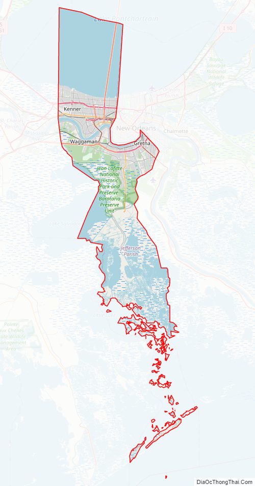
Jefferson Parish Road Map
Geography
According to the U.S. Census Bureau, the parish has a total area of 665 square miles (1,720 km), of which 296 square miles (770 km) is land and 370 square miles (960 km) (56%) is water.
Lake Pontchartrain is situated in the northern part of Jefferson Parish with the parish line several miles north of the southern shore, with St. Tammany Parish at its northern shore. The Mississippi River is located around the midpoint of Jefferson Parish flowing generally in a north-west to south-east direction.
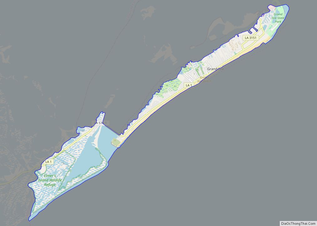
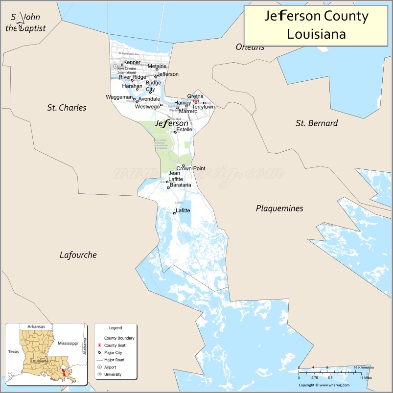
Surrounding parishes include St. Tammany Parish, Louisiana at the north shore of Lake Pontchartrain, St. Charles Parish upriver to the west, Orleans Parish downriver to the east, and Plaquemines Parish downriver to the south-east. The majority of the southern half of Jefferson Parish is uninhabited marshland with one of the exceptions being the town of Grand Isle; the only roads connecting Grand Isle to the rest of Jefferson Parish run through Lafourche Parish and St. Charles Parish.
National protected area
- Jean Lafitte National Historical Park and Preserve (part, in Marrero)
State parks
- Bayou Segnette State Park
- Grand Isle State Park
Adjacent parishes
- Orleans Parish (east)
- St. Bernard Parish (east)
- Plaquemines Parish (east)
- Lafourche Parish (west)
- St. Charles Parish (west)
- St. Tammany Parish (north)
Communities
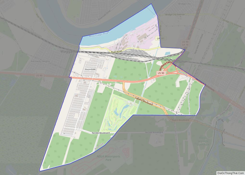
- Avondale
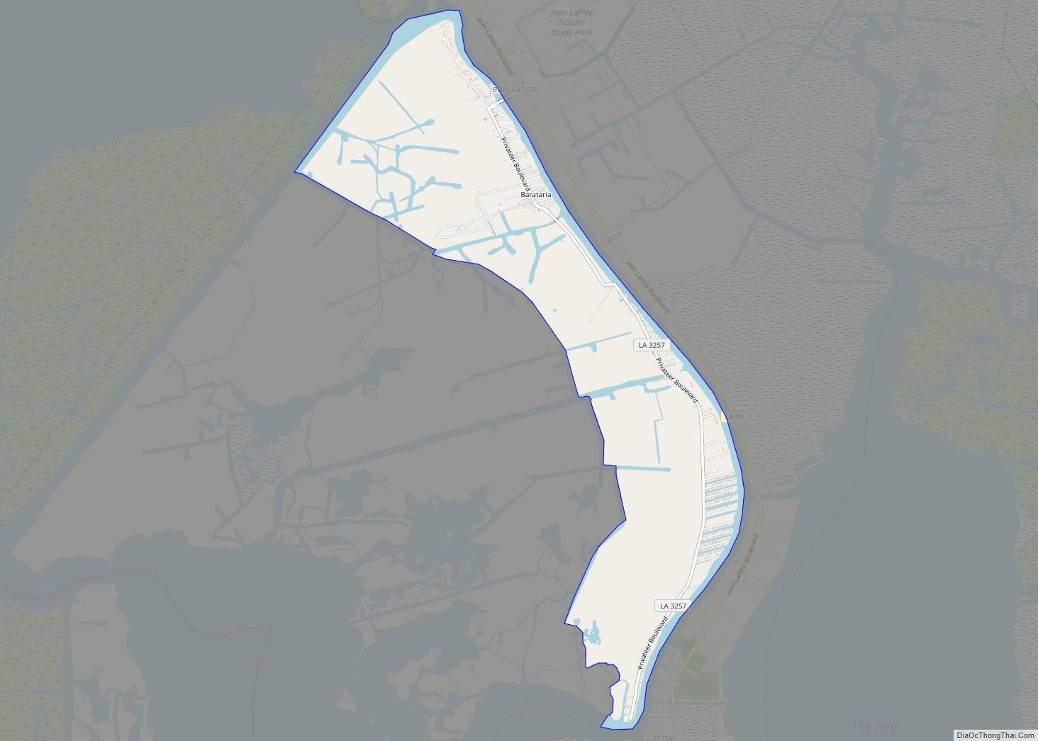
- Barataria
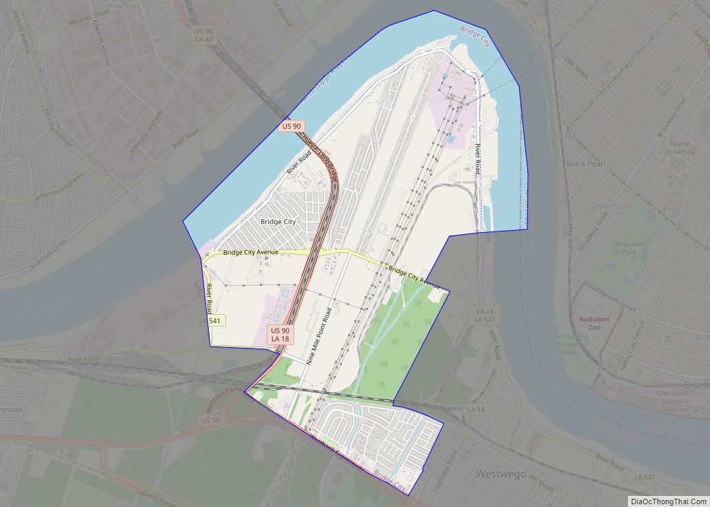
- Bridge City
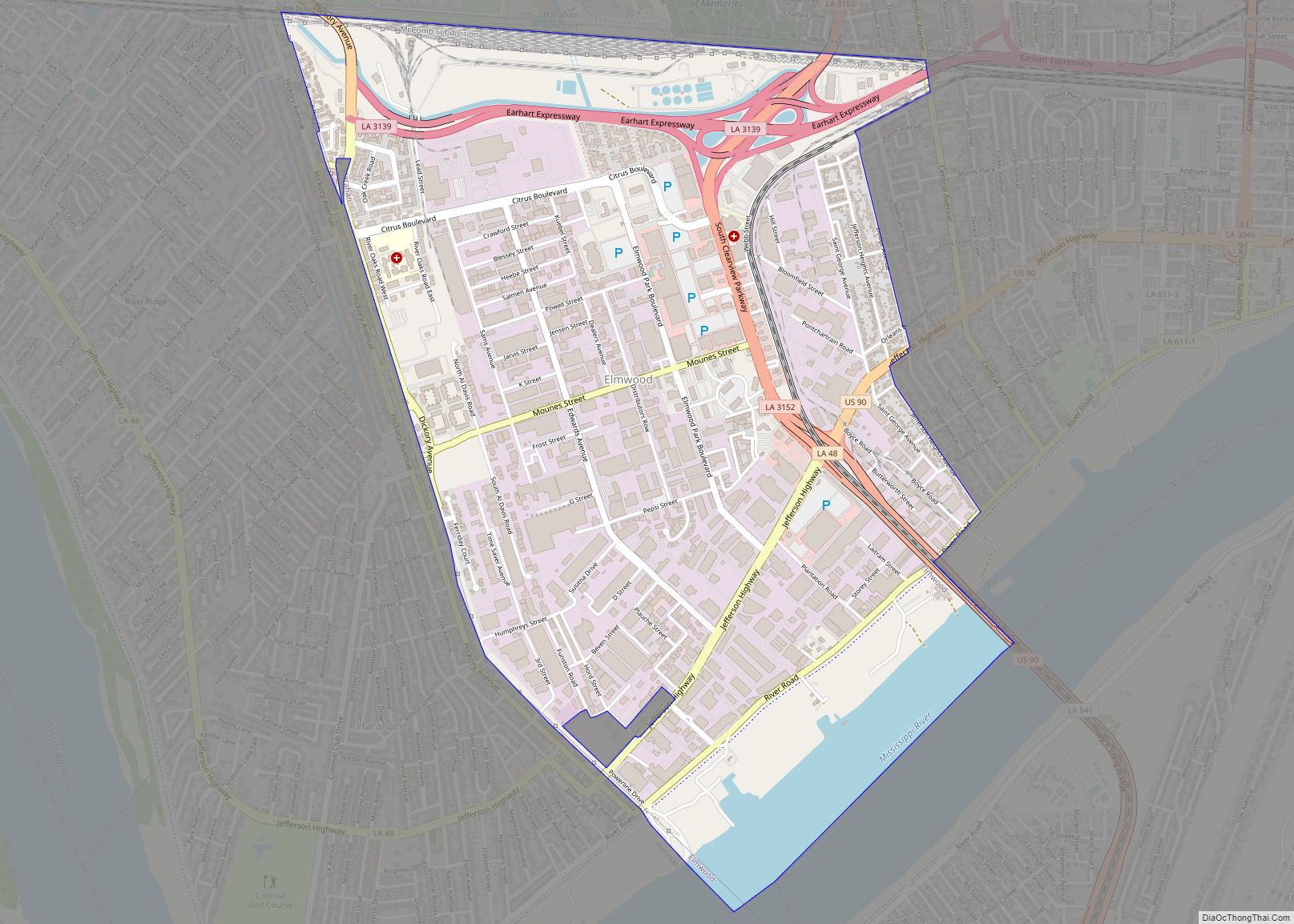
- Elmwood
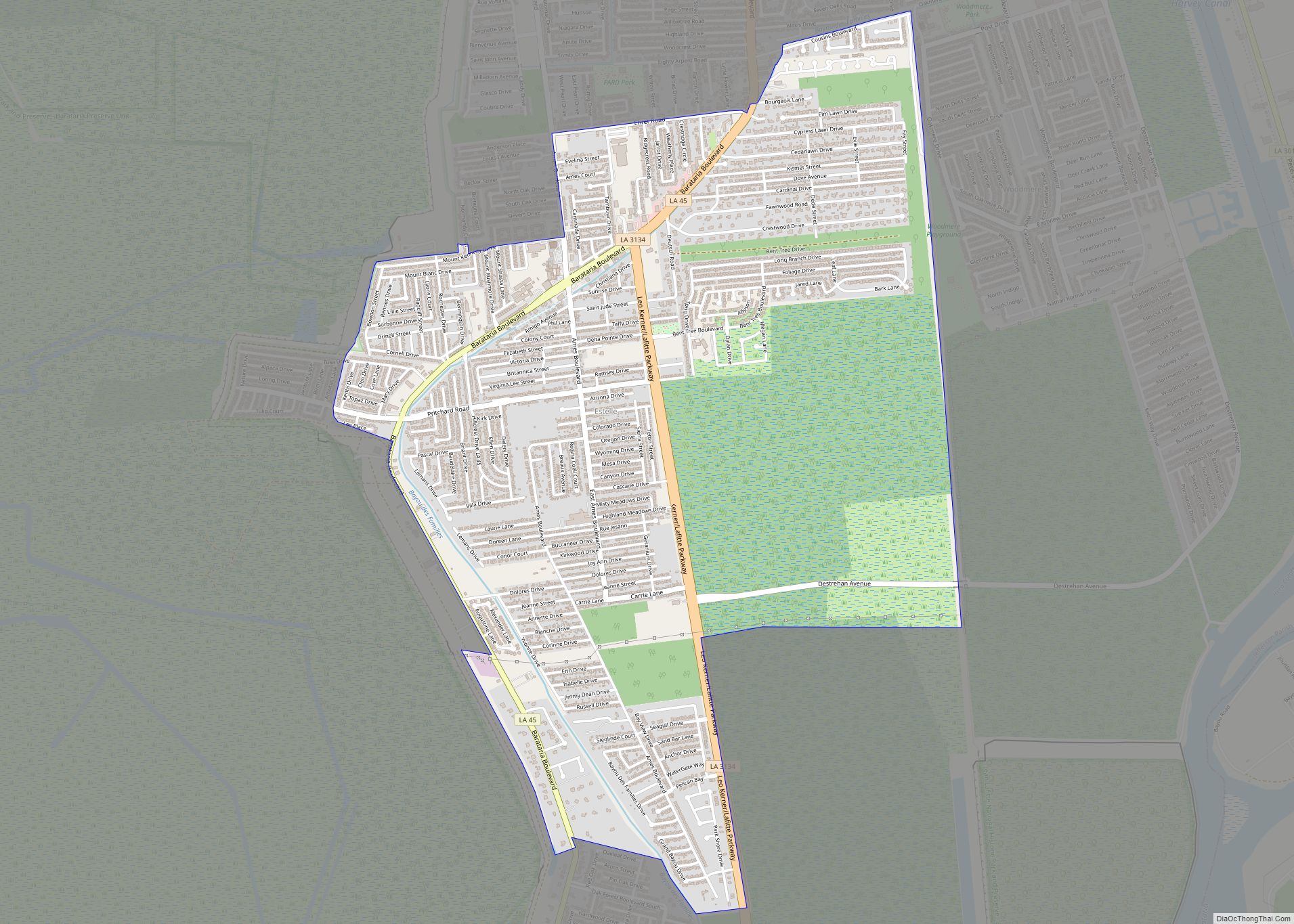
- Estelle
- Harvey
- Jefferson
- Lafitte
- Marrero
- Metairie
- River Ridge
- Terrytown
- Timberlane
- Waggaman
- Woodmere
- Crown Point
- Cheniere Caminada
Jefferson Parish Topographic Map
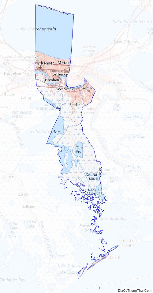
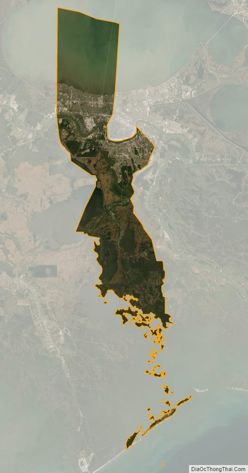
Jefferson Parish Satellite Map
Jefferson Parish Outline Map