Jean Lafitte is a town on Bayou Barataria in the U.S. state of Louisiana. Located in Jefferson Parish, it is named after the privateer Jean Lafitte. The population was 1,809 at the 2020 census. It is part of the New Orleans–Metairie–Kenner metropolitan statistical area.
| Name: | Jean Lafitte town |
|---|---|
| LSAD Code: | 43 |
| LSAD Description: | town (suffix) |
| State: | Louisiana |
| County: | Jefferson Parish |
| Elevation: | 3 ft (0.9 m) |
| Total Area: | 6.21 sq mi (16.09 km²) |
| Land Area: | 5.85 sq mi (15.15 km²) |
| Water Area: | 0.36 sq mi (0.93 km²) |
| Total Population: | 1,809 |
| Population Density: | 341.88/sq mi (132.00/km²) |
| ZIP code: | 60067 |
| Area code: | 504 |
| FIPS code: | 2238092 |
| Website: | www.townofjeanlafitte.com |
Online Interactive Map
Click on ![]() to view map in "full screen" mode.
to view map in "full screen" mode.
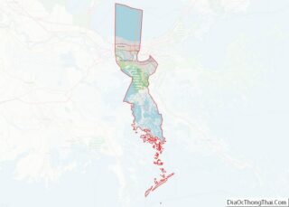
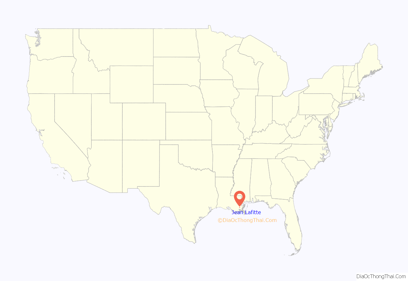
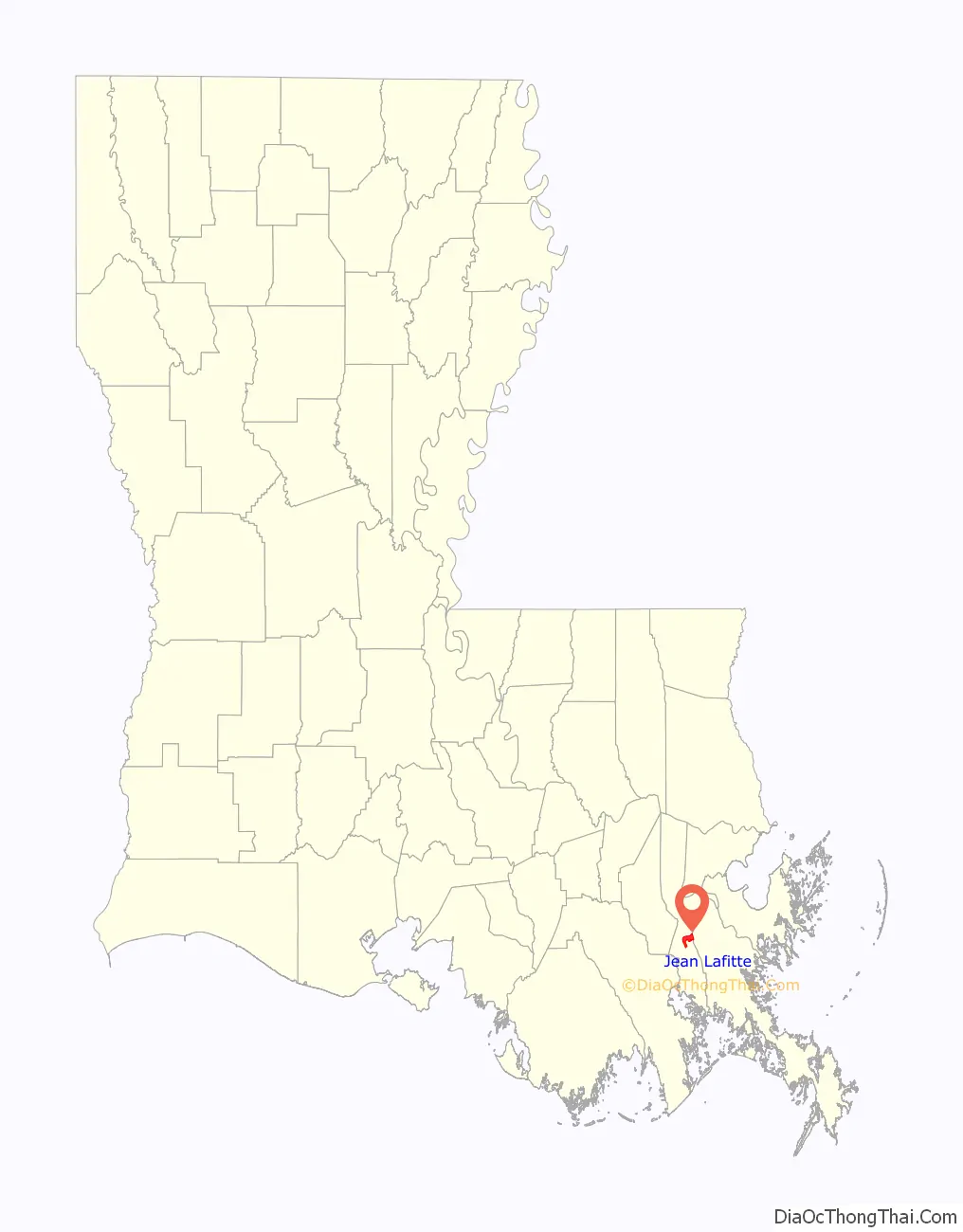
Jean Lafitte location map. Where is Jean Lafitte town?
History
Jean Lafitte was originally settled by Native Americans, then explored and settled by the French who established the area as a harbor for large vessels coming in and out of New Orleans. Today, the communities along Bayou Barataria are made up of Jean Lafitte, Lafitte, Crown Point and Barataria.
The town of Jean Lafitte was officially incorporated in 1974, an effort led by Leo E. Kerner Jr., who became the town’s first mayor. His son, Tim Kerner Sr., later served 7 terms as mayor from 1992 to 2020. In 2020, his son Tim Kerner, Jr. was elected as mayor.
Under the leadership of Timothy Kerner Sr., the town built a number of civic and infrastructure improvements, including: a visitor center, museum, 1,300-seat auditorium, library, civic center, baseball park, senior center, medical clinic, art gallery, and nature trail. One of the mayor’s major accomplishments was the creation of the Lafitte Area Independent Levee District that eventually secured over $300 million in funds to build tidal protection levees and flood walls.
In 2012, a historical marker for the community of Manila Village was placed in Jean Lafitte. Since mid-2013, Manila Plaza, located in front of Jean Lafitte Town Hall, has held several historical markers and commemorative plaques acknowledging important individuals in the area’s Filipino American history. The Philippine-Louisiana Historical Society participated in the dedication ceremony.
While there were several settlements of Filipinos (sometimes called Manilamen or Tagalas) along the Louisiana coast in the late 19th century, Manila Village was the largest. The residents there implemented a system of platforms on which they dried shrimp, as forerunners of Louisiana’s 21st-century dried shrimp industry. This community-on-stilts thrived for nearly a century, until it was destroyed by Hurricane Betsy in 1965.
In 2014, the town of Jean Lafitte unveiled a historical marker sponsored by the Jefferson Parish Historical Commission at the town’s visitor center. The historical marker reads: “Named for legendary privateer Jean Lafitte, who helped the United States win the Battle of New Orleans and used area bayous for his smuggling operations. Home to a thriving seafood industry. Incorporated in 1974 as a village. Became a town in 1977. First mayor of village and town was Leo E. Kerner, Jr., 1974-1991.”
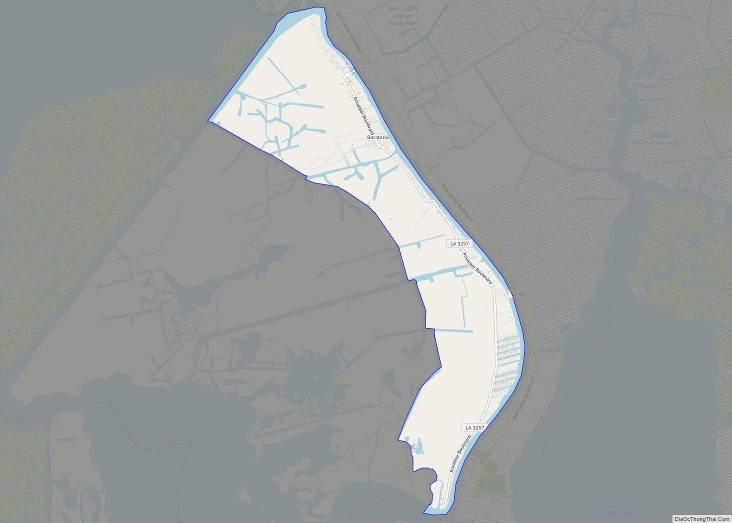
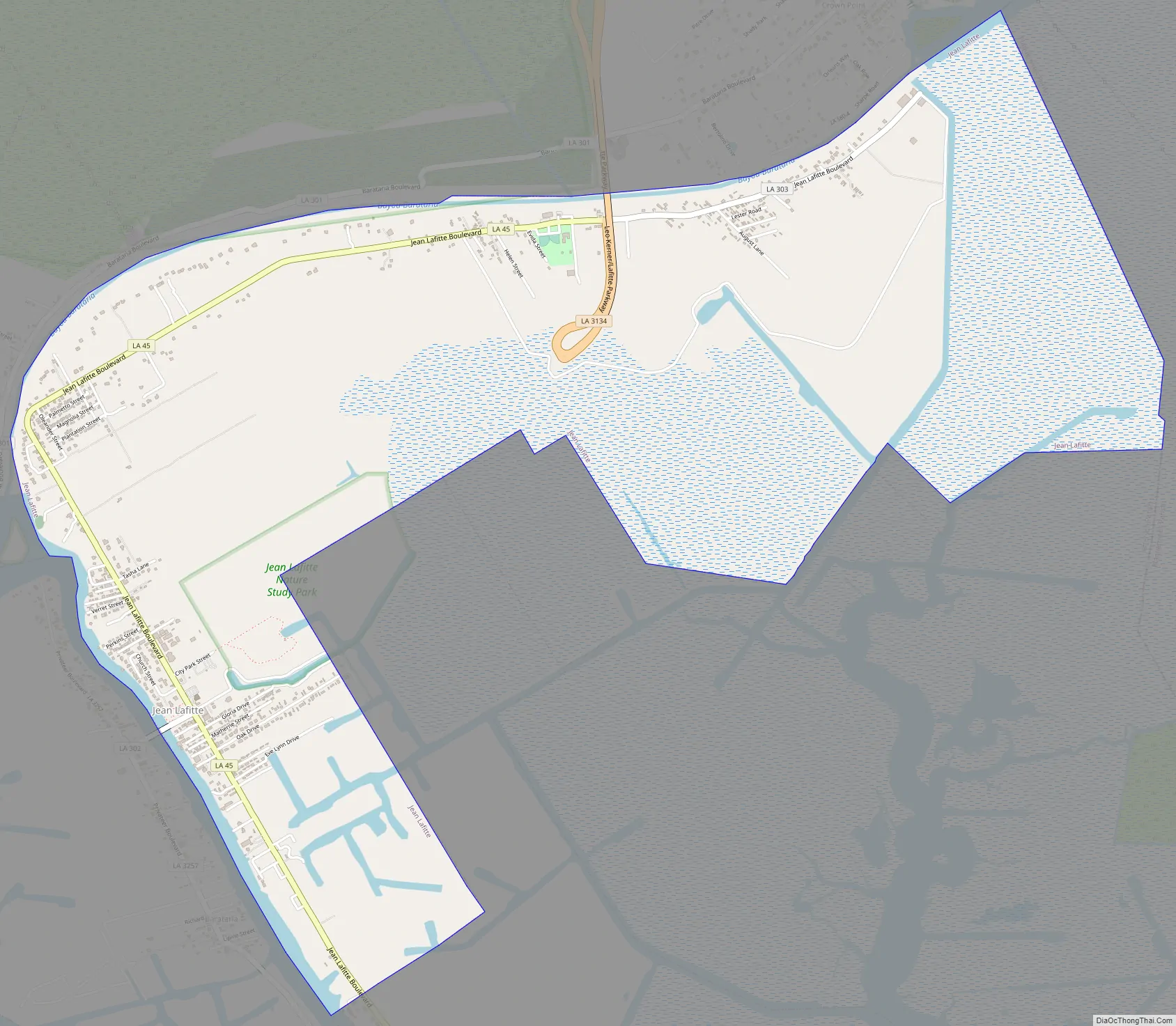
Jean Lafitte Road Map
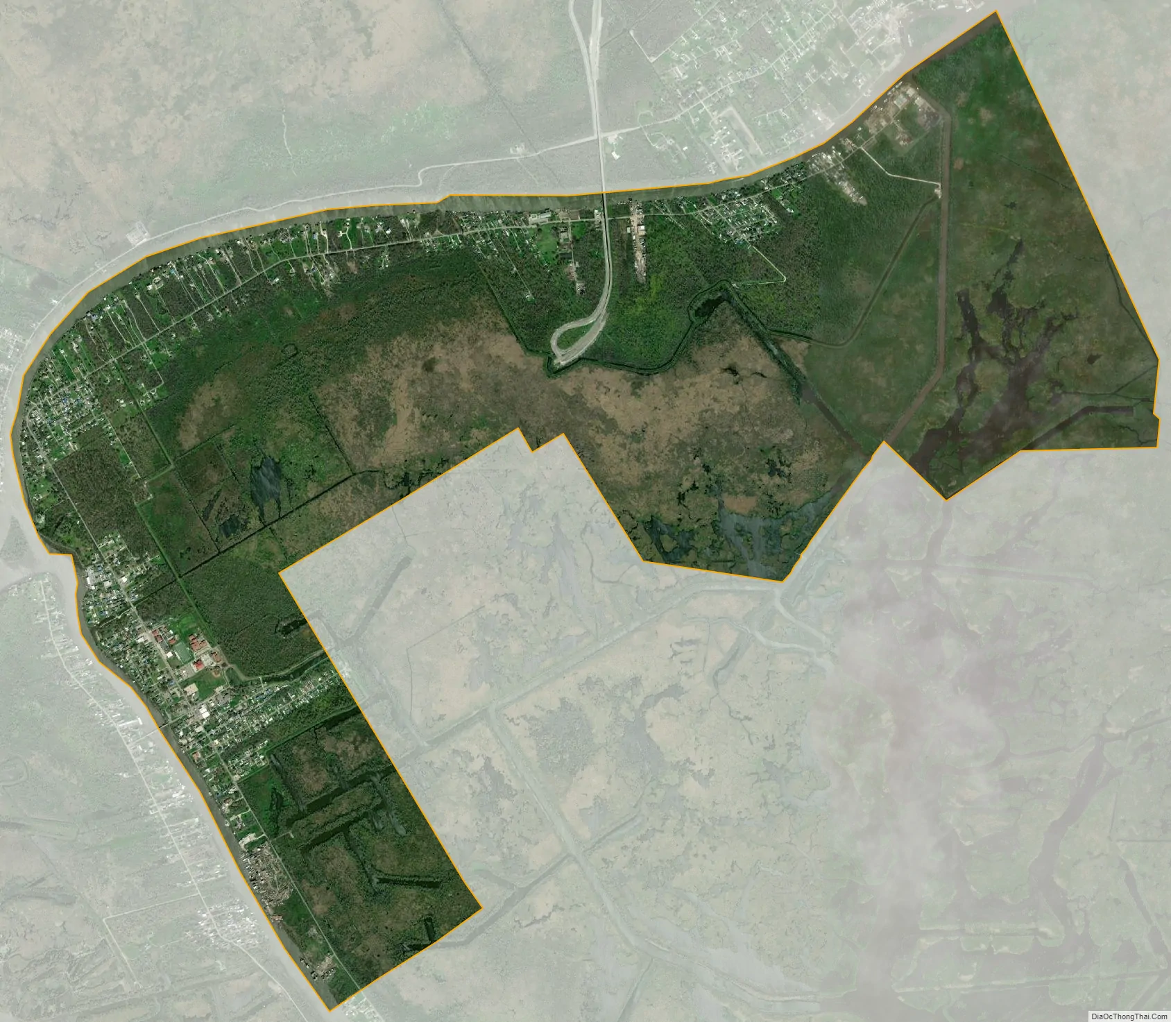
Jean Lafitte city Satellite Map
Geography
The town of Jean Lafitte is located at 29°44′10″N 90°07′36″W / 29.73611°N 90.12667°W / 29.73611; -90.12667 (29.735587, -90.122053). According to the United States Census Bureau, the town has a total area of 6.3 square miles (16 km), of which 6.0 square miles (16 km) is land and 0.3 square miles (0.78 km) (4.47%) is water.
See also
Map of Louisiana State and its subdivision:- Acadia
- Allen
- Ascension
- Assumption
- Avoyelles
- Beauregard
- Bienville
- Bossier
- Caddo
- Calcasieu
- Caldwell
- Cameron
- Catahoula
- Claiborne
- Concordia
- De Soto
- East Baton Rouge
- East Carroll
- East Feliciana
- Evangeline
- Franklin
- Grant
- Iberia
- Iberville
- Jackson
- Jefferson
- Jefferson Davis
- La Salle
- Lafayette
- Lafourche
- Lincoln
- Livingston
- Madison
- Morehouse
- Natchitoches
- Orleans
- Ouachita
- Plaquemines
- Pointe Coupee
- Rapides
- Red River
- Richland
- Sabine
- Saint Bernard
- Saint Charles
- Saint Helena
- Saint James
- Saint John the Baptist
- Saint Landry
- Saint Martin
- Saint Mary
- Saint Tammany
- Tangipahoa
- Tensas
- Terrebonne
- Union
- Vermilion
- Vernon
- Washington
- Webster
- West Baton Rouge
- West Carroll
- West Feliciana
- Winn
- Alabama
- Alaska
- Arizona
- Arkansas
- California
- Colorado
- Connecticut
- Delaware
- District of Columbia
- Florida
- Georgia
- Hawaii
- Idaho
- Illinois
- Indiana
- Iowa
- Kansas
- Kentucky
- Louisiana
- Maine
- Maryland
- Massachusetts
- Michigan
- Minnesota
- Mississippi
- Missouri
- Montana
- Nebraska
- Nevada
- New Hampshire
- New Jersey
- New Mexico
- New York
- North Carolina
- North Dakota
- Ohio
- Oklahoma
- Oregon
- Pennsylvania
- Rhode Island
- South Carolina
- South Dakota
- Tennessee
- Texas
- Utah
- Vermont
- Virginia
- Washington
- West Virginia
- Wisconsin
- Wyoming