Gretna is the second-largest city in, and parish seat of, Jefferson Parish in the U.S. state of Louisiana. Gretna lies on the west bank of the Mississippi River, just east and across the river from uptown New Orleans. It is part of the New Orleans–Metairie–Kenner metropolitan statistical area. The population was 17,814 at the 2020 U.S. census.
| Name: | Gretna city |
|---|---|
| LSAD Code: | 25 |
| LSAD Description: | city (suffix) |
| State: | Louisiana |
| County: | Jefferson Parish |
| Elevation: | 0 ft (0 m) |
| Total Area: | 4.50 sq mi (11.64 km²) |
| Land Area: | 4.04 sq mi (10.45 km²) |
| Water Area: | 0.46 sq mi (1.19 km²) |
| Total Population: | 17,814 |
| Population Density: | 4,413.78/sq mi (1,704.37/km²) |
| ZIP code: | 70053, 70054, 70056 |
| Area code: | 504 |
| FIPS code: | 2231915 |
| Website: | www.gretnala.com |
Online Interactive Map
Click on ![]() to view map in "full screen" mode.
to view map in "full screen" mode.
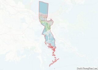
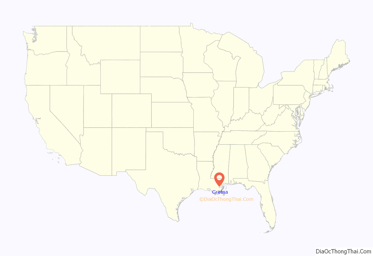
Gretna location map. Where is Gretna city?
History
According to the history published by the city, Gretna’s history can be traced to a plantation established by Jean-Charles de Pradel by 1750 (when the plantation house, Monplaisir, was built). By 1813, the plantation had passed into the hands of one François Bernoudy. John McDonogh (also spelled John McDonough), then a resident of New Orleans, bought the establishment, moved into the house and founded a settlement in 1815, that would be named McDonoghville. He subdivided the rest of the former plantation into regular city lots and 30-arpent farming strips. McDonoghville thus became the first subdivision in Jefferson Parish. McDonough either leased or sold these properties to white laborers or free people of color.
Gretna was settled in 1836, originally as Mechanikham, growing with a station on the Mississippi River for the Missouri Pacific Railroad, Texas and Pacific Railway, and Southern Pacific Railroad, with a ferry across the River to New Orleans. The famous food and spice company Zatarain’s, founded in 1889 in New Orleans, has been located in Gretna since 1963. Gretna was incorporated in 1913, absorbing the section of McDonogh within the Jefferson Parish boundaries. In the 1940 census, Gretna had a population of 10,879.
Hurricane Katrina controversy
The city and its police received considerable press coverage when, in the aftermath of Hurricane Katrina on August 29, 2005, people who attempted to escape from New Orleans by walking over the Crescent City Connection bridge over the Mississippi River were turned back at gunpoint by City of Gretna Police, along with Crescent City Connection Police, and Jefferson Parish Sheriff’s deputies, who set up a roadblock on the bridge in the days following the hurricane. According to eyewitnesses, some officers threatened to shoot those coming from New Orleans as they attempted to cross into Gretna on foot, shots were fired overhead, and downdraft from a police helicopter was used to help clear refugees from the bridge. New Orleans Police Department 911 operator Patryce Jenkins, having walked the city for two days after her dispatch center was flooded, tried to return to her unflooded Gretna apartment via the bridge. Though she had ID to prove her status as a resident, she said instead of checking it police ordered her to turn back, used racial slurs, and fired a warning shot over her head, leaving her crying in disbelief.
Gretna mayor Ronnie Harris pointed out though the city had not flooded, Gretna had been severely damaged as well, losing power, water, and sewage services, claiming the city had no food, no water, no shelters, and no capacity to take refugees. Harris said that the city had commandeered buses and been transporting a crowd of about 6,000 refugees to a nearby FEMA facility. But he said the city enacted the blockade after a spate of door-to-door robberies began in Gretna and stores at the Oakwood Mall were looted and burned. Residents of Gretna were themselves required to evacuate after a few days. Four federal civil lawsuits were filed against the city for violation of civil rights. Two were dismissed, and in a third the Jefferson Parish Sheriff’s Office settled with a family from Algiers for $10,000. A fourth federal case, involving Regional Transit Authority workers, was scheduled to go to trial in April 2011. Several other cases were filed in New Orleans Civil District Court.
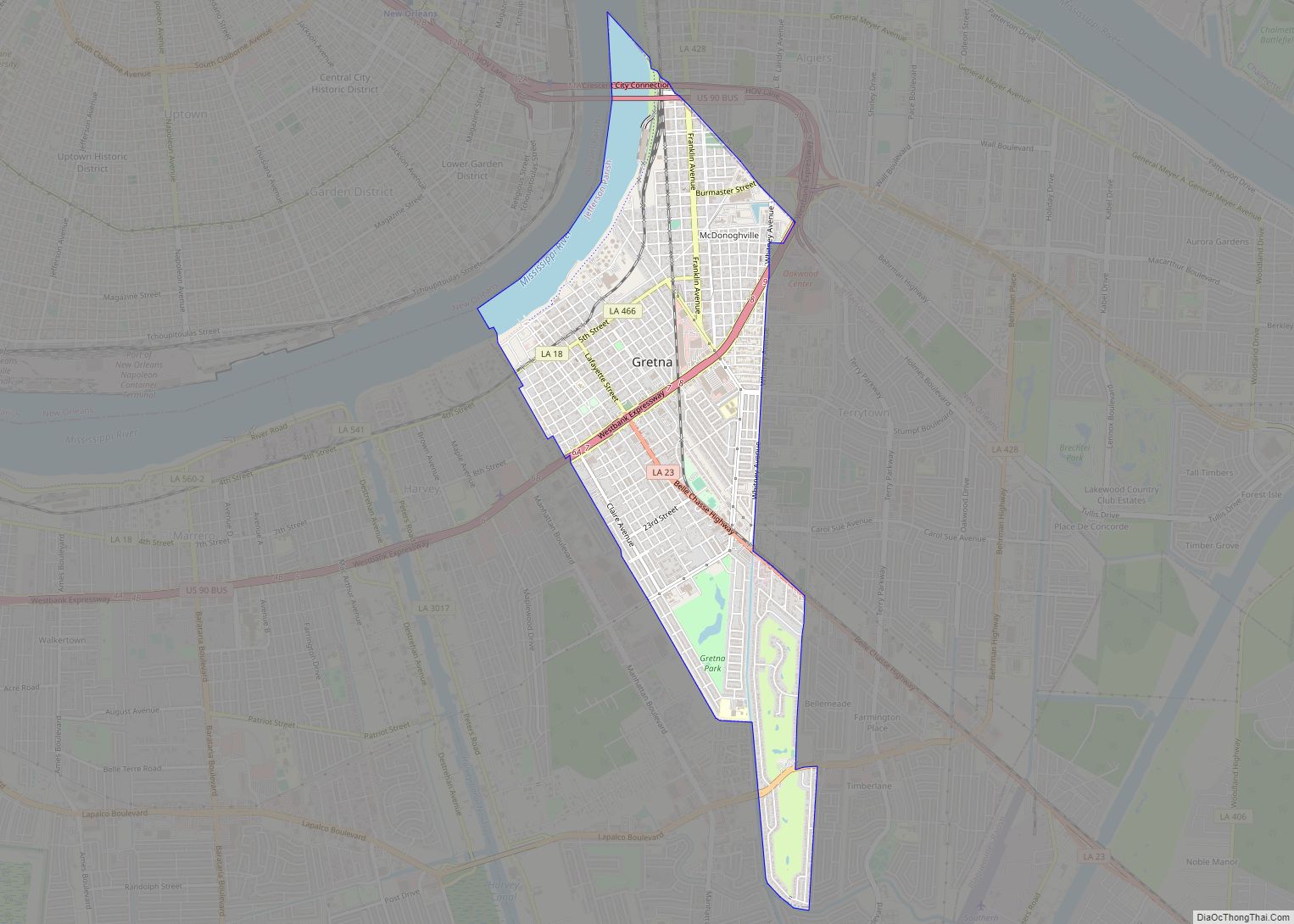
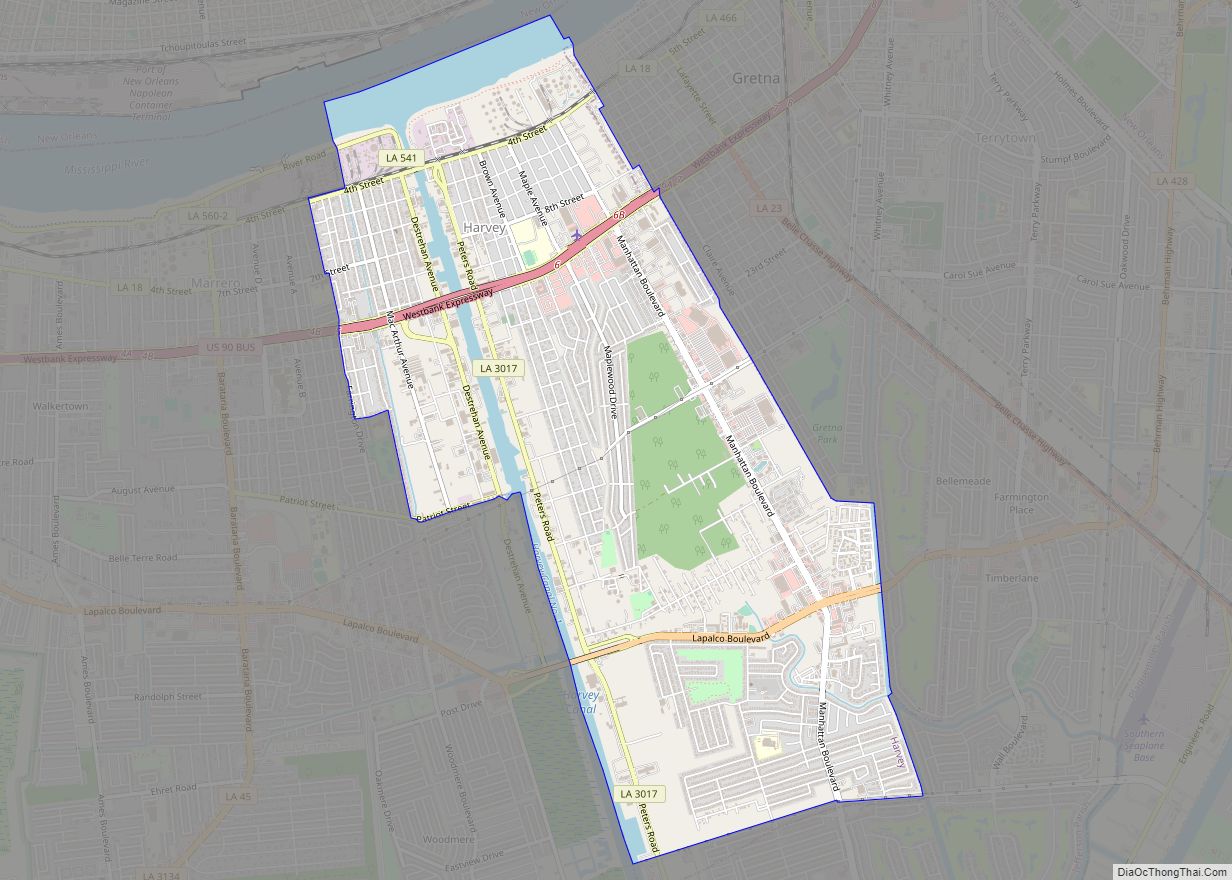
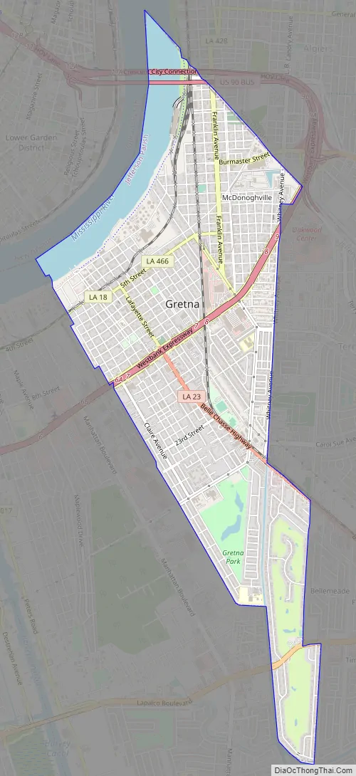
Gretna Road Map
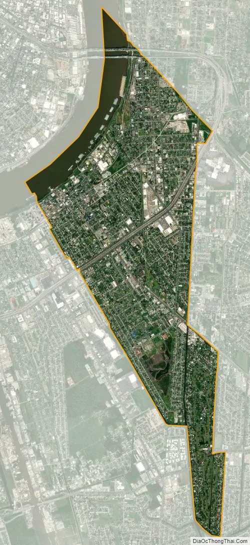
Gretna city Satellite Map
Geography
Gretna is located at 29°54′59″N 90°3′15″W / 29.91639°N 90.05417°W / 29.91639; -90.05417 (29.916459, -90.054260) and has an elevation of 0 feet (0 m) behind the levee along the Mississippi River.
According to the United States Census Bureau, the city has a total area of 3.9 square miles (10 km), of which 3.5 sq mi (9.1 km) is land and 0.4 sq mi (1.0 km) (9.33%) is water.
See also
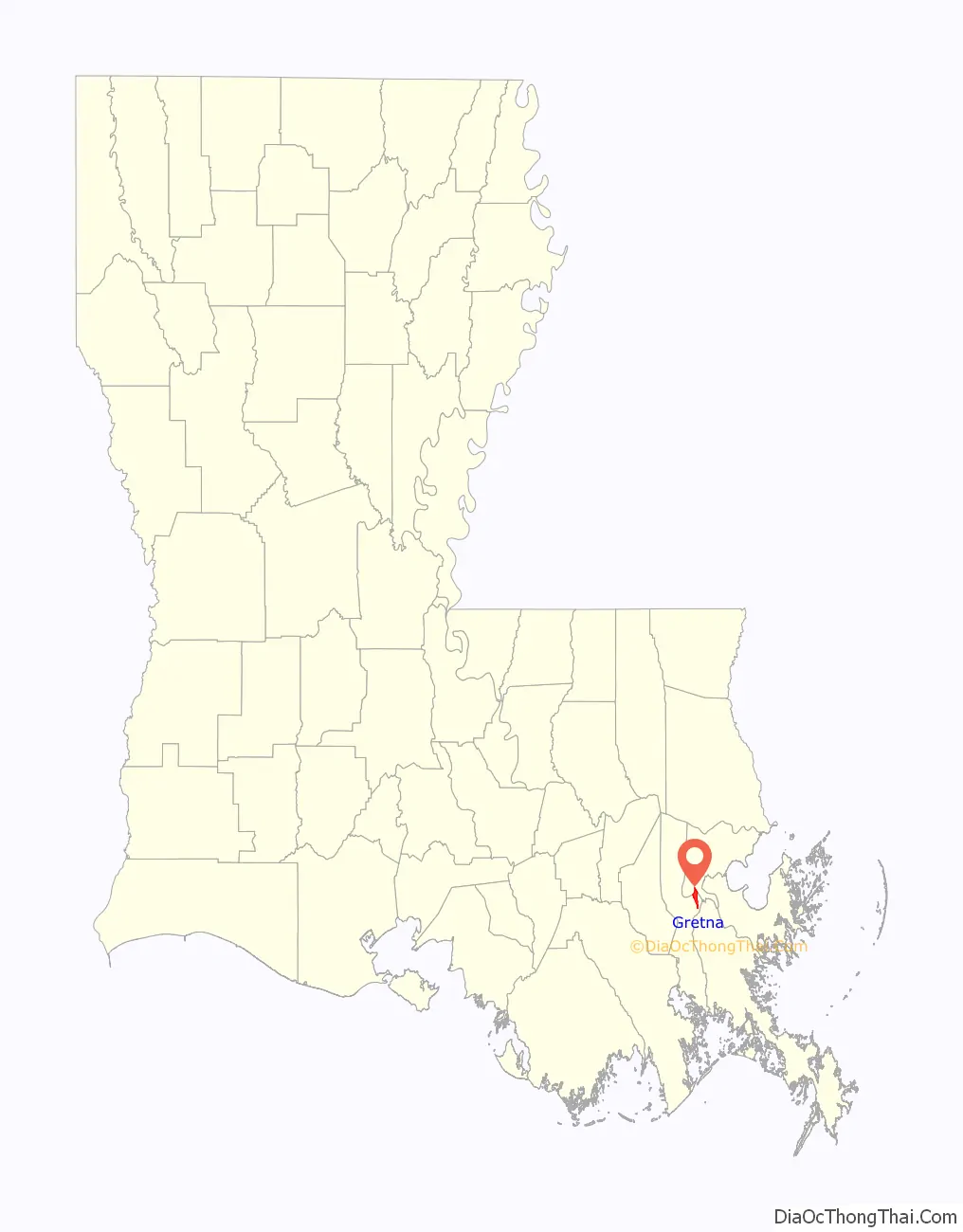
Map of Louisiana State and its subdivision:- Acadia
- Allen
- Ascension
- Assumption
- Avoyelles
- Beauregard
- Bienville
- Bossier
- Caddo
- Calcasieu
- Caldwell
- Cameron
- Catahoula
- Claiborne
- Concordia
- De Soto
- East Baton Rouge
- East Carroll
- East Feliciana
- Evangeline
- Franklin
- Grant
- Iberia
- Iberville
- Jackson
- Jefferson
- Jefferson Davis
- La Salle
- Lafayette
- Lafourche
- Lincoln
- Livingston
- Madison
- Morehouse
- Natchitoches
- Orleans
- Ouachita
- Plaquemines
- Pointe Coupee
- Rapides
- Red River
- Richland
- Sabine
- Saint Bernard
- Saint Charles
- Saint Helena
- Saint James
- Saint John the Baptist
- Saint Landry
- Saint Martin
- Saint Mary
- Saint Tammany
- Tangipahoa
- Tensas
- Terrebonne
- Union
- Vermilion
- Vernon
- Washington
- Webster
- West Baton Rouge
- West Carroll
- West Feliciana
- Winn
- Alabama
- Alaska
- Arizona
- Arkansas
- California
- Colorado
- Connecticut
- Delaware
- District of Columbia
- Florida
- Georgia
- Hawaii
- Idaho
- Illinois
- Indiana
- Iowa
- Kansas
- Kentucky
- Louisiana
- Maine
- Maryland
- Massachusetts
- Michigan
- Minnesota
- Mississippi
- Missouri
- Montana
- Nebraska
- Nevada
- New Hampshire
- New Jersey
- New Mexico
- New York
- North Carolina
- North Dakota
- Ohio
- Oklahoma
- Oregon
- Pennsylvania
- Rhode Island
- South Carolina
- South Dakota
- Tennessee
- Texas
- Utah
- Vermont
- Virginia
- Washington
- West Virginia
- Wisconsin
- Wyoming