River Ridge is an unincorporated community and census-designated place (CDP) in Jefferson Parish, Louisiana, United States. It is a suburb of New Orleans. The population was 13,591 in 2020.
| Name: | River Ridge CDP |
|---|---|
| LSAD Code: | 57 |
| LSAD Description: | CDP (suffix) |
| State: | Louisiana |
| County: | Jefferson Parish |
| Total Area: | 3.55 sq mi (9.19 km²) |
| Land Area: | 2.80 sq mi (7.24 km²) |
| Water Area: | 0.75 sq mi (1.94 km²) |
| Total Population: | 13,591 |
| Population Density: | 4,860.87/sq mi (1,876.97/km²) |
| ZIP code: | 70123 |
| Area code: | 504 |
| FIPS code: | 2265150 |
| GNISfeature ID: | 546872 |
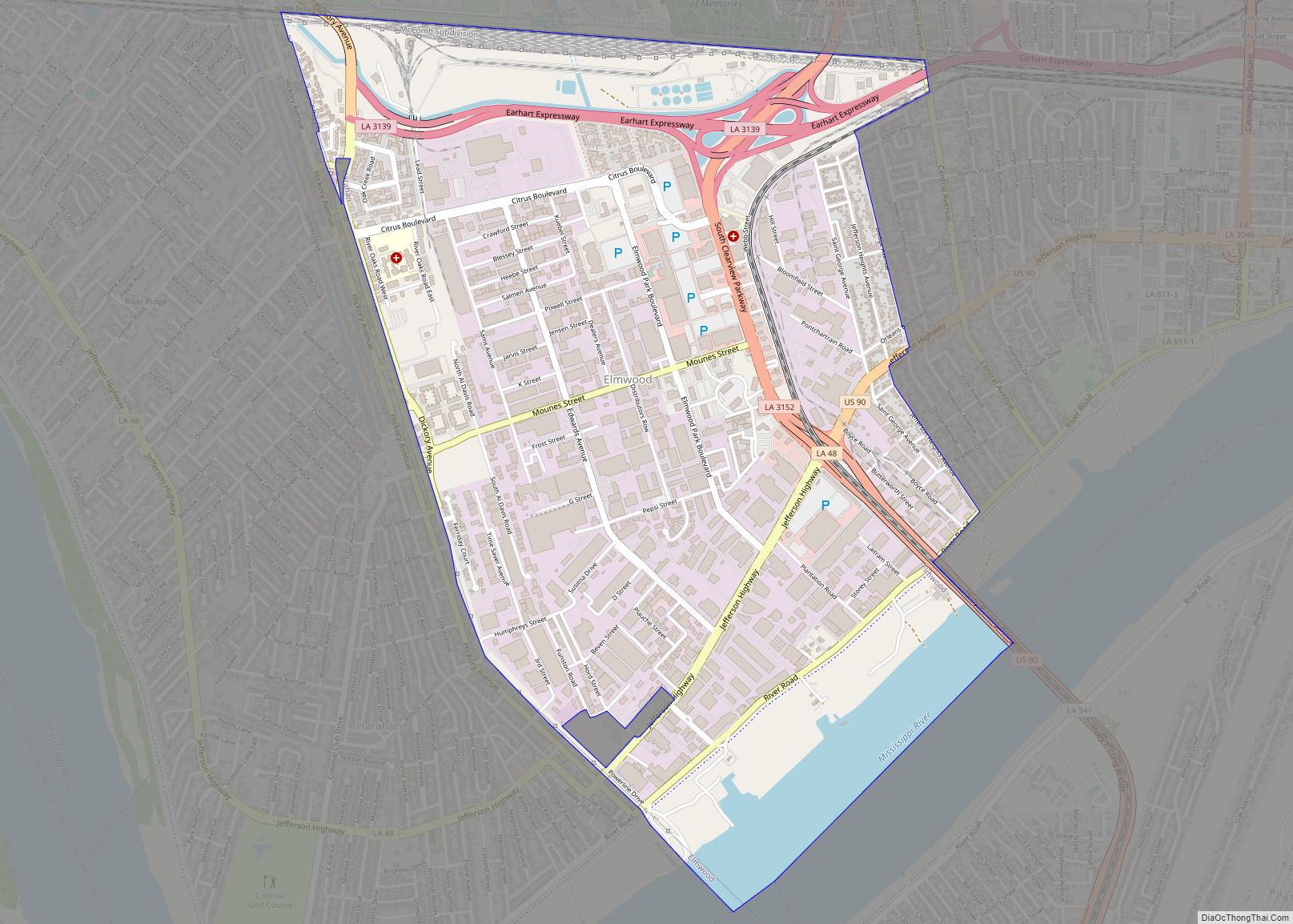
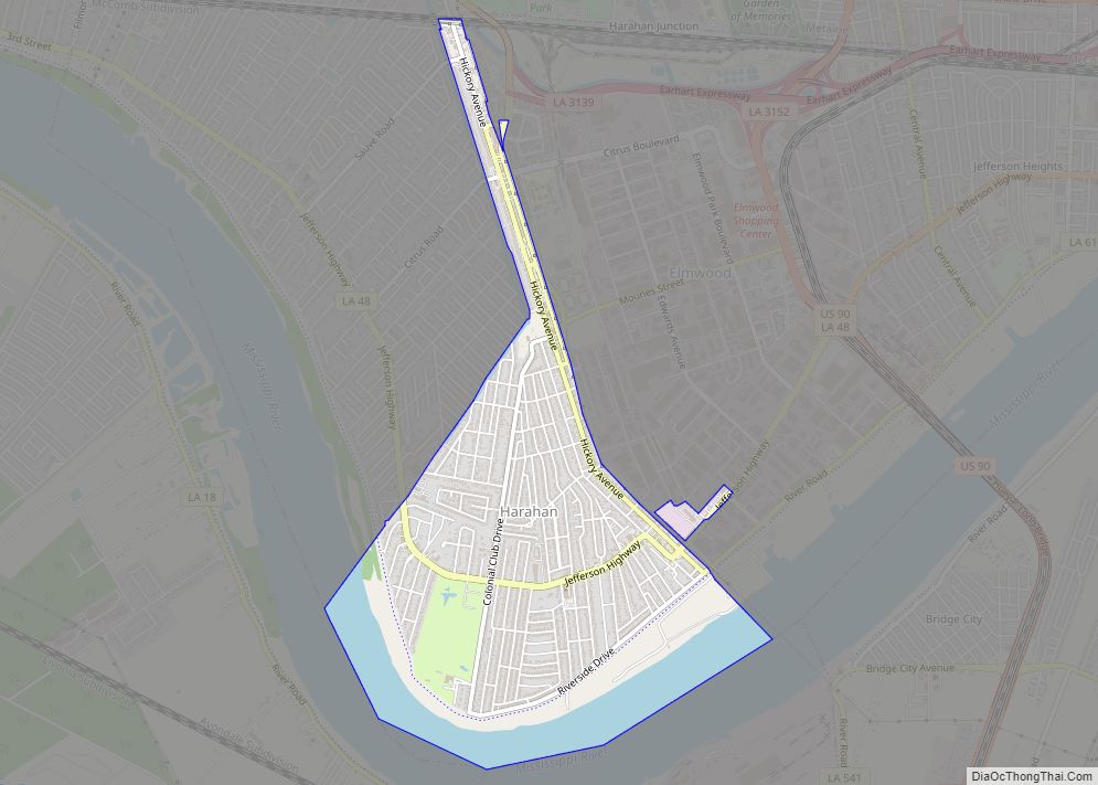
Online Interactive Map
Click on ![]() to view map in "full screen" mode.
to view map in "full screen" mode.
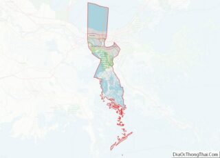
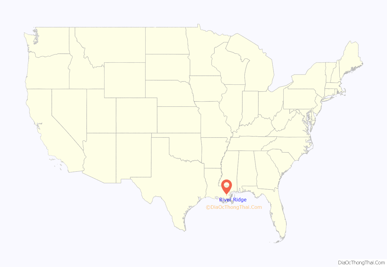
River Ridge location map. Where is River Ridge CDP?
History
The land that is now River Ridge was developed by French colonists and their descendants in the late 18th and early 19th centuries for large sugar plantations; these lined the Mississippi River in traditional French long-lot fashion. The plantations had relatively narrow waterfronts, in order to provide water access, and extended deeply back from the river. These plantations were developed by French colonists and their descendants; they depended on the labor of African slaves. Major landowners included members of the Trudeau and Sauve families. (Pierre Sauve (1805-1867) had a major plantation here known as Providence.)
The alignments of the major streets in the area are vestiges of this era. Sauve Road continues to be a main thoroughfare in River Ridge.
In 1849, a major flooding event known as Sauvé’s Crevasse occurred. The crude river levee at the Sauve Providence plantation failed under pressure of high water on the Mississippi. The massive flood inundated much of the land to the east, including parts of New Orleans. This crevasse occurred where a former meander of the Mississippi River once branched to form the Metairie and Gentilly Ridges.
In the early 20th century, an interurban transit line was constructed through this area. It served to connect the cities of New Orleans and Kenner. It was aligned along the present course of Jefferson Highway, which was improved from earlier roads.
For many years the area remained rural farmland, until the post-World War II suburbanization era. Aided by funding under the G.I. Bill, which enabled veterans to buy houses, large-scale suburban development began in the early 1950s. By 1965, virtually all of the area along the Mississippi River between Harahan and Kenner was developed. This area at the time was known as “Little Farms”, a name which well described its pre-urban history; this was also the place name officially recognized by the Post Office. (To this day Little Farms Avenue remains a major River Ridge thoroughfare.) Other subdivision names such as “East Bank” and “Rural Acres” were used as place names for the area at the time.
To eliminate confusion and create some sense of community identity, the area between Kenner, Harahan, Metairie, and the Mississippi River was officially renamed “River Ridge” in 1974.
In 2019, a baseball team from River Ridge won the Little League World Series, becoming the first team from Louisiana to do so. They also became the first team since 2001 to lose their opening game, but win the championship.
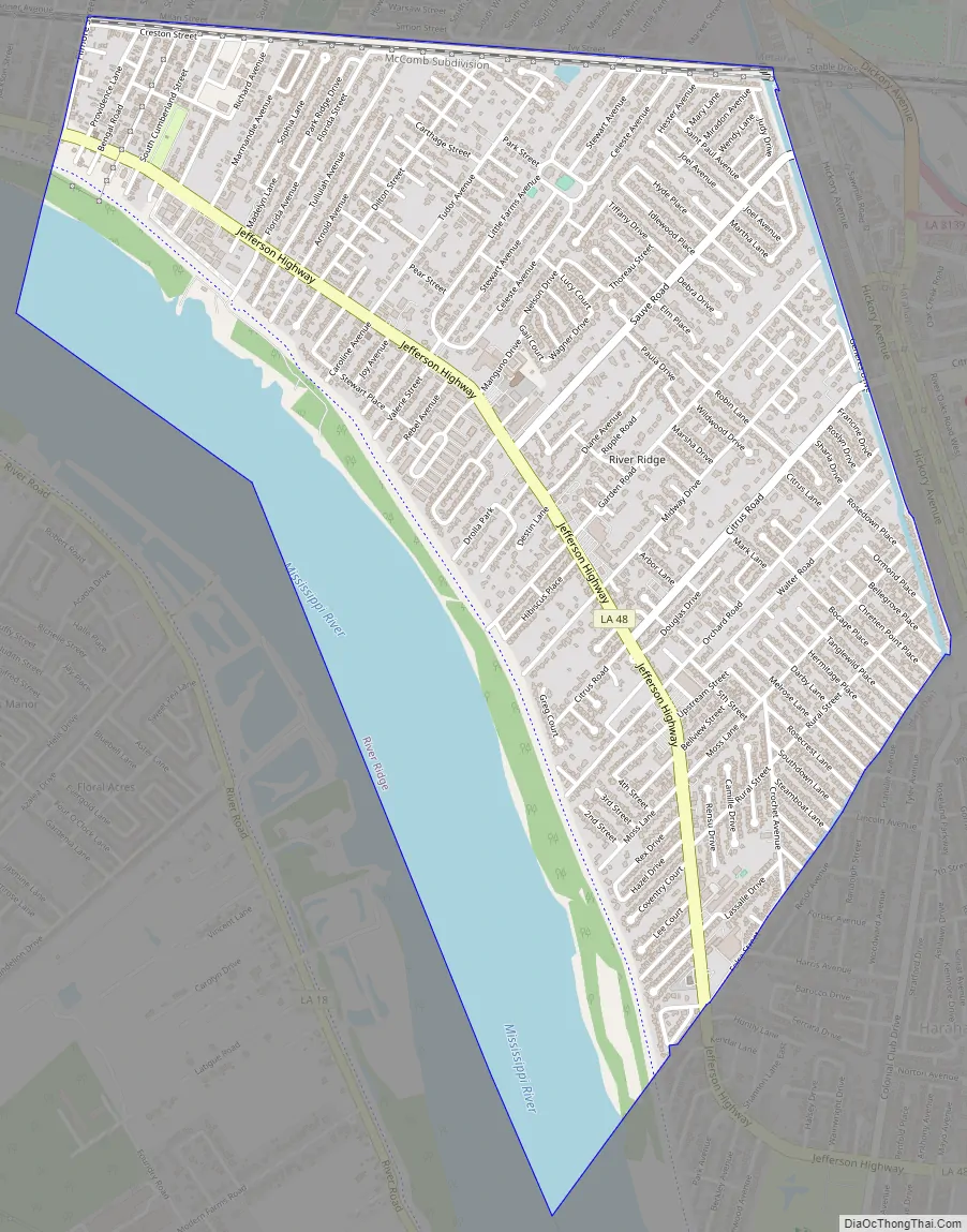
River Ridge Road Map
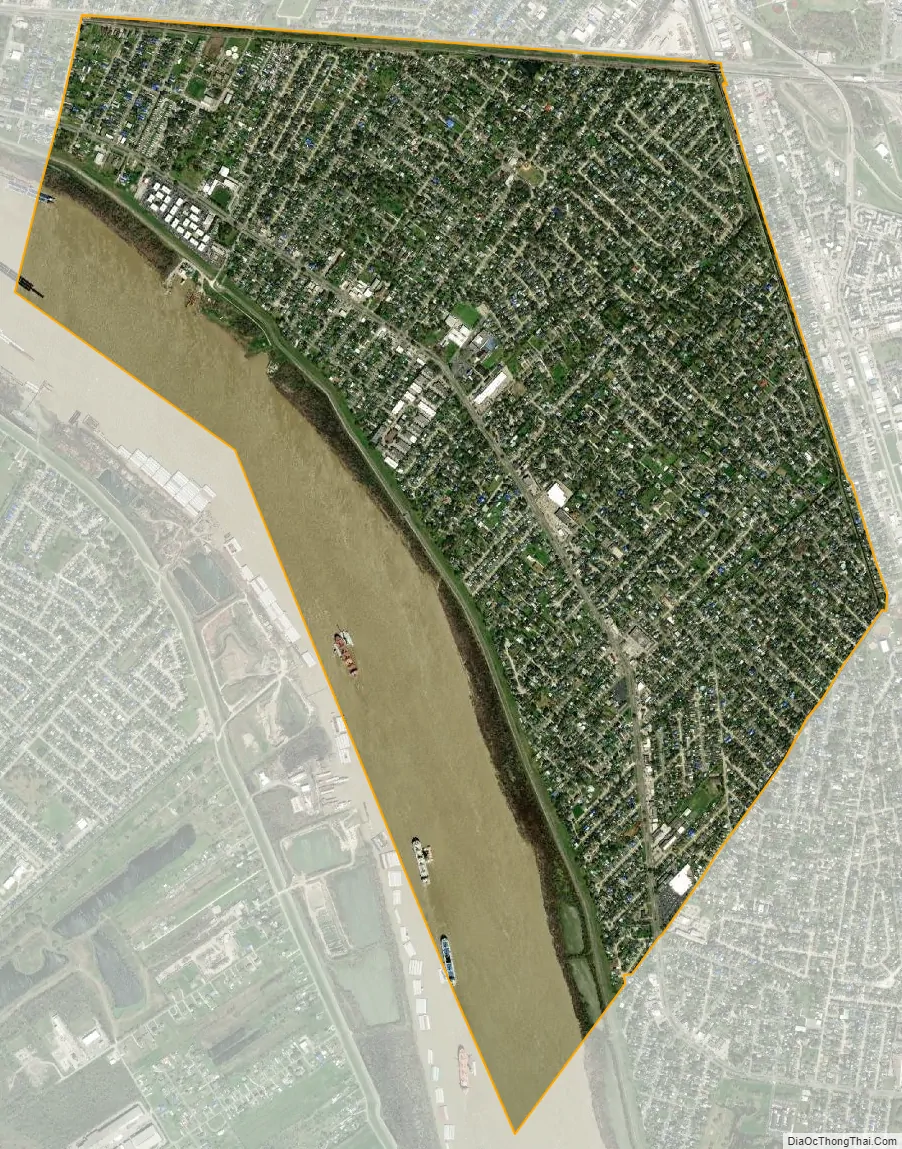
River Ridge city Satellite Map
Geography
River Ridge is located along a 3-mile (5 km) stretch of Jefferson Highway (Louisiana Highway 48). Its boundaries include Harahan to the east, Kenner to the northwest, Metairie to the north, and the Mississippi River to the southwest. Across the Mississippi is the unincorporated community of Waggaman.
River Ridge is located at 29°57′30″N 90°13′19″W / 29.958265°N 90.221894°W / 29.958265; -90.221894. According to the United States Census Bureau, the CDP has a total area of 3.55 square miles (9.19 km), of which 2.80 square miles (7.24 km) are land and 0.75 square miles (1.95 km), or 21.18%, are water.
See also
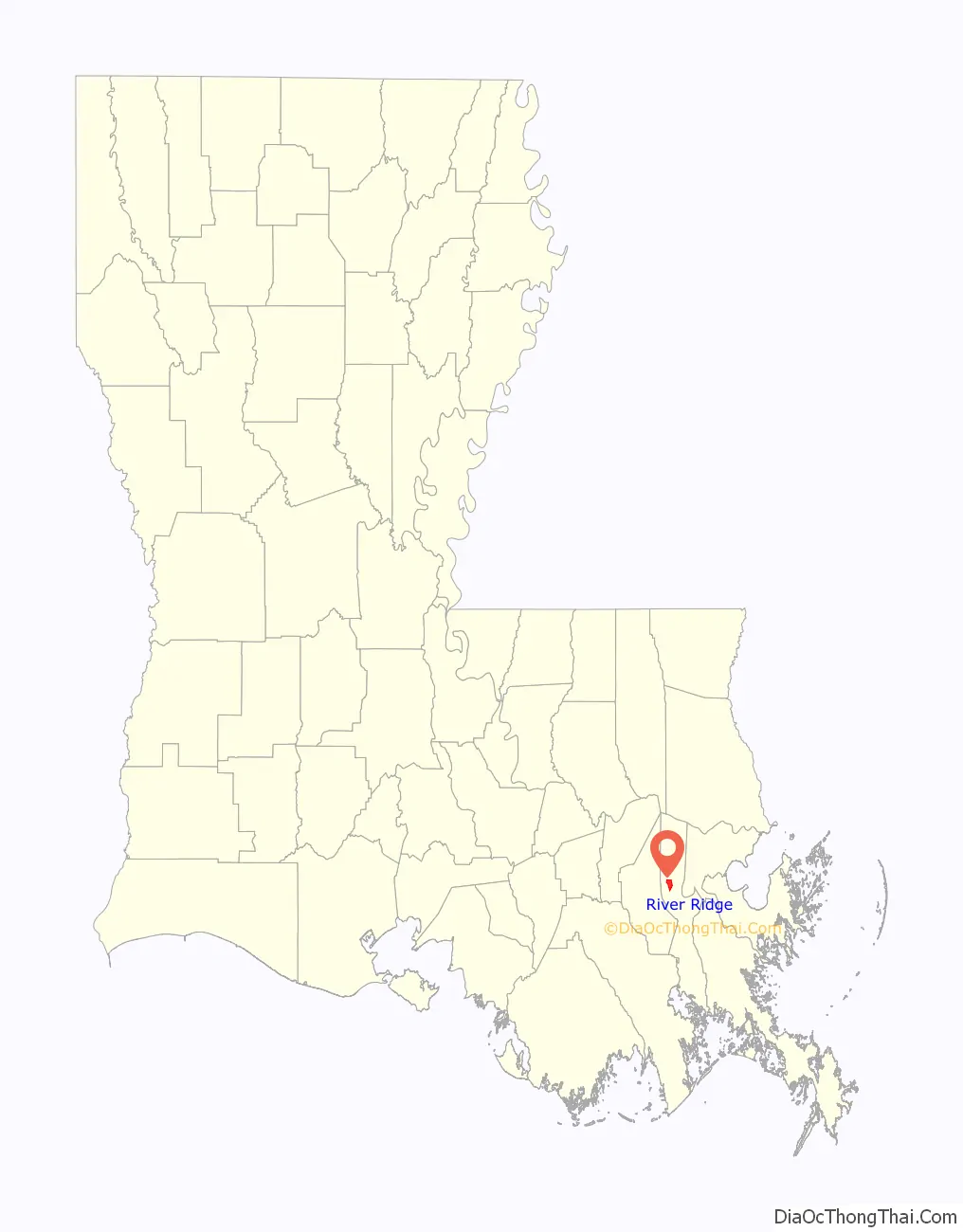
Map of Louisiana State and its subdivision:- Acadia
- Allen
- Ascension
- Assumption
- Avoyelles
- Beauregard
- Bienville
- Bossier
- Caddo
- Calcasieu
- Caldwell
- Cameron
- Catahoula
- Claiborne
- Concordia
- De Soto
- East Baton Rouge
- East Carroll
- East Feliciana
- Evangeline
- Franklin
- Grant
- Iberia
- Iberville
- Jackson
- Jefferson
- Jefferson Davis
- La Salle
- Lafayette
- Lafourche
- Lincoln
- Livingston
- Madison
- Morehouse
- Natchitoches
- Orleans
- Ouachita
- Plaquemines
- Pointe Coupee
- Rapides
- Red River
- Richland
- Sabine
- Saint Bernard
- Saint Charles
- Saint Helena
- Saint James
- Saint John the Baptist
- Saint Landry
- Saint Martin
- Saint Mary
- Saint Tammany
- Tangipahoa
- Tensas
- Terrebonne
- Union
- Vermilion
- Vernon
- Washington
- Webster
- West Baton Rouge
- West Carroll
- West Feliciana
- Winn
- Alabama
- Alaska
- Arizona
- Arkansas
- California
- Colorado
- Connecticut
- Delaware
- District of Columbia
- Florida
- Georgia
- Hawaii
- Idaho
- Illinois
- Indiana
- Iowa
- Kansas
- Kentucky
- Louisiana
- Maine
- Maryland
- Massachusetts
- Michigan
- Minnesota
- Mississippi
- Missouri
- Montana
- Nebraska
- Nevada
- New Hampshire
- New Jersey
- New Mexico
- New York
- North Carolina
- North Dakota
- Ohio
- Oklahoma
- Oregon
- Pennsylvania
- Rhode Island
- South Carolina
- South Dakota
- Tennessee
- Texas
- Utah
- Vermont
- Virginia
- Washington
- West Virginia
- Wisconsin
- Wyoming