Westwego is a city in the U.S. state of Louisiana, located in Jefferson Parish. It is a suburban community of New Orleans in the Greater New Orleans metropolitan area and lies along the west bank of the Mississippi River. The population of the city of Westwego was 8,568 at the 2020 United States census.
| Name: | Westwego city |
|---|---|
| LSAD Code: | 25 |
| LSAD Description: | city (suffix) |
| State: | Louisiana |
| County: | Jefferson Parish |
| Elevation: | 0 ft (0 m) |
| Total Area: | 3.60 sq mi (9.31 km²) |
| Land Area: | 3.12 sq mi (8.07 km²) |
| Water Area: | 0.48 sq mi (1.24 km²) |
| Total Population: | 8,568 |
| Population Density: | 2,749.68/sq mi (1,061.65/km²) |
| ZIP code: | 70094 |
| Area code: | 504 |
| FIPS code: | 2281165 |
| Website: | www.cityofwestwego.com |
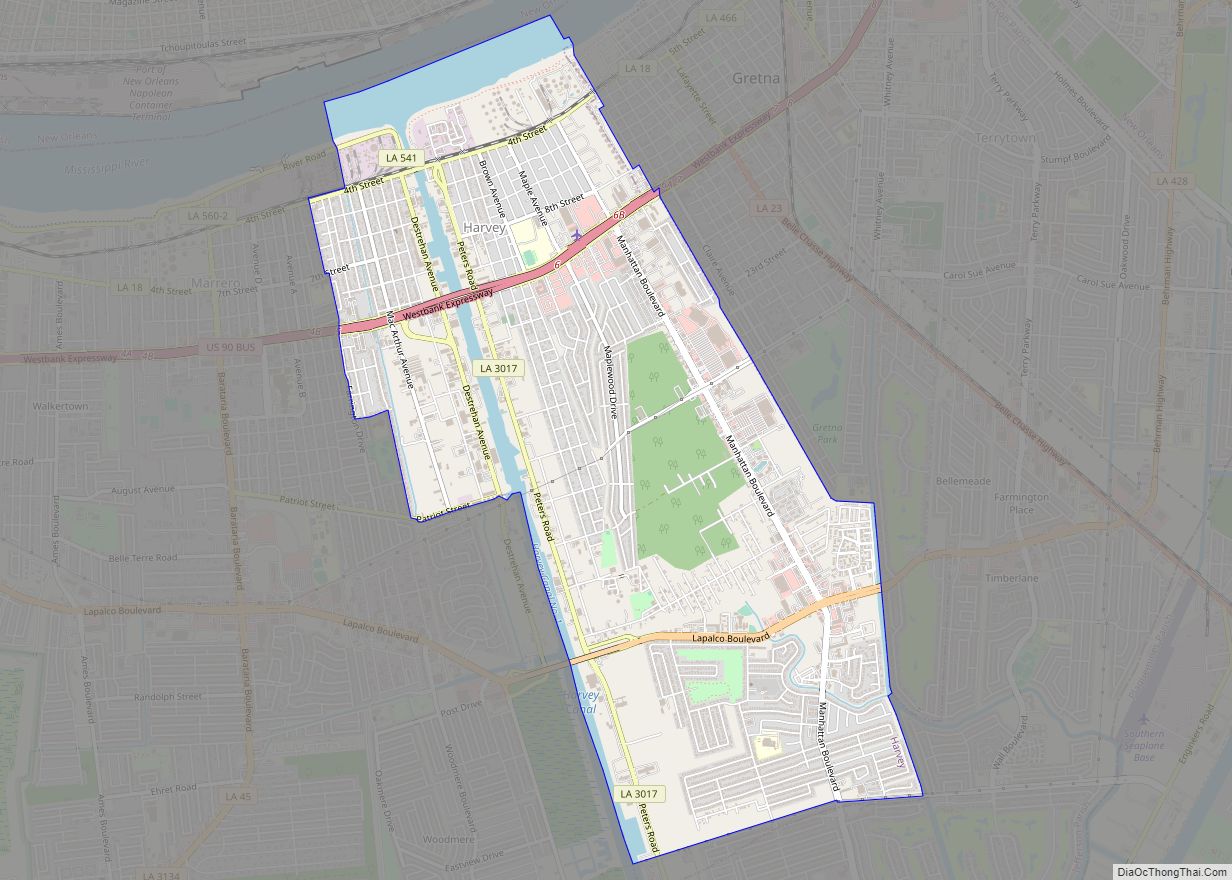
Online Interactive Map
Click on ![]() to view map in "full screen" mode.
to view map in "full screen" mode.
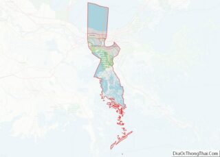
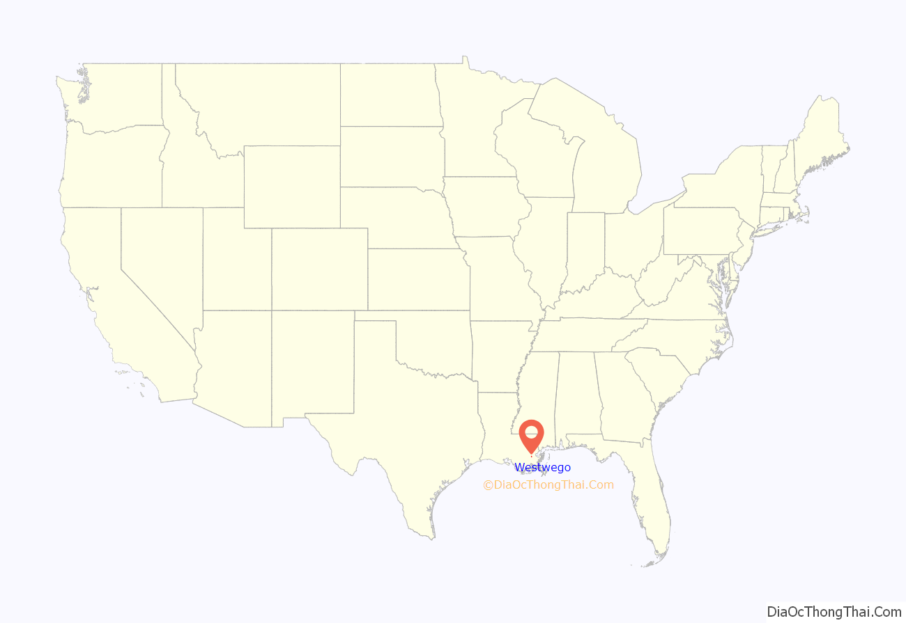
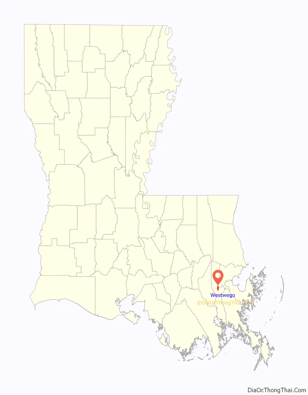
Westwego location map. Where is Westwego city?
History
Early history and development
The area of Westwego, Louisiana was inhabited by Native Americans for thousands of years before Europeans settled here. These indigenous people created huge shell middens that can still be seen in the vicinity today. The French first developed the area in 1719 when French minister of state Claude le Blanc started a plantation and a port along the Mississippi River.
The port became an important site in the history of the transatlantic slave trade. The estate was later owned by the Zeringue family, who turned it into bustling sugar plantation, known as Seven Oaks. Planter Camille Zeringue built a canal at the plantation that played a prominent role in the community’s history for decades. Other antebellum plantations in the area included the Whitehouse Plantation, Magnolia Lane, and the LaBranche Plantation among others. After Camille Zeringue’s death, Seven Oaks was owned by Pablo Sala, who divided the property along the canal into lots, which he sold for $40 each. Many of these lots were purchased by displaced hurricane victims from Cheniere Caminada whose homes were destroyed in the great unnamed 1893 storm. With the addition of these families, who were mostly fisherman and trappers, the community of Salaville was born.
Salaville grew and the local railroad barons coined the name “Westwego”. A number of industries grew around the city’s wetlands and bayous, including those involving fisheries, shrimping, the canning of seafood, etc. Westwego was incorporated as a city in 1951 as its population continued to grow and grow. Within the last decade, Westwego has taken on a number of historical restoration projects, inspired by historian Daniel P. Alario, Sr.
Grain elevator explosion
On December 23, 1977, the Continental Grain Elevator in Westwego exploded. The explosion and resulting collapse of the elevator killed 36 people and injured at least 11 others. Most of the fatalities were caused by a concrete tower collapsing onto an office building, where workers were gathered for a Christmas party. The explosion is believed to have been caused by the ignition of grain dust. The blast caused silos to fall and lean against each over in essentially a domino effect. The accident is the deadliest grain elevator accident in history. The Westwego accident, along with other explosions that occurred within the two-year period, led to new regulations for preventing dust explosions.
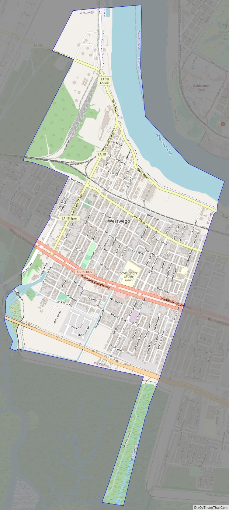
Westwego Road Map
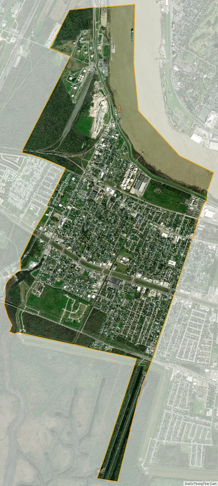
Westwego city Satellite Map
Geography
The city of Westwego is located in the Greater New Orleans metropolitan area and region. According to the United States Census Bureau, the city has a total area of 3.6 square miles (9.2 km), of which 3.1 square miles (8.3 km) is land and 0.5 square mile (1.0 km) (10.64%) is water.
See also
Map of Louisiana State and its subdivision:- Acadia
- Allen
- Ascension
- Assumption
- Avoyelles
- Beauregard
- Bienville
- Bossier
- Caddo
- Calcasieu
- Caldwell
- Cameron
- Catahoula
- Claiborne
- Concordia
- De Soto
- East Baton Rouge
- East Carroll
- East Feliciana
- Evangeline
- Franklin
- Grant
- Iberia
- Iberville
- Jackson
- Jefferson
- Jefferson Davis
- La Salle
- Lafayette
- Lafourche
- Lincoln
- Livingston
- Madison
- Morehouse
- Natchitoches
- Orleans
- Ouachita
- Plaquemines
- Pointe Coupee
- Rapides
- Red River
- Richland
- Sabine
- Saint Bernard
- Saint Charles
- Saint Helena
- Saint James
- Saint John the Baptist
- Saint Landry
- Saint Martin
- Saint Mary
- Saint Tammany
- Tangipahoa
- Tensas
- Terrebonne
- Union
- Vermilion
- Vernon
- Washington
- Webster
- West Baton Rouge
- West Carroll
- West Feliciana
- Winn
- Alabama
- Alaska
- Arizona
- Arkansas
- California
- Colorado
- Connecticut
- Delaware
- District of Columbia
- Florida
- Georgia
- Hawaii
- Idaho
- Illinois
- Indiana
- Iowa
- Kansas
- Kentucky
- Louisiana
- Maine
- Maryland
- Massachusetts
- Michigan
- Minnesota
- Mississippi
- Missouri
- Montana
- Nebraska
- Nevada
- New Hampshire
- New Jersey
- New Mexico
- New York
- North Carolina
- North Dakota
- Ohio
- Oklahoma
- Oregon
- Pennsylvania
- Rhode Island
- South Carolina
- South Dakota
- Tennessee
- Texas
- Utah
- Vermont
- Virginia
- Washington
- West Virginia
- Wisconsin
- Wyoming