Harahan is a city in the U.S. state of Louisiana and suburb of New Orleans. The city of Harahan is located in Jefferson Parish; its population was 9,116 at the 2020 census.
| Name: | Harahan city |
|---|---|
| LSAD Code: | 25 |
| LSAD Description: | city (suffix) |
| State: | Louisiana |
| County: | Jefferson Parish |
| Elevation: | 7 ft (2 m) |
| Total Area: | 2.49 sq mi (6.46 km²) |
| Land Area: | 2.02 sq mi (5.23 km²) |
| Water Area: | 0.48 sq mi (1.23 km²) |
| Total Population: | 9,116 |
| Population Density: | 4,517.34/sq mi (1,743.95/km²) |
| ZIP code: | 70123 |
| Area code: | 504 |
| FIPS code: | 2232930 |
| Website: | www.cityofharahan.com |
Online Interactive Map
Click on ![]() to view map in "full screen" mode.
to view map in "full screen" mode.
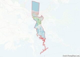
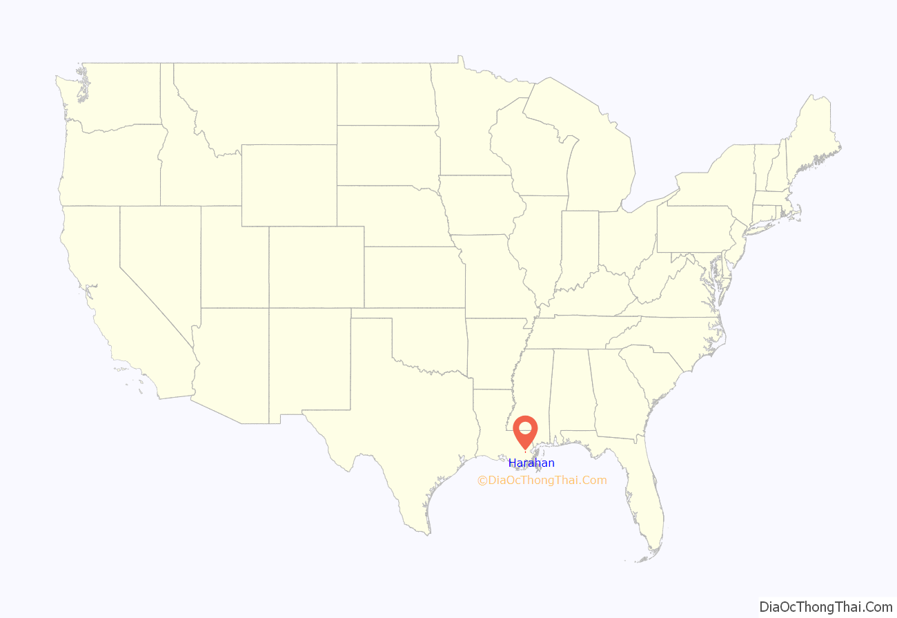
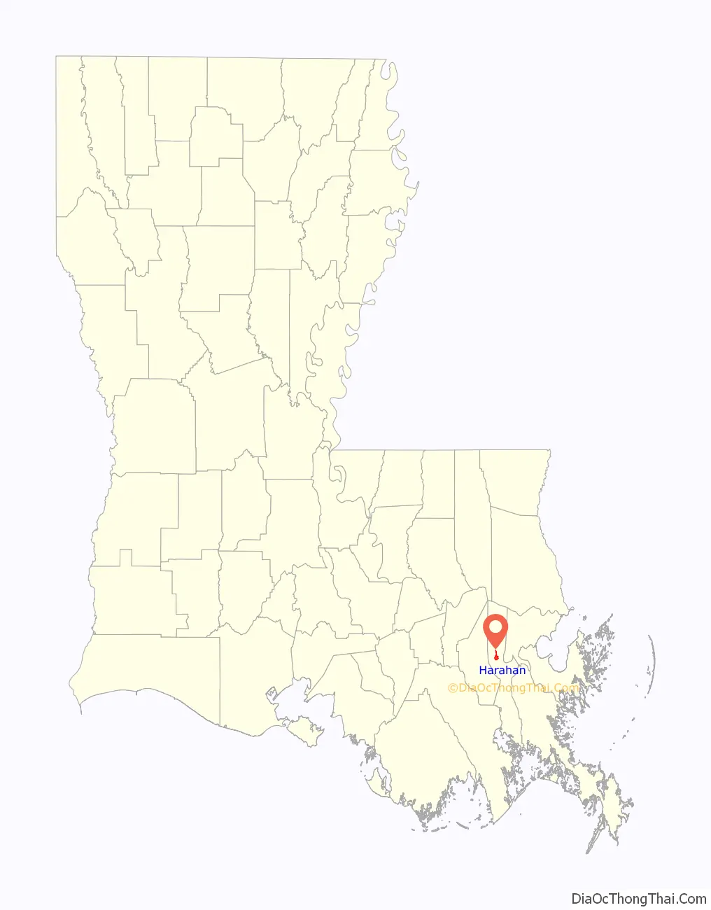
Harahan location map. Where is Harahan city?
History
Harahan occupies land which was once part of the Soniat Plantation. The area was historically known for ideal conditions to use as farming and raising cattle. In the late 1800s, part of the former plantation was used as an experimental farm operated by Southern University and A&M College.
Non-agricultural development began in 1894, when the Illinois Central Railroad (now Canadian National) built a repair yard and roundhouse adjacent to the current city hall. In 1914, the Harahan Land Company, composed of ICRR officials, bought the Southern University tract of land and subdivided it. Residents included railroad workers, river workers and truck farmers. The village of Harahan was incorporated in 1920–named after James Harahan, the ICRR President.
Prior to the Huey P. Long Bridge being built, Harahan was one of few points on the entire Mississippi River where railcars could cross. The Illinois Central and Southern Pacific Railroads maintained a ferry crossing between Harahan and Avondale to carry their railroad cars across the Mississippi River. To reach this ferry, the rail cars traveled up an incline that brought them over the river levee. The three largest barges in the world, the Mastodon, the Mammoth and El Grande once called Harahan home.
In 1908, the Colonial Country Club was built and occupied the old Soniat Plantation home. By 1910, Wedell-Williams on the eastern edge of Harahan, had become the de facto New Orleans airport, and aviation pioneer John Moisant died there in a plane accident while preparing for a competition. Shortly thereafter, Harahan dedicated Moisant Park on Hickory Avenue in his honor. This park was later renamed Zeringue Park shortly after World War II. Wedell-Williams operated commercial and military flights through the 1940s.
In 1930, the Huey P. Long Bridge was opened, increasing the importance of Harahan and by 1940, the population had risen to 1,082 citizens.
During World War II, Camp Plauche was established on the current land occupied by Elmwood. In addition to the camp, Freiburg Mahogany manufacturing began producing critical aircraft and boat components for the war effort. This activity spurred economic growth, particularly new homes; Harahan’s population tripled during this period. This growth continued after the war.
By 1960, the population had grown to over 9,000. Numerous improvements were undertaken, including modernizing the police and fire departments, paving more streets and building a water treatment facility. Commercial activity was limited to Jefferson Highway and the northern end of Hickory. The 1970s and early 80’s so rapid development of apartment construction on Hickory and areas of Elmwood. Completion of Earhart Expressway, making access to New Orleans proper much easier, influenced this growth as the appeal of Harahan as a “bedroom community.” Today, Harahan is directly influenced by its relationship with the larger surrounding areas including Jefferson Parish and the city of New Orleans.
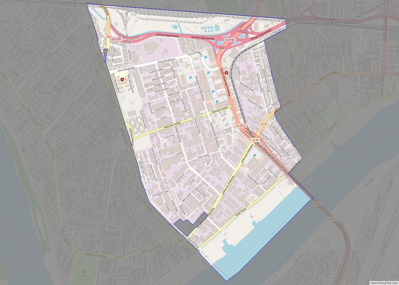
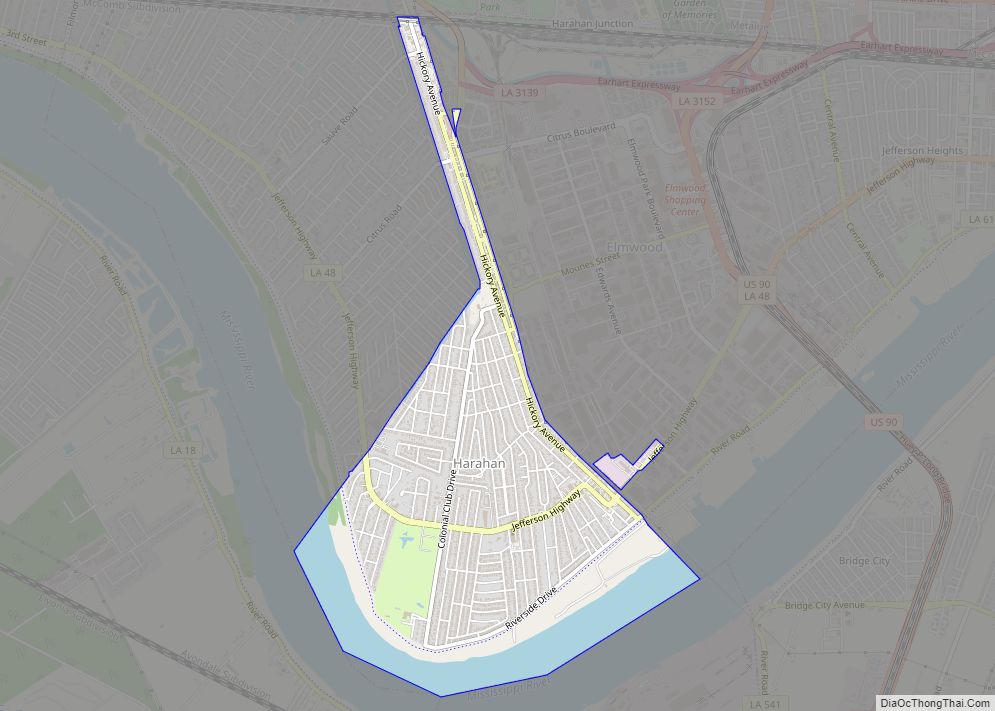
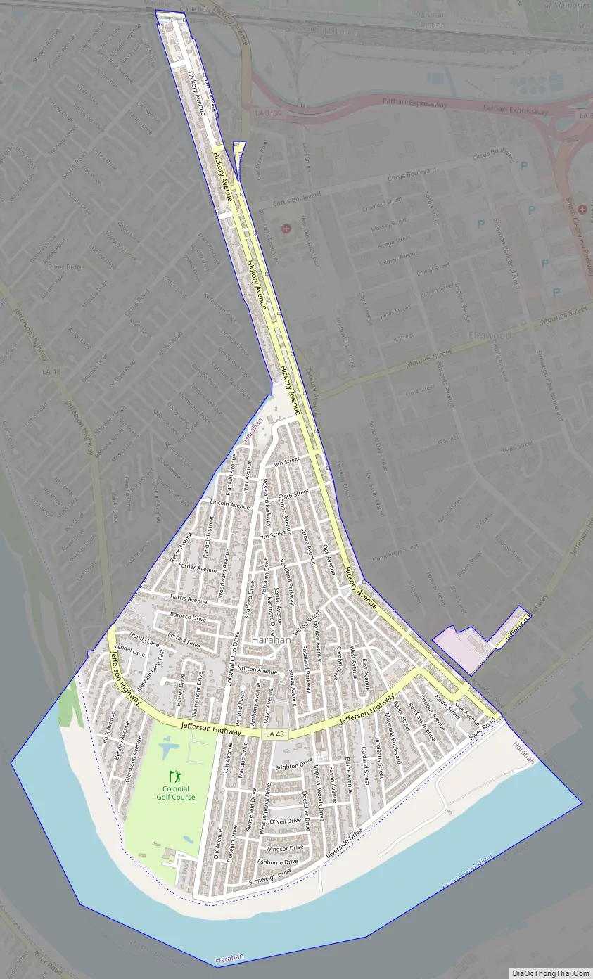
Harahan Road Map
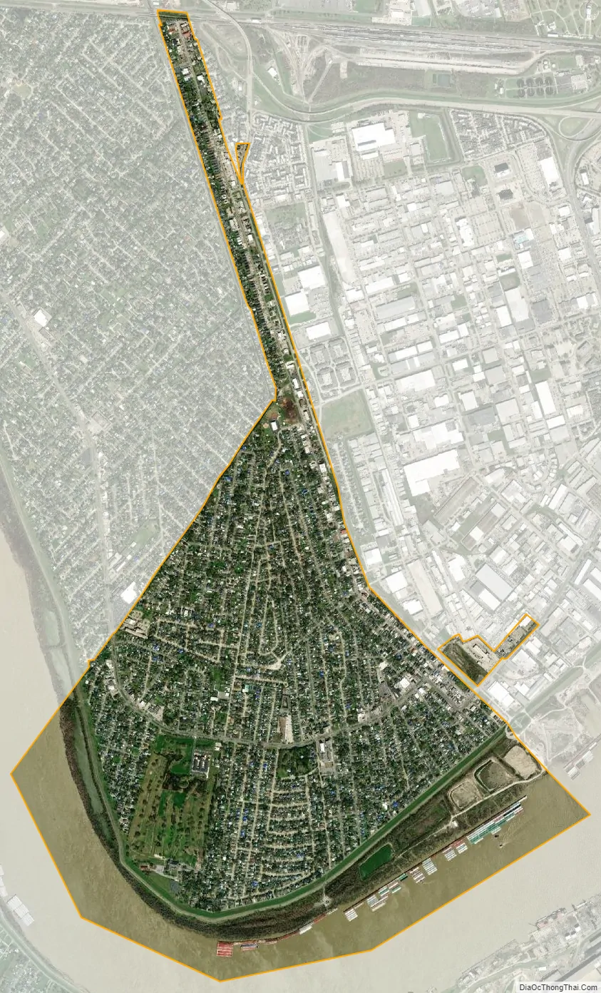
Harahan city Satellite Map
See also
Map of Louisiana State and its subdivision:- Acadia
- Allen
- Ascension
- Assumption
- Avoyelles
- Beauregard
- Bienville
- Bossier
- Caddo
- Calcasieu
- Caldwell
- Cameron
- Catahoula
- Claiborne
- Concordia
- De Soto
- East Baton Rouge
- East Carroll
- East Feliciana
- Evangeline
- Franklin
- Grant
- Iberia
- Iberville
- Jackson
- Jefferson
- Jefferson Davis
- La Salle
- Lafayette
- Lafourche
- Lincoln
- Livingston
- Madison
- Morehouse
- Natchitoches
- Orleans
- Ouachita
- Plaquemines
- Pointe Coupee
- Rapides
- Red River
- Richland
- Sabine
- Saint Bernard
- Saint Charles
- Saint Helena
- Saint James
- Saint John the Baptist
- Saint Landry
- Saint Martin
- Saint Mary
- Saint Tammany
- Tangipahoa
- Tensas
- Terrebonne
- Union
- Vermilion
- Vernon
- Washington
- Webster
- West Baton Rouge
- West Carroll
- West Feliciana
- Winn
- Alabama
- Alaska
- Arizona
- Arkansas
- California
- Colorado
- Connecticut
- Delaware
- District of Columbia
- Florida
- Georgia
- Hawaii
- Idaho
- Illinois
- Indiana
- Iowa
- Kansas
- Kentucky
- Louisiana
- Maine
- Maryland
- Massachusetts
- Michigan
- Minnesota
- Mississippi
- Missouri
- Montana
- Nebraska
- Nevada
- New Hampshire
- New Jersey
- New Mexico
- New York
- North Carolina
- North Dakota
- Ohio
- Oklahoma
- Oregon
- Pennsylvania
- Rhode Island
- South Carolina
- South Dakota
- Tennessee
- Texas
- Utah
- Vermont
- Virginia
- Washington
- West Virginia
- Wisconsin
- Wyoming