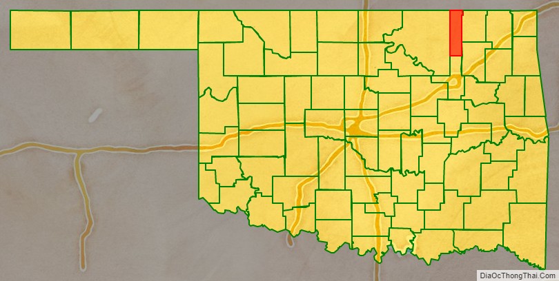
Washington County is a county located in the northeastern part of the U.S. state of Oklahoma. As of the 2020 census, the population was 52,455. Its county seat is Bartlesville. Named for President George Washington, it is the second smallest county in Oklahoma in total area, adjacent to the largest county in Oklahoma, Osage County.
Washington County comprises the Bartlesville, OK Micropolitan Statistical Area, which is also included in the Tulsa–Muskogee-Bartlesville, OK Combined Statistical Area. It is located along the border with Kansas.
| Name: | Washington County |
|---|---|
| FIPS code: | 40-147 |
| State: | Oklahoma |
| Founded: | 1907 |
| Named for: | George Washington |
| Seat: | Bartlesville |
| Largest city: | Bartlesville |
| Total Area: | 424 sq mi (1,100 km²) |
| Land Area: | 415 sq mi (1,070 km²) |
| Total Population: | 52,455 |
| Population Density: | 120/sq mi (48/km²) |
| Website: | www.countycourthouse.org |
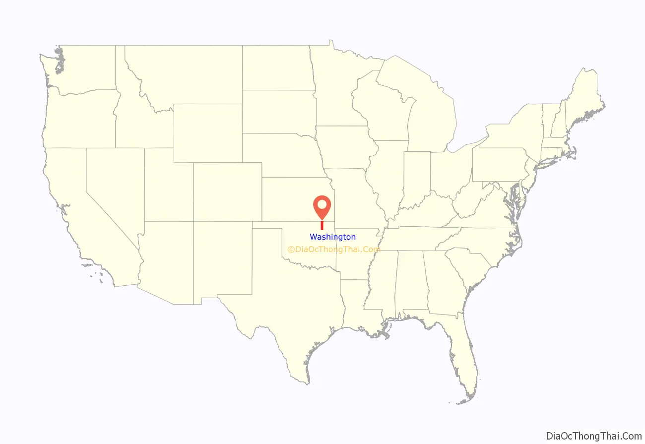
Washington County location map. Where is Washington County?
History
The Osage ceded their land claims in 1825, and the Federal Government allowed the Western Cherokee to settle in this area in 1828. The 1835 Treaty of New Echota confirmed Cherokee ownership of the land. The area now covered by Washington County was part of the Cherokee Saline District between 1840 and 1856 and the Cooweescoowee District from 1856 to 1906.
The first post office was established in 1859 at the confluence of Butler Creek and the Caney River by James L. Butler. Known as Little Verdigris, the settlement also had a trading post and a school. The Civil War caused most of the inhabitants to move away and the post office closed in 1866. In 1867, the Cherokees sold 157,600 acres to the Eastern Delaware
In 1870, Nelson Carr built a grist mill along the Caney River, which he used to grind seed corn. In 1875, he sold the mill to Jacob Bartles (for whom the town of Bartlesville would be named), who modified the mill to produce wheat flour. Other important agricultural crops included potatoes, sorghum and oats, as well as prairie hay and pecans. Cotton production was attempted in the early 1900s, but the soil proved unsuitable and this crop was soon discontinued.
The first commercial oil well in Oklahoma, designated as Nellie Johnstone Number One, was drilled near Bartlesville in 1897. According to the Encyclopedia of Oklahoma History and Culture, the industry developed slowly because of communal land ownership by the Cherokees, the lack of crude oil markets, and lack of reliable transportation. Bartlesville became an oil boom town only after 1900, when the nearby Osage County oil fields were developed and railroads were built into the area. In 1900, Phoenix Oil Company built a pipeline from Osage County to Bartlesville’s Atchison, Topeka and Santa Fe Railway depot, where there was an oil loading facility. Oil was shipped from there to a refinery in Neodesha, Kansas in the same year. Washington County fields were developed soon afterward. The Bartlesville Field reached peak development during 1904 to 1906; the Bartlesville-Dewey Field in 1905 and the Copan, Canary, Hogshooter, and Wann fields were located in 1907. Several oil companies set up headquarters in the county, most notably Phillips Petroleum in Bartlesville.
Railroads came to this area at the turn of the 20th century. The Atchison, Topeka and Santa Fe Railway opened a line from Owen to Owasso, Oklahoma in 1899. The Missouri, Kansas and Texas Railroad opened a line from Stevens, Kansas to Dewey, Oklahoma in 1901-2 and another line from Hominy, Oklahoma to Bartlesville in 1903–04.
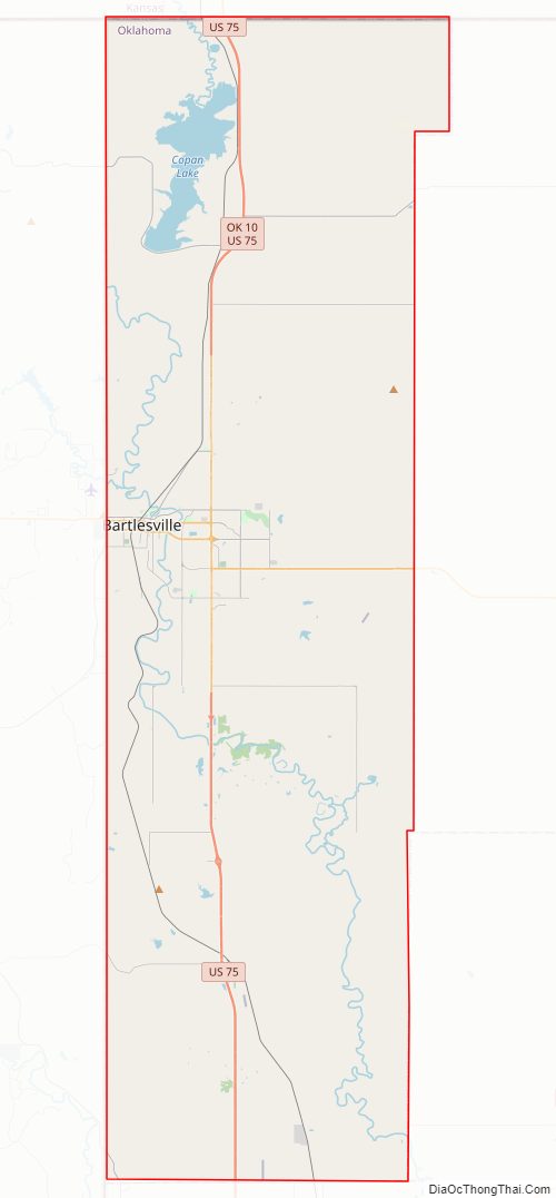
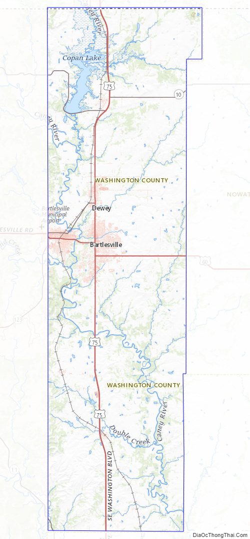
Washington County Road Map
Geography
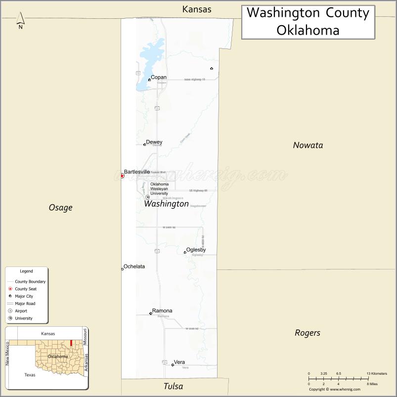
According to the U.S. Census Bureau, the county has a total area of 424 square miles (1,100 km), of which 415 square miles (1,070 km) is land and 8.8 square miles (23 km) (2.1%) is water. It is the second-smallest county in Oklahoma by land area and smallest by total area. It lies in the Eastern Lowlands physiographic region, and is drained by the Caney River. Lakes and reservoirs include Copan Lake, Silver Lake and Bar-Dew Lake.
Adjacent counties
- Montgomery County, Kansas (north)
- Nowata County (east)
- Rogers County (southeast)
- Tulsa County (south)
- Osage County (west)
- Chautauqua County, Kansas (northwest)
Washington County Topographic Map
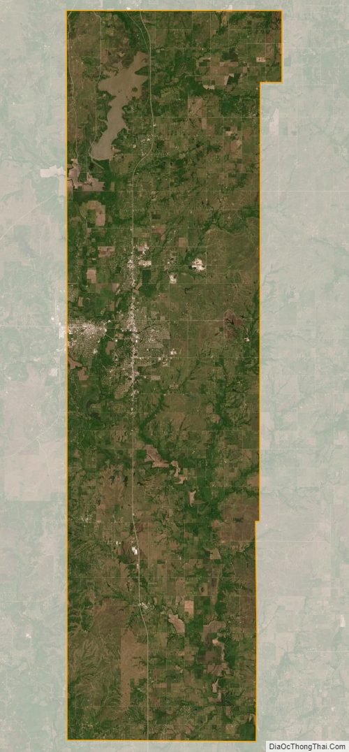
Washington County Satellite Map
Washington County Outline Map

See also
Map of Oklahoma State and its subdivision:- Adair
- Alfalfa
- Atoka
- Beaver
- Beckham
- Blaine
- Bryan
- Caddo
- Canadian
- Carter
- Cherokee
- Choctaw
- Cimarron
- Cleveland
- Coal
- Comanche
- Cotton
- Craig
- Creek
- Custer
- Delaware
- Dewey
- Ellis
- Garfield
- Garvin
- Grady
- Grant
- Greer
- Harmon
- Harper
- Haskell
- Hughes
- Jackson
- Jefferson
- Johnston
- Kay
- Kingfisher
- Kiowa
- Latimer
- Le Flore
- Lincoln
- Logan
- Love
- Major
- Marshall
- Mayes
- McClain
- McCurtain
- McIntosh
- Murray
- Muskogee
- Noble
- Nowata
- Okfuskee
- Oklahoma
- Okmulgee
- Osage
- Ottawa
- Pawnee
- Payne
- Pittsburg
- Pontotoc
- Pottawatomie
- Pushmataha
- Roger Mills
- Rogers
- Seminole
- Sequoyah
- Stephens
- Texas
- Tillman
- Tulsa
- Wagoner
- Washington
- Washita
- Woods
- Woodward
- Alabama
- Alaska
- Arizona
- Arkansas
- California
- Colorado
- Connecticut
- Delaware
- District of Columbia
- Florida
- Georgia
- Hawaii
- Idaho
- Illinois
- Indiana
- Iowa
- Kansas
- Kentucky
- Louisiana
- Maine
- Maryland
- Massachusetts
- Michigan
- Minnesota
- Mississippi
- Missouri
- Montana
- Nebraska
- Nevada
- New Hampshire
- New Jersey
- New Mexico
- New York
- North Carolina
- North Dakota
- Ohio
- Oklahoma
- Oregon
- Pennsylvania
- Rhode Island
- South Carolina
- South Dakota
- Tennessee
- Texas
- Utah
- Vermont
- Virginia
- Washington
- West Virginia
- Wisconsin
- Wyoming