Dewey is a city in Washington County, Oklahoma, United States. Founded by Jacob A. Bartles in 1899, the town was named for Admiral George Dewey. It was incorporated December 8, 1905. The population was 3,179 at the 2000 census and 3,432 at the 2010 census, an increase of 8 percent.
| Name: | Dewey city |
|---|---|
| LSAD Code: | 25 |
| LSAD Description: | city (suffix) |
| State: | Oklahoma |
| County: | Washington County |
| Elevation: | 702 ft (214 m) |
| Total Area: | 2.69 sq mi (6.98 km²) |
| Land Area: | 2.69 sq mi (6.98 km²) |
| Water Area: | 0.00 sq mi (0.00 km²) |
| Total Population: | 3,372 |
| Population Density: | 1,251.21/sq mi (483.09/km²) |
| ZIP code: | 74006, 74029 |
| Area code: | 539/918 |
| FIPS code: | 4020550 |
| GNISfeature ID: | 1092067 |
Online Interactive Map
Click on ![]() to view map in "full screen" mode.
to view map in "full screen" mode.
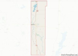
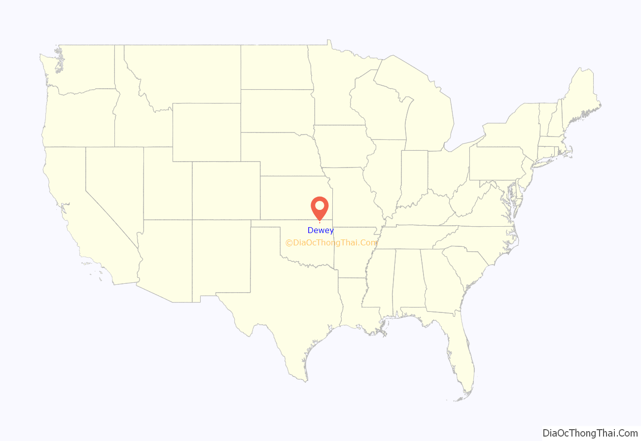
Dewey location map. Where is Dewey city?

History
In 1899, Jacob Bartles moved his grist mill and trading post three miles north from Bartlesville to property he owned along the Atchison, Topeka and Santa Fe Railroad. He built the Dewey Hotel in the following year. The first newspaper in town, the Dewey Eagle, began publication in 1900, and the Missouri, Kansas and Texas Railroad came to Dewey in 1903.
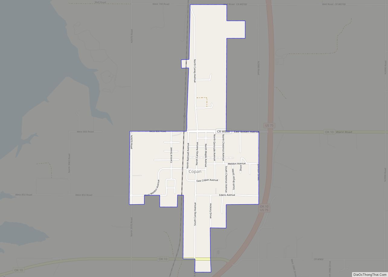
Dewey Road Map
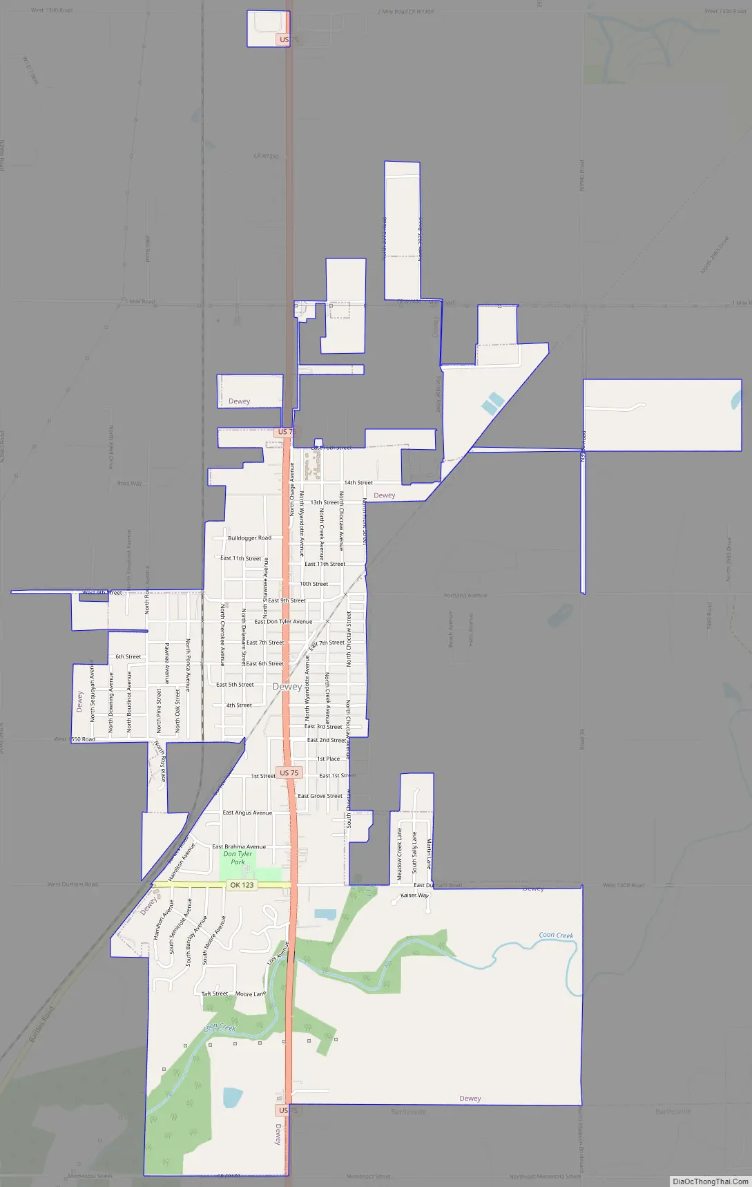
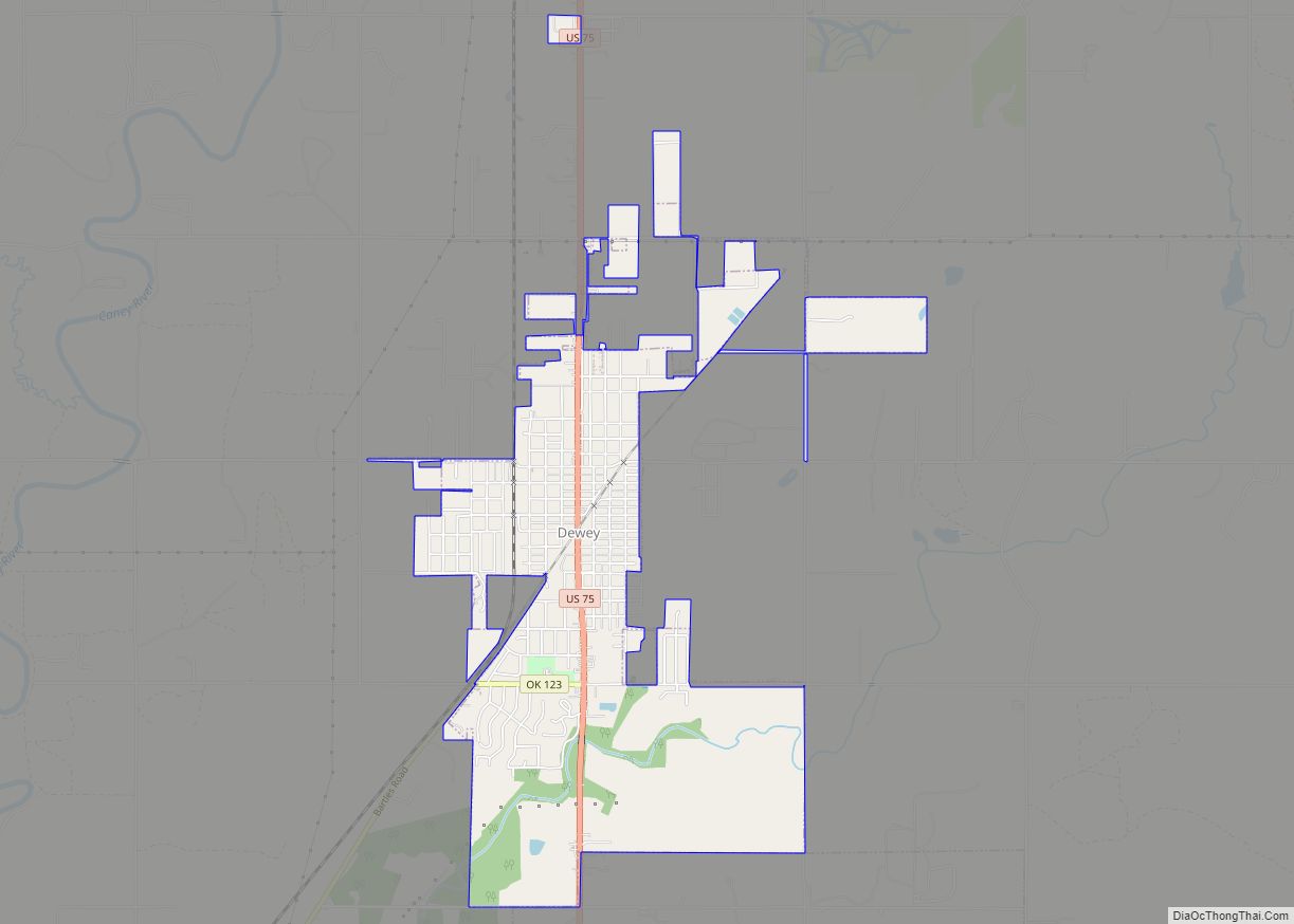
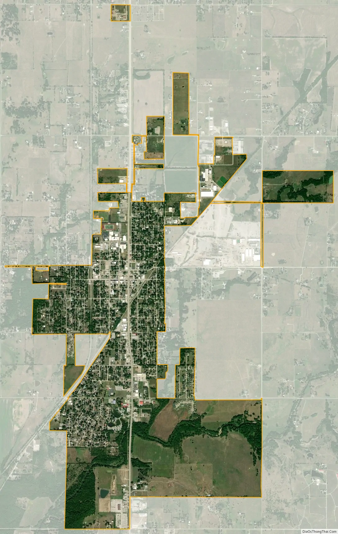
Dewey city Satellite Map
Geography
Dewey is located at 36°47′46″N 95°56′10″W / 36.79611°N 95.93611°W / 36.79611; -95.93611 (36.796106, -95.936102).
According to the United States Census Bureau, the city has a total area of 2.5 square miles (6.5 km), all land.
See also
Map of Oklahoma State and its subdivision:- Adair
- Alfalfa
- Atoka
- Beaver
- Beckham
- Blaine
- Bryan
- Caddo
- Canadian
- Carter
- Cherokee
- Choctaw
- Cimarron
- Cleveland
- Coal
- Comanche
- Cotton
- Craig
- Creek
- Custer
- Delaware
- Dewey
- Ellis
- Garfield
- Garvin
- Grady
- Grant
- Greer
- Harmon
- Harper
- Haskell
- Hughes
- Jackson
- Jefferson
- Johnston
- Kay
- Kingfisher
- Kiowa
- Latimer
- Le Flore
- Lincoln
- Logan
- Love
- Major
- Marshall
- Mayes
- McClain
- McCurtain
- McIntosh
- Murray
- Muskogee
- Noble
- Nowata
- Okfuskee
- Oklahoma
- Okmulgee
- Osage
- Ottawa
- Pawnee
- Payne
- Pittsburg
- Pontotoc
- Pottawatomie
- Pushmataha
- Roger Mills
- Rogers
- Seminole
- Sequoyah
- Stephens
- Texas
- Tillman
- Tulsa
- Wagoner
- Washington
- Washita
- Woods
- Woodward
- Alabama
- Alaska
- Arizona
- Arkansas
- California
- Colorado
- Connecticut
- Delaware
- District of Columbia
- Florida
- Georgia
- Hawaii
- Idaho
- Illinois
- Indiana
- Iowa
- Kansas
- Kentucky
- Louisiana
- Maine
- Maryland
- Massachusetts
- Michigan
- Minnesota
- Mississippi
- Missouri
- Montana
- Nebraska
- Nevada
- New Hampshire
- New Jersey
- New Mexico
- New York
- North Carolina
- North Dakota
- Ohio
- Oklahoma
- Oregon
- Pennsylvania
- Rhode Island
- South Carolina
- South Dakota
- Tennessee
- Texas
- Utah
- Vermont
- Virginia
- Washington
- West Virginia
- Wisconsin
- Wyoming