Owasso is a city in Rogers and Tulsa Counties in the U.S. state of Oklahoma, and the largest northern suburb of Tulsa. The population was 38,732 persons as of the 2021 census estimate, compared to 28,915 at the 2010 census, a gain of 32.24 percent. Originally settled in 1881 in Indian Territory, the town was incorporated in 1904 just before Oklahoma statehood and was chartered as a city in 1972.
| Name: | Owasso city |
|---|---|
| LSAD Code: | 25 |
| LSAD Description: | city (suffix) |
| State: | Oklahoma |
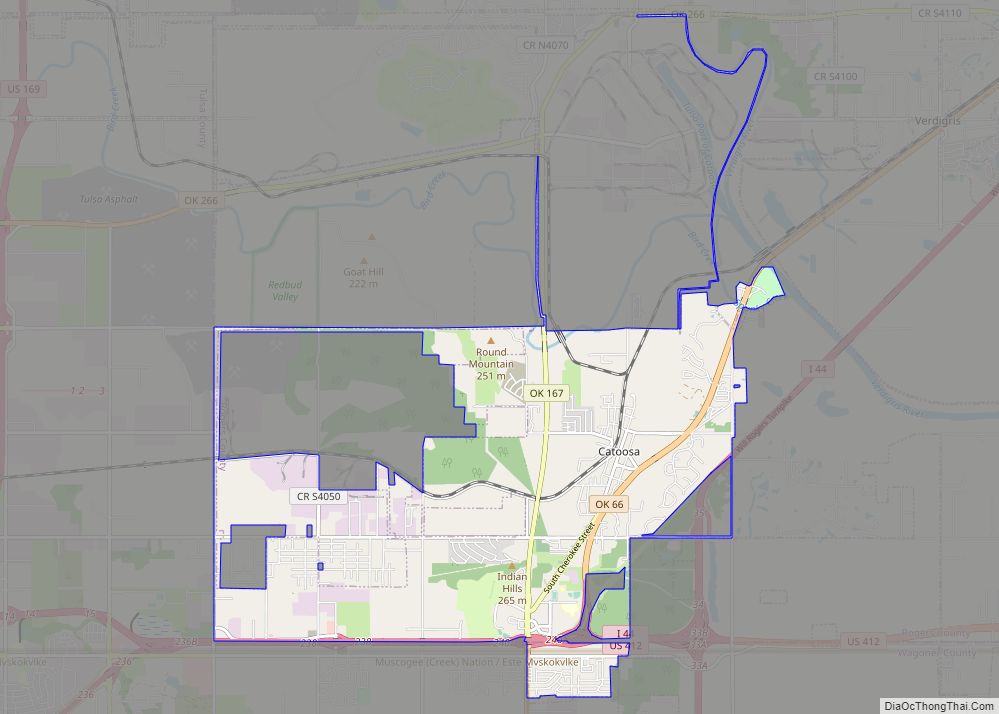
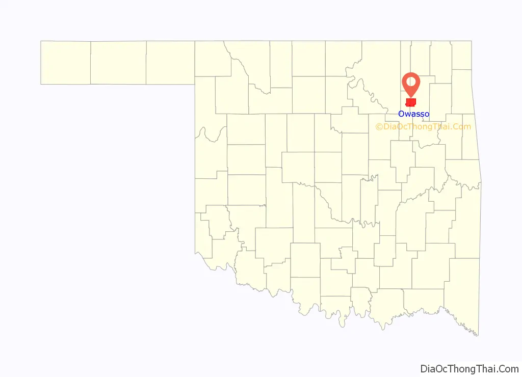
| County: | Rogers County, Tulsa County |
| Incorporated: | 1904 (town in Indian Territory); 1972 (city chartered in Oklahoma) |
| Elevation: | 610 ft (190 m) |
| Total Area: | 17.02 sq mi (44.07 km²) |
| Land Area: | 17.00 sq mi (44.02 km²) |
| Water Area: | 0.02 sq mi (0.05 km²) |
| Total Population: | 38,240 |
| Population Density: | 2,249.94/sq mi (868.73/km²) |
| ZIP code: | 74055 |
| Area code: | 918 |
| FIPS code: | 4056650 |
| Website: | www.cityofowasso.com |
Online Interactive Map
Click on ![]() to view map in "full screen" mode.
to view map in "full screen" mode.
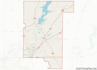
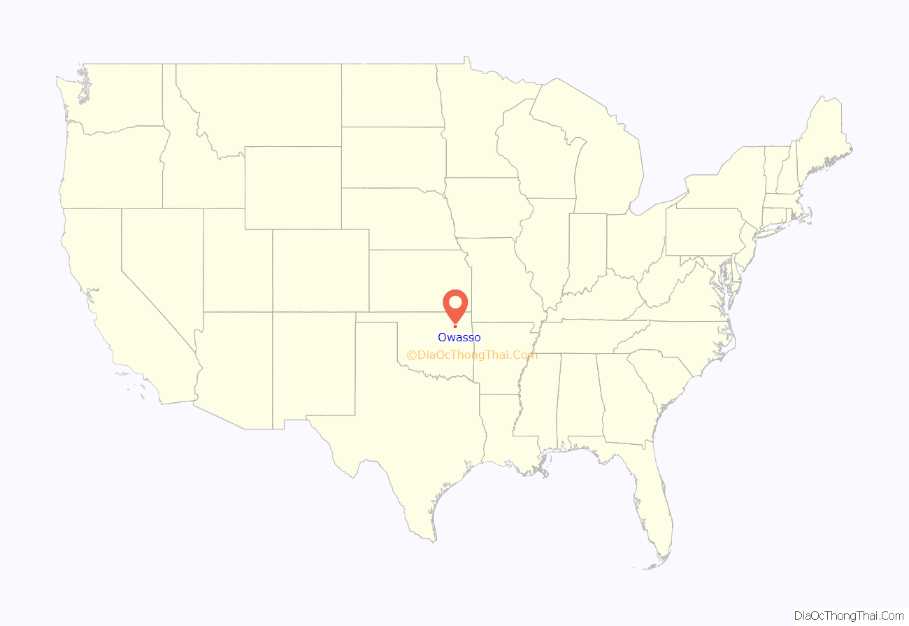
Owasso location map. Where is Owasso city?
History
Owasso began as a settlement in 1881, located in the Cooweescoowee District of the Cherokee Nation in Indian Territory, near what is now 66th Street North and North 129th East Avenue. It was called Elm Creek and was named for Elm Creek, a tributary of Bird Creek. The first settler was H.T. (Tole) Richardson. In June 1893, plans began for a rail line to be extended south from Bartlesville to the cattle ranches in the vicinity of Bird Creek. At that time, already several residences, a blacksmith shop, and a general store were in the Elm Creek settlement. Preston Ballard, the owner of the general store, established a post office in the general store on February 10, 1898, and was appointed the first postmaster. The Joseph T. Barnes family moved to the settlement in 1897. Joseph and Luther Barnes bought the blacksmith shop in 1898. The first gas station was opened in 1902 by Donovan Ranta.
In 1897, Kansas, Oklahoma Central & Southwestern Railway Company acquired right-of-way about 3 miles (4.8 km) northwest of the Elm Creek settlement, dammed a natural spring to form a lake as a water supply for the rail line, and built a depot about a mile south of the lake. The depot was torn down in 1942. Late in 1898, Joseph and Luther Barnes moved their blacksmith shop to the new community. The shop became a temporary home for the Joseph Barnes family. It was the first residence officially moved to the new depot community. In 1898, many of the residents and businesses moved from the Elm Creek settlement to the new community. Preston Ballard moved his post office and general store during that time. The new community became known as Elm Creek since the post office retained its name.
The railroad completed its line in 1899. Its parent company, the Atchison, Topeka & Santa Fe Railway Company, took over the line and property. The first train came into Elm Creek on November 1, 1899. As the land around the end of this railroad developed, the Osage Indian word Owasso, meaning “the end of the trail” or “turn around”, was adopted to identify the area because the rail line ended in a turnaround “Y” near the depot. The name of the Elm Creek post office was officially changed to Owasso on January 24, 1900. The rail line was not extended into Tulsa until 1905.
A plat of the original townsite of Owasso, Cherokee Nation, I.T. was signed by the Secretary of the Interior on March 26, 1904, in connection with the town’s incorporation. That plat shows three streets running north and south and eight streets running east and west. The north-south streets were named Oklahoma, Kansas, and Missouri, and the east-west streets north of what is now Broadway were named for Union generals, while the east-west streets to the south were named for Confederate generals. These names were later changed; east-west streets are now identified by street numbers, and north-south streets are now named after trees. The original street names were changed to their present names around 1960.
By the time Oklahoma became a state on November 16, 1907, Owasso had a population of 379 within the town limits. The first newspaper was The Owasso Ledger which was first published on August 7, 1903, by U. P. Wardrip. The subscription price was $1.00 per year, paid in advance. The Pioneer Telephone and Telegraph Company was granted a franchise on February 6, 1905, for the town’s first telephone exchange. Until the first water tower was erected in 1924, with Spavinaw as the water source, water came into town in barrels from Owasso Lake and sold for $0.50 a barrel.
Owasso was incorporated as a city on September 28, 1972.
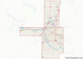
Owasso Road Map
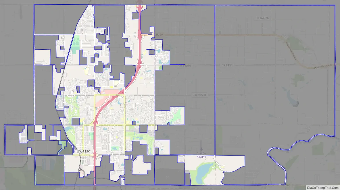
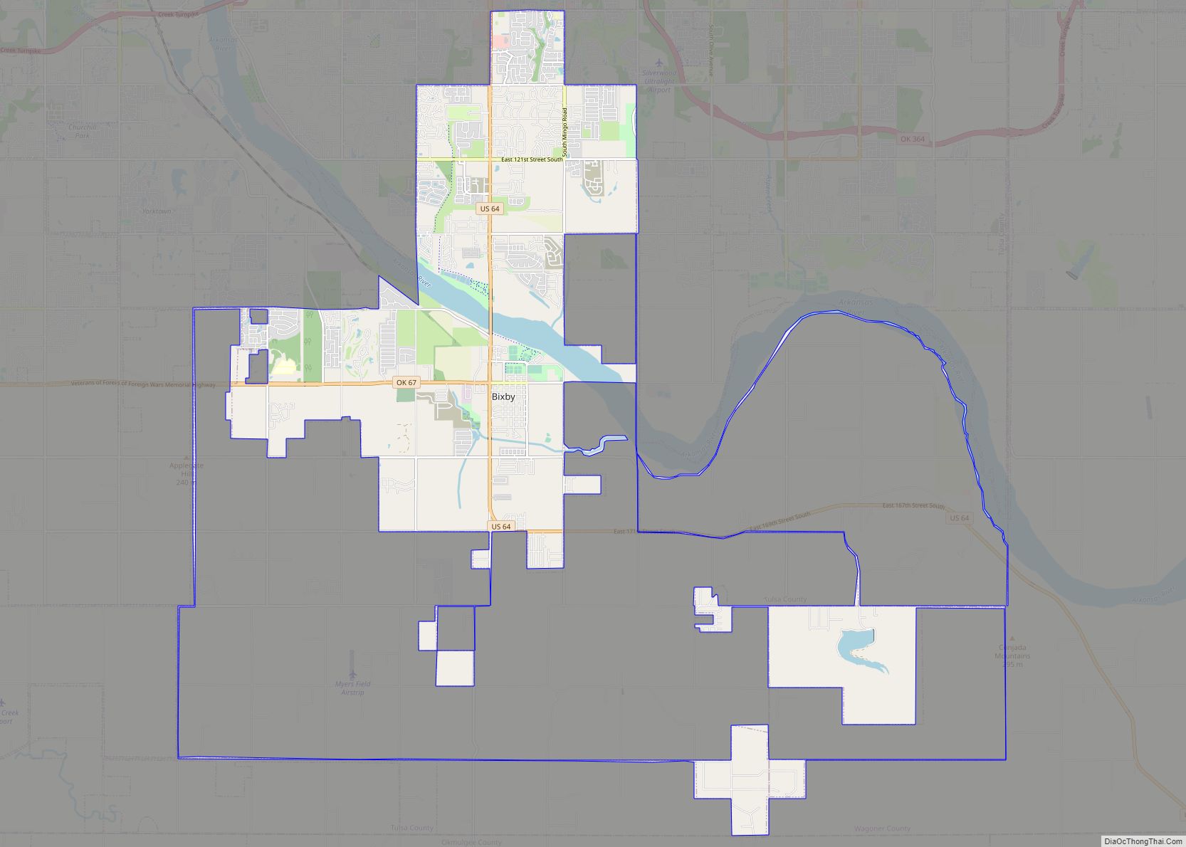
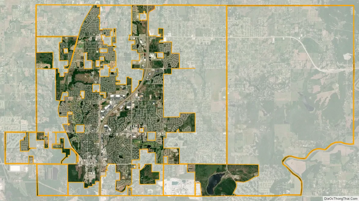
Owasso city Satellite Map
Geography
Owasso is a northern suburb of Tulsa, Oklahoma, in the northeastern corner of Oklahoma known as “Green Country” for its vegetation, hills, woods, and lakes, in contrast to the drier Great Plains region of central and western Oklahoma. According to the United States Census Bureau, the city has an area of 16.31 square miles (42.2 km), 99.1% of which is land, the remainder water.
Climate
Owasso lies in Tornado Alley and has a temperate climate of the humid subtropical variety (Köppen Cfa) with a yearly average temperature of 60 °F (16 °C) and average precipitation of 39.5 inches (1,000 mm).
See also
Map of Oklahoma State and its subdivision:- Adair
- Alfalfa
- Atoka
- Beaver
- Beckham
- Blaine
- Bryan
- Caddo
- Canadian
- Carter
- Cherokee
- Choctaw
- Cimarron
- Cleveland
- Coal
- Comanche
- Cotton
- Craig
- Creek
- Custer
- Delaware
- Dewey
- Ellis
- Garfield
- Garvin
- Grady
- Grant
- Greer
- Harmon
- Harper
- Haskell
- Hughes
- Jackson
- Jefferson
- Johnston
- Kay
- Kingfisher
- Kiowa
- Latimer
- Le Flore
- Lincoln
- Logan
- Love
- Major
- Marshall
- Mayes
- McClain
- McCurtain
- McIntosh
- Murray
- Muskogee
- Noble
- Nowata
- Okfuskee
- Oklahoma
- Okmulgee
- Osage
- Ottawa
- Pawnee
- Payne
- Pittsburg
- Pontotoc
- Pottawatomie
- Pushmataha
- Roger Mills
- Rogers
- Seminole
- Sequoyah
- Stephens
- Texas
- Tillman
- Tulsa
- Wagoner
- Washington
- Washita
- Woods
- Woodward
- Alabama
- Alaska
- Arizona
- Arkansas
- California
- Colorado
- Connecticut
- Delaware
- District of Columbia
- Florida
- Georgia
- Hawaii
- Idaho
- Illinois
- Indiana
- Iowa
- Kansas
- Kentucky
- Louisiana
- Maine
- Maryland
- Massachusetts
- Michigan
- Minnesota
- Mississippi
- Missouri
- Montana
- Nebraska
- Nevada
- New Hampshire
- New Jersey
- New Mexico
- New York
- North Carolina
- North Dakota
- Ohio
- Oklahoma
- Oregon
- Pennsylvania
- Rhode Island
- South Carolina
- South Dakota
- Tennessee
- Texas
- Utah
- Vermont
- Virginia
- Washington
- West Virginia
- Wisconsin
- Wyoming