Hominy (Osage: Hą́mąðį “night-walker”) is a city in Osage County, Oklahoma, United States. The population was 3,565 at the 2010 census, a 38 percent increase over the figure of 2,584 recorded in 2000.
The town was the home of an all-Native American football team in the 1920s. Parts of a docudrama on the Hominy Indians were shot in the area in 2013.
| Name: | Hominy city |
|---|---|
| LSAD Code: | 25 |
| LSAD Description: | city (suffix) |
| State: | Oklahoma |
| County: | Osage County |
| Elevation: | 787 ft (240 m) |
| Total Area: | 1.97 sq mi (5.09 km²) |
| Land Area: | 1.97 sq mi (5.09 km²) |
| Water Area: | 0.00 sq mi (0.00 km²) |
| Total Population: | 3,329 |
| Population Density: | 1,693.29/sq mi (653.91/km²) |
| ZIP code: | 74035 |
| Area code: | 539/918 |
| FIPS code: | 4035850 |
| GNISfeature ID: | 1093874 |
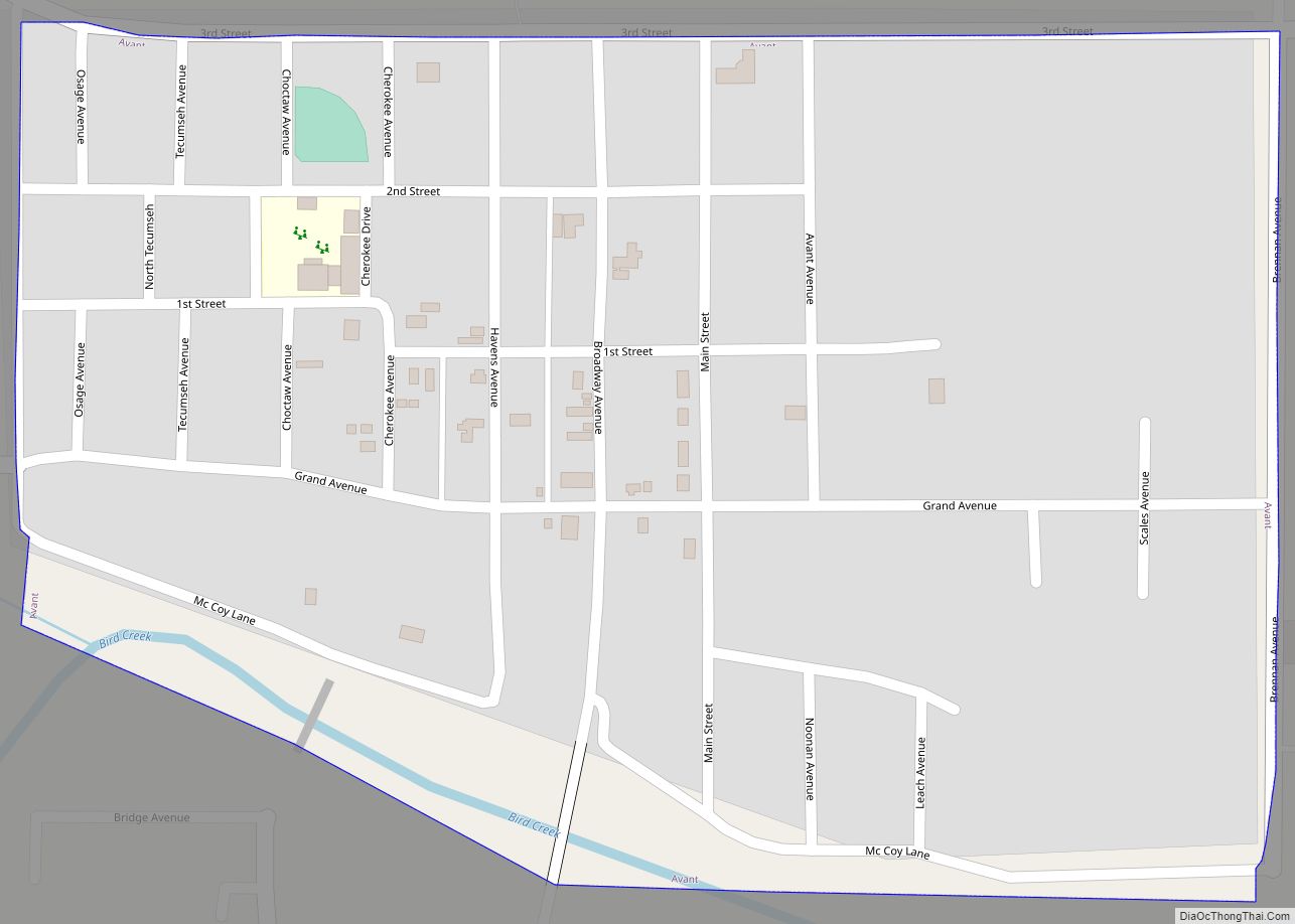
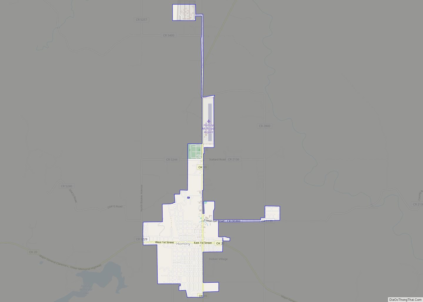
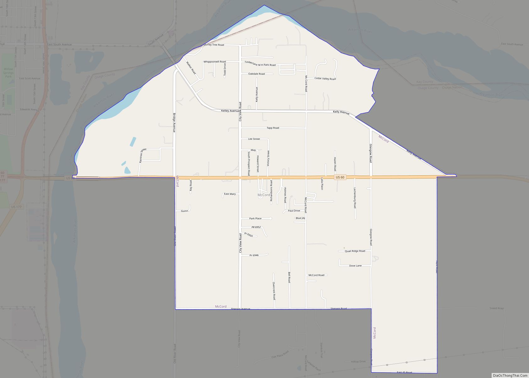
Online Interactive Map
Click on ![]() to view map in "full screen" mode.
to view map in "full screen" mode.
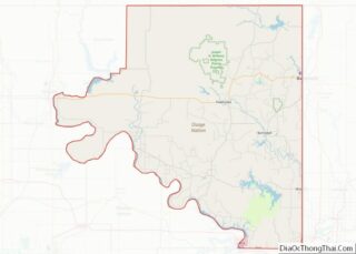
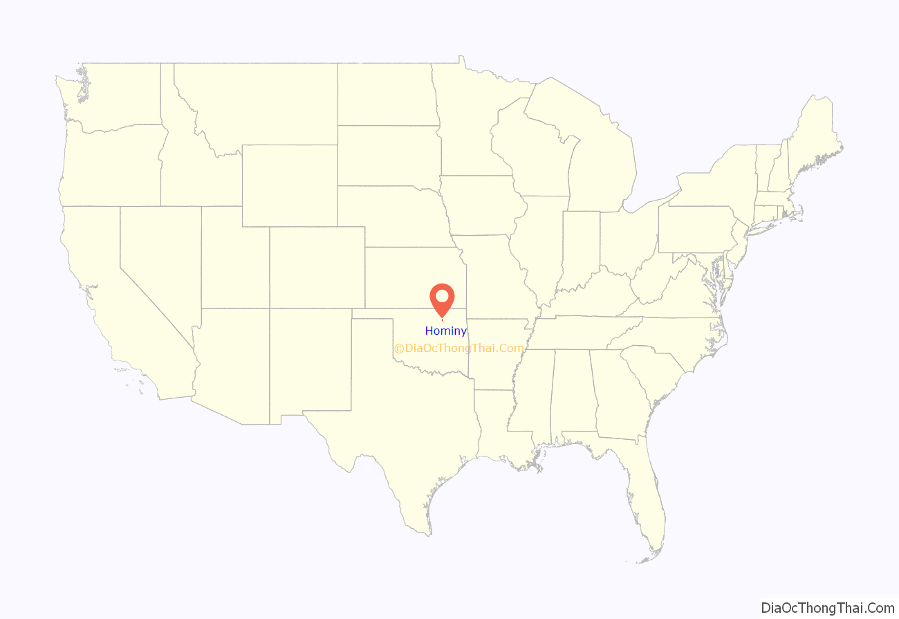
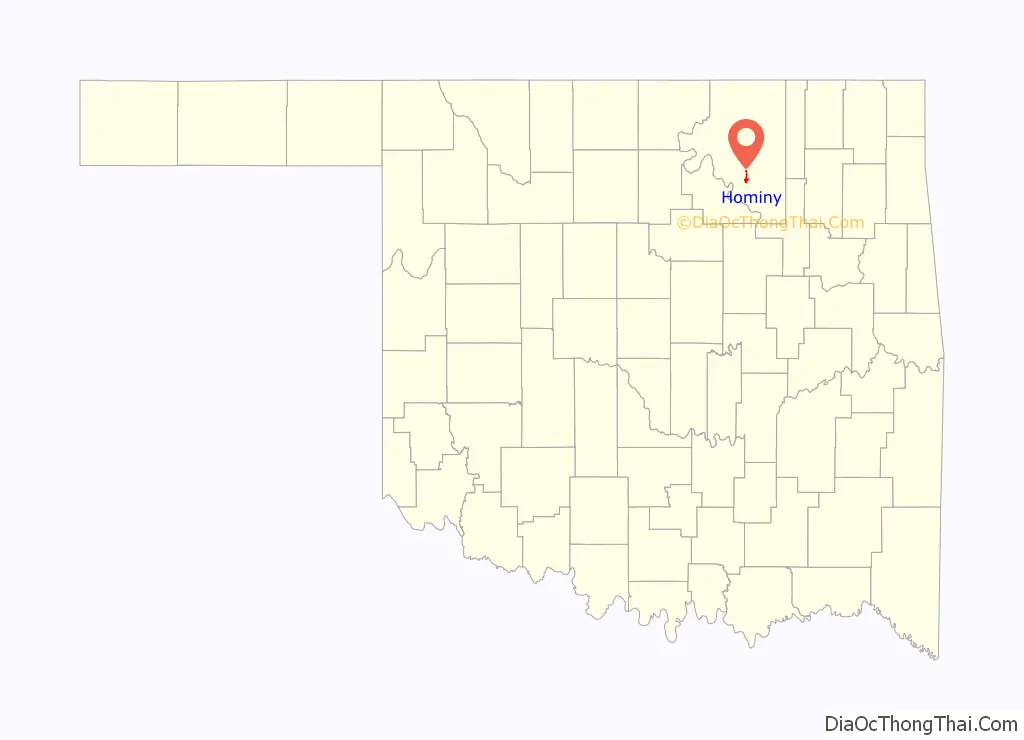
Hominy location map. Where is Hominy city?
History
The town was incorporated in 1908, though the initial settlement developed in the late 1880s. The town’s first mayor was Frederick Drummond.
From the early 1920s to 1932, Hominy was home to a professional football team composed of Native American players.
The Hominy Indians defeated the New York Giants in 1927, just after the Giants were named champions of the National Football League. The team had a 28-game winning streak at one point during its existence, but was disbanded due to the onset of the Great Depression. A screening of the movie “Playground of the Native Son,” based on the events of the team was screened on October 10, 2014, at Circle Cinema, Tulsa’s non-profit independent theater.
A medium security prison was constructed in Hominy at the price of $12.8 million and received its first inmates in August 1979. It was originally named the Jess Dunn Correctional Center, in honor of Warden Jess Dunn who had been shot and killed in 1941 by prisoners during an escape attempt. A 1977 joint resolution renamed the facility the Dick Conner Correctional Center. The facility reached its original design capacity of 400 during the spring of 1980.
The prison was severely damaged by a riot that took place on August 29 and 30, 1983. A riot proclamation was issued by then Governor George Nigh on August 30. The inmates torched the buildings adjacent to the kitchen and completely destroyed the library, school, and church area. All of this resulted in the death of an inmate and damages of $3 million. The first special session of the 39th Legislature re-appropriated nearly $2.5 million to fund reconstruction of the facility.
Hominy Road Map
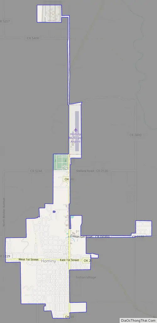
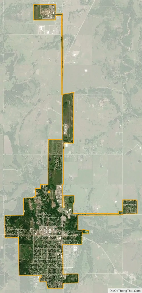
Hominy city Satellite Map
Geography
Hominy is located at 36°25′2″N 96°23′36″W / 36.41722°N 96.39333°W / 36.41722; -96.39333 (36.417141, -96.393423). It is 21 miles (34 km) south of Pawhuska, the county seat.
According to the United States Census Bureau, the city has a total area of 2.0 square miles (5.2 km), all land.
See also
Map of Oklahoma State and its subdivision:- Adair
- Alfalfa
- Atoka
- Beaver
- Beckham
- Blaine
- Bryan
- Caddo
- Canadian
- Carter
- Cherokee
- Choctaw
- Cimarron
- Cleveland
- Coal
- Comanche
- Cotton
- Craig
- Creek
- Custer
- Delaware
- Dewey
- Ellis
- Garfield
- Garvin
- Grady
- Grant
- Greer
- Harmon
- Harper
- Haskell
- Hughes
- Jackson
- Jefferson
- Johnston
- Kay
- Kingfisher
- Kiowa
- Latimer
- Le Flore
- Lincoln
- Logan
- Love
- Major
- Marshall
- Mayes
- McClain
- McCurtain
- McIntosh
- Murray
- Muskogee
- Noble
- Nowata
- Okfuskee
- Oklahoma
- Okmulgee
- Osage
- Ottawa
- Pawnee
- Payne
- Pittsburg
- Pontotoc
- Pottawatomie
- Pushmataha
- Roger Mills
- Rogers
- Seminole
- Sequoyah
- Stephens
- Texas
- Tillman
- Tulsa
- Wagoner
- Washington
- Washita
- Woods
- Woodward
- Alabama
- Alaska
- Arizona
- Arkansas
- California
- Colorado
- Connecticut
- Delaware
- District of Columbia
- Florida
- Georgia
- Hawaii
- Idaho
- Illinois
- Indiana
- Iowa
- Kansas
- Kentucky
- Louisiana
- Maine
- Maryland
- Massachusetts
- Michigan
- Minnesota
- Mississippi
- Missouri
- Montana
- Nebraska
- Nevada
- New Hampshire
- New Jersey
- New Mexico
- New York
- North Carolina
- North Dakota
- Ohio
- Oklahoma
- Oregon
- Pennsylvania
- Rhode Island
- South Carolina
- South Dakota
- Tennessee
- Texas
- Utah
- Vermont
- Virginia
- Washington
- West Virginia
- Wisconsin
- Wyoming