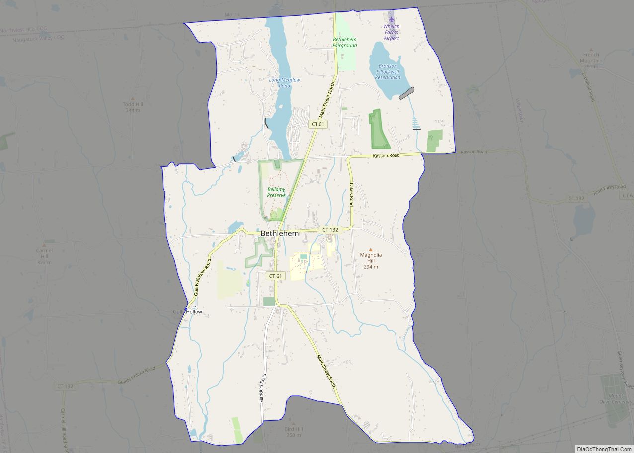
Bethlehem Village is a census-designated place (CDP) within the town of Bethlehem in Litchfield County, Connecticut, United States. The CDP includes the Bethlehem Green Historic District at the town center, as well as surrounding residential and rural land. As of the 2010 census, the CDP had a population of 2,021, out of a population of 3,607 for the entire town of Bethlehem.
| Name: | Bethlehem Village CDP |
|---|---|
| LSAD Code: | 57 |
| LSAD Description: | CDP (suffix) |
| State: | Connecticut |
| County: | Litchfield County |
| Elevation: | 861 ft (262 m) |
| Total Area: | 8.06 sq mi (20.87 km²) |
| Land Area: | 7.79 sq mi (20.18 km²) |
| Water Area: | 0.27 sq mi (0.69 km²) |
| Total Population: | 2,021 |
| Population Density: | 260/sq mi (100.2/km²) |
| ZIP code: | 06751 |
| Area code: | 860 |
| FIPS code: | 0904945 |
| GNISfeature ID: | 2378336 |
Online Interactive Map
Click on ![]() to view map in "full screen" mode.
to view map in "full screen" mode.
Bethlehem Village location map. Where is Bethlehem Village CDP?


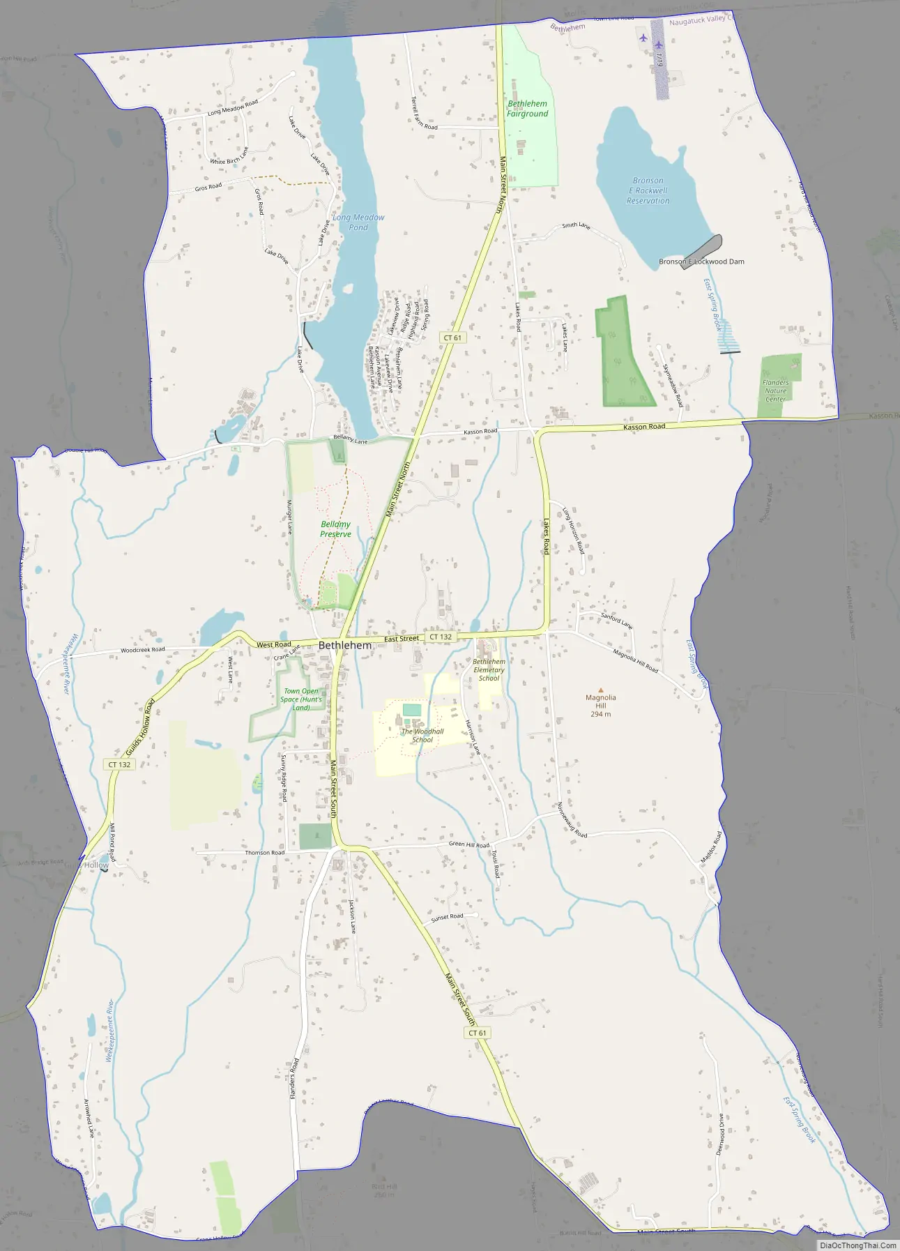
Bethlehem Village Road Map
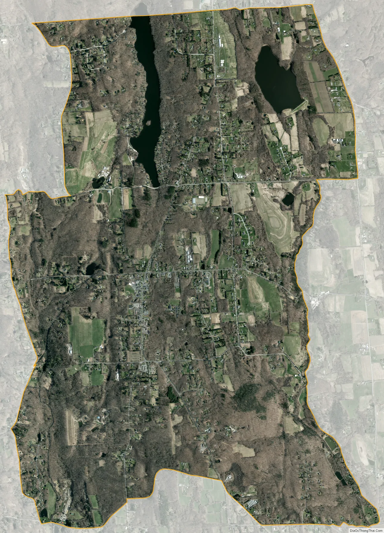
Bethlehem Village city Satellite Map
Geography
The Bethlehem Village CDP occupies about 40% of the town of Bethlehem, covering the center part of the town from its border with Morris in the north to Crane Hollow Road, Robert Leather Road, and Porter Hill Road in the south. The CDP extends east to Hard Hill Road N, East Spring Brook, and Nonnewaug Road, and west to Weekeepeemee Road, Judge Lane, Woodcreek Road, and Munger Lane.
According to the United States Census Bureau, the CDP has a total area of 8.1 square miles (20.9 km), of which 7.8 square miles (20.2 km) are land and 0.3 square miles (0.7 km), or 3.30%, are water. Long Meadow Pond and the Bronson E. Lockwood Reservoir are in the northern part of the CDP.
Connecticut Route 61 passes through the center of the village, leading north 8 miles (13 km) to Litchfield and south 4 miles (6 km) to U.S. Route 6 in Woodbury. Connecticut Route 132 crosses Route 61 at the village center, leading east four miles to Connecticut Route 63 in Watertown and southwest 7 miles (11 km) to Connecticut Route 47 in Woodbury.
See also
Map of Connecticut State and its subdivision: Map of other states:- Alabama
- Alaska
- Arizona
- Arkansas
- California
- Colorado
- Connecticut
- Delaware
- District of Columbia
- Florida
- Georgia
- Hawaii
- Idaho
- Illinois
- Indiana
- Iowa
- Kansas
- Kentucky
- Louisiana
- Maine
- Maryland
- Massachusetts
- Michigan
- Minnesota
- Mississippi
- Missouri
- Montana
- Nebraska
- Nevada
- New Hampshire
- New Jersey
- New Mexico
- New York
- North Carolina
- North Dakota
- Ohio
- Oklahoma
- Oregon
- Pennsylvania
- Rhode Island
- South Carolina
- South Dakota
- Tennessee
- Texas
- Utah
- Vermont
- Virginia
- Washington
- West Virginia
- Wisconsin
- Wyoming