Hazardville is a section of the town of Enfield, Connecticut, in Hartford County. It is a census-designated place (CDP) that had a total population of 4,599 as of the 2010 census.
| Name: | Hazardville CDP |
|---|---|
| LSAD Code: | 57 |
| LSAD Description: | CDP (suffix) |
| State: | Connecticut |
| County: | Hartford County |
| Elevation: | 180 ft (50 m) |
| Total Area: | 3.3 sq mi (8.5 km²) |
| Land Area: | 3.3 sq mi (8.5 km²) |
| Water Area: | 0.0 sq mi (0.0 km²) |
| Total Population: | 4,599 |
| Population Density: | 1,400/sq mi (540/km²) |
| ZIP code: | 06082 |
| Area code: | 860 |
| FIPS code: | 0937770 |
| GNISfeature ID: | 2377824 |
Online Interactive Map
Click on ![]() to view map in "full screen" mode.
to view map in "full screen" mode.
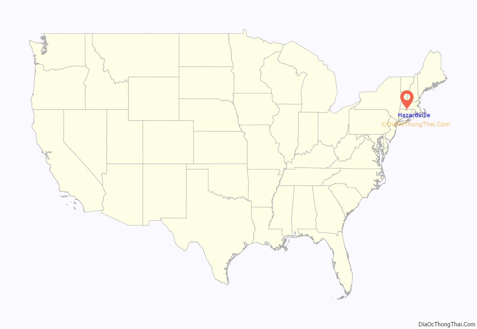
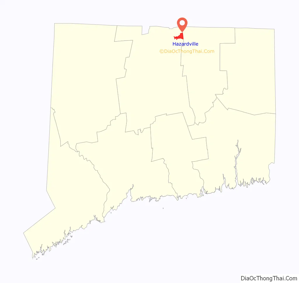
Hazardville location map. Where is Hazardville CDP?
History
Hazardville originated as an industrial village centered around the manufacture of gunpowder using water power from the Scantic River. The first small black powder mill was established in 1835 by Allen Loomis in an area then known as Powder Hollow. This became the Hazard Powder Company.
Hazardville takes its name from Colonel Augustus George Hazard.
Historic district
A 1,075-acre (4.35 km) area in and near Hazardville was listed on the National Register of Historic Places in 1980 as the Hazardville Historic District. The district is an irregularly shaped area that surrounds two interior areas that are not historical and are not included in the district. The district is focused on resources associated with the powder works, and includes industrial archaeological resources on either side of the Scantic River.
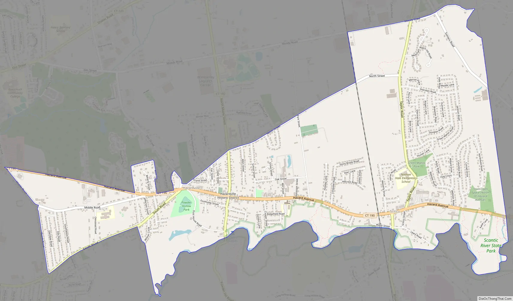
Hazardville Road Map
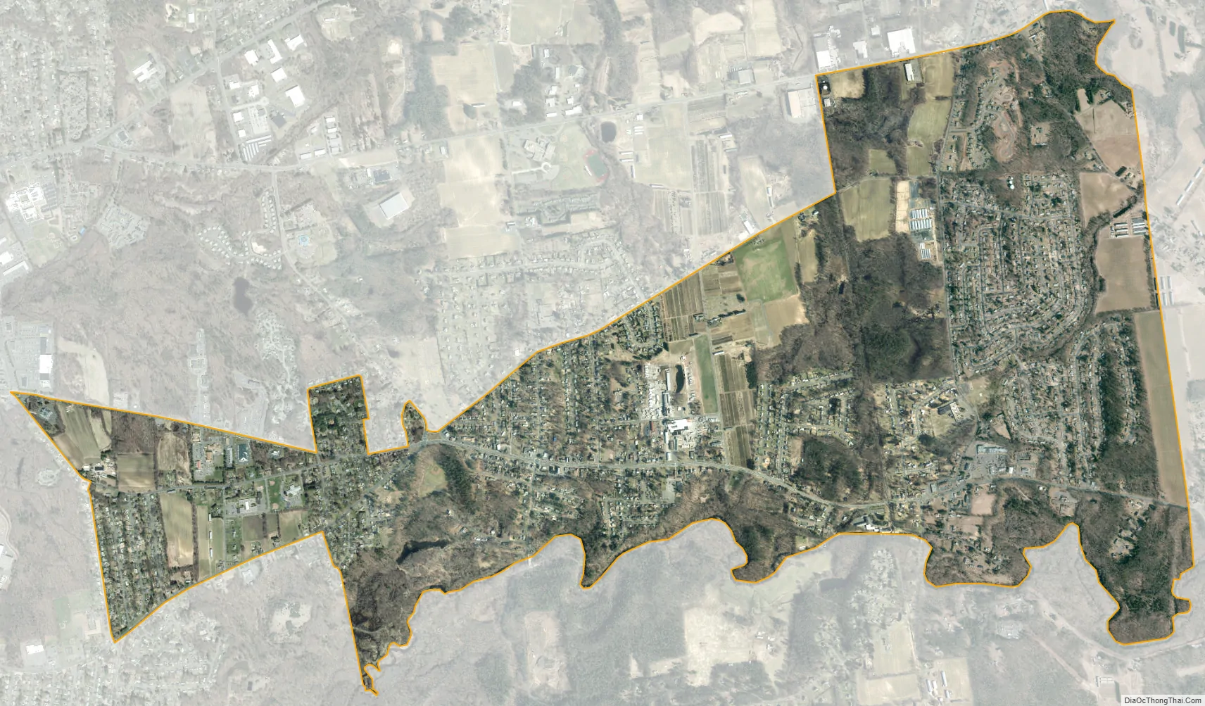
Hazardville city Satellite Map
Geography
The Hazardville CDP includes, in addition to the original Hazardville village, newer suburban developments east of the Central New England Railroad line to the Somers town line. According to the United States Census Bureau, the CDP has a total area of 3.3 square miles (8.5 km), all of which is land.
One parcel of the Scantic River State Park is in the Powder Hollow portion of Hazardville.
See also
Map of Connecticut State and its subdivision: Map of other states:- Alabama
- Alaska
- Arizona
- Arkansas
- California
- Colorado
- Connecticut
- Delaware
- District of Columbia
- Florida
- Georgia
- Hawaii
- Idaho
- Illinois
- Indiana
- Iowa
- Kansas
- Kentucky
- Louisiana
- Maine
- Maryland
- Massachusetts
- Michigan
- Minnesota
- Mississippi
- Missouri
- Montana
- Nebraska
- Nevada
- New Hampshire
- New Jersey
- New Mexico
- New York
- North Carolina
- North Dakota
- Ohio
- Oklahoma
- Oregon
- Pennsylvania
- Rhode Island
- South Carolina
- South Dakota
- Tennessee
- Texas
- Utah
- Vermont
- Virginia
- Washington
- West Virginia
- Wisconsin
- Wyoming


