Bristol is a suburban city located in Hartford County, Connecticut, United States, 20 miles (32 km) southwest-west of Hartford. The city is also 120 miles southwest from Boston, and approximately 100 miles northeast of New York City. The city is part of the Naugatuck Valley Planning Region. As of the 2020 census, the population of the city was 60,833.
Bristol is the location of the general studios of ESPN, and the location of Lake Compounce, the United States’s oldest continuously operating theme park. Bristol was known as a clock-making city in the 19th century, and is the location of American Clock & Watch Museum. Bristol is the site of the former American Silver Company and its predecessor companies.
Bristol’s nickname is the “Mum City”, because it was once a leader in chrysanthemum production and still holds an annual Bristol Mum Festival.
| Name: | Bristol city |
|---|---|
| LSAD Code: | 25 |
| LSAD Description: | city (suffix) |
| State: | Connecticut |
| County: | Hartford County |
| Elevation: | 420 ft (130 m) |
| Total Area: | 26.81 sq mi (69.44 km²) |
| Land Area: | 26.41 sq mi (68.39 km²) |
| Water Area: | 0.40 sq mi (1.05 km²) |
| Total Population: | 60,941 |
| Population Density: | 2,270.20/sq mi (889.5/km²) |
| Area code: | 860/959 |
| FIPS code: | 0908420 |
| GNISfeature ID: | 02378270 |
| Website: | www.ci.bristol.ct.us |
Online Interactive Map
Click on ![]() to view map in "full screen" mode.
to view map in "full screen" mode.
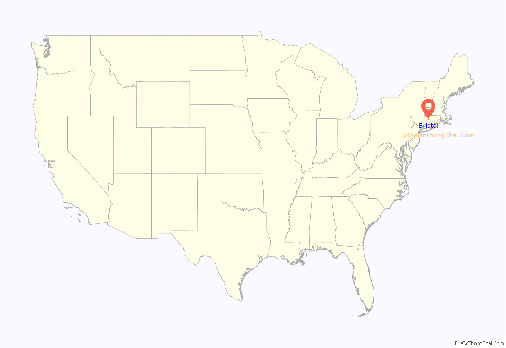
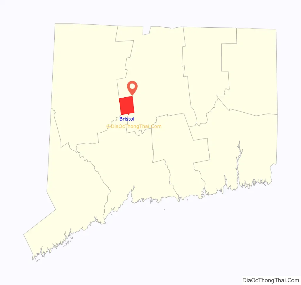
Bristol location map. Where is Bristol city?
History
The area that includes present-day Bristol was originally inhabited by the Tunxis Native American tribe, one of the Eastern Algonquian-speaking peoples that shared the lower Connecticut River Valley.
Originally, Bristol was within the boundaries of Farmington, Connecticut, which was incorporated in 1645. This deed was confirmed by another deed in 1650. The first actual settler of Bristol was Daniel Brownson, who built a house near West Street, but did not stay in the area very long. The first permanent settler was Ebenezer Barnes, who the next year built a home on King Street. Also in 1728, Nehemiah Manross arrived from Lebanon, and built a house north of Barnes Street, on the west side of King Street. The following year the first settlement arrived in what is now known as East Bristol when Nathaniel Messenger of Hartford and Benjamin Buck of Southington bought land and built houses along King Street.
Other houses were soon built around present-day Bristol wherever land was available for farming. This included the slope of Fall Mountain, now called Wolcott Street, and on Chippens Hill. By 1742, the families inhabiting the area petitioned the Connecticut Colony General Court for permission to create their own Congregational Society, citing the difficulties traveling to Farmington during winter. The Court approved their petition for the winter months only, and in 1744, agreed that area residents could set up through own ecclesiastical society. It was called New Cambridge. With their own congregation, area settlers began forming their own local government. However, since homes were so widely scattered, the General Court formed a committee to locate the geographic center of the settlement. The area now known as Federal Hill was deemed the center, and the first Congregationalist church was built there.
In 1785, New Cambridge was incorporated as the town of Bristol, named after Bristol, England. By 1790, the industry for which the town later became famous was established by the pioneer of clock making Gideon Roberts. Roberts began making wooden moment clocks and peddled them by horseback through Connecticut, New York and Pennsylvania. As Roberts’ sons grew up and began helping with the business, Gideon increased production and Bristol clocks were soon sold all over the country. By the early 19th century, nearly all of the capital and skill in town was involved in the clock industry in some form or fashion. The clock business gave way to related industries, which included brass, springs, bearings, and hardware. As Bristol began to grow, many ethnic groups arrived to work in the industries.
It was incorporated as a city in 1911. Today, Bristol is mostly residential and best known as the home of ESPN (which arrived in 1979), the American Clock & Watch Museum (since 1952), and Lake Compounce, America’s oldest operating theme park—opened in 1846.
Blight Committee
In the 1990s, the Blight Committee was formed to enforce appearance laws, and even demolish properties which it deems are unsightly and unkempt. This committee is tasked with ensuring that properties are not abandoned and that all properties are reasonably maintained.
In 2008, the Bristol Blight Committee was disbanded in order to make way for a new committee, the Bristol Code Enforcement Committee. This new committee has even greater powers and can now deal with both appearances and structural integrity issues of buildings in Bristol. The purpose of the committee is to streamline the process of enforcing the issues the former Blight Committee was tasked with. The law requires all structures to be free of “abandoned vehicles, nuisances, refuse, pollution and filth … broken glass, loose shingles, holes, cracked or damaged siding, crumbling brick and other conditions ‘reflective of deterioration or inadequate maintenance.'”
Downtown revitalization
Since 2008, Bristol has begun another renovation of the downtown area. The Bristol Downtown Development Corporation was formed to manage the downtown renovation. This has included a complete overhaul of a park in the center of the city. In addition, the outdated and underused Bristol Centre Mall from the mid-1960s was purchased by the city, then demolished in 2008, yielding a 17-acre site suitable for development, christened Depot Square by the city. Also, North Main Street was improved in 2008 by adding islands in the road, elegant street lighting and a brick median when the road was repaved.
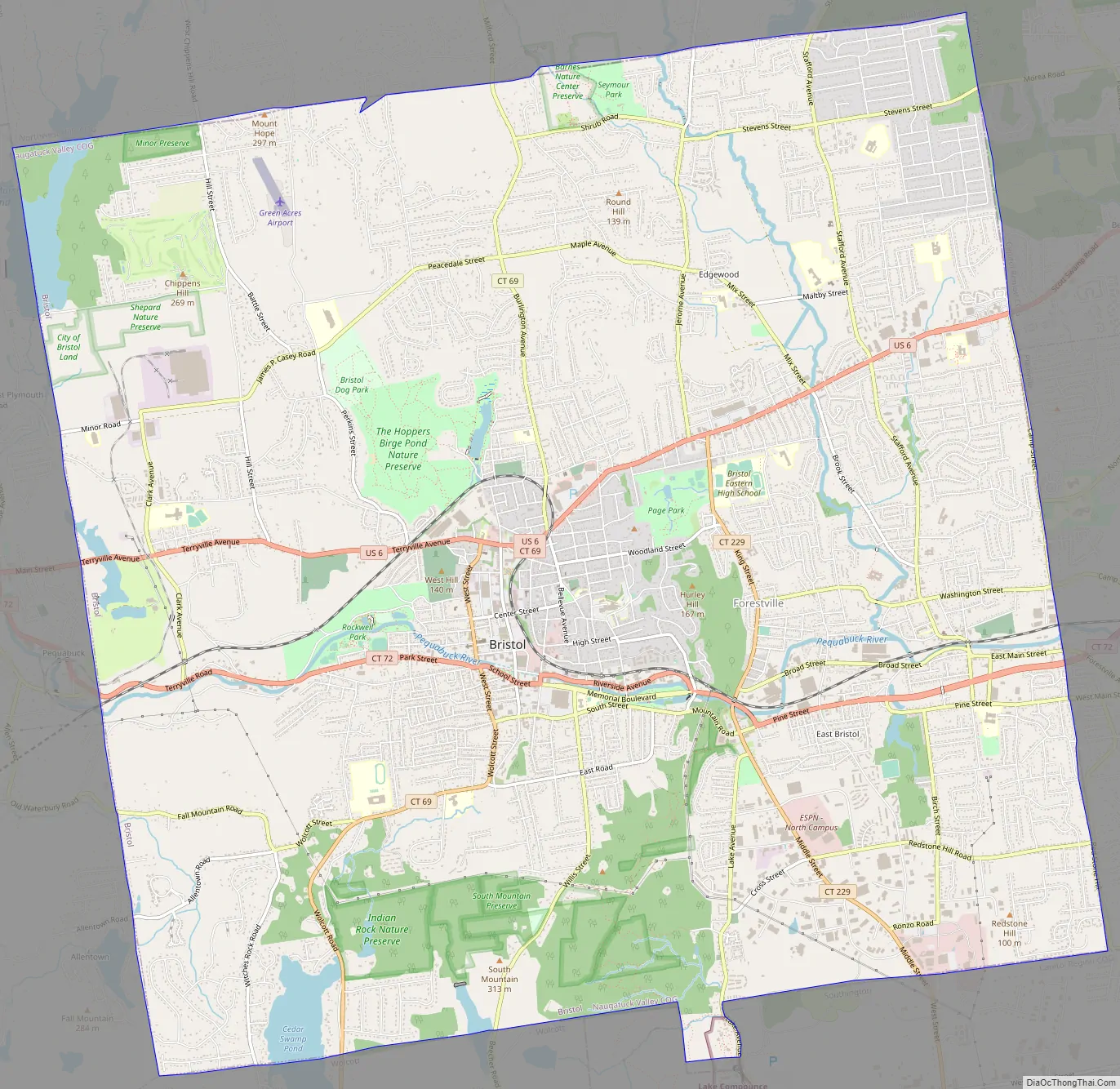
Bristol Road Map
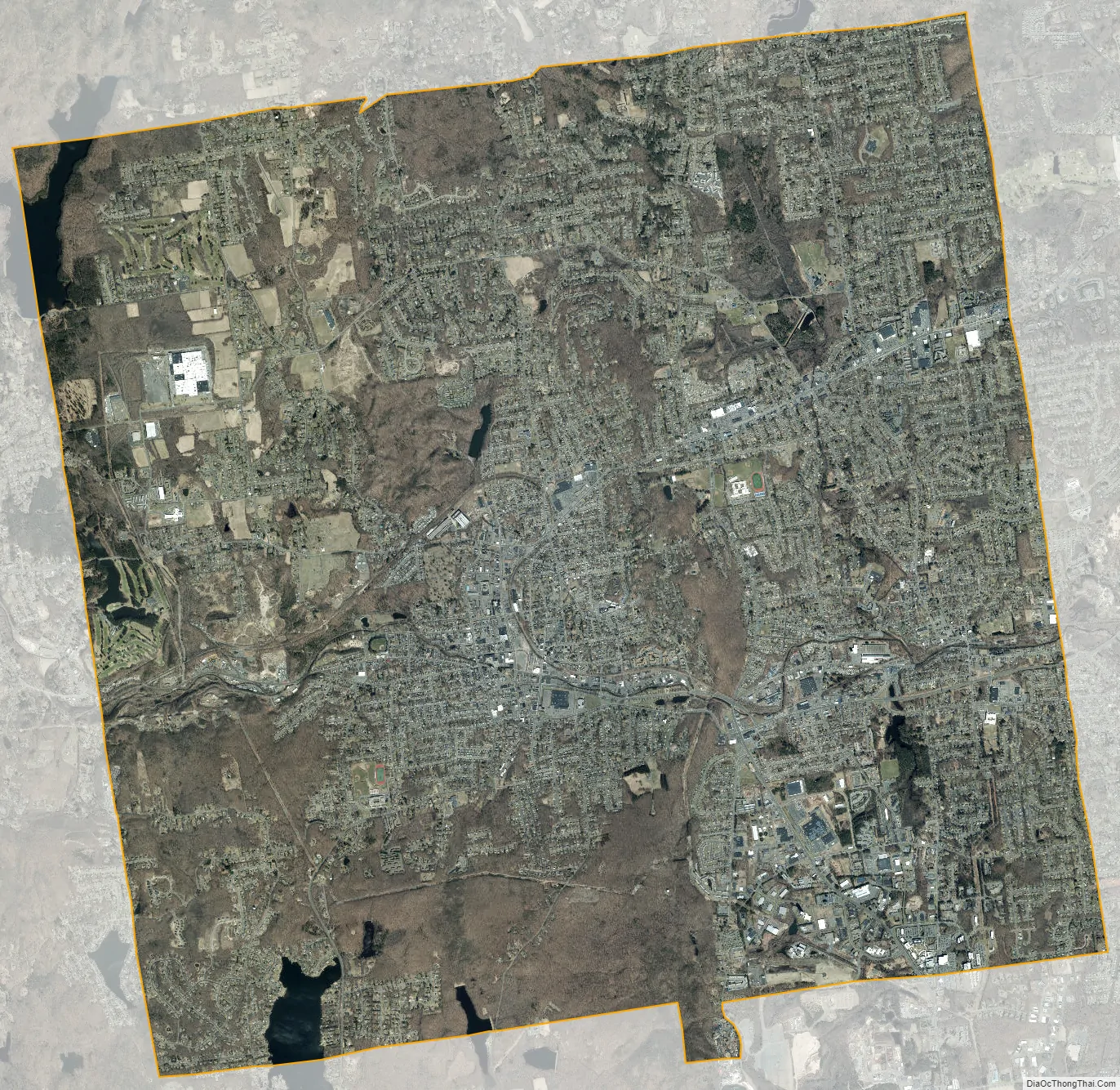
Bristol city Satellite Map
Geography
According to the United States Census Bureau, Bristol has a total area of 26.8 square miles (69.5 km), of which 26.4 square miles (68.4 km) is land and 0.39 square miles (1.0 km), or 1.51%, is water. Bristol contains several distinct sections, including Cedar Lake in the southwestern quarter, Chippens Hill in the northwestern quarter, Edgewood in the northeastern quarter, Forestville in the southeastern quarter and the city in the approximate middle of Bristol. The majority of Bristol’s area is residential in character, though since 2008 there has been a push for commercial development in the city. The city is part of the Naugatuck Valley Regional Planning Organization following the closure of the Central Connecticut Regional Planning Agency, the metropolitan planning organization for Bristol, New Britain, and surrounding towns for decades.
Forestville was the hunting grounds of the Tunxis tribe until the 19th century. The village was established in 1833 and named Forestville for its wooded surroundings. Forestville today has grown into a mini-metropolis of suburban neighborhoods and local businesses. The boundaries of Forestville go from the Plainville town line, south to the Southington town line, west up to the industrial development along Middle street and crosses King Street, including properties on Kingswood Drive and Bernside Drive, north up to Bristol Eastern High School, then north up to the south edge of properties on Louisiana Avenue, then to the west of properties on the west side of Brook Street and from there, goes up to commercial development along Farmington Avenue. Within the Forestville area, there are two subsections known as East Bristol and the Stafford District. Forestville village has a library branch (Manross), post office, meeting hall, community group (Forestville Village Association), fire station, cemetery, funeral home, two urban parks (Quinlan Veterans Park and Clock Tower Park), Pequabuck Duck Race, Memorial Day Parade, Summer Concert Night, Pumpkin Festival, and a railroad station (no longer in use). At one time all of Forestville had its own zip code.
See also
Map of Connecticut State and its subdivision: Map of other states:- Alabama
- Alaska
- Arizona
- Arkansas
- California
- Colorado
- Connecticut
- Delaware
- District of Columbia
- Florida
- Georgia
- Hawaii
- Idaho
- Illinois
- Indiana
- Iowa
- Kansas
- Kentucky
- Louisiana
- Maine
- Maryland
- Massachusetts
- Michigan
- Minnesota
- Mississippi
- Missouri
- Montana
- Nebraska
- Nevada
- New Hampshire
- New Jersey
- New Mexico
- New York
- North Carolina
- North Dakota
- Ohio
- Oklahoma
- Oregon
- Pennsylvania
- Rhode Island
- South Carolina
- South Dakota
- Tennessee
- Texas
- Utah
- Vermont
- Virginia
- Washington
- West Virginia
- Wisconsin
- Wyoming


