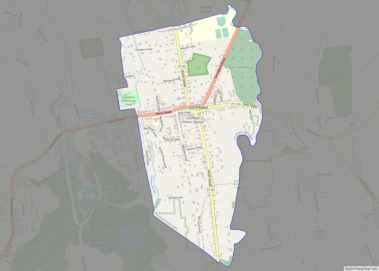
Litchfield is a borough in, and the village center of, the town of Litchfield in Litchfield County, Connecticut, United States. The population was 1,258 at the 2010 census. The entire borough was designated a Connecticut historic district in 1959 by special act of the state General Assembly and is listed on the National Register of Historic Places. Part of the borough is also a National Historic Landmark, the Litchfield Historic District.
| Name: | Litchfield borough |
|---|---|
| LSAD Code: | 21 |
| LSAD Description: | borough (suffix) |
| State: | Connecticut |
| County: | Litchfield County |
| Incorporated: | 1818 |
| Total Population: | 1258 |
| ZIP code: | 06759 |
| FIPS code: | 0943300 |
| Website: | www.townoflitchfield.org |
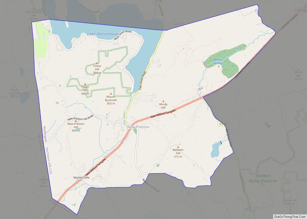
Online Interactive Map
Click on ![]() to view map in "full screen" mode.
to view map in "full screen" mode.
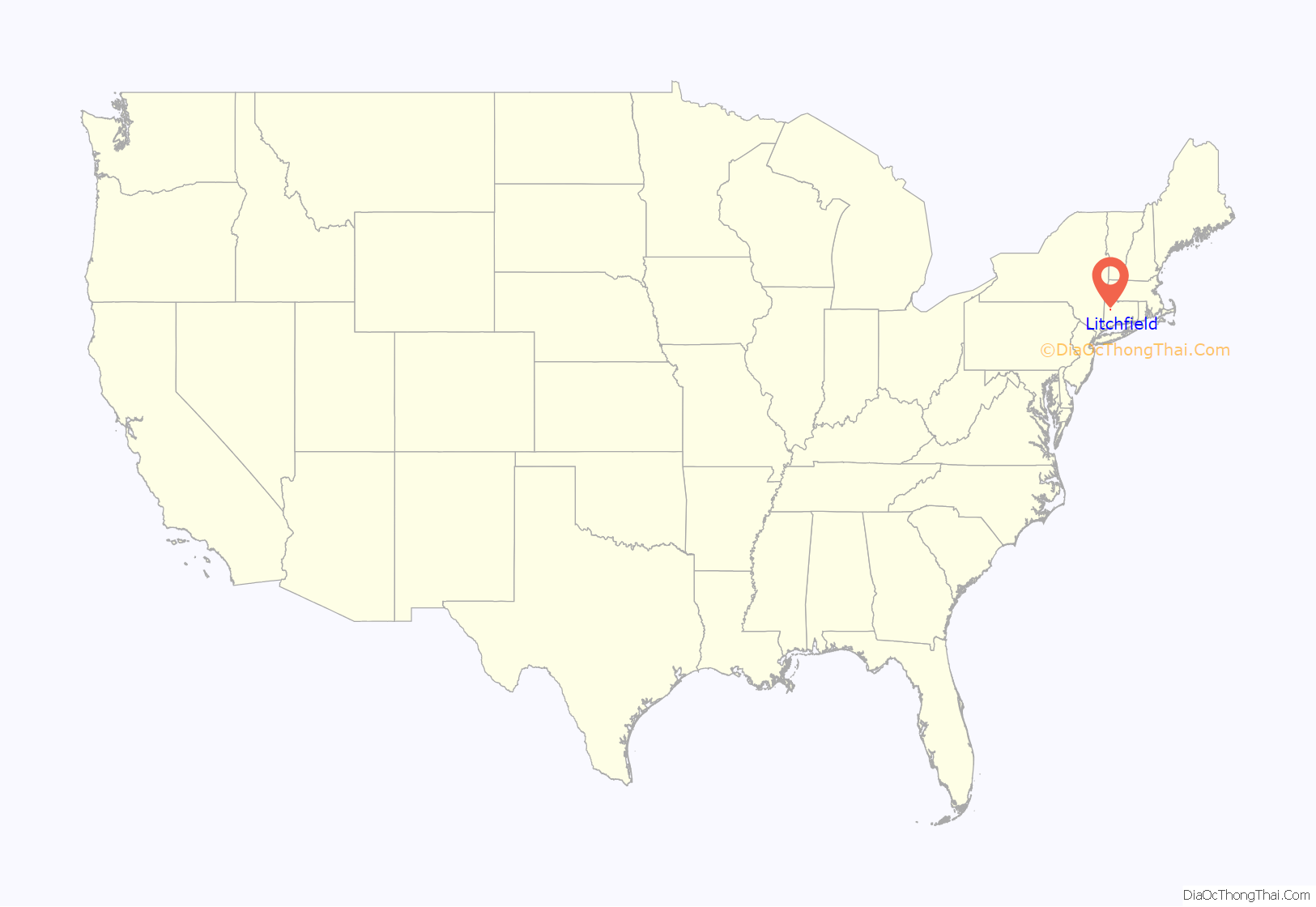
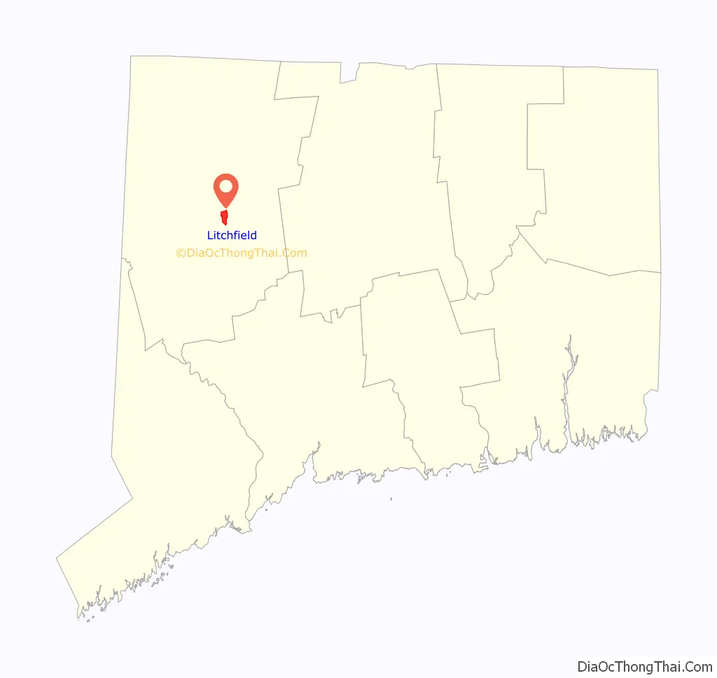
Litchfield location map. Where is Litchfield borough?
Litchfield Road Map
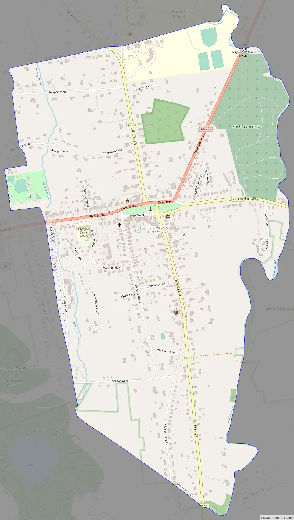
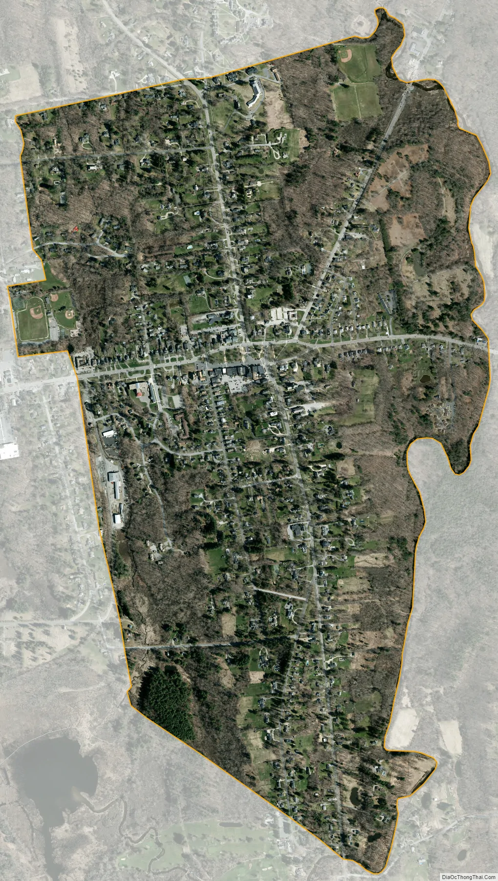
Litchfield city Satellite Map
Geography
Located southwest of Torrington, Litchfield also includes part of Bantam Lake. According to the United States Census Bureau, the town has a total area of 56.8 square miles (147.1 km), of which, 56.1 square miles (145.2 km) of it is land and 0.7 square miles (1.9 km) of it (1.3%) is water.
Litchfield is about 95 mi (153 km) from Central Park in New York, about 50 mi (80 km) from the Hudson River Valley, and about 40 mi (64 km) from the nearest sea coast, on Long Island Sound.
Principal communities
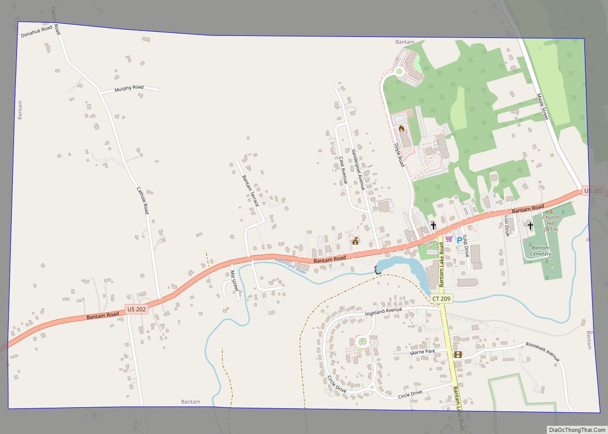
- Bantam (borough)
- East Litchfield (unincorporated
Litchfield borough is at the center of the town of Litchfield and of Litchfield County. U.S. Route 202 passes through the center of the borough at the Litchfield Green, leading northeast 5 miles (8 km) to Torrington and southwest 18 miles (29 km) to New Milford. Connecticut Route 63 runs north from the Litchfield Green 6 miles (10 km) to Goshen and south 10 miles (16 km) to Watertown, and Connecticut Route 118 leads east 8 miles (13 km) to Harwinton.
See also
Map of Connecticut State and its subdivision: Map of other states:- Alabama
- Alaska
- Arizona
- Arkansas
- California
- Colorado
- Connecticut
- Delaware
- District of Columbia
- Florida
- Georgia
- Hawaii
- Idaho
- Illinois
- Indiana
- Iowa
- Kansas
- Kentucky
- Louisiana
- Maine
- Maryland
- Massachusetts
- Michigan
- Minnesota
- Mississippi
- Missouri
- Montana
- Nebraska
- Nevada
- New Hampshire
- New Jersey
- New Mexico
- New York
- North Carolina
- North Dakota
- Ohio
- Oklahoma
- Oregon
- Pennsylvania
- Rhode Island
- South Carolina
- South Dakota
- Tennessee
- Texas
- Utah
- Vermont
- Virginia
- Washington
- West Virginia
- Wisconsin
- Wyoming