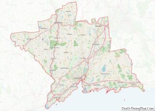
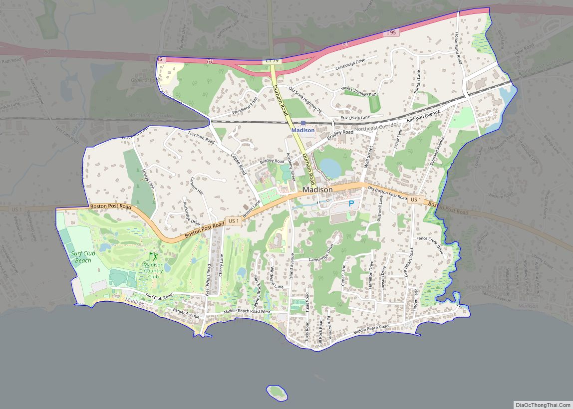
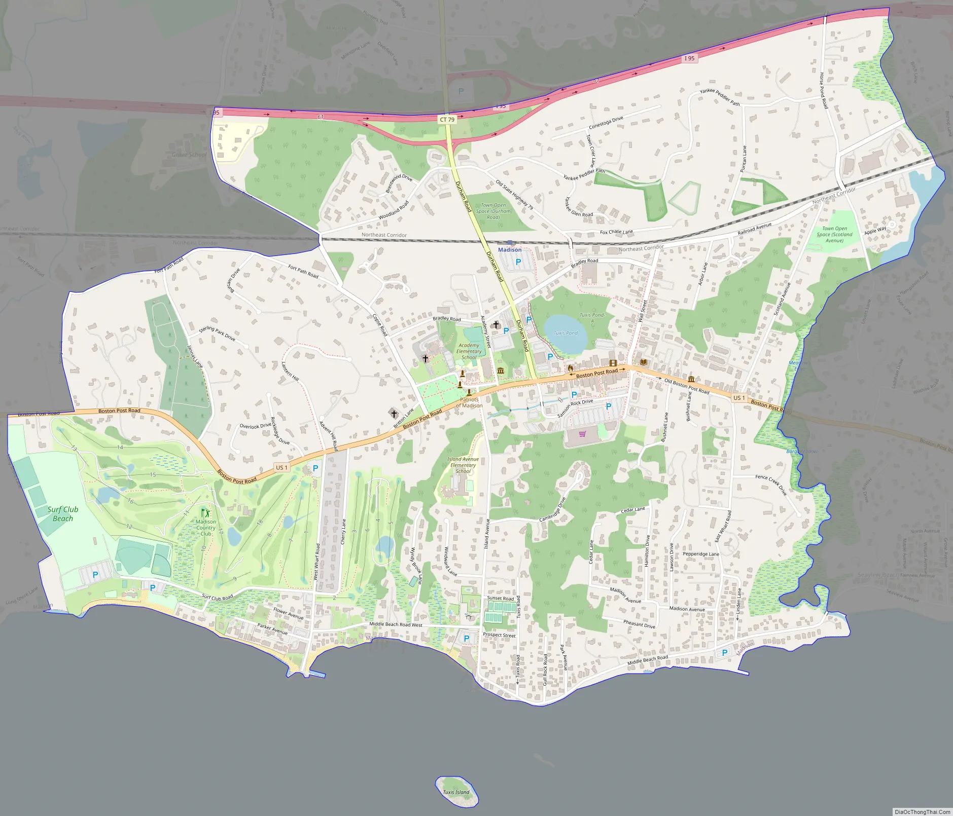
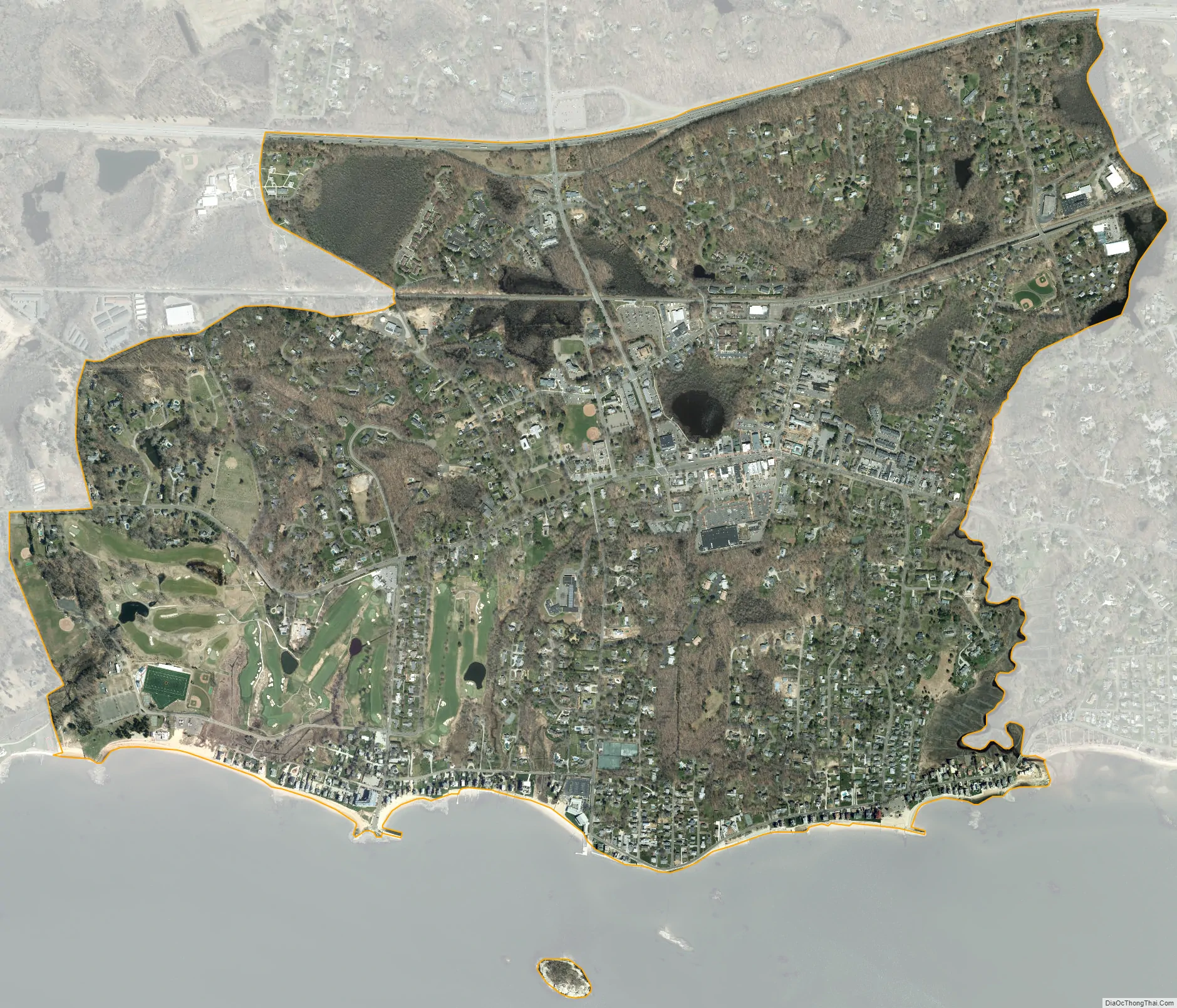
Madison Center is a census-designated place (CDP) comprising the primary village and surrounding residential land in the town of Madison, New Haven County, Connecticut, United States. It is in the southern part of the town, surrounding the intersection of U.S. Route 1 with Connecticut Route 79 (Durham Road). The CDP extends south to Long Island Sound, north to Interstate 95, east to Fence Creek, and west to Long Shore Land and Stony Lane.
As of the 2010 census, the CDP had a population of 2,290, out of 18,269 in the entire town of Madison.
| Name: | Madison Center CDP |
|---|---|
| LSAD Code: | 57 |
| LSAD Description: | CDP (suffix) |
| State: | Connecticut |
| County: | New Haven County |
| Elevation: | 7 m (22 ft) |
| Total Area: | 5.32 km² (2.05 sq mi) |
| Land Area: | 5.28 km² (2.04 sq mi) |
| Water Area: | 0.03 km² (0.01 sq mi) |
| Total Population: | 2,290 |
| Population Density: | 433.3/km² (1,122/sq mi) |
| ZIP code: | 06443 (Madison) |
| Area code: | 203/475 |
| FIPS code: | 0944630 |
| GNISfeature ID: | 2377830 |
Online Interactive Map
Click on ![]() to view map in "full screen" mode.
to view map in "full screen" mode.
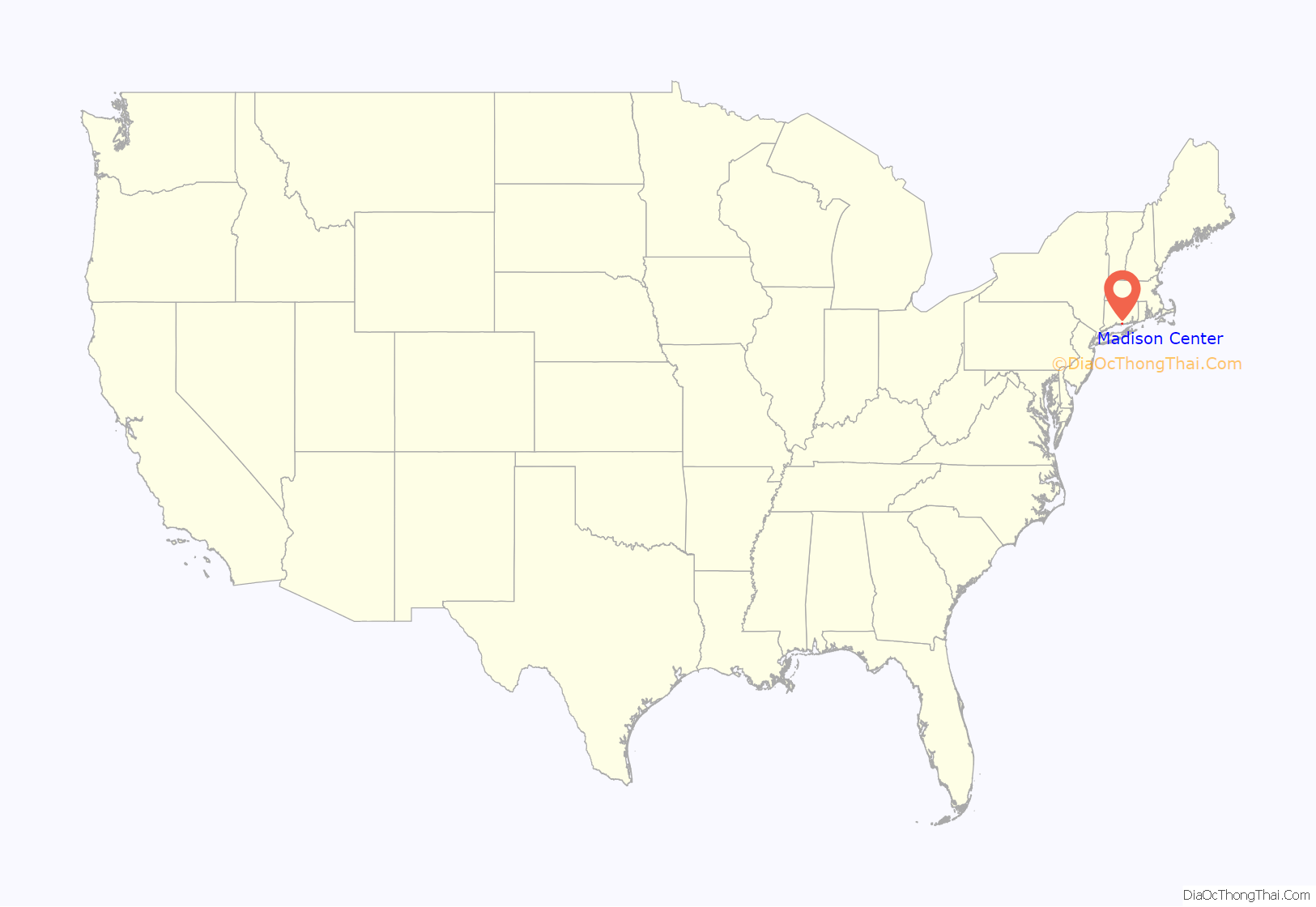
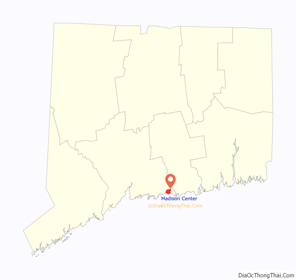
Madison Center location map. Where is Madison Center CDP?
Madison Center Road Map
Madison Center city Satellite Map
See also
Map of Connecticut State and its subdivision: Map of other states:- Alabama
- Alaska
- Arizona
- Arkansas
- California
- Colorado
- Connecticut
- Delaware
- District of Columbia
- Florida
- Georgia
- Hawaii
- Idaho
- Illinois
- Indiana
- Iowa
- Kansas
- Kentucky
- Louisiana
- Maine
- Maryland
- Massachusetts
- Michigan
- Minnesota
- Mississippi
- Missouri
- Montana
- Nebraska
- Nevada
- New Hampshire
- New Jersey
- New Mexico
- New York
- North Carolina
- North Dakota
- Ohio
- Oklahoma
- Oregon
- Pennsylvania
- Rhode Island
- South Carolina
- South Dakota
- Tennessee
- Texas
- Utah
- Vermont
- Virginia
- Washington
- West Virginia
- Wisconsin
- Wyoming