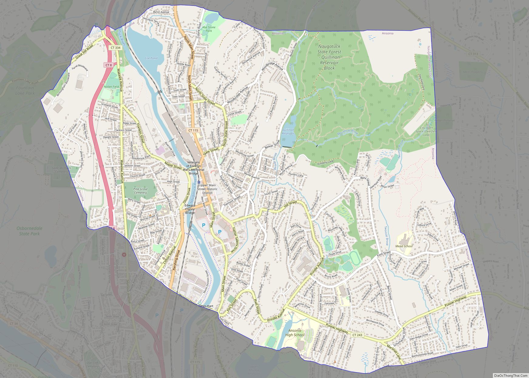
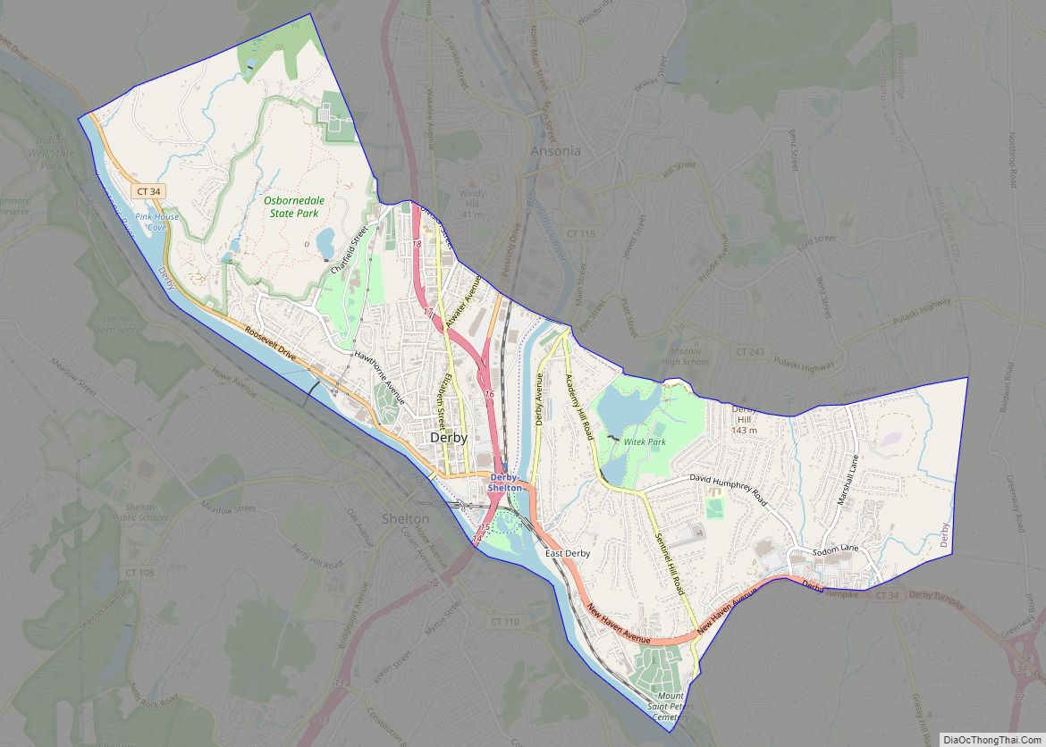
Ansonia is a city in New Haven County, Connecticut, United States. Located on the Naugatuck River, it is immediately north of Derby, and about 12 miles (19 km) northwest of New Haven. The city is part of the Naugatuck Valley Planning Region. The population was 18,918 at the time of the 2020 census. The ZIP code for Ansonia is 06401. The city is served by the Metro-North Railroad. Ansonia Station is a stop on the railroad passenger commuter service’s Waterbury Branch connecting to New York’s Grand Central Terminal. Ansonia also is served by the Connecticut Transit bus carrier. Connecticut Route 8 serves Ansonia (Northbound, Exit 18; Southbound, Exit 19).
Ansonia, also referred to as “The Copper City”, is recognized for its history of heavy machine manufacturing industry in the lower Naugatuck Valley. Production included copper, brass, rubber and plastics processing, molding and tubing, iron castings, sheet metal, electric, automatic screw machine, textiles, and foundry products. The well-known Ansonia Clock Company was founded here in 1851.
Ansonia is the birthplace of David Humphreys, a diplomat and colonel in the American Revolutionary War.
| Name: | Ansonia city |
|---|---|
| LSAD Code: | 25 |
| LSAD Description: | city (suffix) |
| State: | Connecticut |
| County: | New Haven County |
| Elevation: | 82 ft (25 m) |
| Total Area: | 6.19 sq mi (16.02 km²) |
| Land Area: | 6.02 sq mi (15.59 km²) |
| Water Area: | 0.17 sq mi (0.44 km²) |
| Total Population: | 18,918 |
| Population Density: | 3,142.5/sq mi (1,213.5/km²) |
| ZIP code: | 06401 |
| Area code: | 203/475 |
| FIPS code: | 0901150 |
| GNISfeature ID: | 0205107 |
| Website: | www.cityofansonia.com |
Online Interactive Map
Click on ![]() to view map in "full screen" mode.
to view map in "full screen" mode.
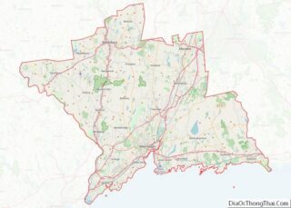
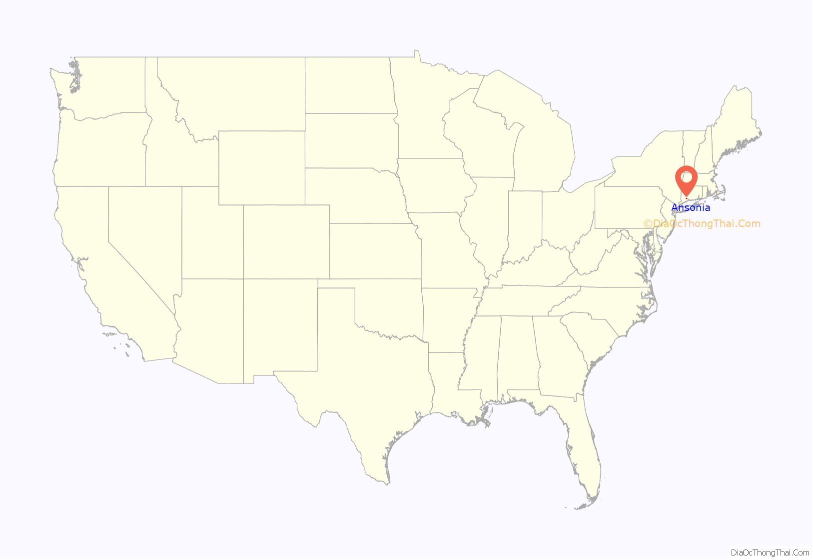
Ansonia location map. Where is Ansonia city?

History
The area along the Naugatuck River, comprising the present Elm Street section of Ansonia and Derby Avenue section of Derby, was first settled by English colonists in 1652; it was originally a part of the township of Derby. Early settlers developed subsistence farming, and used the river for sawmills and gristmills.
In 1844, Anson Green Phelps (1781–1853), a merchant and philanthropist, wanted to expand the old borough of Birmingham (the present downtown of the city of Derby) to the north along the west side of the Naugatuck River to enable industrial development. Unable to purchase the land from its owner, in 1844 Phelps acquired land along the east side of the river; today this is Ansonia’s downtown section. A canal was dug for river power to drive the factories and businesses in the new industrial village, which Phelps named “Ansonia”. He wanted to name the industrial village as “Phelpsville”, but learned there was another village in the region by that name. As suggested by a friend, Phelps changed his first name to create the name “Ansonia”.
As industry developed, soon Ansonia became the most populous area of Derby, boasting many factories. The state chartered Ansonia as a borough of Derby in 1864 and amended it in 1871, granting full municipal privileges. In 1888, a petition was circulated in the borough of Ansonia for the purpose of becoming a separate township from Derby. In 1889 the State General Assembly granted the separation, constituting the Borough, Hilltop, West Ansonia, and Elm Street areas as a separate town known as Ansonia. This was the 168th township in the state of Connecticut. In 1893, Ansonia was incorporated as a city, consolidating with the coterminous Town and the old borough.
By the end of the 19th century, the city had manufacturers of heavy machinery, electric supplies, brass and copper products, and silk goods. Ansonia, Derby, Shelton, Seymour, and Beacon Falls formed one of the most important industrial communities in the state.
Invention of America’s first bicycle
In 1866, while residing in Ansonia, inventor Pierre Lallement, a native of Pont-a-Mousson, France, submitted a patent application for the first pedaled (rotary crank mechanism) bicycle.
20th century to present
Ansonia suffered grievous damage in the Flood of 1955 on August 19, when the Naugatuck River flooded due to heavy rain from Hurricane Diane. Submerging the land along the river, the flood destroyed many houses and businesses. The high river waters swept away Maple Street Bridge, one of two bridges linking the east and west sides of Ansonia. After the inundation, the authorities erected a flood wall along the east bank of the river to protect the city’s factories and Main Street. On the west bank, federal public housing was built to replace blocks of destroyed homes and businesses on Broad Street, now known as Olson Drive.
In the decades following the flood and suburbanization, Ansonia’s Main Street fell into decline as retail shoppers decamped to the Ansonia Mall at its far end. (This was replaced with the Ansonia Shopping Center in the 90’s) Later other malls attracted shoppers to nearby Milford, Trumbull, and Waterbury. Since the late 20th century, Main Street has been enlivened by the opening of several antique stores, a wine bar, a coffee shop, a Polish delicatessen, and other retail businesses. Main Street now has a Target store near the currently abandoned building that housed American Brass Co. Wire Mill, later Farrel Corporation.
For years, Ansonia had a daily newspaper, the “Evening Sentinel”, that enjoyed a wide readership throughout the Naugatuck Valley. However, the parent company of the Connecticut Post bought the Sentinel in the 1980s and quickly closed it, despite their promises not to do so. Allegedly, the “Post” wanted to consolidate their position as the region’s main newspaper. To provide an alternative, a non-profit, online-only news site, named The Valley Independent Sentinel in honor of the historic paper, has been organized and launched June 22, 2009.
In the early morning hours of November 6, 1960, Senator John F. Kennedy’s presidential campaign motorcade stopped on its way to Waterbury for the candidate to make an appearance and brief address in front of City Hall. He drew thousands to downtown, many with transistor radios tuned to live reports on WADS of Senator Kennedy’s progress towards Ansonia. President Kennedy returned to Ansonia on October 17, 1962, while on his way to Waterbury, but did not stop here.
President George H. W. Bush paid a visit to Ansonia by helicopter during the 1992 presidential election campaign. He was running far behind schedule due to severe weather damage to a large area of New Jersey. He arrived late and delivered a truncated speech, causing many residents in this heavily Democratic area to feel he had slighted their city.
In 2000, the Lower Naugatuck Valley, which includes Ansonia, was named an “All America City” by the National Civic League.
In May 2001, a wind-driven fire destroyed the Latex Foam Company building, a very large rubber plant along the Naugatuck River in downtown Ansonia. The fire gutted the 284,000-square-foot (26,400 m) building, which was the workplace of 250 people. Firefighters from multiple counties fought the fire tirelessly for five days. Lingering clouds of foul-smelling smoke spread over the city and nearby communities, and chemical runoff produced by the fire unbalanced the ecosystem of the nearby river. The aforementioned Target store was constructed on the empty lot, opening in July 2007. [1] Following the fire, the Latex Foam Company purchased a vacant plant off Route 110 in nearby Shelton and resumed production.
Ansonia Road Map
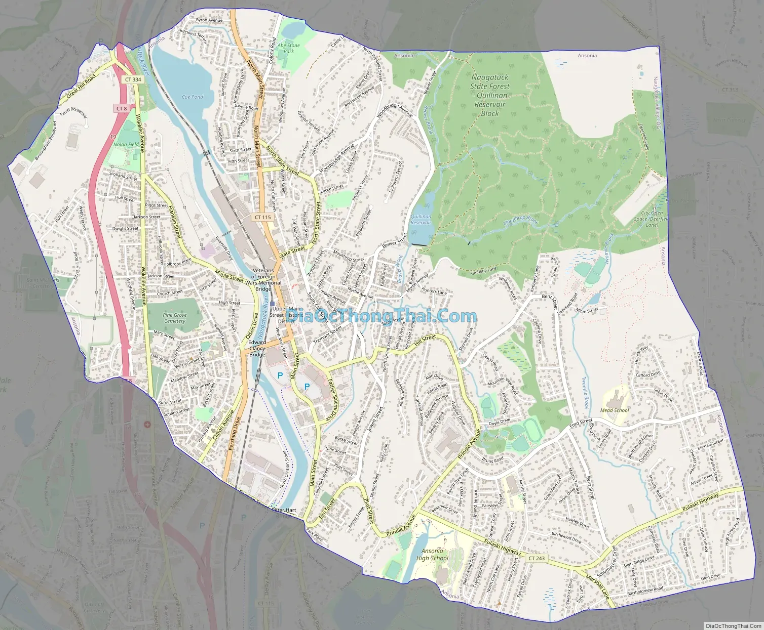
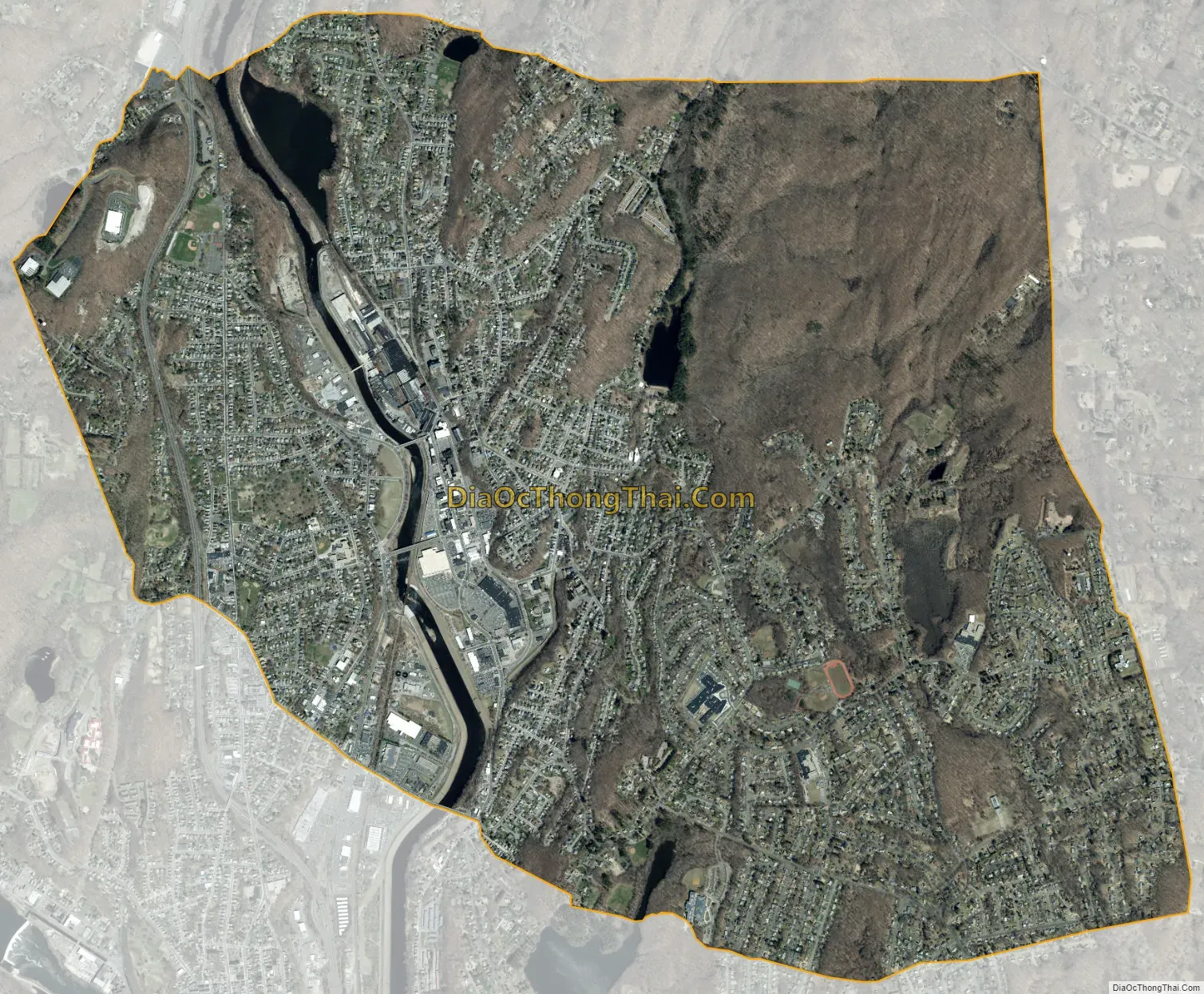
Ansonia city Satellite Map
Geography
According to the United States Census Bureau, the city has a total area of 6.2 square miles (16.0 km), of which 6.0 square miles (15.6 km) is land and 0.15 square miles (0.4 km), or 2.72%, is water. The city is bisected by the Naugatuck River and spreads out from the river’s banks up the hills—some quite steep—of the river valley. On the west side of the river, the city abuts Derby and Seymour along Silver Hill. On the east side, the city’s Hilltop neighborhood meets Woodbridge.
The land along the river is mostly given over to factory sites (both operational and defunct), with an area of wooded land on the west bank close to the city’s northern boundary that belongs to the American Brass Company. In the early 1990s, this site was proposed by Texas company American Ref-Fuel for a solid waste-to-electric energy cogeneration plant. The proposal was controversial, and protests by residents resulted in its defeat.
Residential housing occupies most of the land in Ansonia, chiefly one- or two-family houses on plots of a 1/4 acre up to an acre. Larger houses on larger plots are found in the Hilltop neighborhood. The Ansonia Nature Center on Hilltop preserves some open fields and woodlands and is a favorite for school trips.
An airport once operated on Hilltop on a grass field, at the eastern edge of the city. During the Cold War, the United States military deployed Nike missiles in silos at the airport. Since the military released the airport grounds for other uses, developers have built residential housing there. The Nike base is now adapted as a horse farm with riding stables; few reminders of its former operations remain.
Neighborhoods
Downtown – The original industrial village and later borough of Ansonia. Includes the area stretching between the factories at the north side of down town to the newer shopping plazas on the south side of downtown (Big Y, Target, etc.)
Library District – The neighborhood surrounding the Ansonia Library. Just east of downtown on top of the cliff. Includes the residential neighborhood between State Street and Beaver Street including South Cliff Street, North Cliff Street, Mott Street and Cottage Avenue. Contains mostly single-family historic Queen Anne Victorian homes. While now predominantly middle class, this area was settled early in Ansonia’s history and was once home to many of the wealthy industrial families of Ansonia.
North End – The area comprising the North Main Street corridor stretching from Downtown to the Seymour town line.
Reservoir – The area comprises the area of the Beaver, North Prospect, and Prospect Street corridors. It is along the Quillinan Reservoir.
Derby Hill – The area surrounding the Elm Street and Jewett Street area on the east side. Elm Street is also the town’s historic district and was part of the original 1654 settlement of Derby. The name of this section of the town is sometimes disputed.
Hilltop – The area of the city that comprises the area of Prindle Avenue, Pulaski Highway and Ford Street corridors. This section was mainly farm land in the early days of the town. After World War II, it was developed as the largest residential area of the city.
West Ansonia – The residential village that comprised the west side of the Naugatuck River across from Ansonia (downtown). The original West Ansonia neighborhood consisted of High, Maple, and Jersey streets (the latter somewhat redirected and now known as ‘Olson Drive’), and later its name was synonymous with the entire present west side of the city.
Windy Hill – A section of West Ansonia centered around Murray, May, and Francis street. This area is considered to encompass the territory from the Derby town line to Grove Street.
Silver Hill – The section of West Ansonia along the Silver Hill Road corridor. Parts of this section are shared with Derby.
See also
Map of Connecticut State and its subdivision: Map of other states:- Alabama
- Alaska
- Arizona
- Arkansas
- California
- Colorado
- Connecticut
- Delaware
- District of Columbia
- Florida
- Georgia
- Hawaii
- Idaho
- Illinois
- Indiana
- Iowa
- Kansas
- Kentucky
- Louisiana
- Maine
- Maryland
- Massachusetts
- Michigan
- Minnesota
- Mississippi
- Missouri
- Montana
- Nebraska
- Nevada
- New Hampshire
- New Jersey
- New Mexico
- New York
- North Carolina
- North Dakota
- Ohio
- Oklahoma
- Oregon
- Pennsylvania
- Rhode Island
- South Carolina
- South Dakota
- Tennessee
- Texas
- Utah
- Vermont
- Virginia
- Washington
- West Virginia
- Wisconsin
- Wyoming