New Preston is a rural village and census-designated place (CDP) in the northwest corner of the town of Washington, Litchfield County, Connecticut, United States. As of the 2010 census, the population of the New Preston CDP was 1,182, out of 3,578 in the entire town of Washington.
| Name: | New Preston CDP |
|---|---|
| LSAD Code: | 57 |
| LSAD Description: | CDP (suffix) |
| State: | Connecticut |
| County: | Litchfield County |
| Elevation: | 606 ft (185 m) |
| Total Area: | 7.8 sq mi (20.3 km²) |
| Land Area: | 7.3 sq mi (19.0 km²) |
| Water Area: | 0.5 sq mi (1.3 km²) |
| Total Population: | 1,182 |
| Population Density: | 162/sq mi (62.4/km²) |
| ZIP code: | 06777 |
| FIPS code: | 0952770 |
| GNISfeature ID: | 209251 |
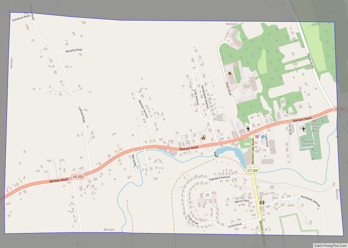
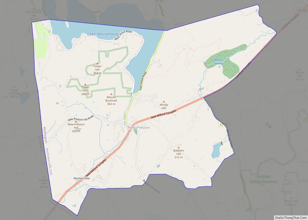
Online Interactive Map
Click on ![]() to view map in "full screen" mode.
to view map in "full screen" mode.
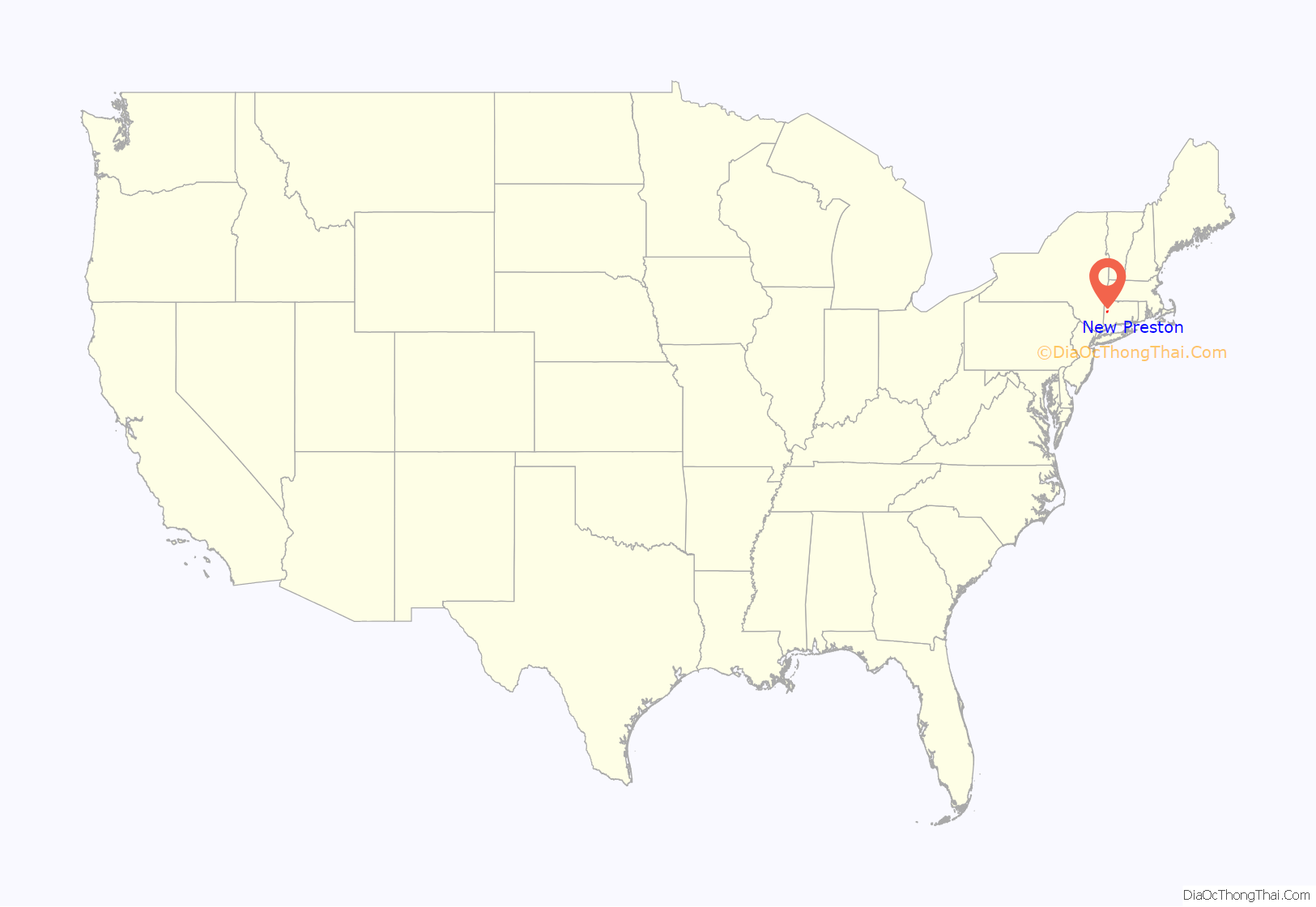
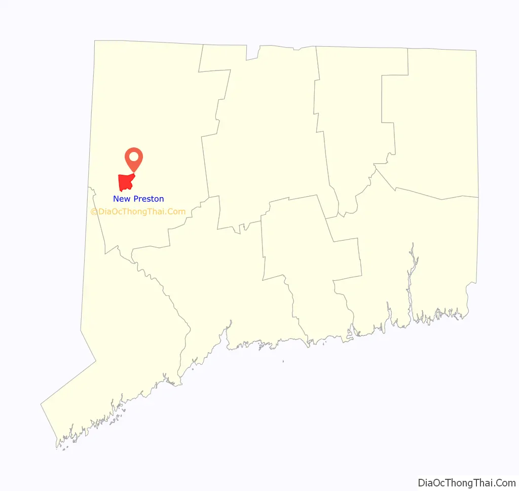
New Preston location map. Where is New Preston CDP?
History
Pre-colonial
Archeological evidence suggests that Native Americans first settled in the area around 10,000 years ago, following the retreat of the glaciers at the conclusion of the last ice age. What is now known as New Preston came to be inhabited by the Wyantenock tribe of Native Americans, who spent summers at Lake Waramaug, establishing a pattern of seasonal residence that is widely repeated by New Preston’s present-day occupants.
Colonial
The signature of Chief Waramaug, who led the Wyantenock tribe in the early 18th century, appears on several local colonial-era property records, including the “New Milford North Purchase”, which encompassed a substantial swath of southern Litchfield County, including contemporary New Preston. Colonists settled New Preston in 1741, and the General Assembly of the Connecticut Colony granted a petition for the establishment of the New Preston Ecclesiastical Society in 1753. In April 1778 the 270 families living in the area petitioned the General Assembly to be incorporated as a town. The petition was granted in January of the following year, incorporating the Town of Washington from the parishes of Judea and New Preston and taking from the towns of Woodbury, Litchfield, Kent, and New Milford. The action marked the first establishment of a municipality in Connecticut after the Declaration of Independence was signed. The town was named after George Washington, who, in his capacity as Commander of the Continental Army during the American Revolution, passed through the area several times. In May 1781, George Washington slept in New Preston at the Cogswell Tavern, which still stands on present-day Christian Street and is used as a private residence.
19th century
In the early decades of the 19th century (the era of the Industrial Revolution), numerous mills and modestly scaled factories were constructed along the East Aspetuck River, which drops precipitously between its source at Lake Waramaug and the New Preston village center, providing a robust source of water power. New Preston housed an iron works, as well as manufacturers of twine, hats, cheese boxes, ax handles, shoes, and harnesses. However, with the advent of electricity, expansion of national rail networks, and the rise of larger, more accessible manufacturing centers during the latter part of the 19th century, industrial activity in New Preston decreased, eventually disappearing altogether.
In the latter decades of the 19th century, New Preston began its transformation to a summer colony. With the arrival of the Shepaug Railroad in 1872, passenger service was introduced between New Preston Station and New York City, which gave rise to the construction of summer homes and inns around the perimeter of Lake Waramaug.
20th century
The railroad ceased operation in 1948, and many of the large inns on the lake closed, giving way to single-family residences used primarily as vacation homes.
By the 1970s, much of New Preston’s diminutive village center had fallen into decline, with many shops left vacant and in various states of disrepair. Several buildings and locations in New Preston were used in the filming of the 1981 horror movie Friday the 13th, Part 2.
In the mid-1980s, a transformation of the village center began with the opening of a store specializing in antique gardening books and horticultural prints. Antique shops and other upscale retail establishments soon followed, and many of New Preston’s historic commercial structures underwent renovation. The village’s only grocery store, pharmacy, and gas station closed, leaving New Preston largely devoid of essential services.
By the mid-1990s, the village center had been completely made over into a picturesque, high-end retail destination catering primarily to weekend residents and out-of-town visitors.
Contemporary
During the booming economy of the late 1990s and early first decade of the 21st century, the gentrification of New Preston shifted into high gear. Modest lake cottages around Lake Waramaug were torn down and replaced with larger, more luxurious homes, and other lake houses underwent substantial renovation and expansion. Two of the four remaining inns on the lake—The Inn at Lake Waramaug and The Birches Inn—were converted into lavish single-family residences.
New Preston Road Map
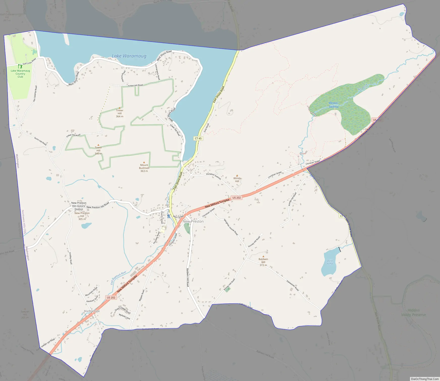
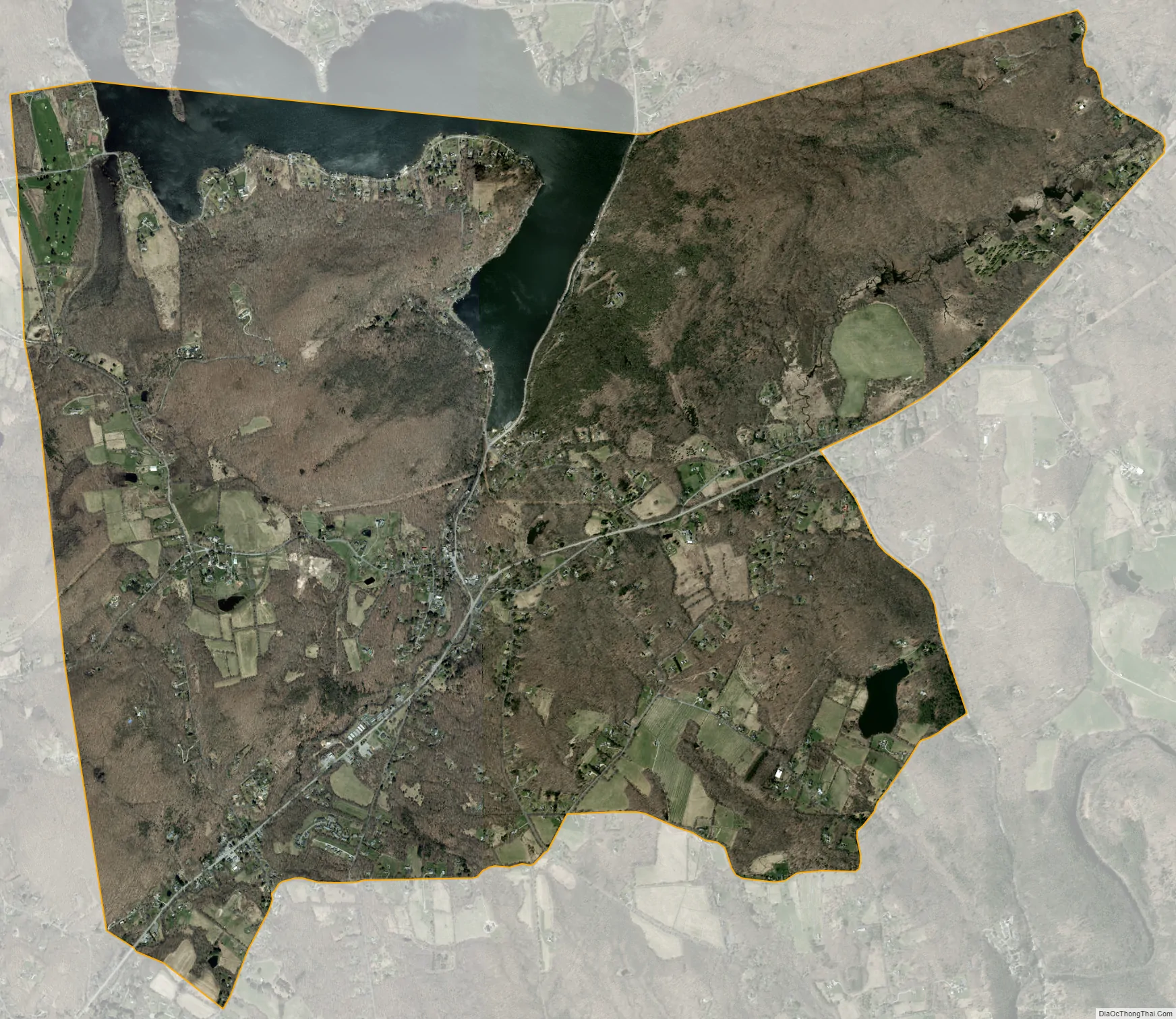
New Preston city Satellite Map
Geography
The New Preston CDP includes the entire northwestern quadrant of the town of Washington, including the villages of New Preston and Marbledale, as well as 1,195-foot (364 m) Mount Bushnell and Meeker Swamp. The CDP has a total area of 7.8 square miles (20.3 km), of which 7.3 square miles (19.0 km) are land and 0.50 square miles (1.3 km), or 6.47%, are water. The dominant geographic feature of New Preston is Lake Waramaug, which is situated just north of the New Preston village center and is the headwaters of the East Aspetuck River, which runs through the village center and over New Preston Falls. The terrain is characterized by steep hills and narrow valleys, with a preponderance of talus slopes and ledge rock.
See also
Map of Connecticut State and its subdivision: Map of other states:- Alabama
- Alaska
- Arizona
- Arkansas
- California
- Colorado
- Connecticut
- Delaware
- District of Columbia
- Florida
- Georgia
- Hawaii
- Idaho
- Illinois
- Indiana
- Iowa
- Kansas
- Kentucky
- Louisiana
- Maine
- Maryland
- Massachusetts
- Michigan
- Minnesota
- Mississippi
- Missouri
- Montana
- Nebraska
- Nevada
- New Hampshire
- New Jersey
- New Mexico
- New York
- North Carolina
- North Dakota
- Ohio
- Oklahoma
- Oregon
- Pennsylvania
- Rhode Island
- South Carolina
- South Dakota
- Tennessee
- Texas
- Utah
- Vermont
- Virginia
- Washington
- West Virginia
- Wisconsin
- Wyoming