Tariffville is a neighborhood and census-designated place (CDP) in the town of Simsbury in Hartford County, Connecticut, United States. The population was 1,324 at the 2010 census. It is a popular location for whitewater paddlers who use the Farmington River.
Part of the original mill village area is included in the Tariffville Historic District, listed on the National Register of Historic Places. The historic district excludes newer development around West Point Terrace and Hayes Road, as well as properties along White Water Turn, Wooster Road, and Main Street Extension. The historic district is architecturally significant for preserving some evidence of early nineteenth-century mill village characteristics (in retaining some old mill housing and street layout) and for also preserving later 19th-century Greek Revival and Gothic Revival structures.
| Name: | Tariffville CDP |
|---|---|
| LSAD Code: | 57 |
| LSAD Description: | CDP (suffix) |
| State: | Connecticut |
| County: | Hartford County |
| Elevation: | 200 ft (60 m) |
| Total Area: | 0.65 sq mi (1.69 km²) |
| Land Area: | 0.60 sq mi (1.55 km²) |
| Water Area: | 0.05 sq mi (0.13 km²) |
| Total Population: | 1,324 |
| Population Density: | 2,207/sq mi (852.2/km²) |
| ZIP code: | 06081 |
| Area code: | 860 |
| FIPS code: | 0975100 |
| GNISfeature ID: | 2377870 |
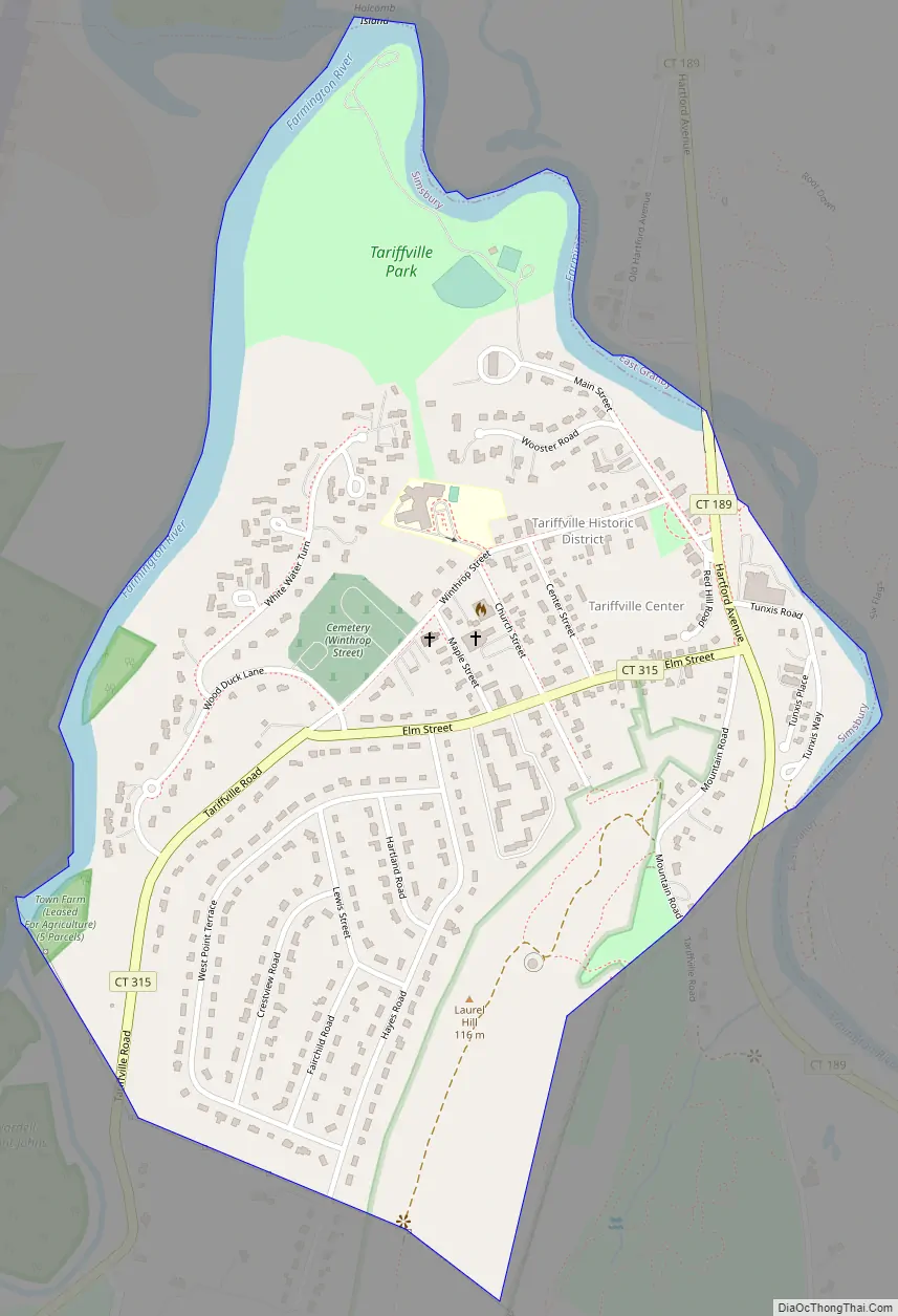
Online Interactive Map
Click on ![]() to view map in "full screen" mode.
to view map in "full screen" mode.
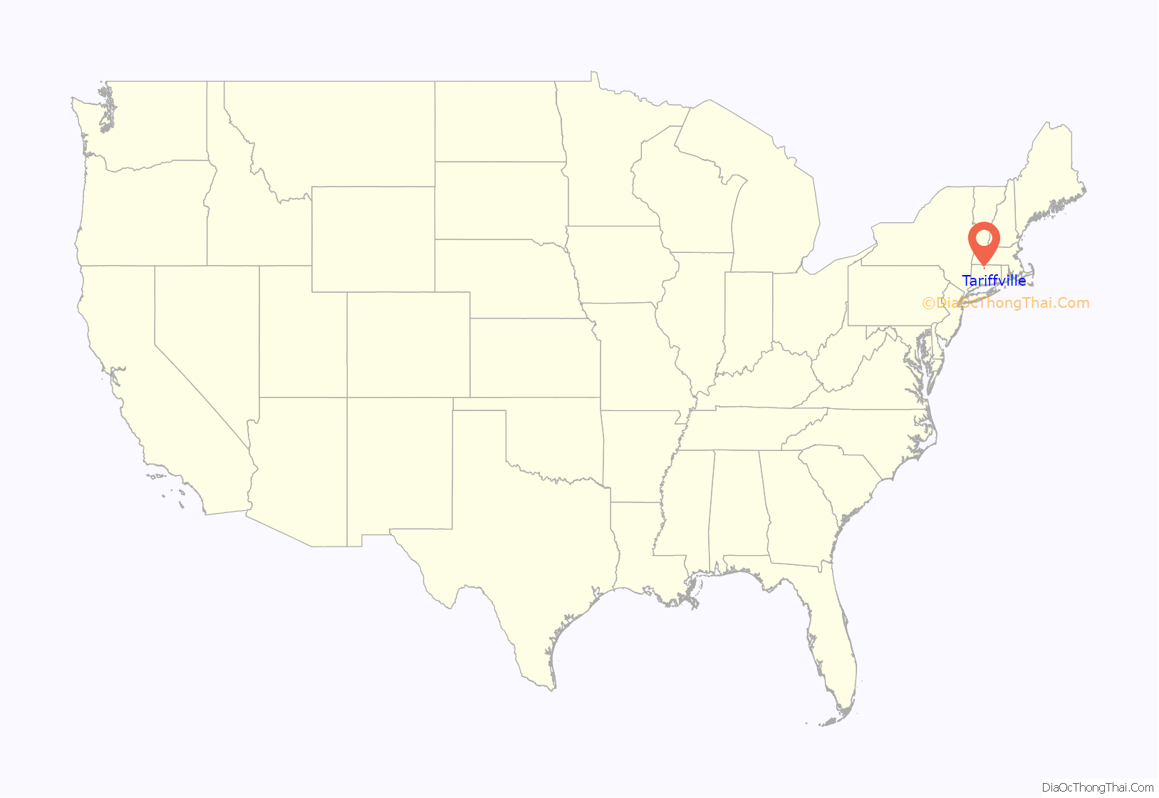
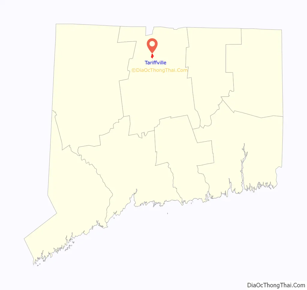
Tariffville location map. Where is Tariffville CDP?
History
In 1825 (or 1827), the Tariff Manufacturing Company built a carpet mill along the Farmington River, giving its name to the area. The company name came from the Tariff Act of 1824 which included protective tariffs for a number of products, including wool and cotton textiles. The area did not have sufficient housing for the workers, so the company built housing, some of which survives today. The carpet business survived for a few decades, but by 1867, the primary industry in the area was sorting and packing of tobacco. The tobacco business would continue as the chief industry through the 1930s. The town was the site of a major rail accident, the Tariffville train crash, in 1878.
The first steel manufacturing plant in the country was established in Tariffville at a site on the Farmington River in 1727.
Tariffville Road Map
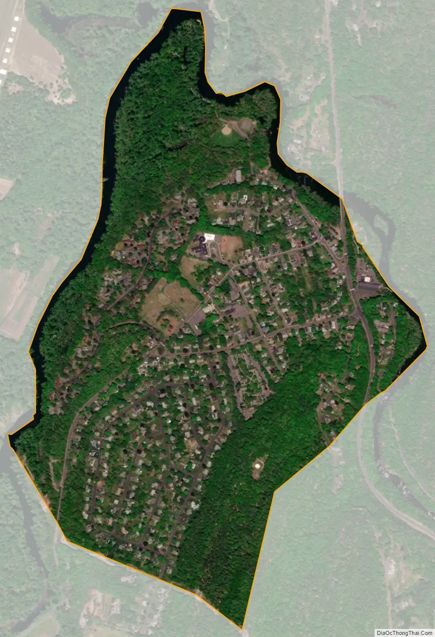
Tariffville city Satellite Map
Geography
Tariffville is in the northeast corner of the town of Simsbury, on the inside of a sharp bend in the Farmington River. The northeast and northwest borders of the CDP follow the river, with the northeast part also forming the town line with East Granby. The southeast border of the CDP follows the crest of Talcott Mountain and is the town line with Bloomfield. The southern border of the CDP follows a line just south of West Point Terrace from Talcott Mountain back down to the river.
Connecticut Route 189 (Hartford Avenue) runs through the east end of Tariffville, leading north 3.5 miles (5.6 km) to Granby and south 12 miles (19 km) to Hartford. Connecticut Route 315 passes through the center of Tariffville as Elm Street and Tariffville Road.
According to the United States Census Bureau, the CDP has a total area of 0.7 square miles (1.7 km), of which 0.6 square miles (1.6 km) is land and 0.04 square miles (0.1 km), or 7.98%, is water.
See also
Map of Connecticut State and its subdivision: Map of other states:- Alabama
- Alaska
- Arizona
- Arkansas
- California
- Colorado
- Connecticut
- Delaware
- District of Columbia
- Florida
- Georgia
- Hawaii
- Idaho
- Illinois
- Indiana
- Iowa
- Kansas
- Kentucky
- Louisiana
- Maine
- Maryland
- Massachusetts
- Michigan
- Minnesota
- Mississippi
- Missouri
- Montana
- Nebraska
- Nevada
- New Hampshire
- New Jersey
- New Mexico
- New York
- North Carolina
- North Dakota
- Ohio
- Oklahoma
- Oregon
- Pennsylvania
- Rhode Island
- South Carolina
- South Dakota
- Tennessee
- Texas
- Utah
- Vermont
- Virginia
- Washington
- West Virginia
- Wisconsin
- Wyoming


