Weatogue is a village and census-designated place in Simsbury, Hartford County, Connecticut. The population was 2,776 at the 2010 census.
| Name: | Weatogue CDP |
|---|---|
| LSAD Code: | 57 |
| LSAD Description: | CDP (suffix) |
| State: | Connecticut |
| County: | Hartford County |
| Elevation: | 300 ft (90 m) |
| Total Area: | 3.02 sq mi (7.81 km²) |
| Land Area: | 3.00 sq mi (7.76 km²) |
| Water Area: | 0.02 sq mi (0.05 km²) |
| Total Population: | 2,776 |
| Population Density: | 926/sq mi (357.7/km²) |
| ZIP code: | 06089 |
| Area code: | 860 |
| FIPS code: | 0980770 |
| GNISfeature ID: | 2377877 |
Online Interactive Map
Click on ![]() to view map in "full screen" mode.
to view map in "full screen" mode.
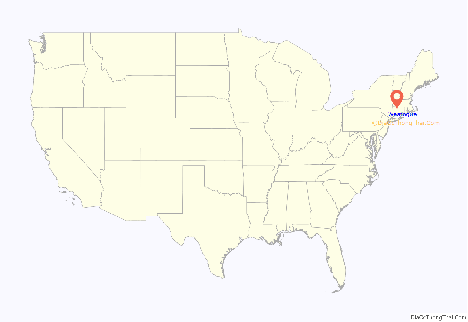
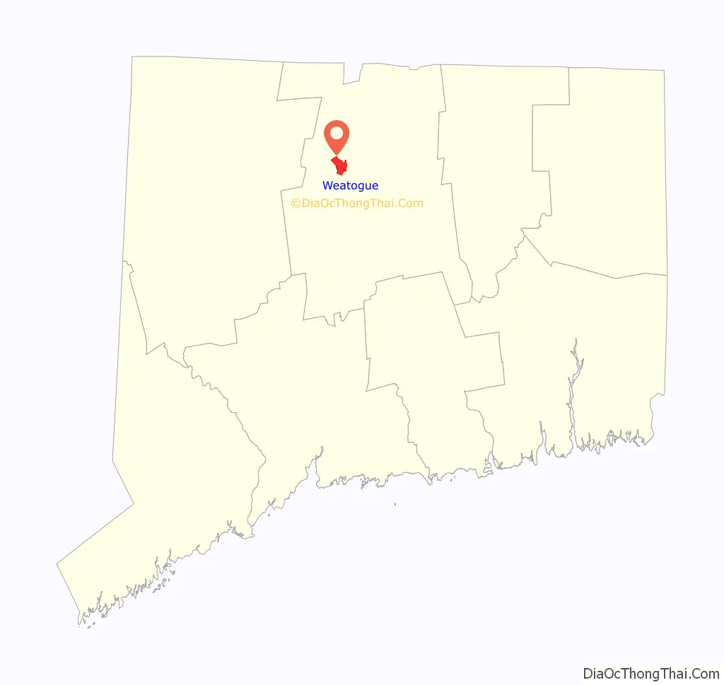
Weatogue location map. Where is Weatogue CDP?
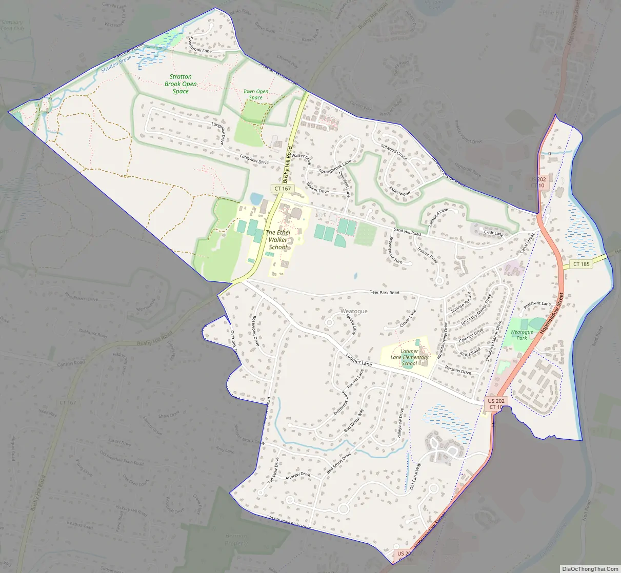
Weatogue Road Map
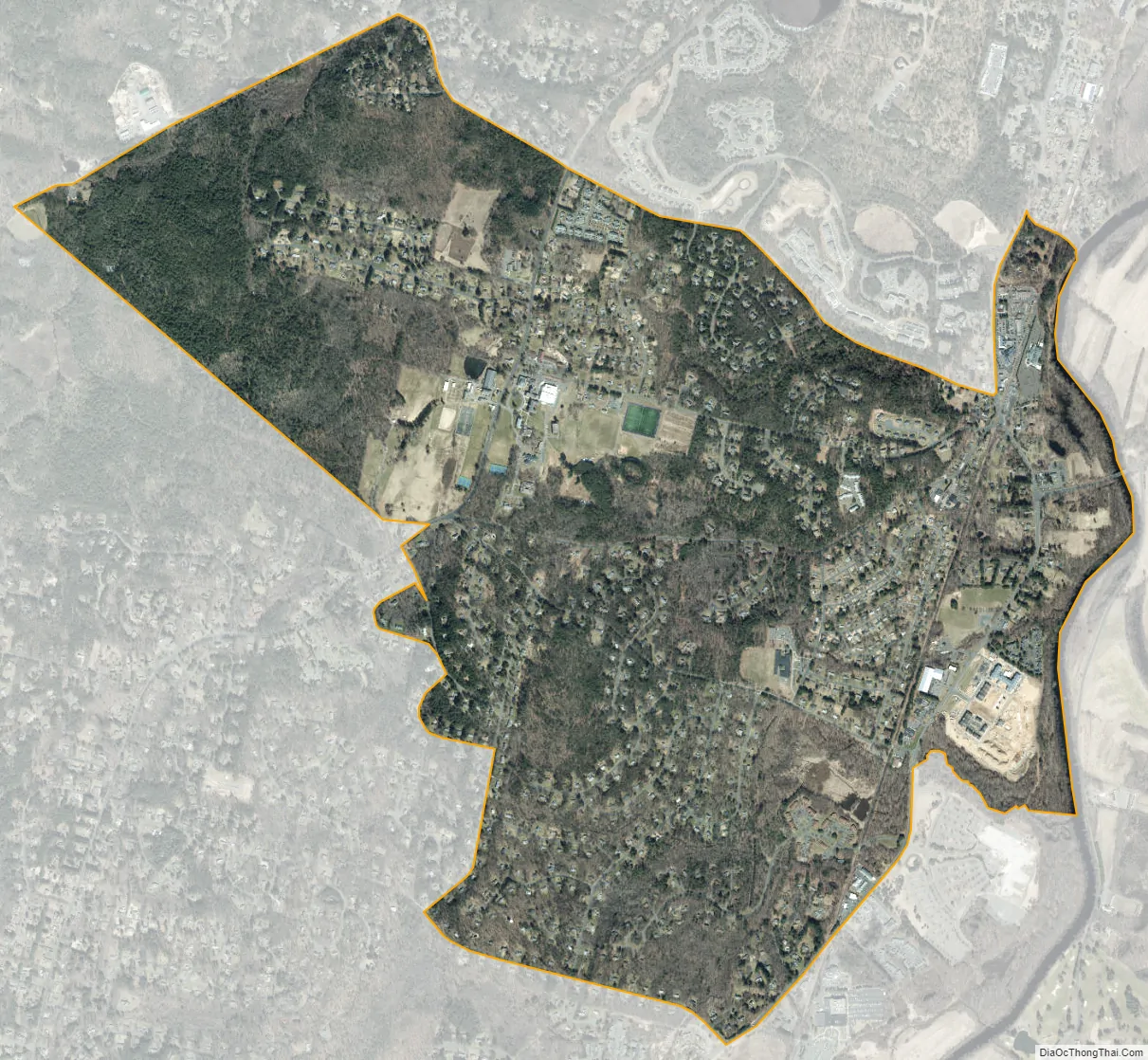
Weatogue city Satellite Map
Geography
Weatogue is in the southern part of the town of Simsbury and is bordered to the northwest by West Simsbury and to the northeast by Simsbury Center. The northern border of the CDP follows Town Forest Road, Stratton Brook Road, a small portion of U.S. Route 202, and Second Brook to its mouth in the Farmington River. The eastern border of the CDP follows the river south (upstream) to Minister Brook. The southern border follows Minister Brook, US 202, and Old Meadow Plain Road, and the western border follows Pine Glen Road, Park Road, Orchard Lane, and Overlook Terrace to Connecticut Route 167, from which point the border strikes northwest to Town Forest Road at Nimrod Road. The original settlement of Weatogue is in the eastern part of the CDP, at the junction of US 202 (Hopmeadow Street) with Canal Street and Stratton Brook Road.
According to the United States Census Bureau, the CDP has a total area of 3.02 square miles (7.81 km), of which 3.00 square miles (7.76 km) is land and 0.019 square miles (0.05 km), or 0.66%, is water.
See also
Map of Connecticut State and its subdivision: Map of other states:- Alabama
- Alaska
- Arizona
- Arkansas
- California
- Colorado
- Connecticut
- Delaware
- District of Columbia
- Florida
- Georgia
- Hawaii
- Idaho
- Illinois
- Indiana
- Iowa
- Kansas
- Kentucky
- Louisiana
- Maine
- Maryland
- Massachusetts
- Michigan
- Minnesota
- Mississippi
- Missouri
- Montana
- Nebraska
- Nevada
- New Hampshire
- New Jersey
- New Mexico
- New York
- North Carolina
- North Dakota
- Ohio
- Oklahoma
- Oregon
- Pennsylvania
- Rhode Island
- South Carolina
- South Dakota
- Tennessee
- Texas
- Utah
- Vermont
- Virginia
- Washington
- West Virginia
- Wisconsin
- Wyoming


