Woodbury Center is a census-designated place (CDP) in Litchfield County, Connecticut, United States. It comprises the twin villages of Woodbury and North Woodbury and surrounding residential land in the town of Woodbury. As of the 2010 census, the population of the CDP was 1,294, out of 9,975 in the entire town.
| Name: | Woodbury Center CDP |
|---|---|
| LSAD Code: | 57 |
| LSAD Description: | CDP (suffix) |
| State: | Connecticut |
| County: | Litchfield County |
| Elevation: | 264 ft (80 m) |
| Total Area: | 1.95 sq mi (5.04 km²) |
| Land Area: | 1.95 sq mi (5.04 km²) |
| Water Area: | 0.0 sq mi (0.0 km²) |
| Total Population: | 1,294 |
| Population Density: | 665/sq mi (256.8/km²) |
| ZIP code: | 06798 |
| FIPS code: | 0987980 |
| GNISfeature ID: | 2377886 |
Online Interactive Map
Click on ![]() to view map in "full screen" mode.
to view map in "full screen" mode.
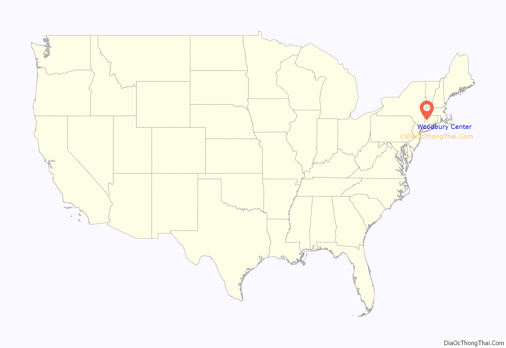
Woodbury Center location map. Where is Woodbury Center CDP?
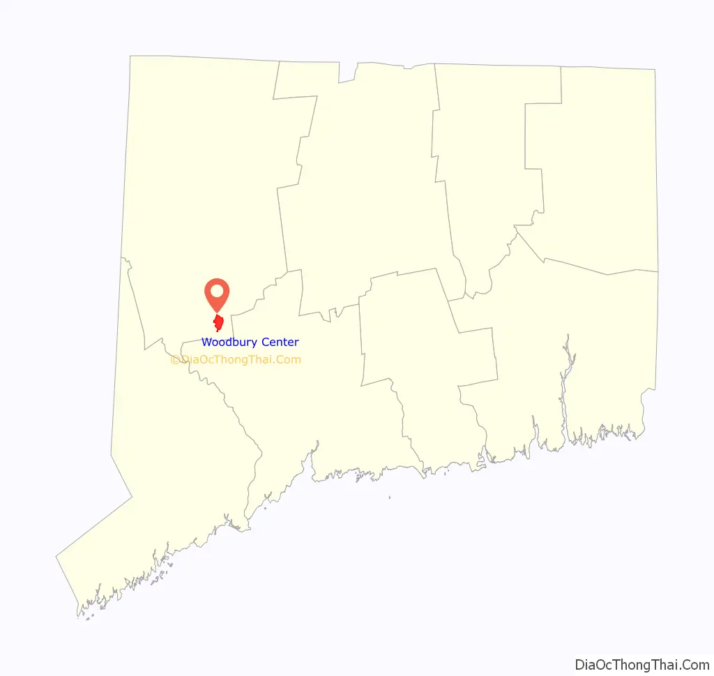
Woodbury Center Road Map
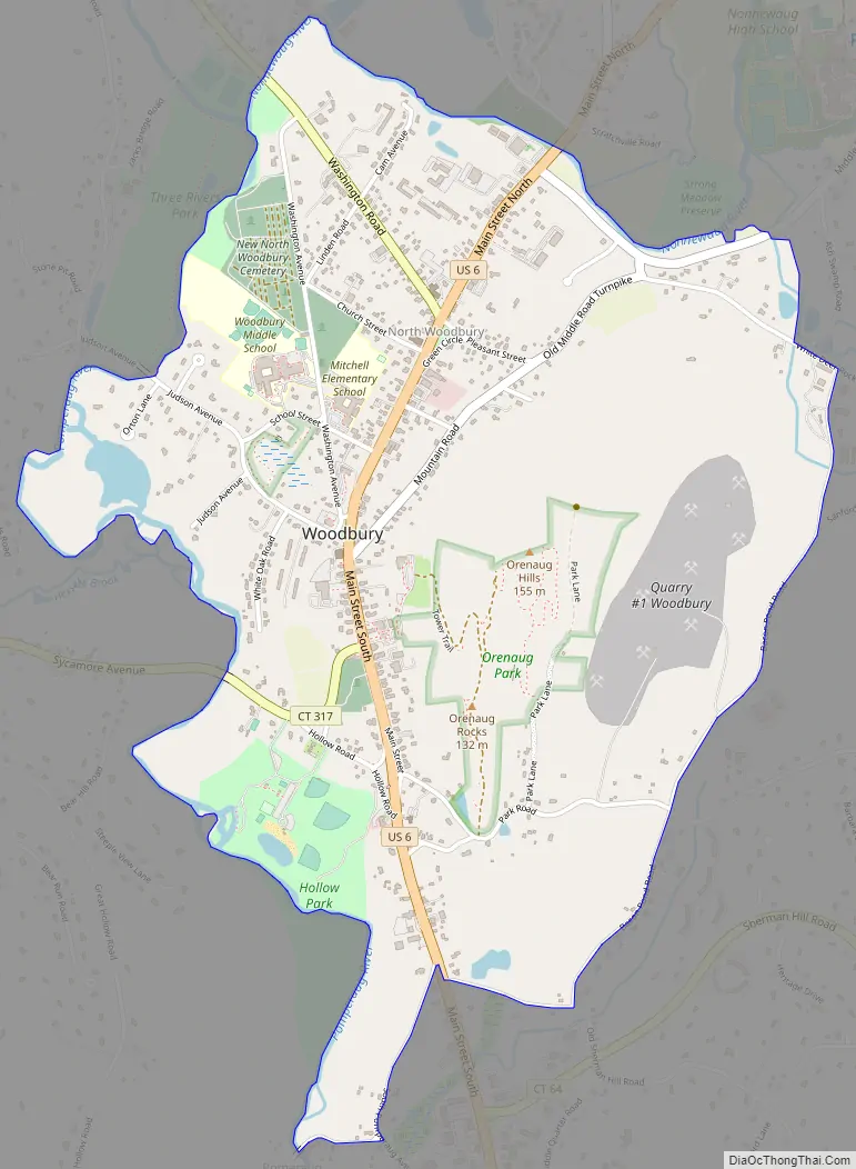
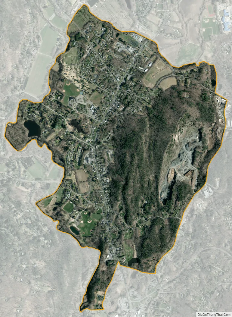
Woodbury Center city Satellite Map
Geography
The Woodbury Center CDP is in the south-central part of the town of Woodbury, in the valley of the Pomperaug River. The adjacent villages of Woodbury and North Woodbury occupy the western side of the CDP, and the Orenaug Hills, rising to 509 feet (155 m), occupy the eastern portion. The CDP is bordered to the east by Bacon Pond Road; to the south by Old Sherman Hill Road, South Pomperaug Avenue, and Pomperaug Road; to the west by the Pomperaug River; and to the north by the Nonewaug River, a tributary of the Pomperaug.
U.S. Route 6 passes north to south through the community as Main Street. Route 6 leads northeast 7 miles (11 km) to Watertown and south 5 miles (8 km) to Southbury and an interchange with Interstate 84. Connecticut Route 47 begins in North Woodbury and leads northwest 8 miles (13 km) to Washington. Connecticut Route 317 has its eastern terminus in Woodbury village and leads west 6 miles (10 km) to Roxbury.
According to the U.S. Census Bureau, the Woodbury Center CDP has an area of 1.9 square miles (5.0 km), all of it recorded as land.
See also
Map of Connecticut State and its subdivision: Map of other states:- Alabama
- Alaska
- Arizona
- Arkansas
- California
- Colorado
- Connecticut
- Delaware
- District of Columbia
- Florida
- Georgia
- Hawaii
- Idaho
- Illinois
- Indiana
- Iowa
- Kansas
- Kentucky
- Louisiana
- Maine
- Maryland
- Massachusetts
- Michigan
- Minnesota
- Mississippi
- Missouri
- Montana
- Nebraska
- Nevada
- New Hampshire
- New Jersey
- New Mexico
- New York
- North Carolina
- North Dakota
- Ohio
- Oklahoma
- Oregon
- Pennsylvania
- Rhode Island
- South Carolina
- South Dakota
- Tennessee
- Texas
- Utah
- Vermont
- Virginia
- Washington
- West Virginia
- Wisconsin
- Wyoming