Millsboro is a town in Sussex County, Delaware, United States. Millsboro is part of the Salisbury metropolitan area.
| Name: | Millsboro town |
|---|---|
| LSAD Code: | 43 |
| LSAD Description: | town (suffix) |
| State: | Delaware |
| County: | Sussex County |
| Elevation: | 23 ft (7 m) |
| Total Area: | 5.43 sq mi (14.06 km²) |
| Land Area: | 5.20 sq mi (13.46 km²) |
| Water Area: | 0.23 sq mi (0.61 km²) |
| Total Population: | 6,863 |
| Population Density: | 1,321.08/sq mi (510.03/km²) |
| ZIP code: | 19966 |
| Area code: | 302 |
| FIPS code: | 1047940 |
| GNISfeature ID: | 214319 |
| Website: | www.millsboro.org |
Online Interactive Map
Click on ![]() to view map in "full screen" mode.
to view map in "full screen" mode.
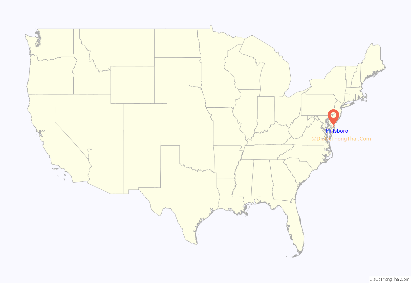
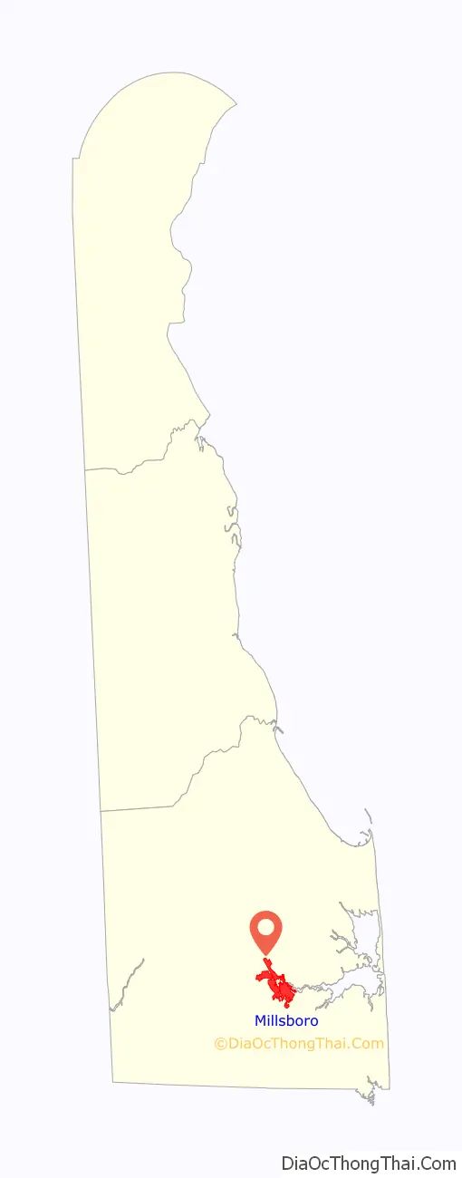
Millsboro location map. Where is Millsboro town?
History
Millsboro’s earliest European settlers were of English family origin; though most were second generation colonists who simply migrated north from the eastern shore of Virginia in order to join in the timber drive of the later 17th century, which brought many seeking to cut the vast mixed deciduous forests. The settlement itself was created in the second half of the 17th century when settlers from Accomack County, Virginia arrived to cut timber along the drainages. At one time no less than seven lumber mills were present, the largest employing over 70 laborers. These early years are well documented in the annals of Virginia history. The township during the first settlement period, although unincorporated, had several stores, churches, a bakery and various tack and blacksmith shops as well as and both Anglican and Presbyterian congregations. The area has many cemeteries dating from this original settlement period, which is considered the founding of the township, including the Lingo Family Cemetery and others.
A second period of settlement occurred after Elisha Dickerson built a dam on the Indian River in the 1792. There had been a settlement there for nearly a century before this, but the building of the dam was considered the official town establishment. At the time it was called “Rock Hole”. The town grew, and more mills were built. The official incorporation of the town was in 1893.
Prior to the American Revolutionary War, the present-day Town of Millsboro was in the Province of Maryland (Somerset and, later, Worcester County). Members of the Nanticoke people and related tribes lived, and live, in Millsboro. Ball Theatre, The Robert Davis Farmhouse, Harmon School, Isaac Harmon Farmhouse, Harmony Church, Ames Hitchens Chicken Farm, Indian Mission Church, Indian Mission School, Indian River Archeological Complex, Johnson School, Perry-Shockley House, Warren’s Mill, and Warren T. Wright Farmhouse Site at and near Millsboro are listed on the National Register of Historic Places.
On July 21, 1930, the temperature in Millsboro rose to 110 °F (43 °C), the highest temperature ever recorded in Delaware. On January 17, 1893, the temperature fell to -17 °F (-27 °C) in Millsboro, the coldest temperature experienced in the state. Millsboro is one of only three cities in the United States to record both its state’s extreme temperatures, the others being Chester, Massachusetts and Warsaw, Missouri.
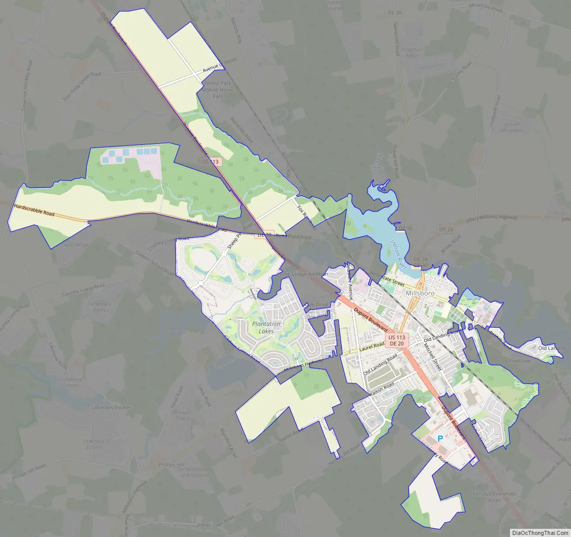
Millsboro Road Map
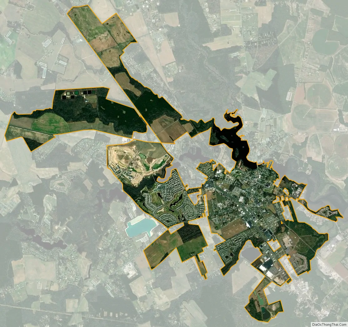
Millsboro city Satellite Map
Geography
Millsboro is located at 38°35′29″N 75°17′29″W / 38.59139°N 75.29139°W / 38.59139; -75.29139 (38.5915023, –75.2913018). The town is approximately 20 miles from the Delaware and Maryland beaches – as well as Salisbury, Maryland – and around 10 miles from the Maryland state line.
See also
Map of Delaware State and its subdivision: Map of other states:- Alabama
- Alaska
- Arizona
- Arkansas
- California
- Colorado
- Connecticut
- Delaware
- District of Columbia
- Florida
- Georgia
- Hawaii
- Idaho
- Illinois
- Indiana
- Iowa
- Kansas
- Kentucky
- Louisiana
- Maine
- Maryland
- Massachusetts
- Michigan
- Minnesota
- Mississippi
- Missouri
- Montana
- Nebraska
- Nevada
- New Hampshire
- New Jersey
- New Mexico
- New York
- North Carolina
- North Dakota
- Ohio
- Oklahoma
- Oregon
- Pennsylvania
- Rhode Island
- South Carolina
- South Dakota
- Tennessee
- Texas
- Utah
- Vermont
- Virginia
- Washington
- West Virginia
- Wisconsin
- Wyoming


