Plains is a city in Sumter County, Georgia, United States. The population was 776 at the 2010 census. It is part of the Americus Micropolitan Statistical Area. Plains is best known as the birthplace and home of Jimmy Carter, the 39th president of the United States.
| Name: | Plains city |
|---|---|
| LSAD Code: | 25 |
| LSAD Description: | city (suffix) |
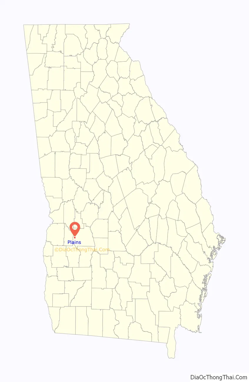
| State: | Georgia |
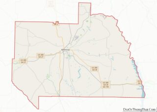
| County: | Sumter County |
| Elevation: | 499 ft (152 m) |
| Total Area: | 0.81 sq mi (2.11 km²) |
| Land Area: | 0.81 sq mi (2.11 km²) |
| Water Area: | 0.00 sq mi (0.00 km²) |
| Total Population: | 573 |
| Population Density: | 703.93/sq mi (271.76/km²) |
| ZIP code: | 31780 |
| Area code: | 229 |
| FIPS code: | 1361628 |
| GNISfeature ID: | 0356474 |
| Website: | plainsgeorgia.org |
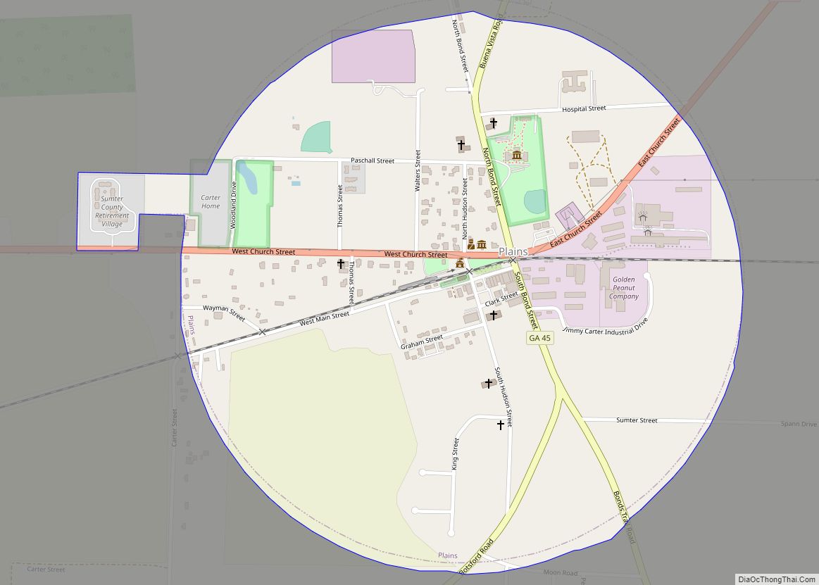
Online Interactive Map
Click on ![]() to view map in "full screen" mode.
to view map in "full screen" mode.
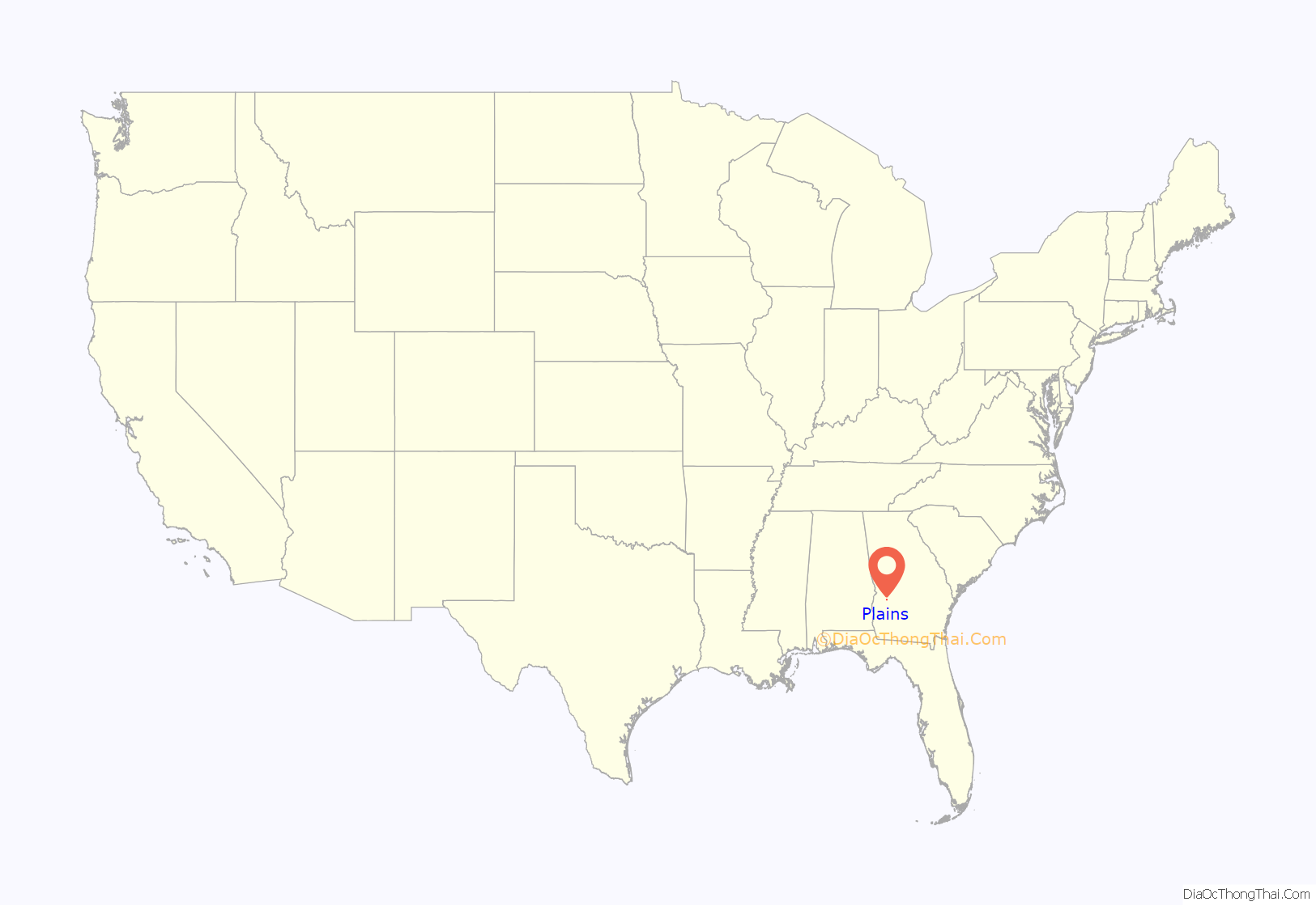
Plains location map. Where is Plains city?
History
Originally inhabited by the Muscogee people, by the 1840s three small settlements existed nearby: Plains of Dura, Magnolia Springs, and Lebanon. As railway access expanded into the region in response to increased cotton farming, these settlements coalesced closer to the new railway location. As businesses rapidly developed, local businessmen successfully petitioned the State Legislature to shorten Plains of Dura to Plains. Plains was subsequently incorporated in 1896. Plains continued to experience growth fueled by cotton cultivation well into the early twentieth century. A substantial school and the pioneering Wise Sanitarium were both built in the 1920s. Despite differentiation into peanut cultivation, the Great Depression deprived the community of much of its prosperity. Plains remained a quiet Southern town until Jimmy Carter rose to political prominence as Governor of Georgia in the 1970s, eventually becoming President of the United States from 1977 to 1981.
During the 1976 presidential election and for many years afterwards, Plains saw a giant influx in tourism. Nearly ten thousand people would pour into the community daily.
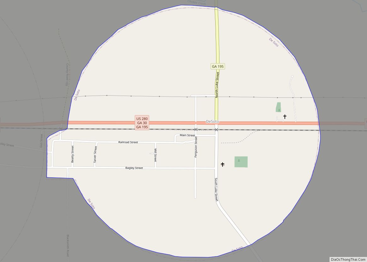
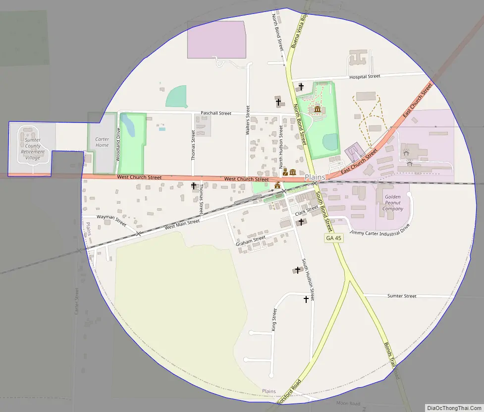
Plains Road Map
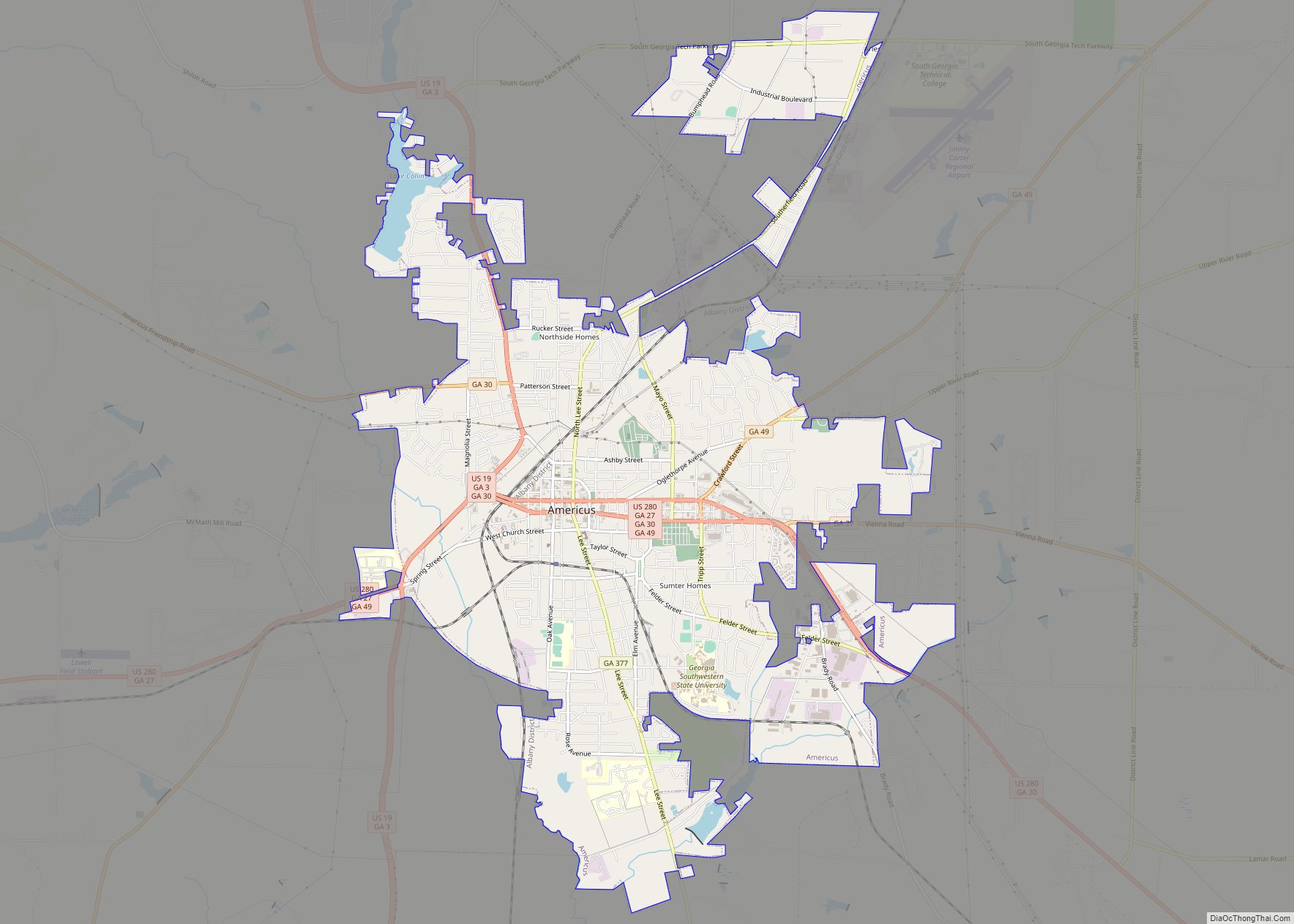
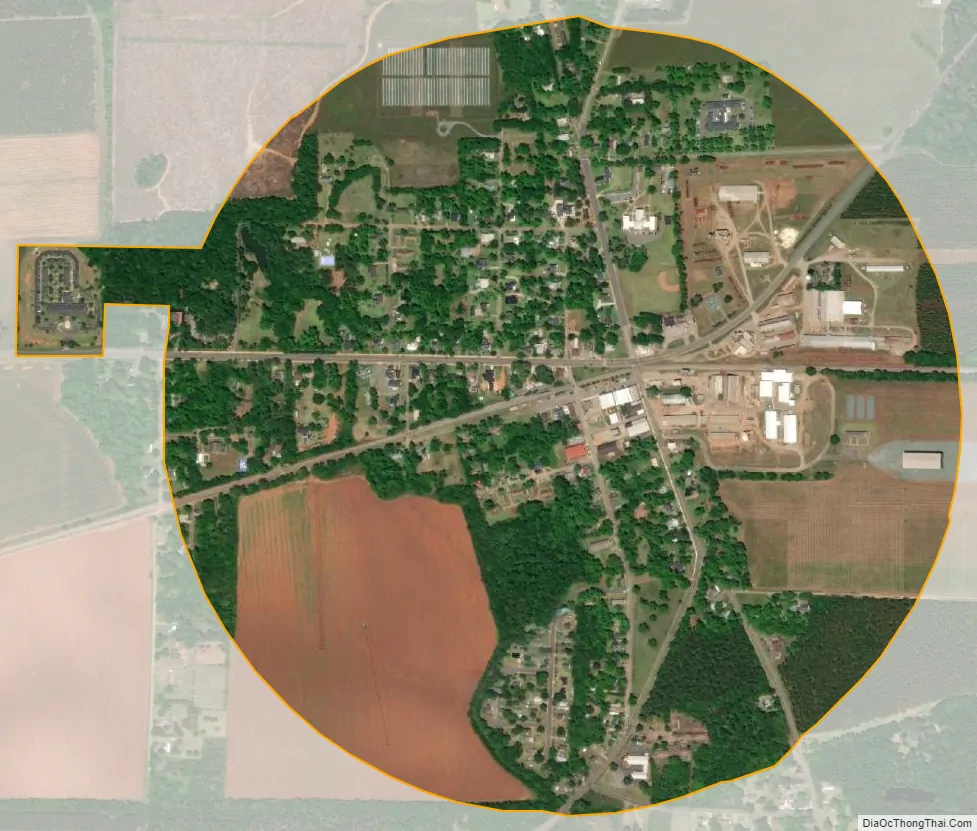
Plains city Satellite Map
Geography
According to the United States Census Bureau, the city has a total area of 0.8 square miles (2.1 km), all land. The city’s boundary is in the shape of a circle. Plains has a center longitude/latitude point which is -83.0813/33.4553. Plains is located in west-south-western Georgia, 120 miles due south of Atlanta.
See also
Map of Georgia State and its subdivision:- Appling
- Atkinson
- Bacon
- Baker
- Baldwin
- Banks
- Barrow
- Bartow
- Ben Hill
- Berrien
- Bibb
- Bleckley
- Brantley
- Brooks
- Bryan
- Bulloch
- Burke
- Butts
- Calhoun
- Camden
- Candler
- Carroll
- Catoosa
- Charlton
- Chatham
- Chattahoochee
- Chattooga
- Cherokee
- Clarke
- Clay
- Clayton
- Clinch
- Cobb
- Coffee
- Colquitt
- Columbia
- Cook
- Coweta
- Crawford
- Crisp
- Dade
- Dawson
- Decatur
- DeKalb
- Dodge
- Dooly
- Dougherty
- Douglas
- Early
- Echols
- Effingham
- Elbert
- Emanuel
- Evans
- Fannin
- Fayette
- Floyd
- Forsyth
- Franklin
- Fulton
- Gilmer
- Glascock
- Glynn
- Gordon
- Grady
- Greene
- Gwinnett
- Habersham
- Hall
- Hancock
- Haralson
- Harris
- Hart
- Heard
- Henry
- Houston
- Irwin
- Jackson
- Jasper
- Jeff Davis
- Jefferson
- Jenkins
- Johnson
- Jones
- Lamar
- Lanier
- Laurens
- Lee
- Liberty
- Lincoln
- Long
- Lowndes
- Lumpkin
- Macon
- Madison
- Marion
- McDuffie
- McIntosh
- Meriwether
- Miller
- Mitchell
- Monroe
- Montgomery
- Morgan
- Murray
- Muscogee
- Newton
- Oconee
- Oglethorpe
- Paulding
- Peach
- Pickens
- Pierce
- Pike
- Polk
- Pulaski
- Putnam
- Quitman
- Rabun
- Randolph
- Richmond
- Rockdale
- Schley
- Screven
- Seminole
- Spalding
- Stephens
- Stewart
- Sumter
- Talbot
- Taliaferro
- Tattnall
- Taylor
- Telfair
- Terrell
- Thomas
- Tift
- Toombs
- Towns
- Treutlen
- Troup
- Turner
- Twiggs
- Union
- Upson
- Walker
- Walton
- Ware
- Warren
- Washington
- Wayne
- Webster
- Wheeler
- White
- Whitfield
- Wilcox
- Wilkes
- Wilkinson
- Worth
- Alabama
- Alaska
- Arizona
- Arkansas
- California
- Colorado
- Connecticut
- Delaware
- District of Columbia
- Florida
- Georgia
- Hawaii
- Idaho
- Illinois
- Indiana
- Iowa
- Kansas
- Kentucky
- Louisiana
- Maine
- Maryland
- Massachusetts
- Michigan
- Minnesota
- Mississippi
- Missouri
- Montana
- Nebraska
- Nevada
- New Hampshire
- New Jersey
- New Mexico
- New York
- North Carolina
- North Dakota
- Ohio
- Oklahoma
- Oregon
- Pennsylvania
- Rhode Island
- South Carolina
- South Dakota
- Tennessee
- Texas
- Utah
- Vermont
- Virginia
- Washington
- West Virginia
- Wisconsin
- Wyoming