Ketchum is a city in Blaine County, Idaho, located in the central part of the state. The population was 3,555 at the 2020 census, up from 2,689 in 2010. Located in the Wood River Valley, Ketchum is adjacent to Sun Valley and the communities share many resources: both sit in the same valley beneath Bald Mountain, with its world-famous skiing. The city also draws tourists from around the world to enjoy its fishing, hiking, trail riding, tennis, shopping, art galleries, and more. The airport for Ketchum, Friedman Memorial Airport, is approximately 15 miles (24 km) south in Hailey.
| Name: | Ketchum city |
|---|---|
| LSAD Code: | 25 |
| LSAD Description: | city (suffix) |
| State: | Idaho |
| County: | Blaine County |
| Founded: | 1880 |
| Elevation: | 5,853 ft (1,784 m) |
| Total Area: | 3.25 sq mi (8.43 km²) |
| Land Area: | 3.21 sq mi (8.31 km²) |
| Water Area: | 0.05 sq mi (0.12 km²) |
| Total Population: | 3,555 |
| ZIP code: | 83340 |
| Area code: | 208, 986 |
| FIPS code: | 1643030 |
| GNISfeature ID: | 0397833 |
| Website: | ketchumidaho.org |
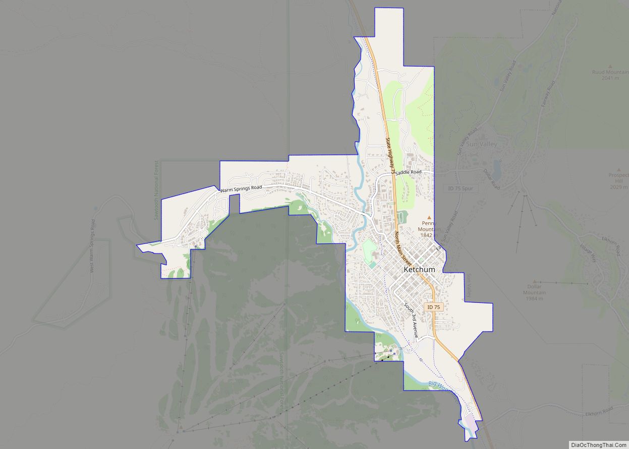
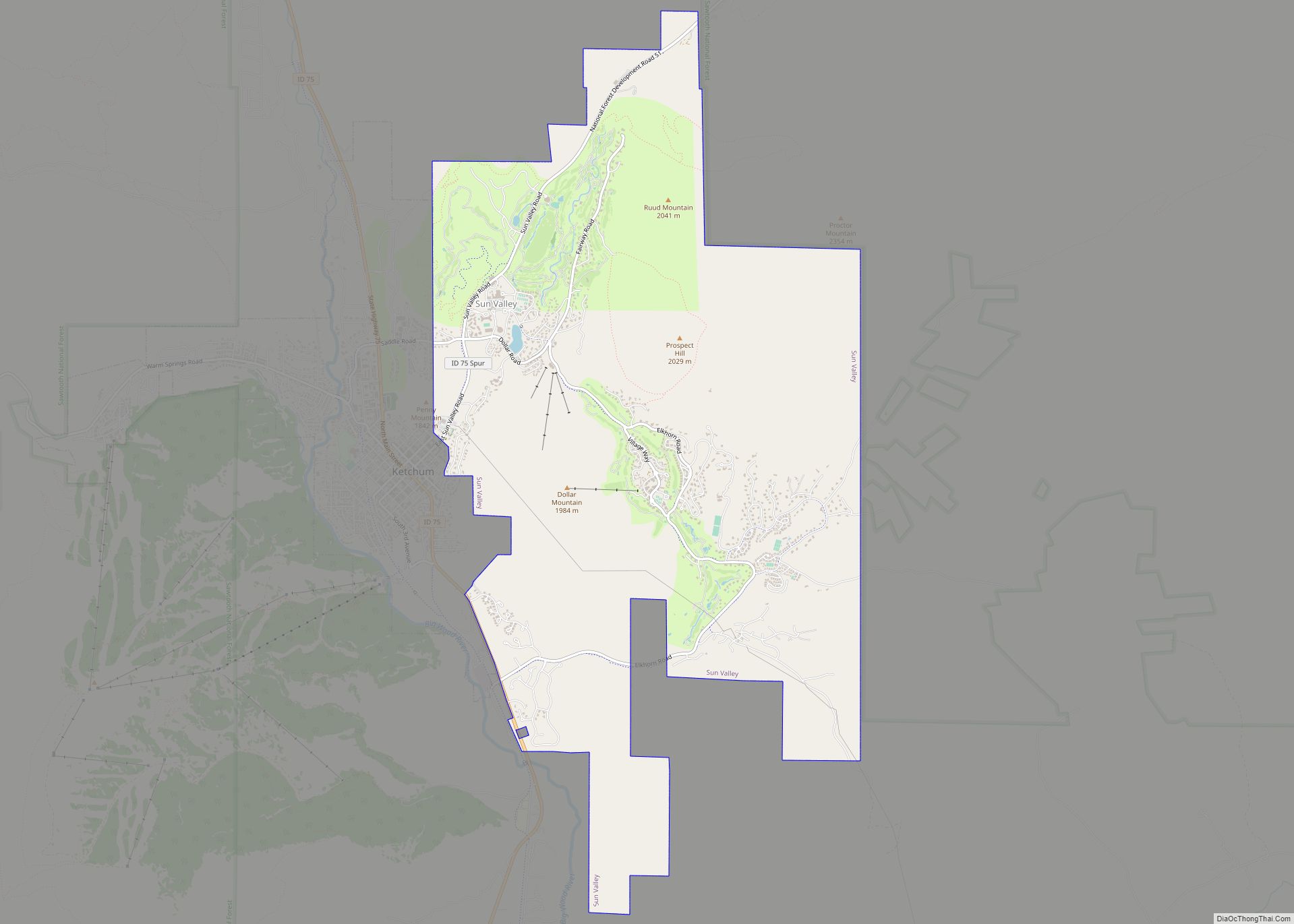
Online Interactive Map
Click on ![]() to view map in "full screen" mode.
to view map in "full screen" mode.
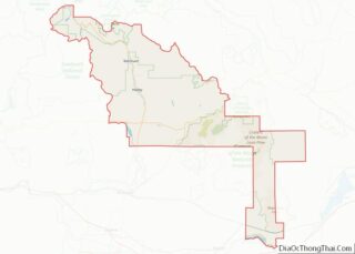
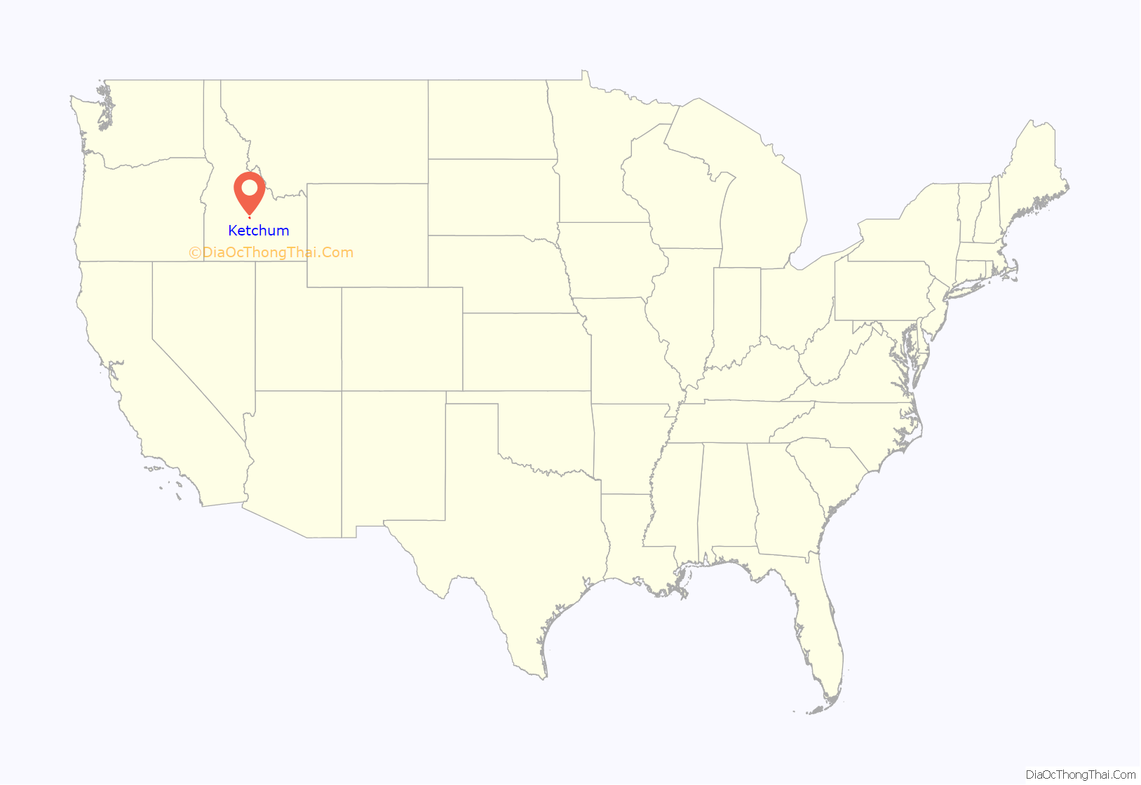
Ketchum location map. Where is Ketchum city?

History
Originally the smelting center of the Warm Springs mining district, the town was first named Leadville in 1880. The postal department decided that was too common and renamed it for David Ketchum, a local trapper and guide who had staked a claim in the basin a year earlier. Smelters were built in the 1880s, with the Philadelphia Smelter, located on Warm Springs Road, processing large amounts of lead and silver for about a decade.
After the mining boom subsided in the 1890s, sheepmen from the south drove their flocks north through Ketchum in the summer, to graze in the upper elevation areas of the Pioneer, Boulder, and Sawtooth mountains. By 1920, Ketchum had become the largest sheep-shipping center in the West. In the fall, massive flocks of sheep flowed south into the town’s livestock corrals at the Union Pacific Railroad’s railhead, which connected to the main line at Shoshone.
After the development of Sun Valley by the Union Pacific Railroad in 1936, Ketchum became popular with celebrities, including Gary Cooper and Ernest Hemingway. Hemingway loved the surrounding area; he fished, hunted, and in the late 1950s bought a home overlooking the Wood River in nearby Warm Springs. It was there he committed suicide; he and his granddaughter, model and actress Margaux Hemingway, are buried in the Ketchum Cemetery. The local elementary school is named in his honor.
Every Labor Day weekend, Ketchum hosts the Wagon Days festival, a themed carnival featuring Old West wagon trains, narrow ore wagons, and a parade.
The Clint Eastwood film Pale Rider (1985) was partially filmed in the Boulder Mountains near Ketchum.
Ketchum is referenced in the song “Ketchum, ID” by indie rock band boygenius.
Ketchum Road Map

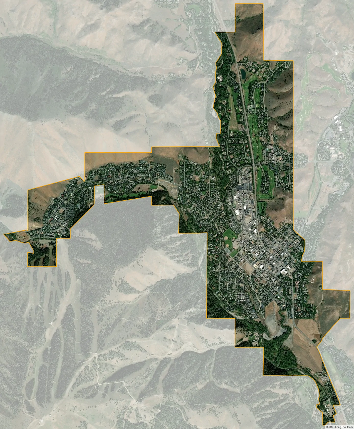
Ketchum city Satellite Map
Geography
Ketchum is located at an elevation of 5,853 feet (1,784 m) above sea level.
According to the United States Census Bureau, the city has a total area of 3.08 square miles (7.98 km), of which, 3.05 square miles (7.90 km) is land and 0.03 square miles (0.08 km) is water. However, two mountain streams, Trail Creek and Warm Springs Creek, join the Big Wood River in Ketchum.
Climate
According to the Köppen Climate Classification system, Ketchum has a warm-summer mediterranean continental climate, abbreviated “Dsb” on climate maps. The hottest temperature recorded in Ketchum was 98 °F (36.7 °C) on July 13, 2002, while the coldest temperature recorded was −46 °F (−43.3 °C) on February 2, 1950.
See also
Map of Idaho State and its subdivision:- Ada
- Adams
- Bannock
- Bear Lake
- Benewah
- Bingham
- Blaine
- Boise
- Bonner
- Bonneville
- Boundary
- Butte
- Camas
- Canyon
- Caribou
- Cassia
- Clark
- Clearwater
- Custer
- Elmore
- Franklin
- Fremont
- Gem
- Gooding
- Idaho
- Jefferson
- Jerome
- Kootenai
- Latah
- Lemhi
- Lewis
- Lincoln
- Madison
- Minidoka
- Nez Perce
- Oneida
- Owyhee
- Payette
- Power
- Shoshone
- Teton
- Twin Falls
- Valley
- Washington
- Alabama
- Alaska
- Arizona
- Arkansas
- California
- Colorado
- Connecticut
- Delaware
- District of Columbia
- Florida
- Georgia
- Hawaii
- Idaho
- Illinois
- Indiana
- Iowa
- Kansas
- Kentucky
- Louisiana
- Maine
- Maryland
- Massachusetts
- Michigan
- Minnesota
- Mississippi
- Missouri
- Montana
- Nebraska
- Nevada
- New Hampshire
- New Jersey
- New Mexico
- New York
- North Carolina
- North Dakota
- Ohio
- Oklahoma
- Oregon
- Pennsylvania
- Rhode Island
- South Carolina
- South Dakota
- Tennessee
- Texas
- Utah
- Vermont
- Virginia
- Washington
- West Virginia
- Wisconsin
- Wyoming