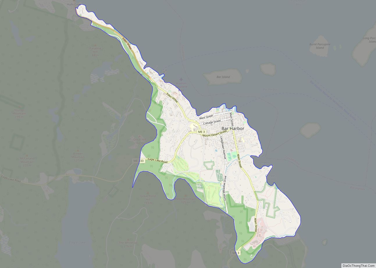
Bar Harbor is a census-designated place (CDP) in the town of Bar Harbor in Hancock County, Maine, United States. The CDP population was 2,552 at the 2010 census, out of a population of 5,235 in the town of Bar Harbor as a whole.
| Name: | Bar Harbor CDP |
|---|---|
| LSAD Code: | 57 |
| LSAD Description: | CDP (suffix) |
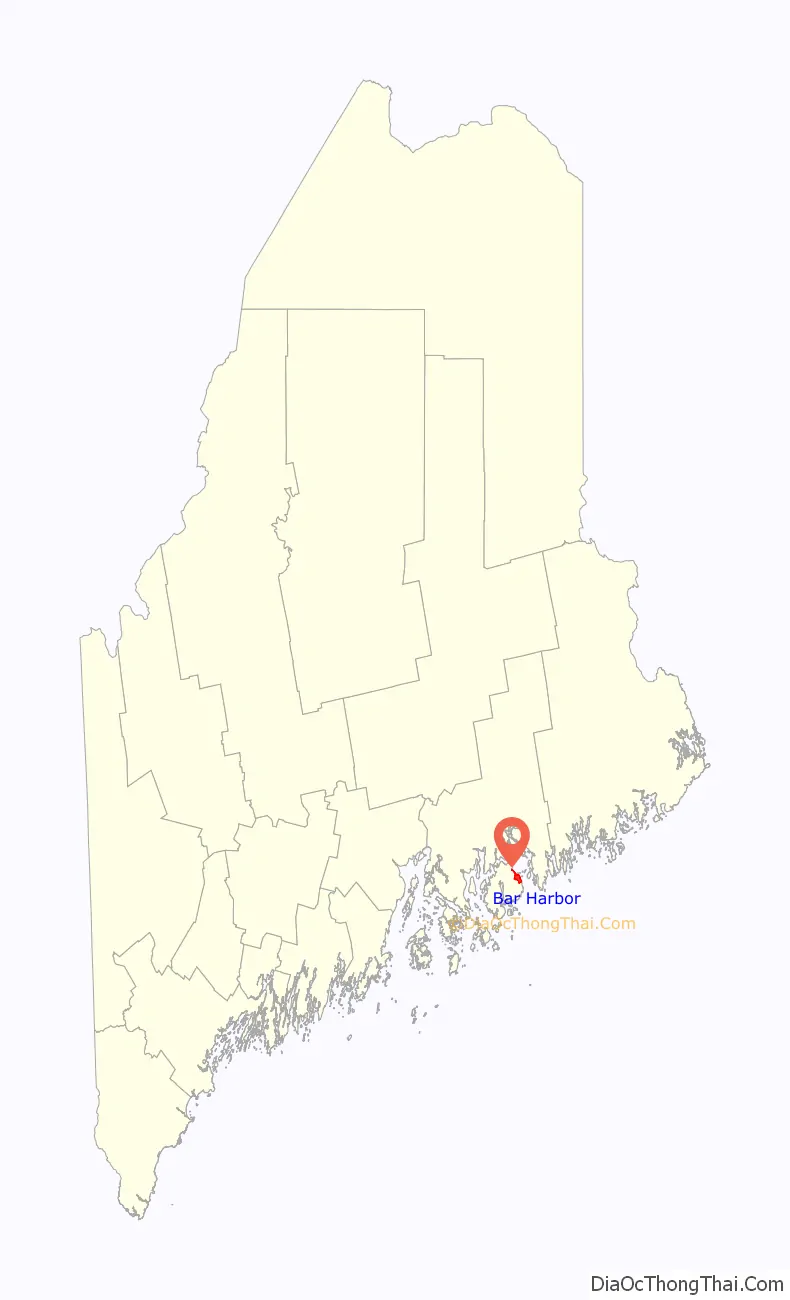
| State: | Maine |
| County: | Hancock County |
| Elevation: | 60 ft (20 m) |
| Total Area: | 3.17 sq mi (8.22 km²) |
| Land Area: | 3.17 sq mi (8.22 km²) |
| Water Area: | 0.00 sq mi (0.00 km²) |
| Total Population: | 2,260 |
| Population Density: | 711.81/sq mi (274.81/km²) |
| ZIP code: | 04609 |
| Area code: | 207 |
| FIPS code: | 2302830 |
| GNISfeature ID: | 0561569 |
Online Interactive Map
Click on ![]() to view map in "full screen" mode.
to view map in "full screen" mode.
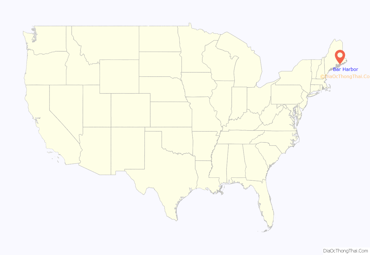
Bar Harbor location map. Where is Bar Harbor CDP?
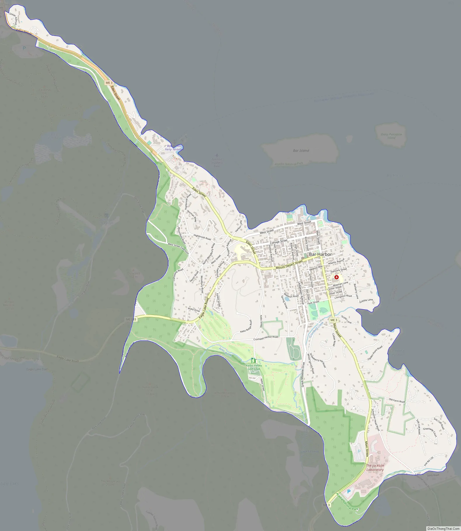
Bar Harbor Road Map
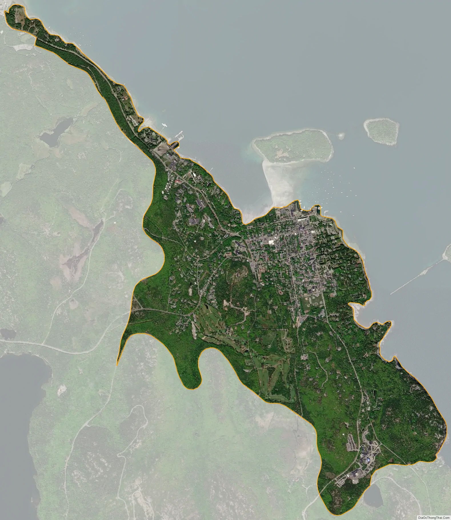
Bar Harbor city Satellite Map
Geography
The Bar Harbor CDP consists of the main urban center of the town of Bar Harbor. The CDP is located on Mount Desert Island at 44°23′9″N 68°12′34″W / 44.38583°N 68.20944°W / 44.38583; -68.20944 (44.385904, −68.209514), in the eastern part of the town. The CDP is bordered to the northeast by Frenchman Bay, including the actual Bar Harbor cove, to the west by Paradise Hill Road and to the south by Park Loop Road and Bear Brook. The western and southern margins of the CDP are within Acadia National Park. The CDP extends northwest along Route 3 and the Frenchman Bay shoreline as far as Hulls Cove.
Maine State Route 3 is the primary road through the community, leading northwest 11 miles (18 km) to the bridge to the mainland at Mount Desert Narrows and 20 miles (32 km) to Ellsworth. Route 3 leads south from Bar Harbor 12 miles (19 km) through Acadia National Park to Northeast Harbor. Maine State Route 233 leads west from Bar Harbor 8 miles (13 km) to Somesville.
According to the United States Census Bureau, the CDP has a total area of 3.2 square miles (8.2 km), all land.
See also
Map of Maine State and its subdivision: Map of other states:- Alabama
- Alaska
- Arizona
- Arkansas
- California
- Colorado
- Connecticut
- Delaware
- District of Columbia
- Florida
- Georgia
- Hawaii
- Idaho
- Illinois
- Indiana
- Iowa
- Kansas
- Kentucky
- Louisiana
- Maine
- Maryland
- Massachusetts
- Michigan
- Minnesota
- Mississippi
- Missouri
- Montana
- Nebraska
- Nevada
- New Hampshire
- New Jersey
- New Mexico
- New York
- North Carolina
- North Dakota
- Ohio
- Oklahoma
- Oregon
- Pennsylvania
- Rhode Island
- South Carolina
- South Dakota
- Tennessee
- Texas
- Utah
- Vermont
- Virginia
- Washington
- West Virginia
- Wisconsin
- Wyoming