Old Town is a city in Penobscot County, Maine, United States. The population was 7,431 at the 2020 census. The city’s developed area is chiefly located on the relatively large Marsh Island, but its boundaries extend beyond it. The island is surrounded and defined by the Penobscot River to the east and the Stillwater River to the west.
| Name: | Old Town city |
|---|---|
| LSAD Code: | 25 |
| LSAD Description: | city (suffix) |
| State: | Maine |
| County: | Penobscot County |
| Elevation: | 108 ft (33 m) |
| Total Area: | 43.24 sq mi (111.98 km²) |
| Land Area: | 38.81 sq mi (100.52 km²) |
| Water Area: | 4.43 sq mi (11.46 km²) |
| Total Population: | 7,431 |
| Population Density: | 191.47/sq mi (73.93/km²) |
| ZIP code: | 04468 |
| Area code: | 207 |
| FIPS code: | 2355225 |
| GNISfeature ID: | 0572733 |
| Website: | www.old-town.org |
Online Interactive Map
Click on ![]() to view map in "full screen" mode.
to view map in "full screen" mode.
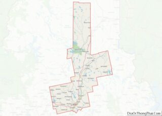
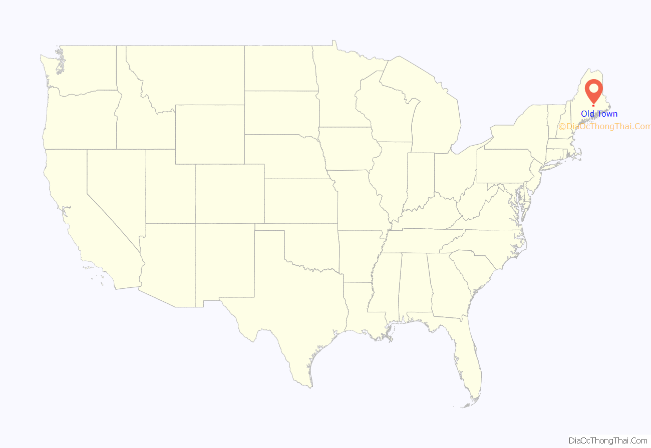
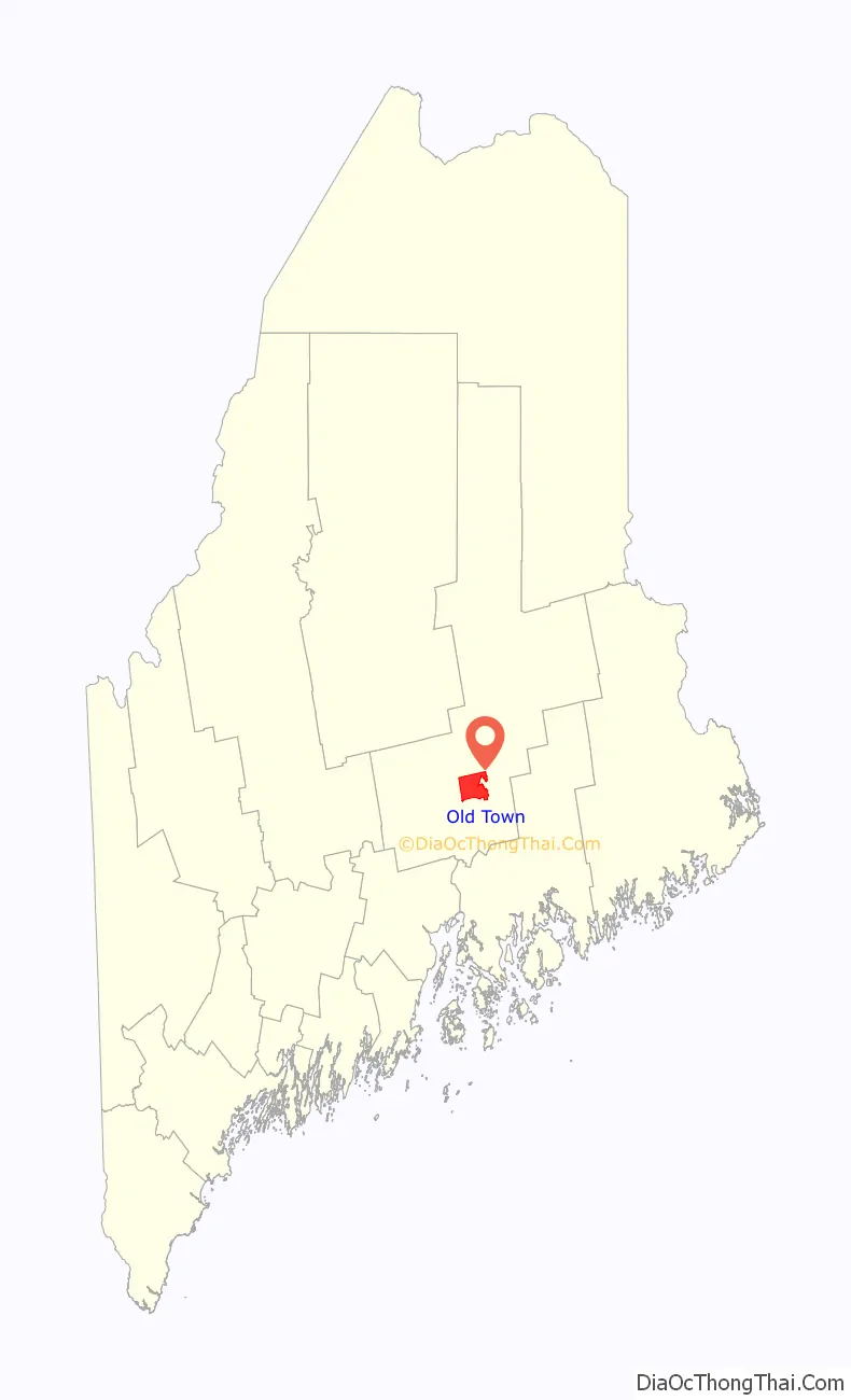
Old Town location map. Where is Old Town city?
History
Abenaki Indians called it Pannawambskek, meaning “where the ledges spread out,” referring to rapids and drops in the river bed. The French established a Jesuit Catholic mission here in the 1680s. Nearly a century later after Great Britain took over French territory following its victory in the Seven Years’ War, the area was settled by English pioneers in 1774. The name Old Town derives from “Indian Old Town”, which was the English name for the largest Penobscot Indian village, now known as Indian Island.
Located within the city limits but on its own island in the Penobscot River, the reservation is the current and historical home of the Penobscot Nation.
In 1820, when the present city was set off from neighboring Orono (named for a Penobscot sachem), it was given the name Old Town because it contained the Penobscot village. Over time, the Penobscot village ceased to be called Old Town, and the name migrated to the much newer American settlement across the river.
Old Town may be best known for Old Town Canoe Co., a major manufacturer of canoes and kayaks, which has been based in the city for more than 100 years. The city’s location along a series of rapids in the Penobscot River, near the head of tide just downstream in Bangor, made it an ideal location in the 1800s to marshal the water power for mills to process lumber from the millions of board feet of spruce and pine logs floated annually down the Penobscot.
Today many residents work for the University of Maine in Orono and the Eastern Maine Medical Center in Bangor, the two largest employers in the area. Old Town is home to a former Georgia-Pacific paper mill, which is being redeveloped for adaptive reuse.
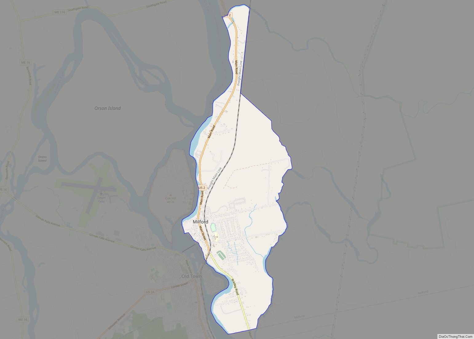
The city of Old Town includes Treat-Webster Island (a.k.a. “French Island”), a predominantly residential neighborhood located on a small island in the middle of the Penobscot River. French Island is the intermediate land mass between Milford and Old Town; it is connected on either side by a bridge.
Old toll bridge in 1907
Public Library in 1909
City Hall in 1914
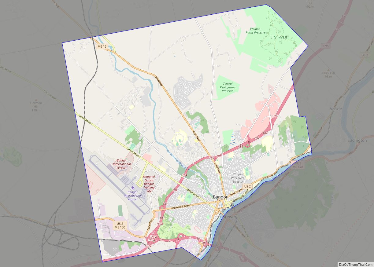
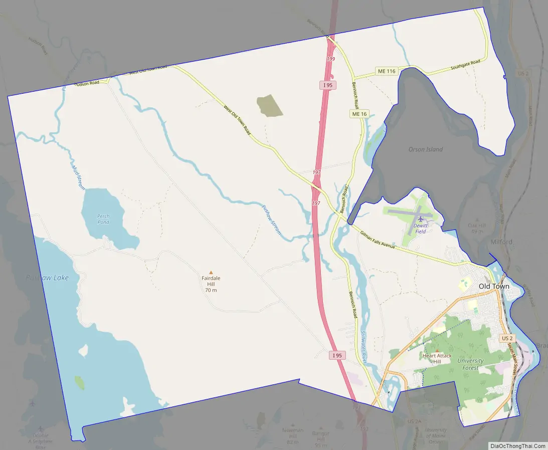
Old Town Road Map
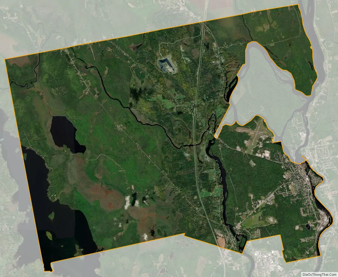
Old Town city Satellite Map
Geography
Old Town is located at 44°56′35″N 68°40′35″W / 44.94306°N 68.67639°W / 44.94306; -68.67639 (44.943047, −68.676461).
According to the United States Census Bureau, the city has a total area of 43.28 square miles (112.09 km), of which 38.85 square miles (100.62 km) is land and 4.43 square miles (11.47 km) is water. With its business district located on an island, Old Town is drained by the Stillwater River and Penobscot River.
The city is crossed by Interstate 95, U. S. Route 2 and 2A, and state routes 16, 43 and 116. It borders the towns of Orono to the south, Glenburn to the west, Hudson to the northwest, Alton and Argyle Township to the north, and (separated by water) is near Milford east, and Bradley to the southeast.
Climate
This climatic region is typified by large seasonal temperature differences, with warm to hot (and often humid) summers and cold (sometimes severely cold) winters. According to the Köppen Climate Classification system, Old Town has a humid continental climate, abbreviated “Dfb” on climate maps.
See also
Map of Maine State and its subdivision: Map of other states:- Alabama
- Alaska
- Arizona
- Arkansas
- California
- Colorado
- Connecticut
- Delaware
- District of Columbia
- Florida
- Georgia
- Hawaii
- Idaho
- Illinois
- Indiana
- Iowa
- Kansas
- Kentucky
- Louisiana
- Maine
- Maryland
- Massachusetts
- Michigan
- Minnesota
- Mississippi
- Missouri
- Montana
- Nebraska
- Nevada
- New Hampshire
- New Jersey
- New Mexico
- New York
- North Carolina
- North Dakota
- Ohio
- Oklahoma
- Oregon
- Pennsylvania
- Rhode Island
- South Carolina
- South Dakota
- Tennessee
- Texas
- Utah
- Vermont
- Virginia
- Washington
- West Virginia
- Wisconsin
- Wyoming