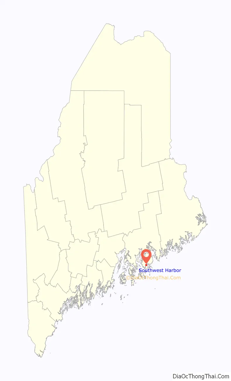
Southwest Harbor is a census-designated place (CDP) in the town of Southwest Harbor in Hancock County, Maine, United States. The CDP population was 720 at the 2010 census, out of 1,764 people in the town as a whole.
| Name: | Southwest Harbor CDP |
|---|---|
| LSAD Code: | 57 |
| LSAD Description: | CDP (suffix) |
| State: | Maine |
| County: | Hancock County |
| Elevation: | 46 ft (14 m) |
| Total Area: | 1.35 sq mi (3.49 km²) |
| Land Area: | 1.35 sq mi (3.49 km²) |
| Water Area: | 0.00 sq mi (0.00 km²) |
| Total Population: | 740 |
| Population Density: | 549.37/sq mi (212.16/km²) |
| ZIP code: | 04679 |
| Area code: | 207 |
| FIPS code: | 2372830 |
| GNISfeature ID: | 2630701 |
Online Interactive Map
Click on ![]() to view map in "full screen" mode.
to view map in "full screen" mode.
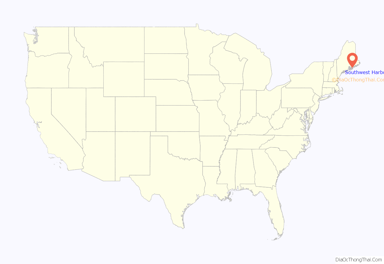
Southwest Harbor location map. Where is Southwest Harbor CDP?
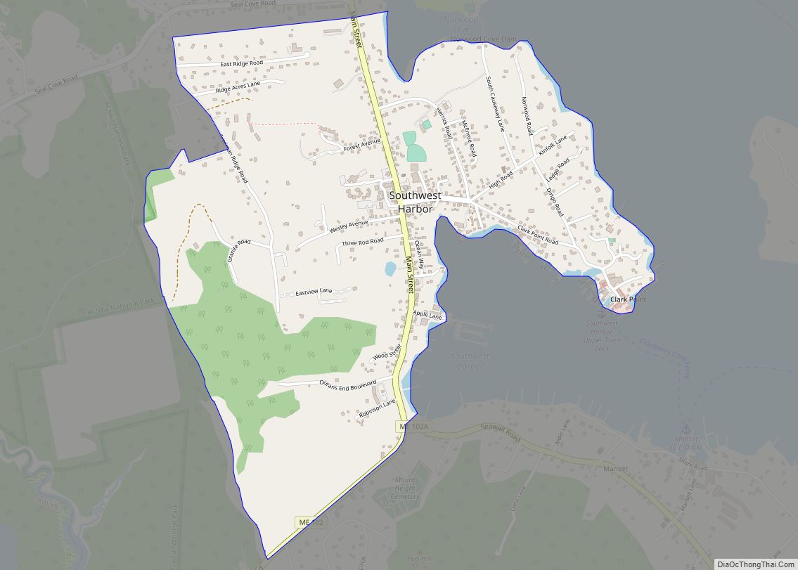
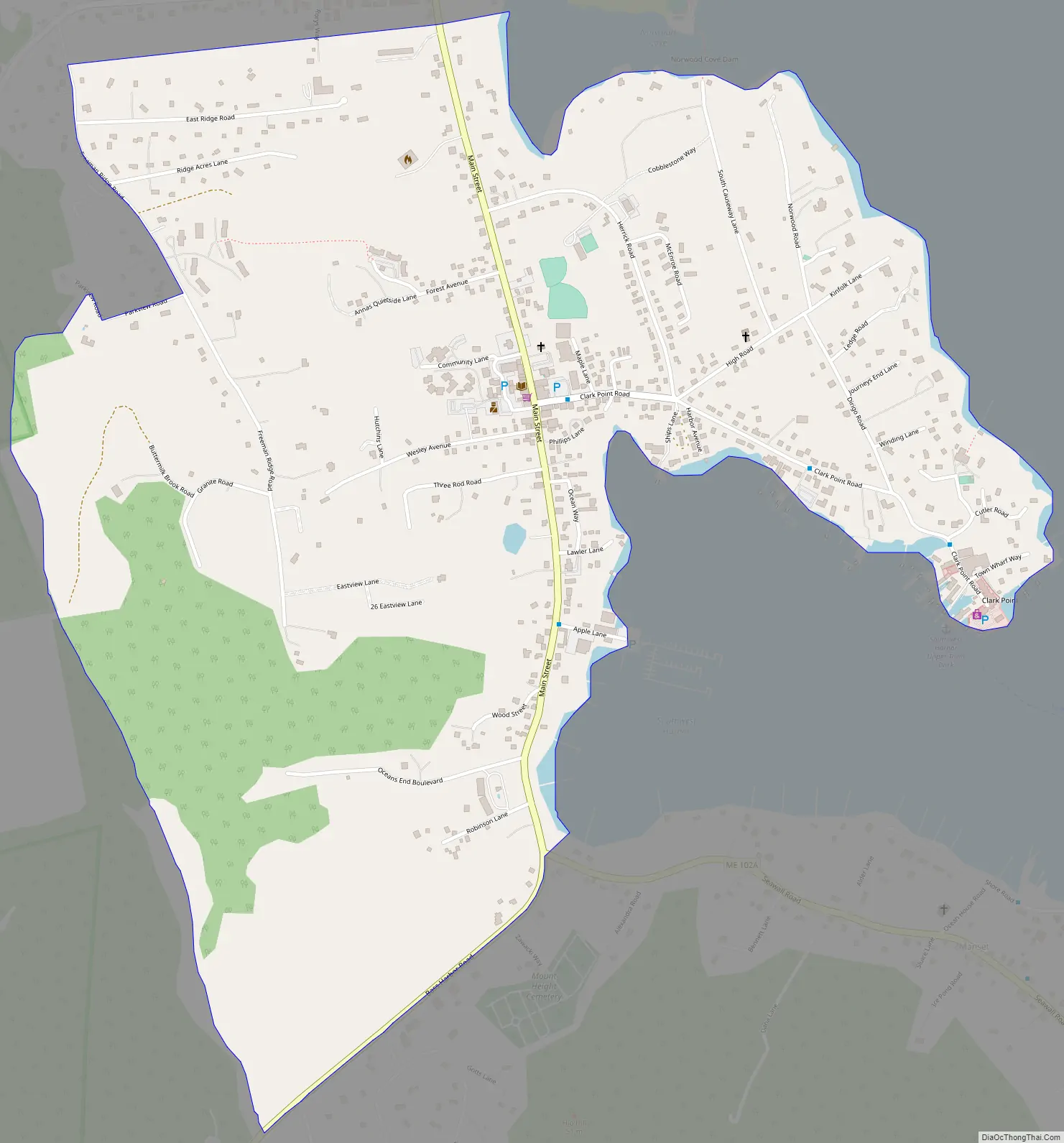
Southwest Harbor Road Map
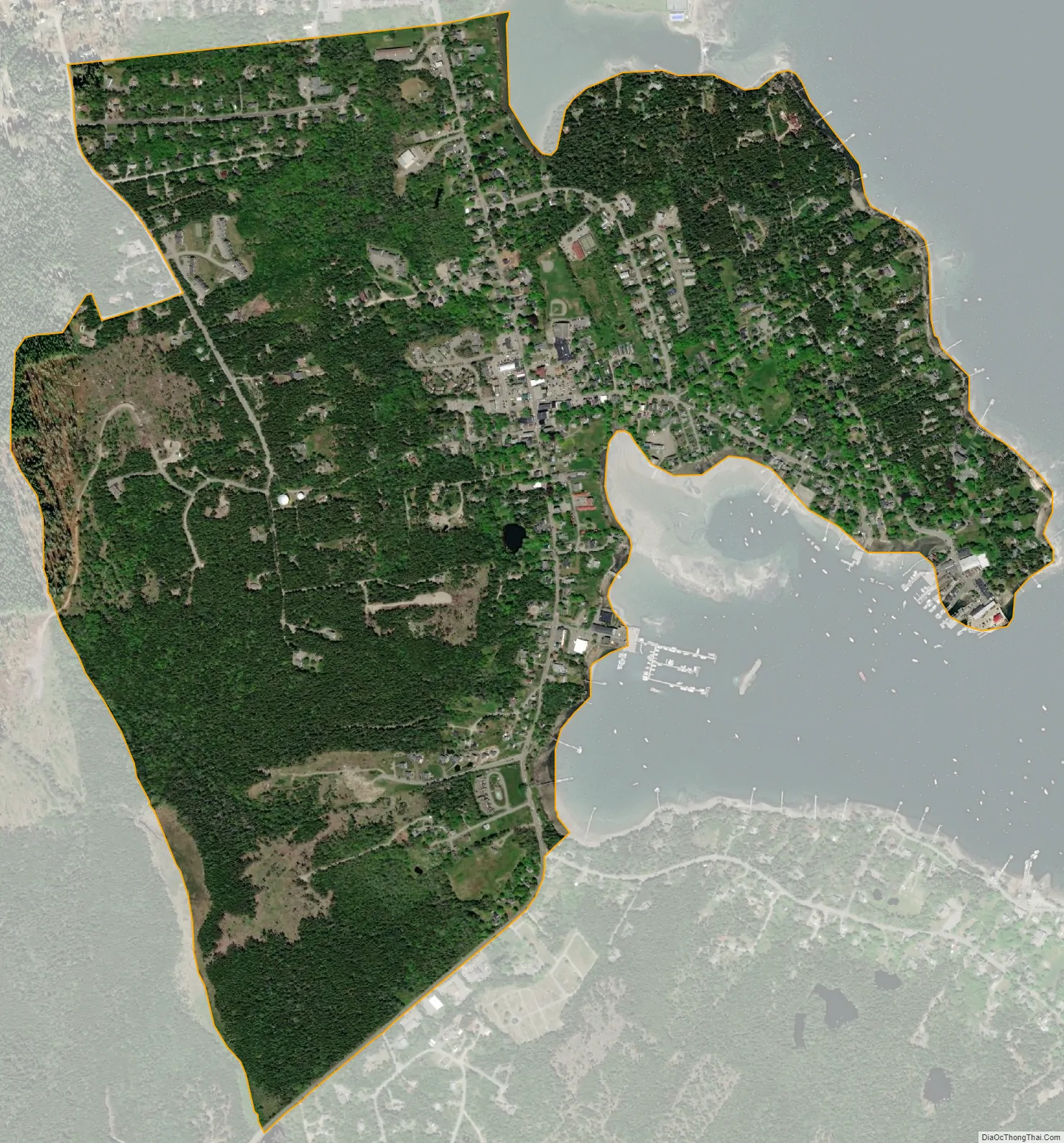
Southwest Harbor city Satellite Map
Geography
The Southwest Harbor CDP is the main village within the town of Southwest Harbor on Mount Desert Island. It is situated primarily around the tidal cove of Southwest Harbor and extends north to Norwood Cove. Both inlets are located at the southern end of Somes Sound, an arm of the Gulf of Maine.
Maine State Route 102 passes through Southwest Harbor, leading southwest 2.5 miles (4.0 km) to Tremont and north 6 miles (10 km) to Somesville at the north end of Somes Sound. Route 102A splits east from Route 102 at the southern end of the Southwest Harbor CDP, and makes a loop through Seawall and Bass Harbor, reaching Tremont in 7 miles (11 km).
According to the United States Census Bureau, the Southwest Harbor CDP has an area of 1.4 square miles (3.5 km), all land.
See also
Map of Maine State and its subdivision: Map of other states:- Alabama
- Alaska
- Arizona
- Arkansas
- California
- Colorado
- Connecticut
- Delaware
- District of Columbia
- Florida
- Georgia
- Hawaii
- Idaho
- Illinois
- Indiana
- Iowa
- Kansas
- Kentucky
- Louisiana
- Maine
- Maryland
- Massachusetts
- Michigan
- Minnesota
- Mississippi
- Missouri
- Montana
- Nebraska
- Nevada
- New Hampshire
- New Jersey
- New Mexico
- New York
- North Carolina
- North Dakota
- Ohio
- Oklahoma
- Oregon
- Pennsylvania
- Rhode Island
- South Carolina
- South Dakota
- Tennessee
- Texas
- Utah
- Vermont
- Virginia
- Washington
- West Virginia
- Wisconsin
- Wyoming