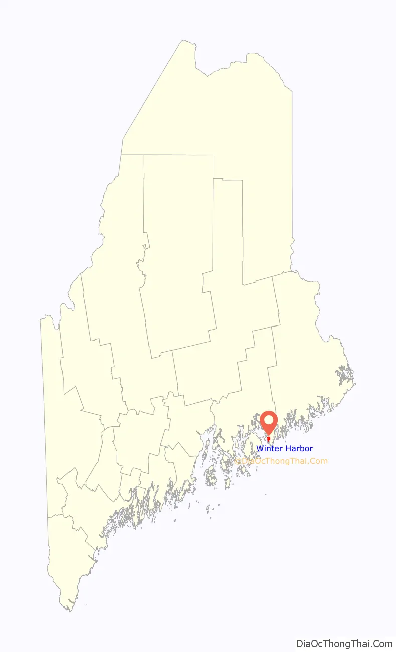
Winter Harbor is a census-designated place (CDP) in the town of Winter Harbor in Hancock County, Maine, United States. The CDP population was 426 at the 2010 census, out of 516 people in the town as a whole.
| Name: | Winter Harbor CDP |
|---|---|
| LSAD Code: | 57 |
| LSAD Description: | CDP (suffix) |
| State: | Maine |
| County: | Hancock County |
| Elevation: | 55 ft (17 m) |
| Total Area: | 2.17 sq mi (5.62 km²) |
| Land Area: | 2.17 sq mi (5.62 km²) |
| Water Area: | 0.00 sq mi (0.00 km²) |
| Total Population: | 385 |
| Population Density: | 177.50/sq mi (68.54/km²) |
| ZIP code: | 04693 |
| Area code: | 207 |
| FIPS code: | 2386620 |
| GNISfeature ID: | 2630702 |
Online Interactive Map
Click on ![]() to view map in "full screen" mode.
to view map in "full screen" mode.
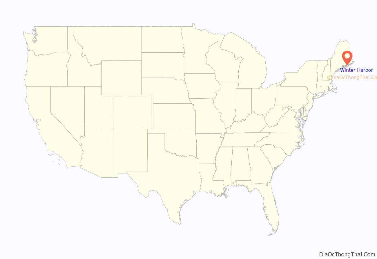
Winter Harbor location map. Where is Winter Harbor CDP?
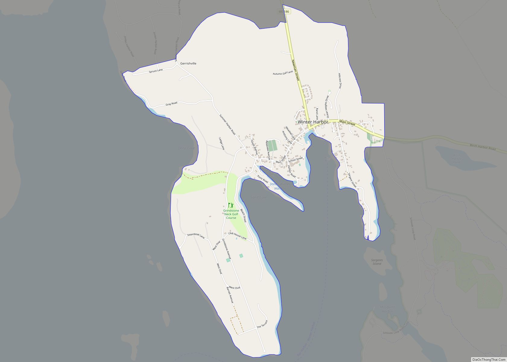
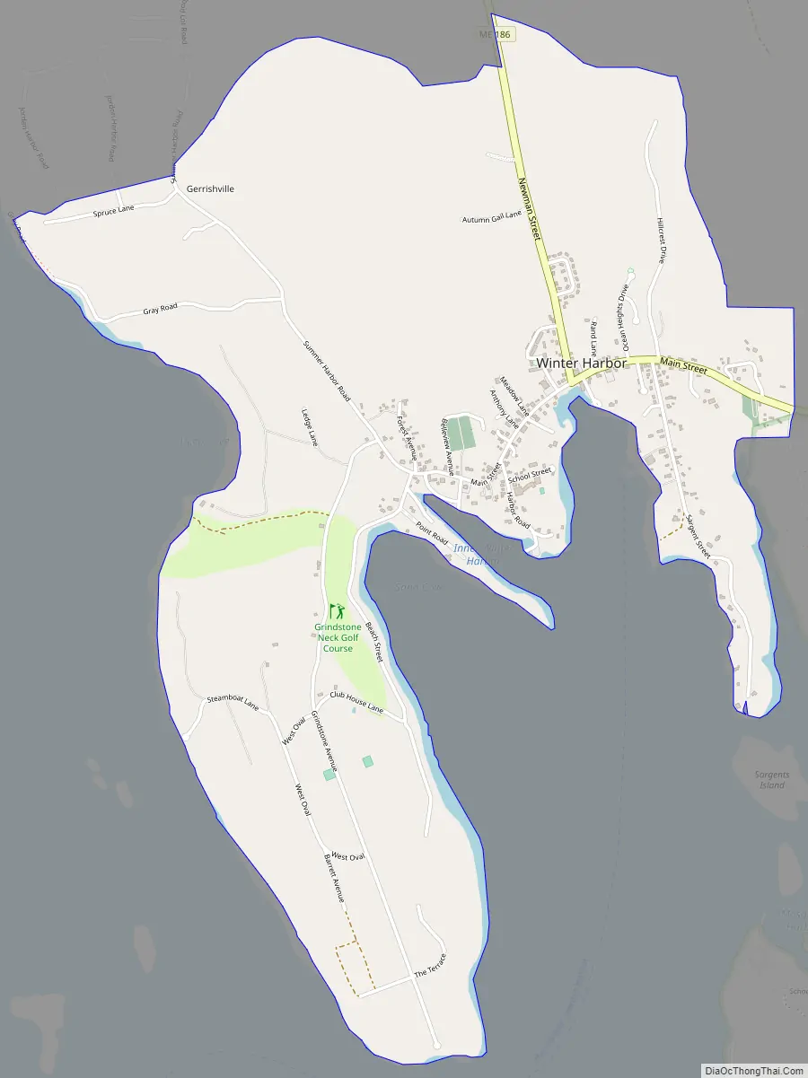
Winter Harbor Road Map
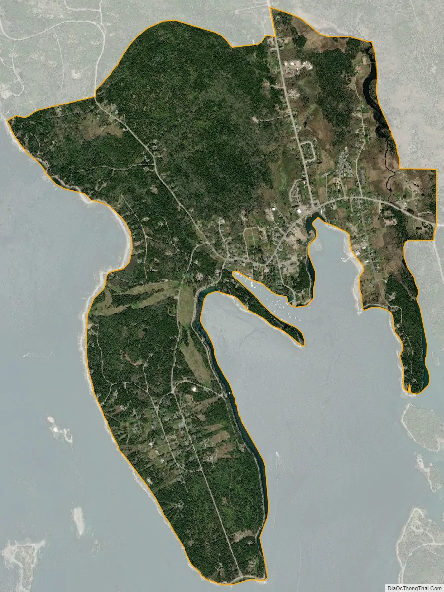
Winter Harbor city Satellite Map
Geography
The Winter Harbor CDP is the main village within the town of Winter Harbor on Mount Desert Island. It is situated at the northern end of the harbor of the same name, an arm on the east side of Frenchman Bay. Maine State Route 186 is the primary road through the community. The CDP extends east along Route 186 to Moore Road, the western entrance to the loop road around the Schoodic Peninsula. To the north, the CDP includes the small community of Gerrishville. The CDP is bordered to the west by Frenchman Bay and extends south to include all of Grindstone Neck between Frenchman Bay and the Winter Harbor inlet. Route 186 leads north 6 miles (10 km) to U.S. Route 1 at West Gouldsboro and east 4 miles (6 km) to Prospect Harbor.
According to the United States Census Bureau, the Winter Harbor CDP has an area of 2.2 square miles (5.6 km), all land.
See also
Map of Maine State and its subdivision: Map of other states:- Alabama
- Alaska
- Arizona
- Arkansas
- California
- Colorado
- Connecticut
- Delaware
- District of Columbia
- Florida
- Georgia
- Hawaii
- Idaho
- Illinois
- Indiana
- Iowa
- Kansas
- Kentucky
- Louisiana
- Maine
- Maryland
- Massachusetts
- Michigan
- Minnesota
- Mississippi
- Missouri
- Montana
- Nebraska
- Nevada
- New Hampshire
- New Jersey
- New Mexico
- New York
- North Carolina
- North Dakota
- Ohio
- Oklahoma
- Oregon
- Pennsylvania
- Rhode Island
- South Carolina
- South Dakota
- Tennessee
- Texas
- Utah
- Vermont
- Virginia
- Washington
- West Virginia
- Wisconsin
- Wyoming