Wiscasset is a census-designated place (CDP) comprising the primary settlement in the town of Wiscasset in Lincoln County, Maine, United States. The population was 1,097 at the 2010 census, out of 3,732 people in the entire town. Wiscasset is the county seat of Lincoln County.
| Name: | Wiscasset CDP |
|---|---|
| LSAD Code: | 57 |
| LSAD Description: | CDP (suffix) |
| State: | Maine |
| County: | Lincoln County |
| Elevation: | 90 ft (30 m) |
| Total Area: | 3.93 sq mi (10.19 km²) |
| Land Area: | 3.90 sq mi (10.10 km²) |
| Water Area: | 0.04 sq mi (0.09 km²) |
| Total Population: | 1,232 |
| Population Density: | 315.98/sq mi (122.00/km²) |
| ZIP code: | 04578 |
| Area code: | 207 |
| FIPS code: | 2387040 |
| GNISfeature ID: | 0578612 |
Online Interactive Map
Click on ![]() to view map in "full screen" mode.
to view map in "full screen" mode.
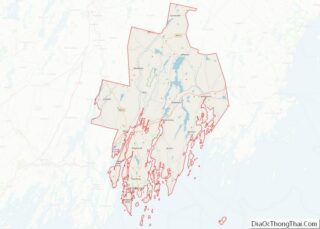
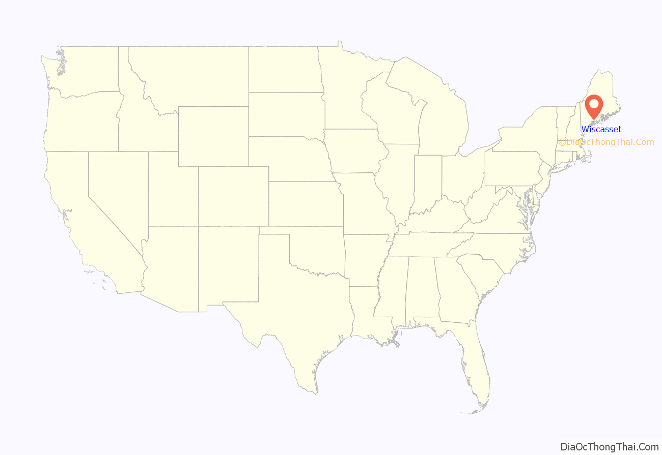
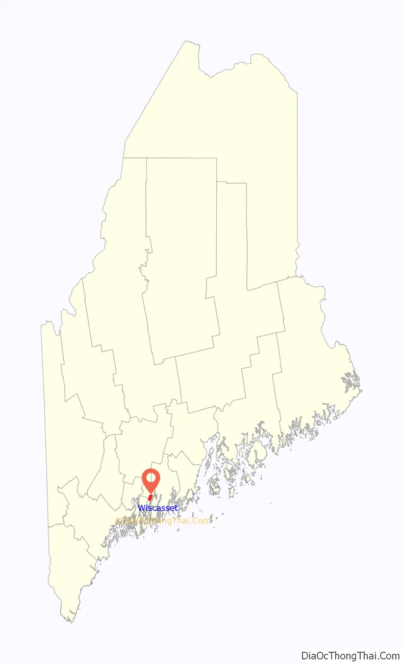
Wiscasset location map. Where is Wiscasset CDP?
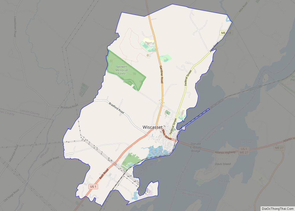
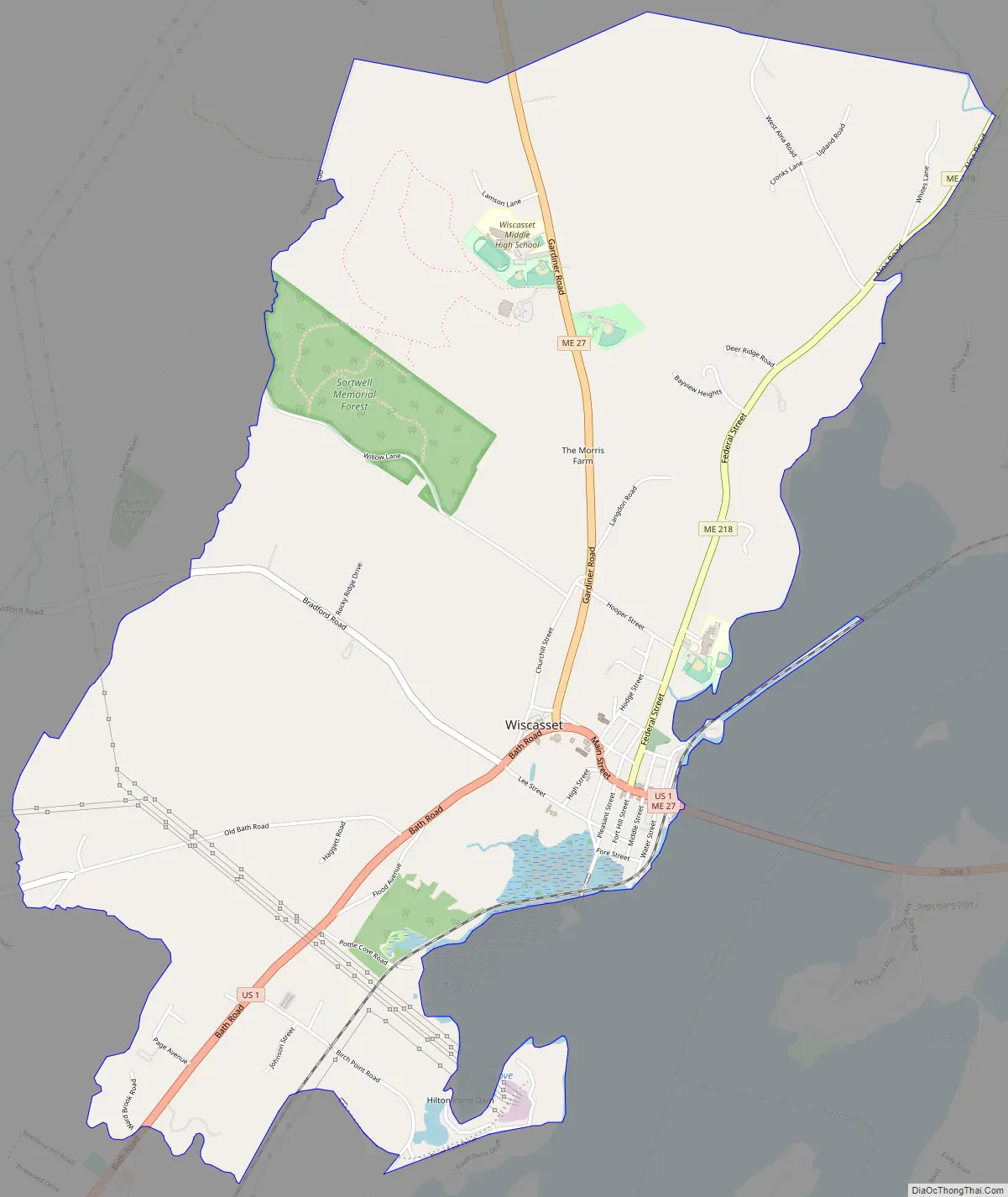
Wiscasset Road Map
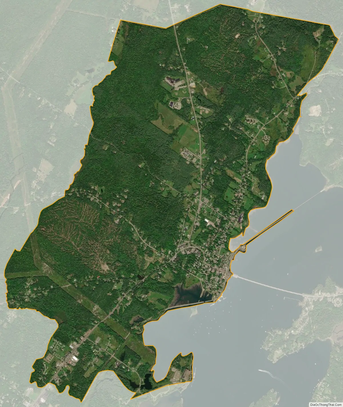
Wiscasset city Satellite Map
Geography
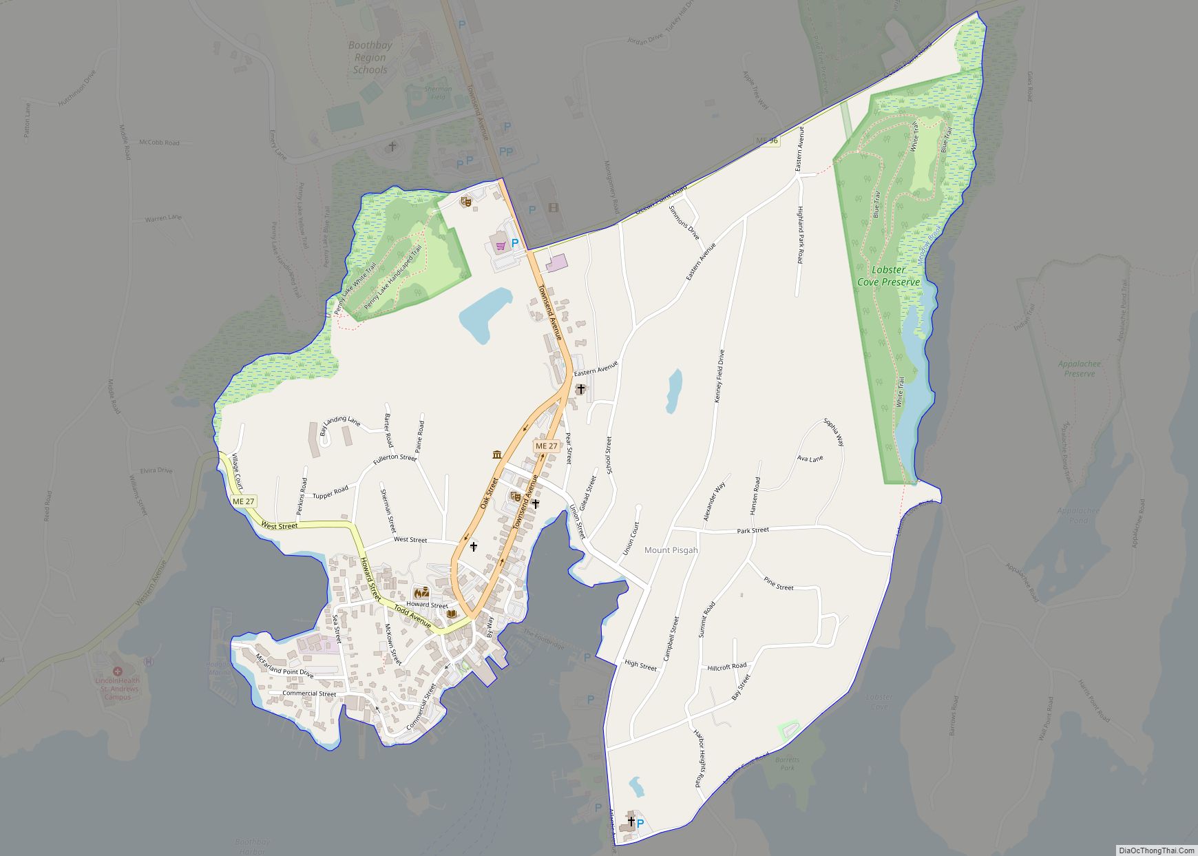
The Wiscasset CDP is located in the east-central part of the town of Wiscasset at 44°00′19″N 69°40′13″W / 44.005362°N 69.670372°W / 44.005362; -69.670372 (44.005362, −69.670372), in western Lincoln County. The village sits on the west side of the tidal Sheepscot River, which forms the boundary with the town of Edgecomb to the east. The CDP extends along the Sheepscot south to Birch Point and north to an unnamed cove downstream from Clark Point. The CDP extends west as far as Ward Brook and north to a powerline near Foye Road.
U.S. Route 1 passes through the center of the village as Main Street, heading east across the Sheepscot River on the Donald E. Davey Bridge into the north part of Edgecomb. US 1 leads northeast 8 miles (13 km) to Damariscotta and southwest 10 miles (16 km) to Bath. Portland is 44 miles (71 km) to the southwest. Maine State Route 27 enters Wiscasset from the east with US 1 but turns and leads north 17 miles (27 km) to Gardiner and 23 miles (37 km) to Augusta, the state capital. ME 27 splits off US 1 in Edgecomb and leads south to Boothbay Harbor, 13 miles (21 km) from Wiscasset. Maine State Route 218 (Federal Street) leads northeast out of Wiscasset 13 miles (21 km) to Whitefield.
According to the United States Census Bureau, the Wiscasset CDP has a total area of 3.9 square miles (10.2 km), of which 3.9 square miles (10.1 km) are land and 0.04 square miles (0.1 km), or 0.89%, are water. It is home to Wiscasset High School.
See also
Map of Maine State and its subdivision: Map of other states:- Alabama
- Alaska
- Arizona
- Arkansas
- California
- Colorado
- Connecticut
- Delaware
- District of Columbia
- Florida
- Georgia
- Hawaii
- Idaho
- Illinois
- Indiana
- Iowa
- Kansas
- Kentucky
- Louisiana
- Maine
- Maryland
- Massachusetts
- Michigan
- Minnesota
- Mississippi
- Missouri
- Montana
- Nebraska
- Nevada
- New Hampshire
- New Jersey
- New Mexico
- New York
- North Carolina
- North Dakota
- Ohio
- Oklahoma
- Oregon
- Pennsylvania
- Rhode Island
- South Carolina
- South Dakota
- Tennessee
- Texas
- Utah
- Vermont
- Virginia
- Washington
- West Virginia
- Wisconsin
- Wyoming