Portland (/ˈpɔːrtlənd/ PORT-lənd) is a port city and the most populous city in the U.S. state of Maine and the seat of Cumberland County. Portland’s population was 68,408 in April 2020. The Greater Portland metropolitan area is home to over half a million people, the 104th-largest metropolitan area in the United States. Portland’s economy relies mostly on the service sector and tourism. The Old Port is known for its nightlife and 19th-century architecture. The marine industry plays an important role in the city’s economy, with an active waterfront that supports fishing and commercial shipping. The Port of Portland is the second-largest tonnage seaport in New England.
The city seal depicts a phoenix rising from ashes, a reference to recovery from four devastating fires. Portland was named after the English Isle of Portland. In turn, the city of Portland, Oregon was named after Portland, Maine. The word Portland is derived from the Old English word Portlanda, which means “land surrounding a harbor”. The Greater Portland area has emerged as an important center for the creative economy, which is also bringing gentrification.
| Name: | Portland city |
|---|---|
| LSAD Code: | 25 |
| LSAD Description: | city (suffix) |
| State: | Maine |
| County: | Cumberland County |
| Incorporated: | July 4, 1786 |
| Elevation: | 62 ft (19 m) |
| Land Area: | 21.54 sq mi (55.79 km²) |
| Water Area: | 47.90 sq mi (124.06 km²) |
| Population Density: | 3,175.86/sq mi (1,226.21/km²) |
| Area code: | 207 |
| FIPS code: | 2360545 |
| GNISfeature ID: | 573692 |
| Website: | PortlandMaine.gov |
Online Interactive Map
Click on ![]() to view map in "full screen" mode.
to view map in "full screen" mode.
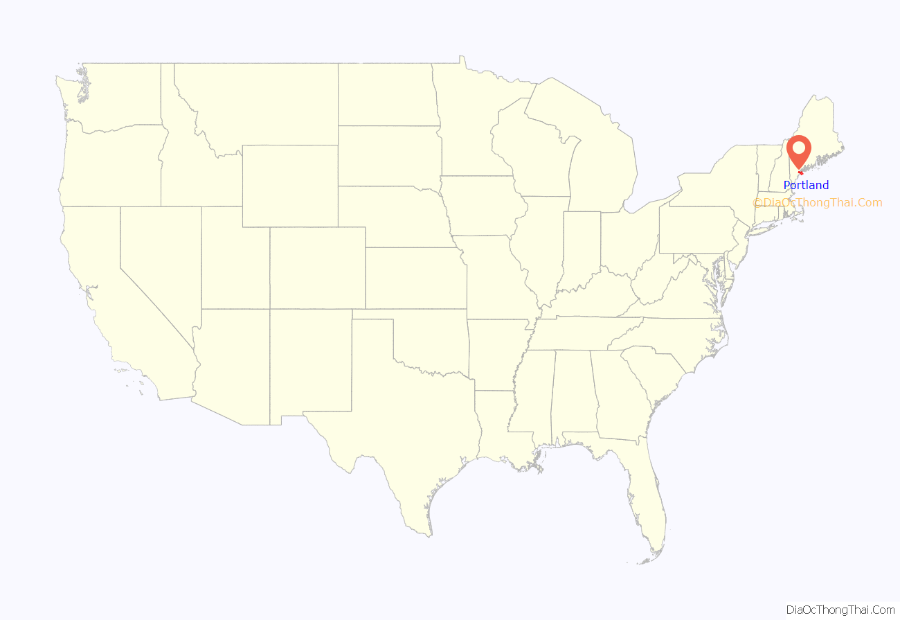
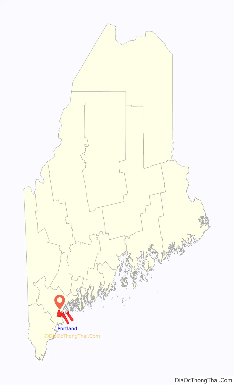
Portland location map. Where is Portland city?
History
Native Americans originally called the Portland peninsula Machigonne (“Great Neck”). The first European settler was Capt. Christopher Levett, an English naval captain granted 6,000 acres (2,400 ha) in 1623 to found a settlement in Casco Bay. A member of the Council for New England and agent for Ferdinando Gorges, Levett built a stone house where he left a company of ten men, then returned to England to write a book about his voyage to bolster support for the settlement. Ultimately, the settlement was a failure and the fate of Levett’s colonists is unknown. The explorer sailed from England to the Massachusetts Bay Colony to meet John Winthrop in 1630, but never returned to Maine. Fort Levett in the harbor is named for him.
The peninsula was settled in 1632 as a fishing and trading village named Casco. When the Massachusetts Bay Colony took over Casco Bay in 1658, the town’s name changed again to Falmouth. In 1676, the village was destroyed by the Abenaki during King Philip’s War. It was rebuilt. During King William’s War, a raiding party of French and their native allies attacked and largely destroyed it again in the Battle of Fort Loyal (1690).
On October 18, 1775, Falmouth was burned in the Revolution by the Royal Navy under command of Captain Henry Mowat. Following the war, a section of Falmouth called The Neck developed as a commercial port and began to grow rapidly as a shipping center. In 1786, the citizens of Falmouth formed a separate town in Falmouth Neck and named it Portland, after the isle off the coast of Dorset, England. Portland’s economy was greatly stressed by the Embargo Act of 1807 (prohibition of trade with the British), which ended in 1809, and the War of 1812, which ended in 1815.
In 1820, Maine was established as a state with Portland as its capital. In 1832, the capital was moved north and East to Augusta. In 1851, Maine led the nation by passing the first state law prohibiting the sale of alcohol except for “medicinal, mechanical or manufacturing purposes.” The law subsequently became known as the Maine Law, as 18 states quickly followed. On June 2, 1855, the Portland Rum Riot occurred.
In 1853, upon completion of the Grand Trunk Railway to Montreal, Portland became the primary ice-free winter seaport for Canadian exports. The Portland Company, located on Fore Street, manufactured more than 600 19th-century steam locomotives, as well as engines for trains and boats, fire engines and other railroad transportation equipment. The Portland Company was, for a time, the city’s largest employer and many of its employees were immigrants from Canada, Ireland and Italy. Portland became a 20th-century rail hub as five additional rail lines merged into Portland Terminal Company in 1911. These rail lines also facilitated movement of returning Canadian troops from the First World War in 1919. Following nationalization of the Grand Trunk system in 1923, Canadian export traffic was diverted from Portland to Halifax, Nova Scotia, resulting in marked local economic decline. In the 20th century, icebreakers later enabled ships to reach Montreal in winter, drastically reducing Portland’s role as a winter port for Canada.
On June 26, 1863, a Confederate raiding party led by Captain Charles Read entered the harbor at Portland leading to the Battle of Portland Harbor, one of the northernmost battles of the Civil War. The 1866 Great Fire of Portland, Maine, on July 4, 1866, ignited during the Independence Day celebration, destroyed most of the commercial buildings in the city, half the churches and hundreds of homes. More than 10,000 people were left homeless.
By act of the Maine Legislature in 1899, Portland annexed the city of Deering, despite a vote by Deering residents rejecting the annexation, thereby greatly increasing the size of the city and opening areas for development beyond the peninsula.
In 1967, the city began the controversial razing of Franklin Street to construct a limited access highway to speed access in an out of the city for nonresidents. The reconstruction of the street demolished 130 homes and businesses and caused an unknown number of families to be relocated or displaced. The construction of The Maine Mall, an indoor shopping center established in the suburb of South Portland, during the 1970s, economically depressed downtown Portland. The trend reversed when tourists and new businesses started revitalizing the old seaport, a part of which is known locally as the Old Port.
Since the 1990s, the historically industrial Bayside neighborhood has seen rapid development, including attracting a Whole Foods and Trader Joe’s supermarkets, as well as Baxter Academy for Technology and Science, an increasingly popular charter school. Other rapidly developing neighborhoods include the India Street neighborhood near the Ocean Gateway and Munjoy Hill, where many modern condos have been built. The Maine College of Art has been a revitalizing force downtown, attracting students from around the country. The historic Porteous building on Congress Street was restored by the college. Universities operating in the city are expanding. The University of Southern Maine is expanding its Portland campus with a 580-bed dorm, student center, and an arts center. The University of New England intends to move its medical school from its Biddeford campus to its Portland campus. Northeastern University’s Roux Institute plans to build on the former B&M Baked Beans factory campus in East Deering. Portland is known as a walkable city, offering many opportunities for walking tours that feature its maritime and architectural history.
Portland Road Map
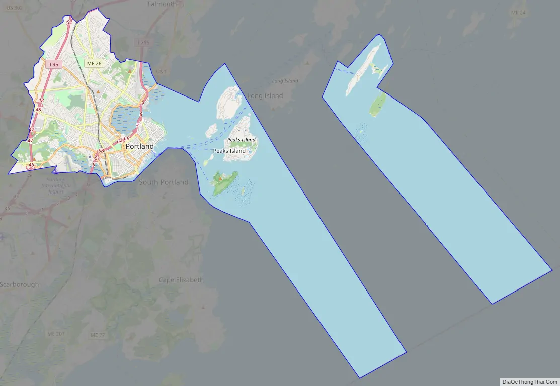
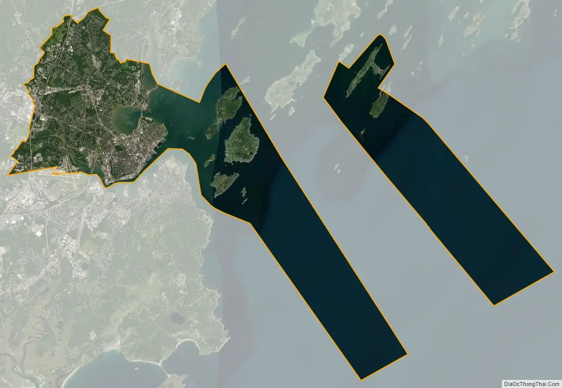
Portland city Satellite Map
Geography
According to the United States Census Bureau, the city has a total area of 69.44 sq mi (179.85 km), of which 21.31 sq mi (55.19 km) is land and 48.13 sq mi (124.66 km) is water. Portland is situated on a peninsula in Casco Bay on the Gulf of Maine and the Atlantic Ocean.
Portland borders South Portland, Westbrook and Falmouth. The city is located at 43.66713 N, 70.20717 W.
Climate
Portland has a humid continental climate (Köppen: Dfb, closely bordering on Dfa), with cold, snowy, and often prolonged winters, and warm, relatively short summers. The monthly average high temperature ranges from roughly 30 °F (−1 °C) in January to around 80 °F (27 °C) in July. Daily high temperatures reach or exceed 90 °F (32 °C) on only four days per year on average, while cold-season lows of 0 °F (−18 °C) or below are reached on 10 nights per year on average. The area can be affected by severe nor’easters during winter, with high winds and snowfall totals often measuring over a foot. Annual liquid precipitation (rain) averages 47.2 in (1,200 mm) and is plentiful year-round, but with a slightly drier summer. Annual frozen precipitation (snow) averages 69 in (175 cm) in the city. However, neighborhoods away from the immediate coast average slightly more, as the warmer ocean waters and onshore flow can cause snow to transition to sleet or rain along the coast. In Southern Maine, winter-season snowstorms can be intense from November through early April, while warm-season thunderstorms are somewhat less frequent than in the Midwestern, Mid-Atlantic, and Southeastern U.S. (although their frequency has increased in recent years). Direct strikes by hurricanes or tropical storms are rare, partially due to the normally cooler Atlantic waters off the Maine coast (which usually weaken tropical systems), but primarily because most tropical systems approaching or reaching 40 degrees North latitude recurve (due to the Coriolis force) and track east out to sea well south of the Portland area. Extreme temperatures range from −39 °F (−39 °C) on February 16, 1943, to 103 °F (39 °C) on July 4, 1911, and August 2, 1975. The hardiness zones are 5b and 6a.
Sea-level rise
Portland is becoming increasingly affected by global warming and the rise of sea levels. The coast is one of the fastest-warming saltwater bodies and is predicted to see an increase to about 10-17 inches by 2030, in comparison to the levels in 2000. This is a major threat to the residents and ocean life around the area. In 2022, the National Oceanic and Atmospheric Administration issued a report that showed sea level in Portland could rise by six inches by 2050, two feet by 2060 and two to six feet by 2100.
Neighborhoods
Portland is organized into neighborhoods generally recognized by residents, but they have no legal or political authority. In many cases, city signs identify neighborhoods or intersections (which are often called corners). Most city neighborhoods have a local association which usually maintains ongoing relations of varying degrees with the city government on issues affecting the neighborhood.
On March 8, 1899, Portland annexed the neighboring city of Deering. Deering neighborhoods now comprise the northern and eastern sections of the city before the merger. Portland’s Deering High School was formerly the public high school for Deering.
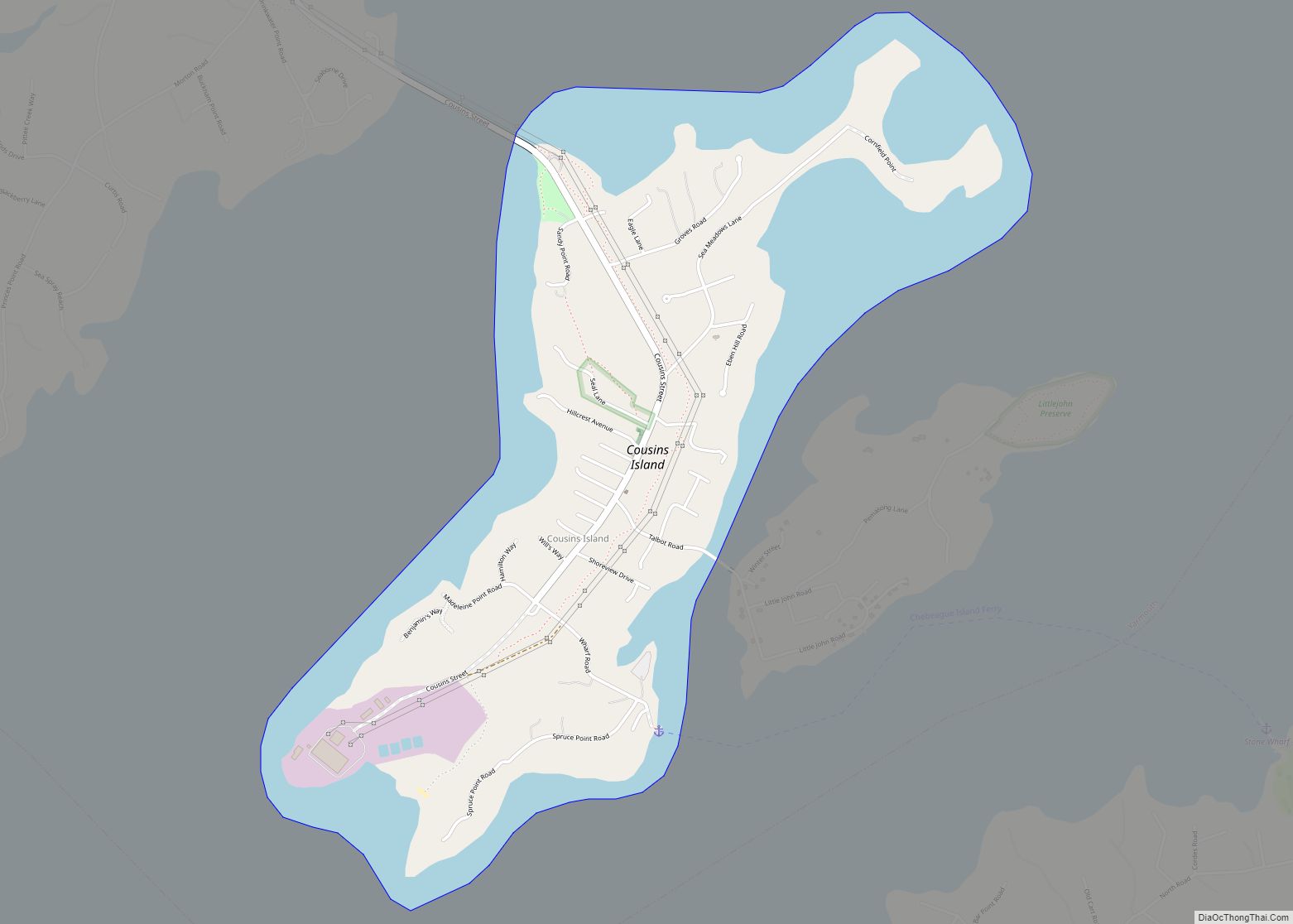
Portland’s neighborhoods include the Arts District, Bayside, Bradley’s Corner, Cliff Island, Cushing’s Island, Deering Center, Deering Highlands, Downtown, East Deering, East Bayside, East End, Eastern Cemetery, Great Diamond Island, Highlands, Kennedy Park, Libbytown, Little Diamond Island, Lunt’s Corner, Morrill’s Corner, Munjoy Hill, Nason’s Corner, North Deering, Oakdale, the Old Port, Parkside, Peaks Island, Riverton Park, Rosemont, Stroudwater, West End, and Woodford’s Corner.
From the early 2000s onward, many of Portland’s neighborhoods have faced gentrification, causing many local residents to be “priced out” of their neighborhoods. In 2015, the Portland Press Herald published a series of articles documenting the “super-tight apartment market” and the trauma caused by evictions and steep jumps in monthly rent. Also in that year, city landlords raised rents by an average of 17.4%, which was the second-largest jump in the country.
See also
Map of Maine State and its subdivision: Map of other states:- Alabama
- Alaska
- Arizona
- Arkansas
- California
- Colorado
- Connecticut
- Delaware
- District of Columbia
- Florida
- Georgia
- Hawaii
- Idaho
- Illinois
- Indiana
- Iowa
- Kansas
- Kentucky
- Louisiana
- Maine
- Maryland
- Massachusetts
- Michigan
- Minnesota
- Mississippi
- Missouri
- Montana
- Nebraska
- Nevada
- New Hampshire
- New Jersey
- New Mexico
- New York
- North Carolina
- North Dakota
- Ohio
- Oklahoma
- Oregon
- Pennsylvania
- Rhode Island
- South Carolina
- South Dakota
- Tennessee
- Texas
- Utah
- Vermont
- Virginia
- Washington
- West Virginia
- Wisconsin
- Wyoming