Greenville is a census-designated place (CDP) and the main village in the town of Greenville in Hillsborough County, New Hampshire, United States. The population of the CDP was 1,074 at the 2020 census, out of 1,974 in the entire town.
| Name: | Greenville CDP |
|---|---|
| LSAD Code: | 57 |
| LSAD Description: | CDP (suffix) |
| State: | New Hampshire |
| County: | Hillsborough County |
| Elevation: | 825 ft (251 m) |
| Total Area: | 3.43 sq mi (8.88 km²) |
| Land Area: | 3.43 sq mi (8.88 km²) |
| Water Area: | 0.00 sq mi (0.00 km²) |
| Total Population: | 1,074 |
| Population Density: | 313.39/sq mi (121.01/km²) |
| ZIP code: | 03048 |
| Area code: | 603 |
| FIPS code: | 3331860 |
| GNISfeature ID: | 2378066 |
Online Interactive Map
Click on ![]() to view map in "full screen" mode.
to view map in "full screen" mode.
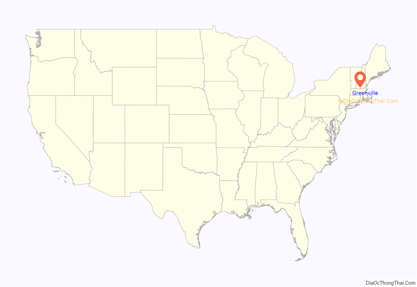
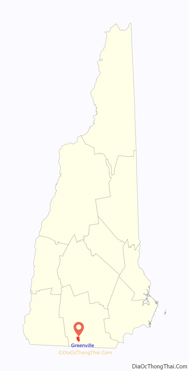
Greenville location map. Where is Greenville CDP?
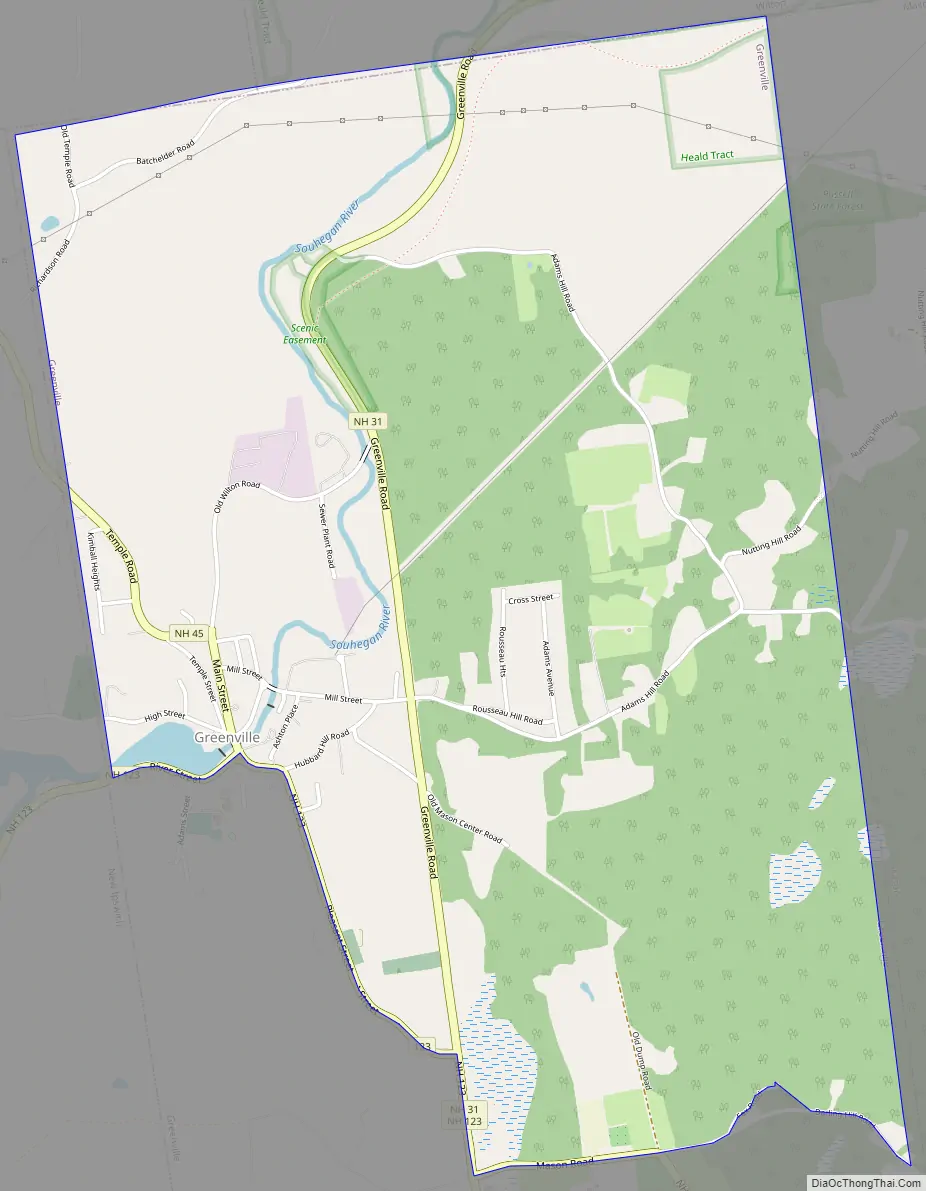
Greenville Road Map
Greenville city Satellite Map
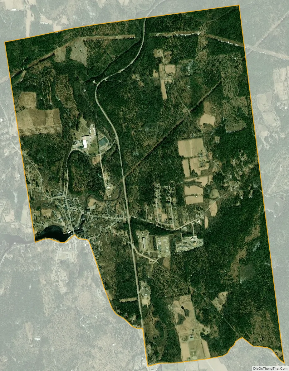
Geography
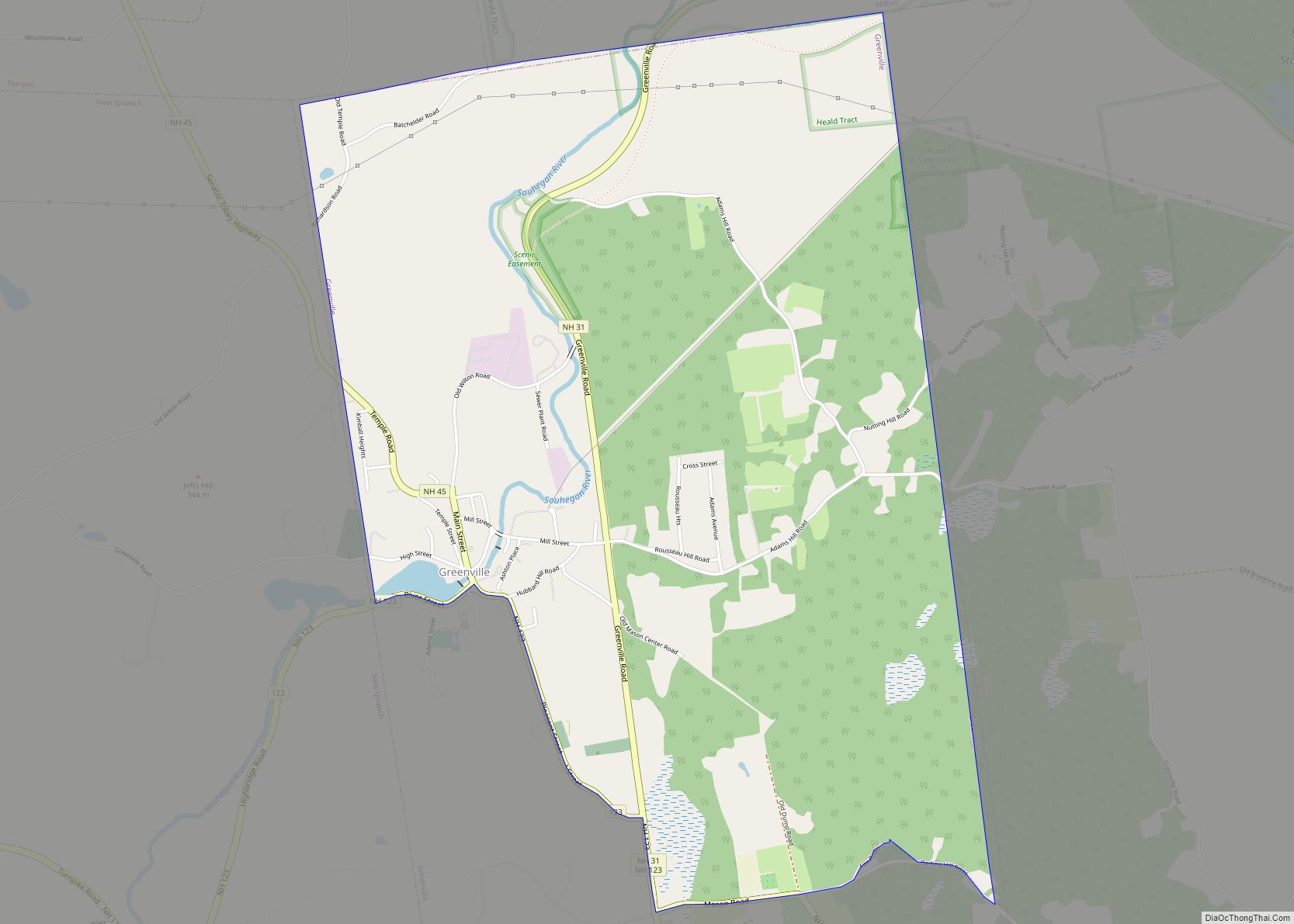
The CDP occupies the northern half of the town of Greenville. The village of Greenville is in the western part of the CDP, on both sides of the Souhegan River. The CDP boundary follows the Greenville town line to the north, east, and west. To the south, the CDP border follows New Hampshire Route 123 (River Street, Pleasant Street, and Mason Road) and Darling Hill Road. The portion of the town of Greenville south of these roads is outside the CDP.
New Hampshire Route 31 is the main road through the CDP, passing east of the village center. Route 31 leads northeast 8 miles (13 km) to Wilton and south 13 miles (21 km) to Fitchburg, Massachusetts. Route 123 leads west 4 miles (6 km) to New Ipswich and southeast through Mason 6 miles (10 km) to the Massachusetts border. Route 45 leads northwest from the village center through Temple 6 miles (10 km) to New Hampshire Route 101 at a point 5 miles (8 km) east of Peterborough.
According to the U.S. Census Bureau, the Greenville CDP has a total area of 3.4 square miles (8.9 km), all land.
See also
Map of New Hampshire State and its subdivision: Map of other states:- Alabama
- Alaska
- Arizona
- Arkansas
- California
- Colorado
- Connecticut
- Delaware
- District of Columbia
- Florida
- Georgia
- Hawaii
- Idaho
- Illinois
- Indiana
- Iowa
- Kansas
- Kentucky
- Louisiana
- Maine
- Maryland
- Massachusetts
- Michigan
- Minnesota
- Mississippi
- Missouri
- Montana
- Nebraska
- Nevada
- New Hampshire
- New Jersey
- New Mexico
- New York
- North Carolina
- North Dakota
- Ohio
- Oklahoma
- Oregon
- Pennsylvania
- Rhode Island
- South Carolina
- South Dakota
- Tennessee
- Texas
- Utah
- Vermont
- Virginia
- Washington
- West Virginia
- Wisconsin
- Wyoming