Fitchburg is a city in northern Worcester County, Massachusetts, United States. The third-largest city in the county, its population was 41,946 at the 2020 census. Fitchburg is home to Fitchburg State University as well as 17 public and private elementary and high schools.
| Name: | Fitchburg city |
|---|---|
| LSAD Code: | 25 |
| LSAD Description: | city (suffix) |
| State: | Massachusetts |
| County: | Worcester County |
| Elevation: | 482 ft (143 m) |
| Total Area: | 28.12 sq mi (72.82 km²) |
| Land Area: | 27.82 sq mi (72.06 km²) |
| Water Area: | 0.29 sq mi (0.76 km²) |
| Total Population: | 41,946 |
| Population Density: | 1,507.55/sq mi (582.07/km²) |
| ZIP code: | 01420 |
| Area code: | 351/978 |
| FIPS code: | 2523875 |
| GNISfeature ID: | 0617121 |
| Website: | www.fitchburgma.gov |
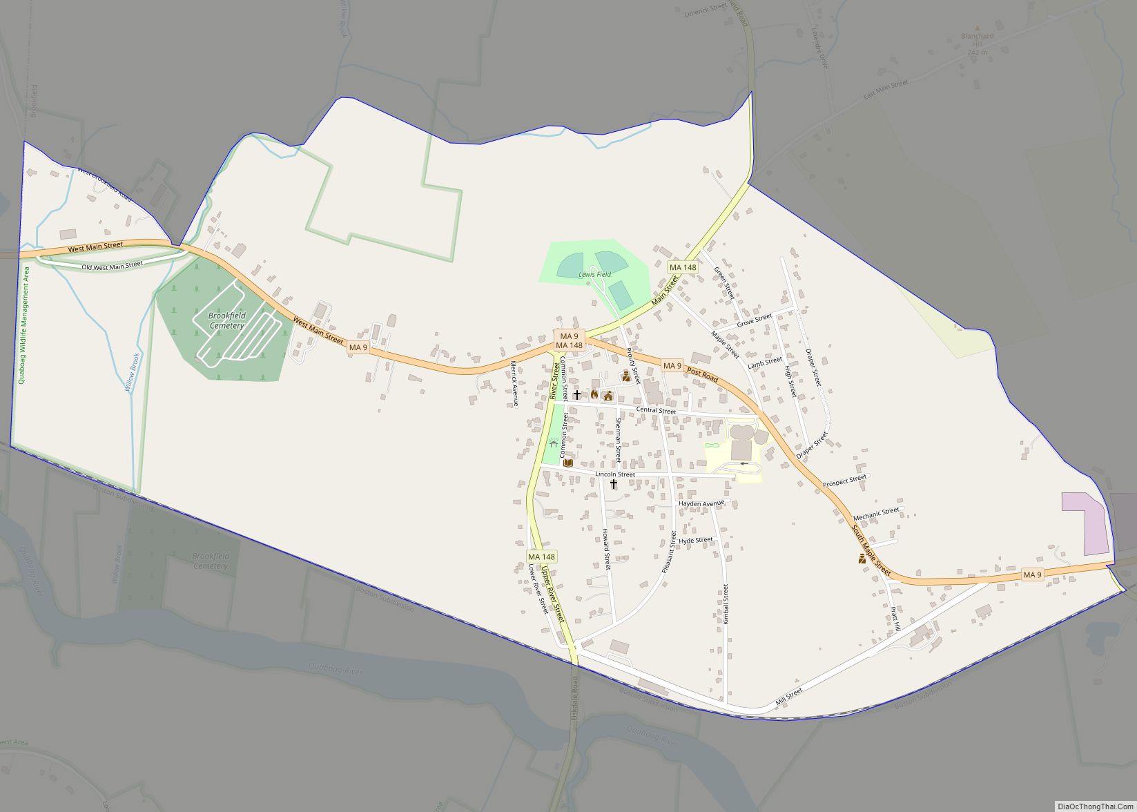
Online Interactive Map
Click on ![]() to view map in "full screen" mode.
to view map in "full screen" mode.
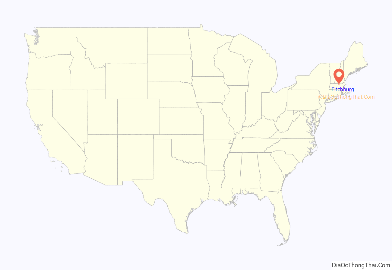
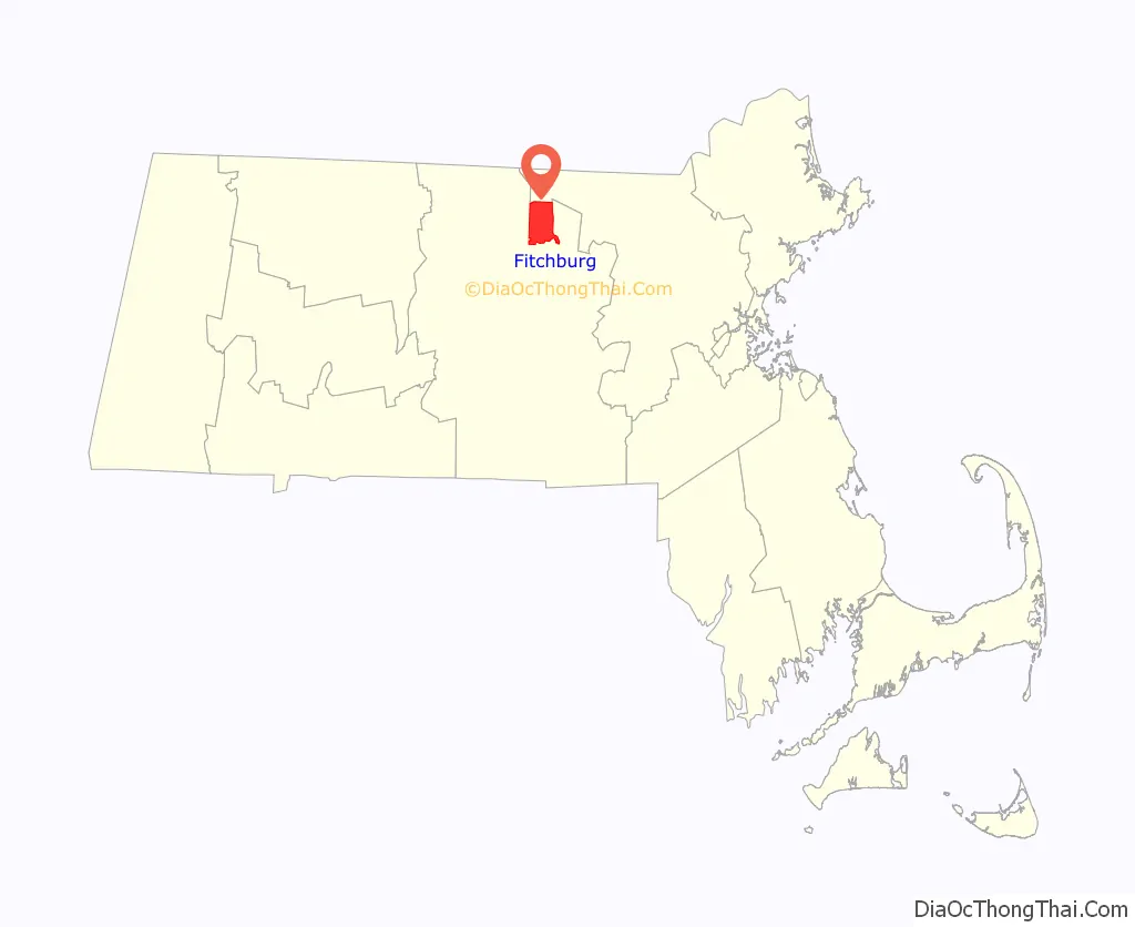
Fitchburg location map. Where is Fitchburg city?
History
Fitchburg was first settled in by Europeans in 1730 as part of Lunenburg, and was officially set apart from that town and incorporated in 1764. The area was previously occupied by the Nipmuc tribe. It is named for John Fitch, one of the committee that procured the act of incorporation. In July 1748 Fitch and his family, living in this isolated spot, were abducted to Canada by Native Americans, but returned the next year.
Fitchburg is situated on both the Nashua River and a railroad line. The original Fitchburg Railroad ran through the Hoosac Tunnel, linking Boston and Albany, New York. The tunnel was built using the Burleigh Rock Drill, designed and built in Fitchburg. Fitchburg was a 19th-century industrial center. Originally operated by water power, large mills produced machines, tools, clothing, paper, and firearms. The city is noted for its architecture, particularly in the Victorian style, built at the height of its mill town prosperity. A few examples of these 19th century buildings are the Fay Club, the old North Worcester County Courthouse and the Bullock house.
As the city is one of Worcester County’s two shire towns, it has hosted the Northern Worcester County Registry of Deeds, established in 1903, and the county jail on Water Street.
The 1961 film Return to Peyton Place was filmed in Fitchburg.
Fitchburg Road Map
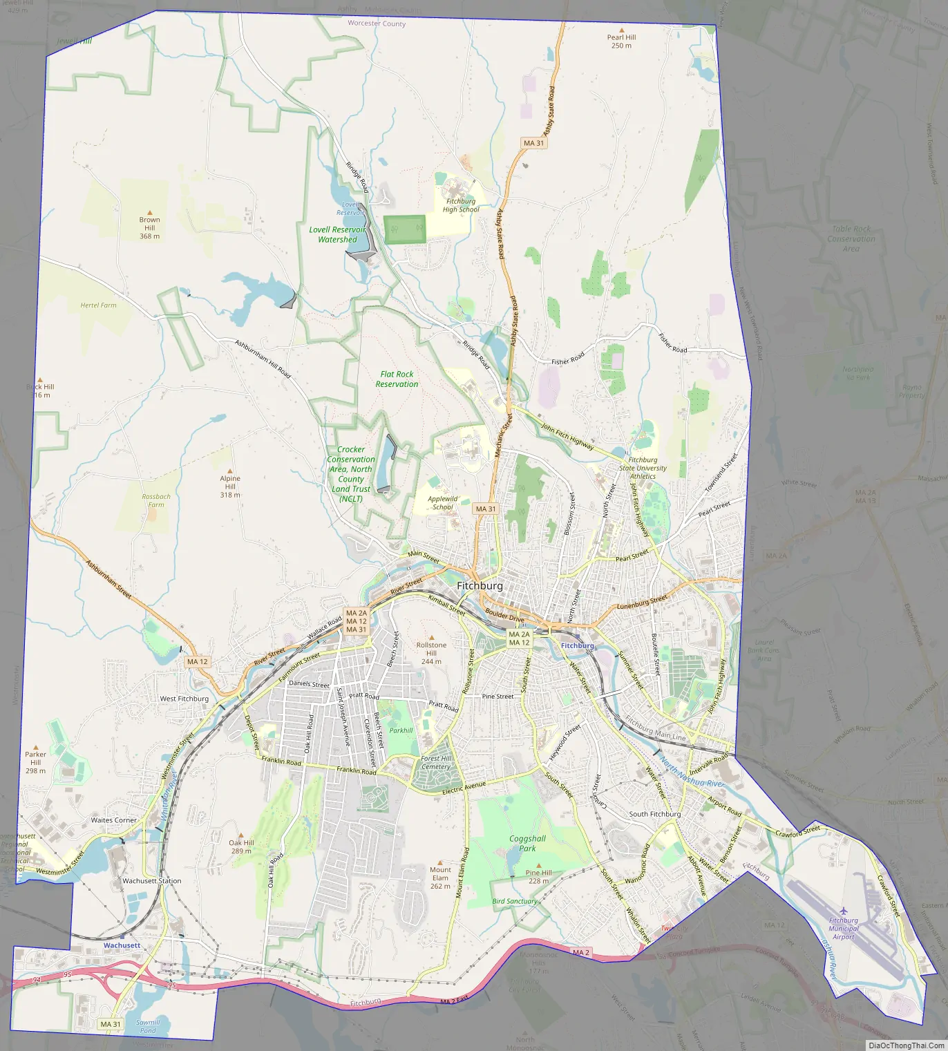
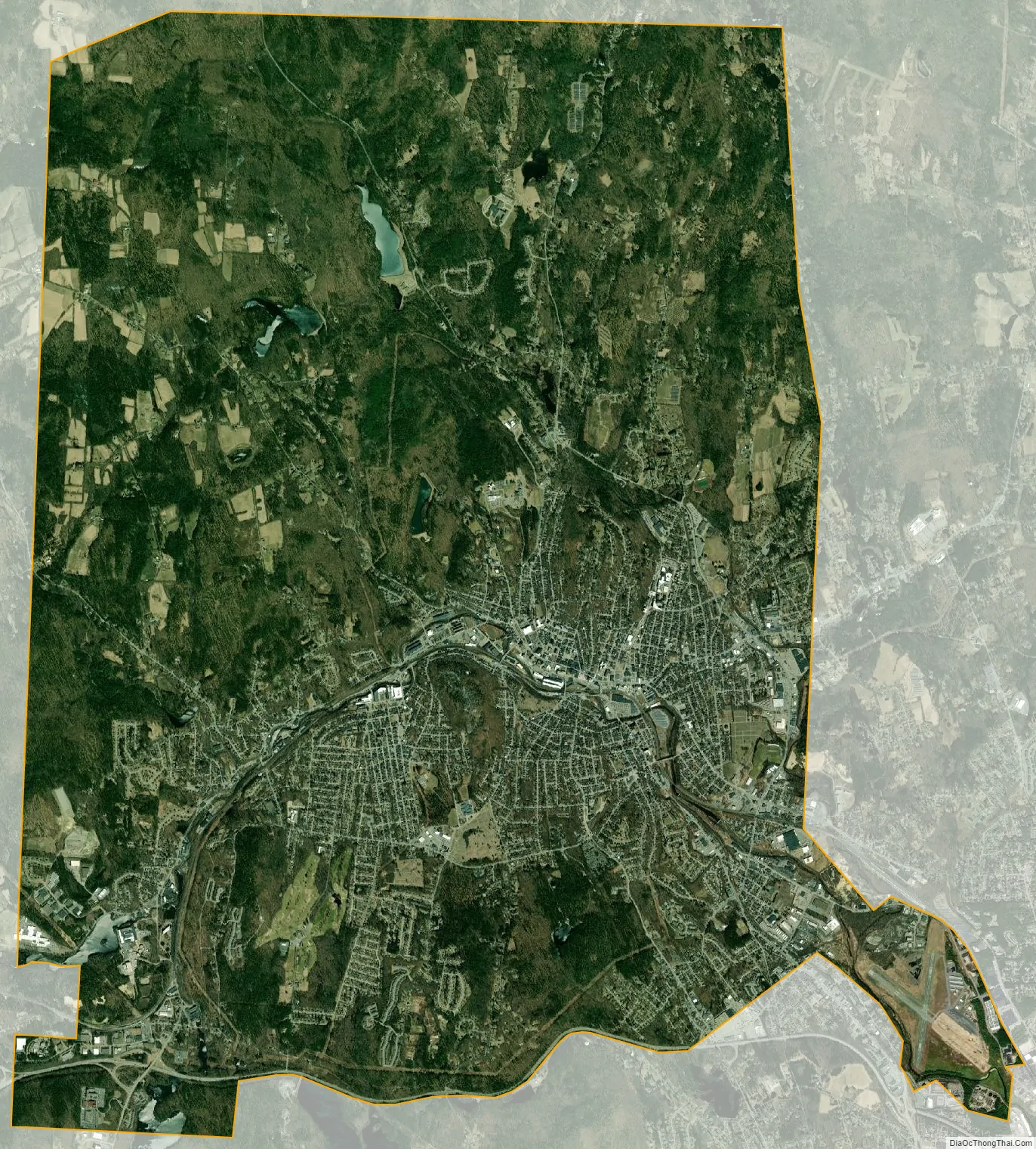
Fitchburg city Satellite Map
Geography
Fitchburg is located at 42°34′43″N 71°48′12″W / 42.57861°N 71.80333°W / 42.57861; -71.80333 (42.578689, −71.803383).
According to the United States Census Bureau, the city has a total area of 28.1 square miles (73 km), of which 27.8 square miles (72 km) is land and 0.3 square miles (0.78 km), or 1.07%, is water. The city is drained by the Nashua River. The highest point in Fitchburg is the summit of Brown Hill near the northwestern corner of the city, at 1,210 feet (370 m) above sea level.
Fitchburg is bordered by Ashby to the north, Lunenburg to the east, Leominster to the south, Westminster to the west, and a small portion of Ashburnham to the northwest.
Neighborhoods
Fitchburg is divided into multiple different neighborhoods/villages, including:
- Cleghorn
- Crockerville
- College Area
- Downtown Fitchburg
- East Side
- Green Acres Village
- North Fitchburg
- The Patch
- Prichard-Pleasant Street
- South Fitchburg
- Tar Hill
- Upper Common
- Waite’s Corner
- West Fitchburg
Climate
Fitchburg’s climate is humid continental, which is the predominant climate for Massachusetts and New England. Summers are typically warm, rainy, and humid, while winters are cold, windy, and snowy. Spring and fall are usually mild, but conditions are widely varied, depending on wind direction and jet stream positioning. The warmest month is July, with an average high temperature of about 81 °F and an average low temperature of about 61 °F. The coldest month is January, with an average high temperature of about 34 °F and an average low temperature of about 15 °F.
See also
Map of Massachusetts State and its subdivision: Map of other states:- Alabama
- Alaska
- Arizona
- Arkansas
- California
- Colorado
- Connecticut
- Delaware
- District of Columbia
- Florida
- Georgia
- Hawaii
- Idaho
- Illinois
- Indiana
- Iowa
- Kansas
- Kentucky
- Louisiana
- Maine
- Maryland
- Massachusetts
- Michigan
- Minnesota
- Mississippi
- Missouri
- Montana
- Nebraska
- Nevada
- New Hampshire
- New Jersey
- New Mexico
- New York
- North Carolina
- North Dakota
- Ohio
- Oklahoma
- Oregon
- Pennsylvania
- Rhode Island
- South Carolina
- South Dakota
- Tennessee
- Texas
- Utah
- Vermont
- Virginia
- Washington
- West Virginia
- Wisconsin
- Wyoming