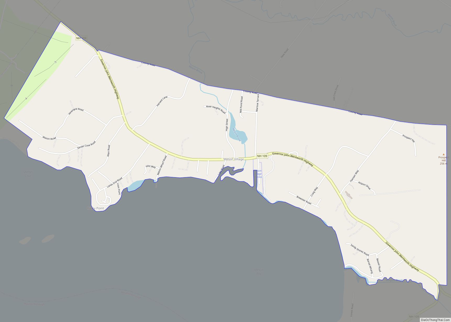
Melvin Village is a census-designated place (CDP) within the town of Tuftonboro in Carroll County, New Hampshire, United States. Its population at the 2020 census was 273. The village is a summer vacation spot on Melvin Bay of Lake Winnipesaukee.
| Name: | Melvin Village CDP |
|---|---|
| LSAD Code: | 57 |
| LSAD Description: | CDP (suffix) |
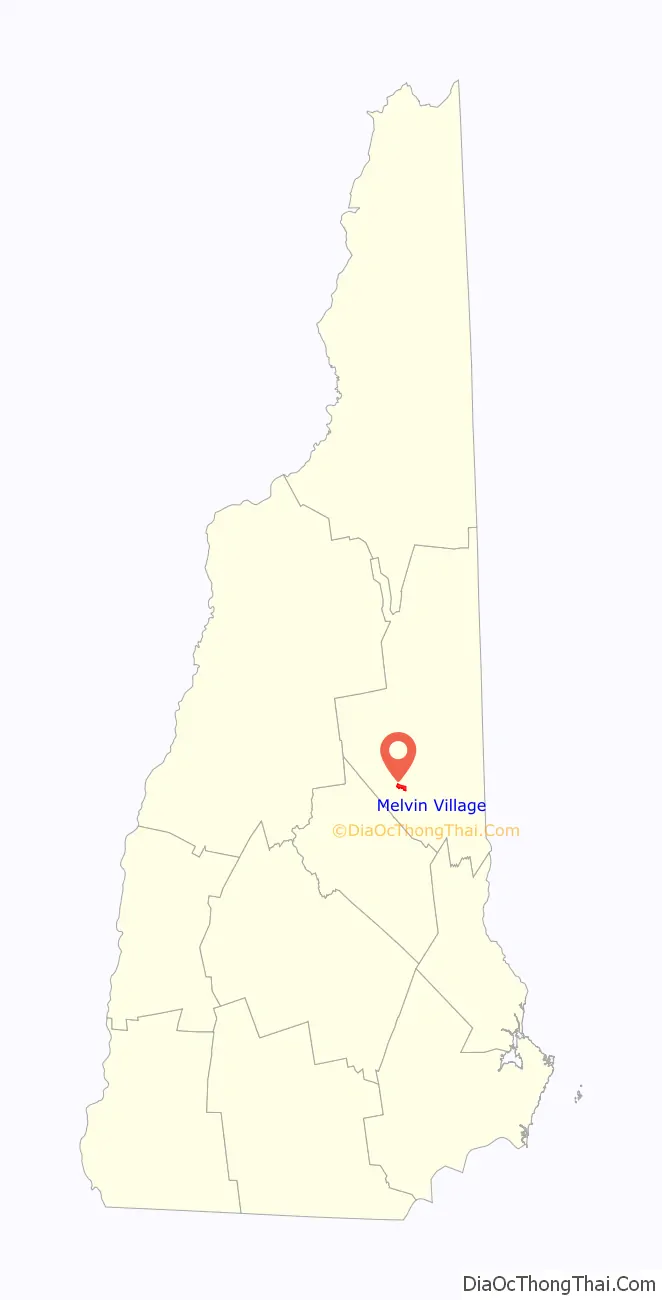
| State: | New Hampshire |
| County: | Carroll County |
| Elevation: | 520 ft (160 m) |
| Total Area: | 2.34 sq mi (6.07 km²) |
| Land Area: | 1.60 sq mi (4.16 km²) |
| Water Area: | 0.74 sq mi (1.91 km²) |
| Total Population: | 273 |
| Population Density: | 170.09/sq mi (65.67/km²) |
| ZIP code: | 03850 |
| Area code: | 603 |
| FIPS code: | 3346980 |
| GNISfeature ID: | 0868377 |
Online Interactive Map
Click on ![]() to view map in "full screen" mode.
to view map in "full screen" mode.
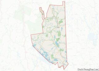
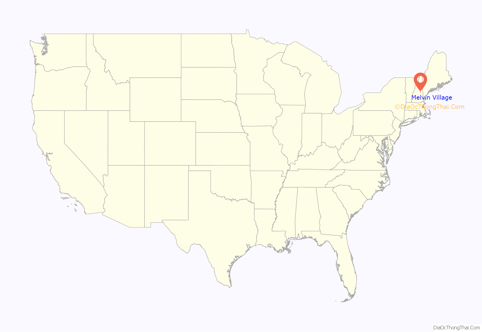
Melvin Village location map. Where is Melvin Village CDP?
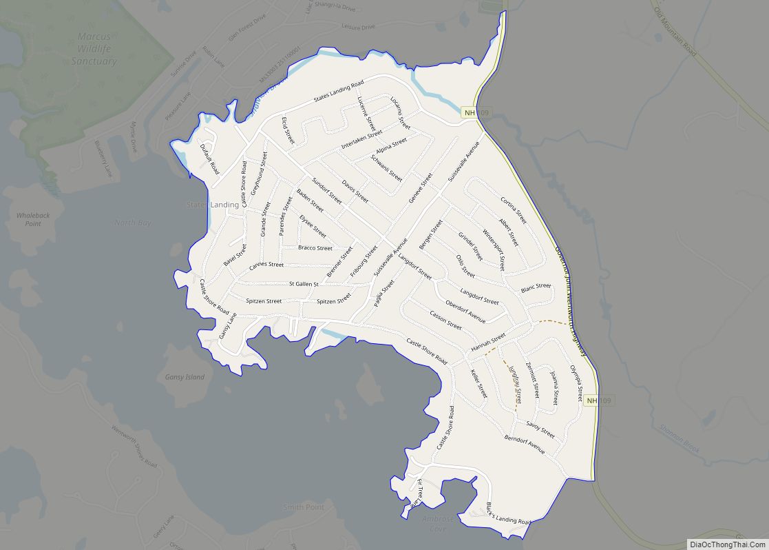
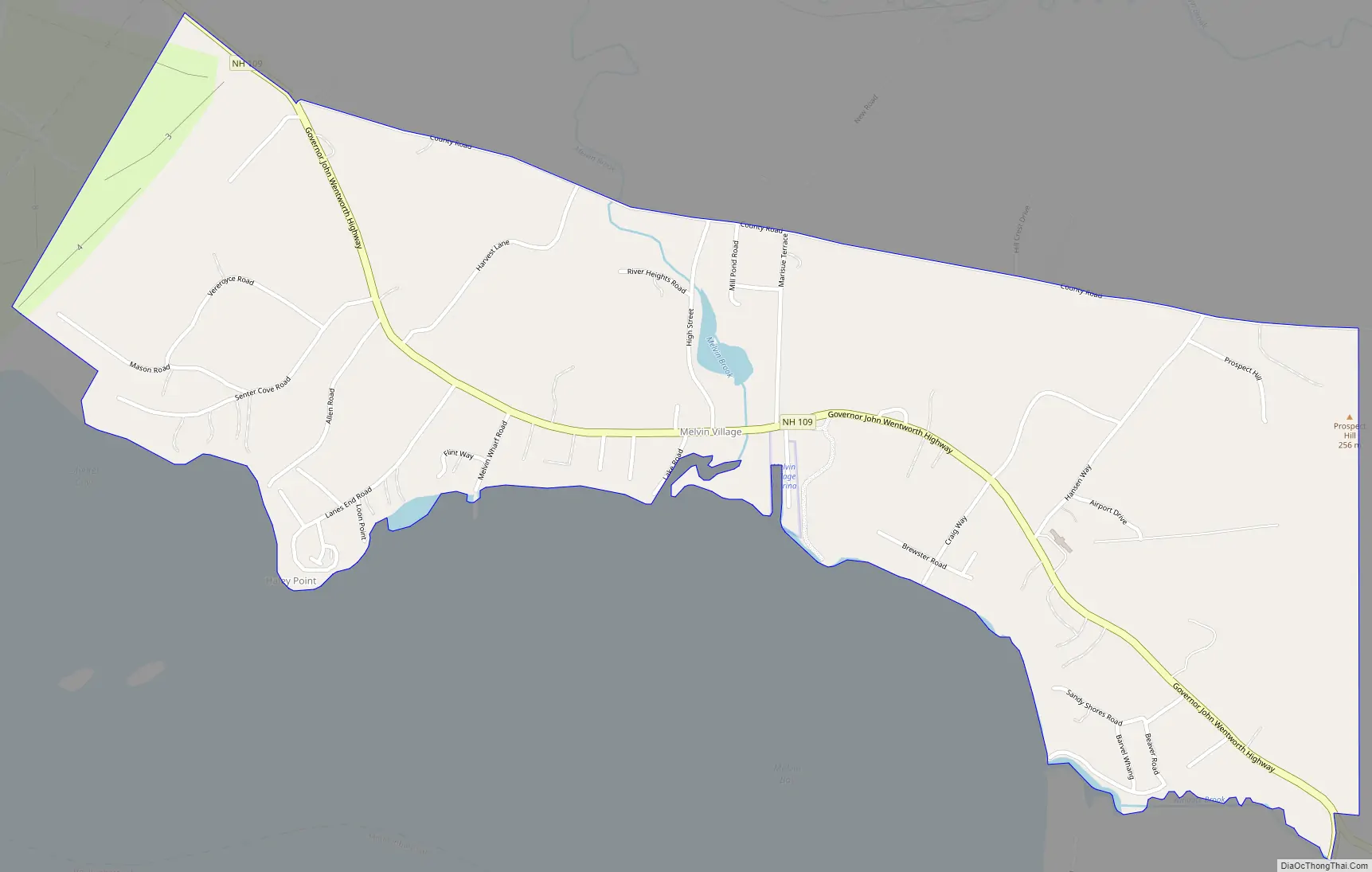
Melvin Village Road Map
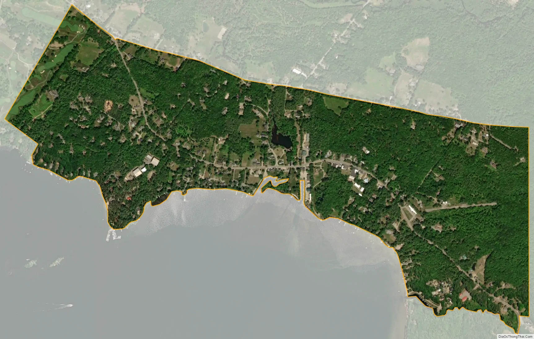
Melvin Village city Satellite Map
Geography
Melvin Village is in the western part of the town of Tuftonboro, where the Melvin River enters Lake Winnipesaukee. Running through the center is New Hampshire Route 109, which leads southeast 10 miles (16 km) to Wolfeboro and northwest 7 miles (11 km) to Moultonborough.
The village is little changed over the last century. Most of the buildings remain and there are few new ones. As recently as 1950, there were two general stores and two gas stations, all of which are now gone. The village was a stop in William Least Heat-Moon’s book, Blue Highways.
It has a marina and there are also compounds of cottages and lakeside homes. Merrymount Landing is the only remaining mail boat stop in the northeast corner of the lake.
According to the U.S. Census Bureau, the Melvin Village CDP has a total area of 2.4 square miles (6.1 km), of which 1.6 square miles (4.2 km) are land and 0.73 square miles (1.9 km), or 3.15%, are water.
See also
Map of New Hampshire State and its subdivision: Map of other states:- Alabama
- Alaska
- Arizona
- Arkansas
- California
- Colorado
- Connecticut
- Delaware
- District of Columbia
- Florida
- Georgia
- Hawaii
- Idaho
- Illinois
- Indiana
- Iowa
- Kansas
- Kentucky
- Louisiana
- Maine
- Maryland
- Massachusetts
- Michigan
- Minnesota
- Mississippi
- Missouri
- Montana
- Nebraska
- Nevada
- New Hampshire
- New Jersey
- New Mexico
- New York
- North Carolina
- North Dakota
- Ohio
- Oklahoma
- Oregon
- Pennsylvania
- Rhode Island
- South Carolina
- South Dakota
- Tennessee
- Texas
- Utah
- Vermont
- Virginia
- Washington
- West Virginia
- Wisconsin
- Wyoming