Meredith is a census-designated place (CDP) and the main village in the town of Meredith in Belknap County, New Hampshire, United States. The population was 2,527 at the 2020 census, out of 6,662 in the entire town of Meredith.
| Name: | Meredith CDP |
|---|---|
| LSAD Code: | 57 |
| LSAD Description: | CDP (suffix) |
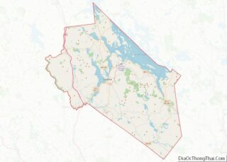
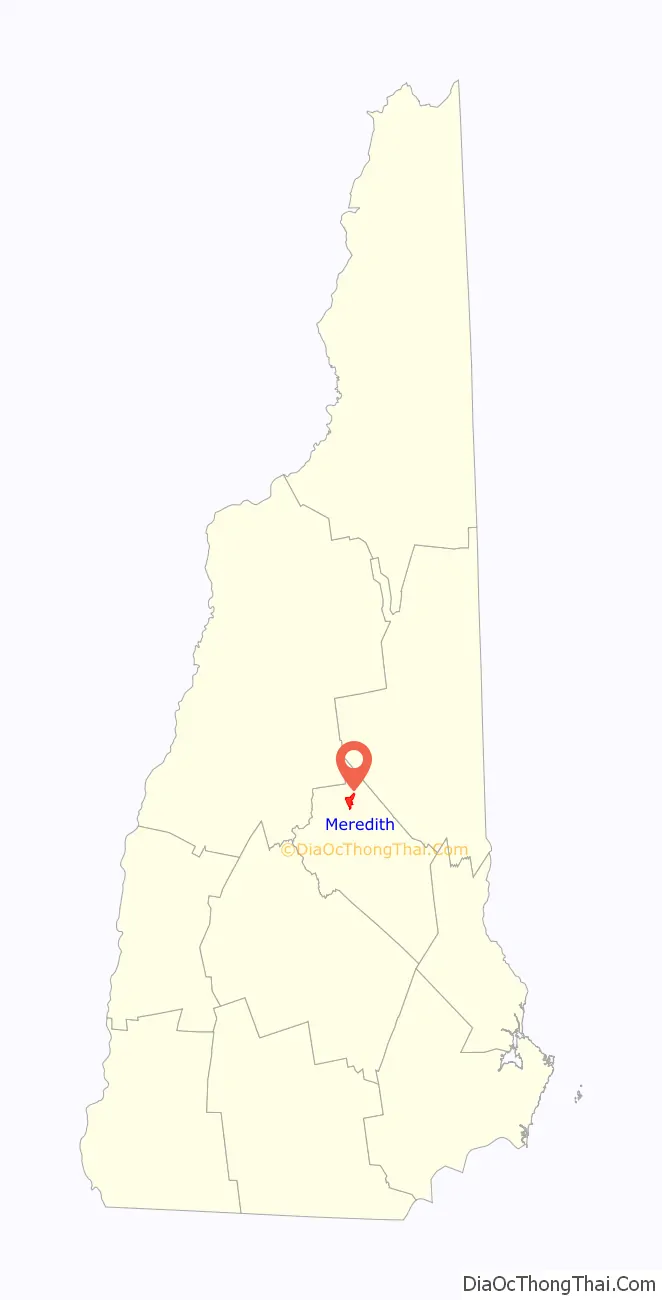
| State: | New Hampshire |
| County: | Belknap County |
| Elevation: | 520 ft (160 m) |
| Total Area: | 4.22 sq mi (10.92 km²) |
| Land Area: | 2.92 sq mi (7.55 km²) |
| Water Area: | 1.30 sq mi (3.37 km²) |
| Total Population: | 2,527 |
| Population Density: | 866.60/sq mi (334.59/km²) |
| ZIP code: | 03253 |
| Area code: | 603 |
| FIPS code: | 3347060 |
| GNISfeature ID: | 2378081 |
Online Interactive Map
Click on ![]() to view map in "full screen" mode.
to view map in "full screen" mode.
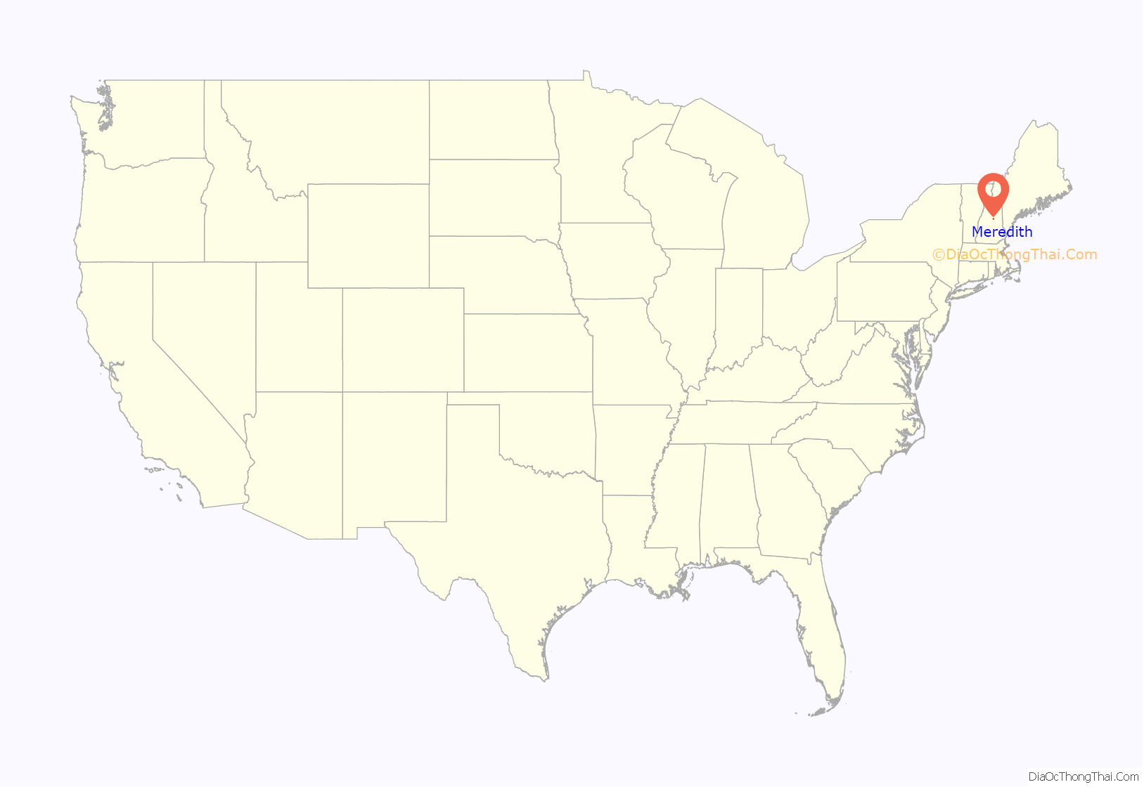
Meredith location map. Where is Meredith CDP?
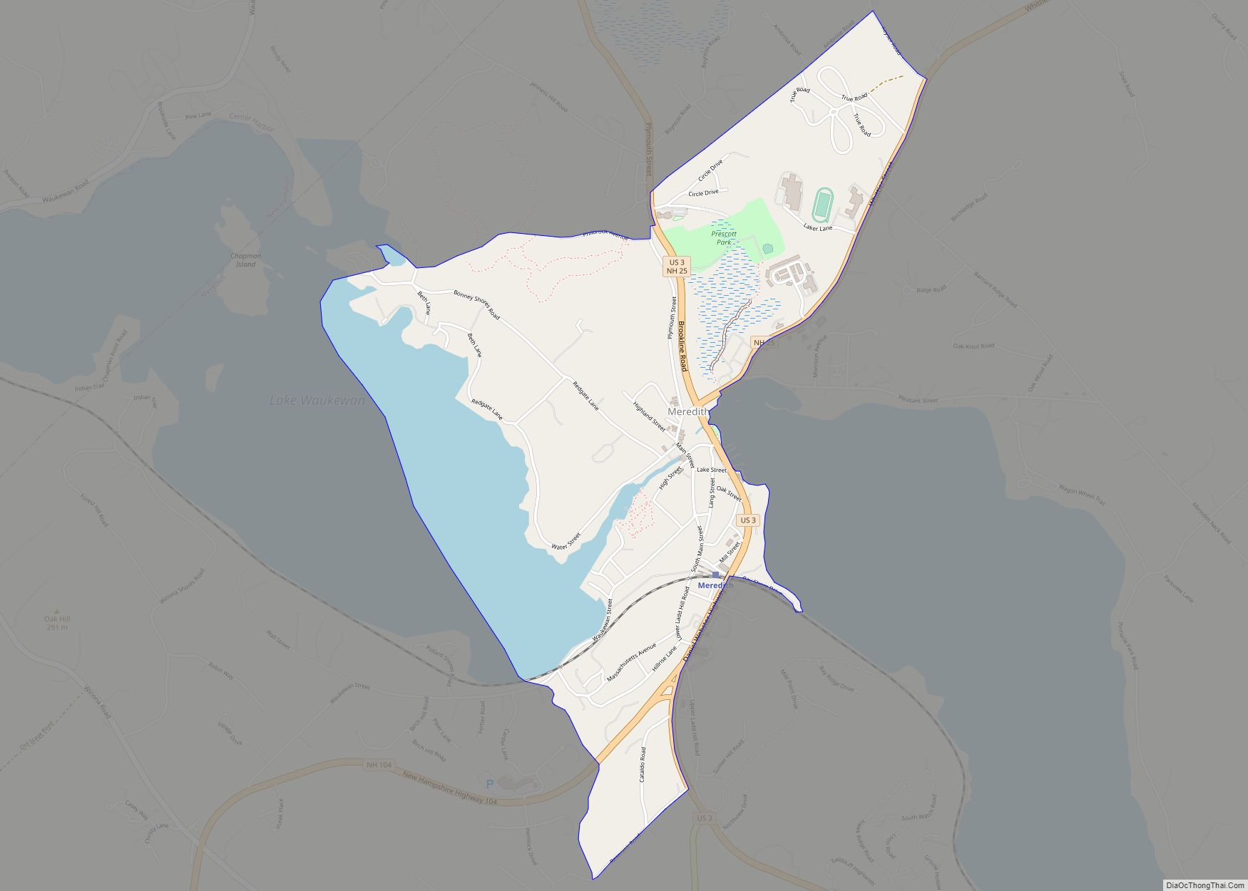
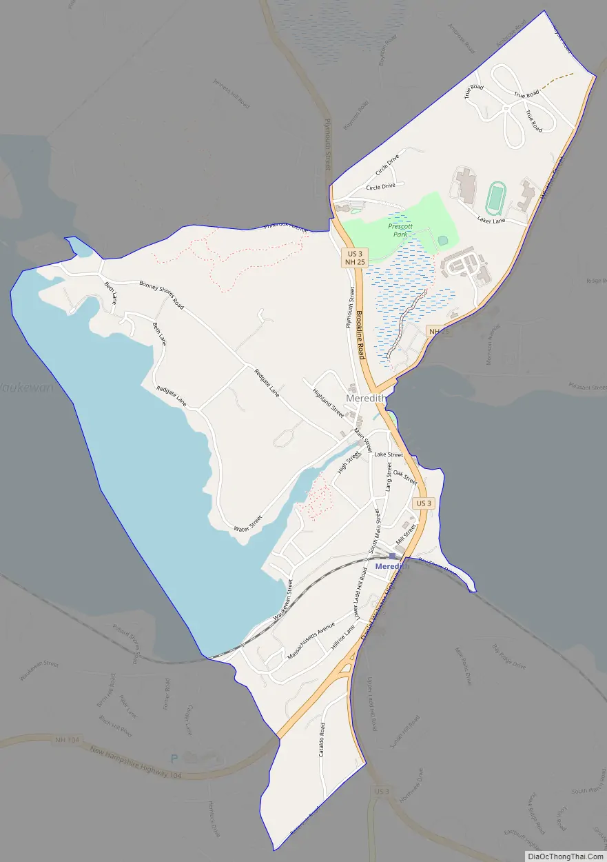
Meredith Road Map
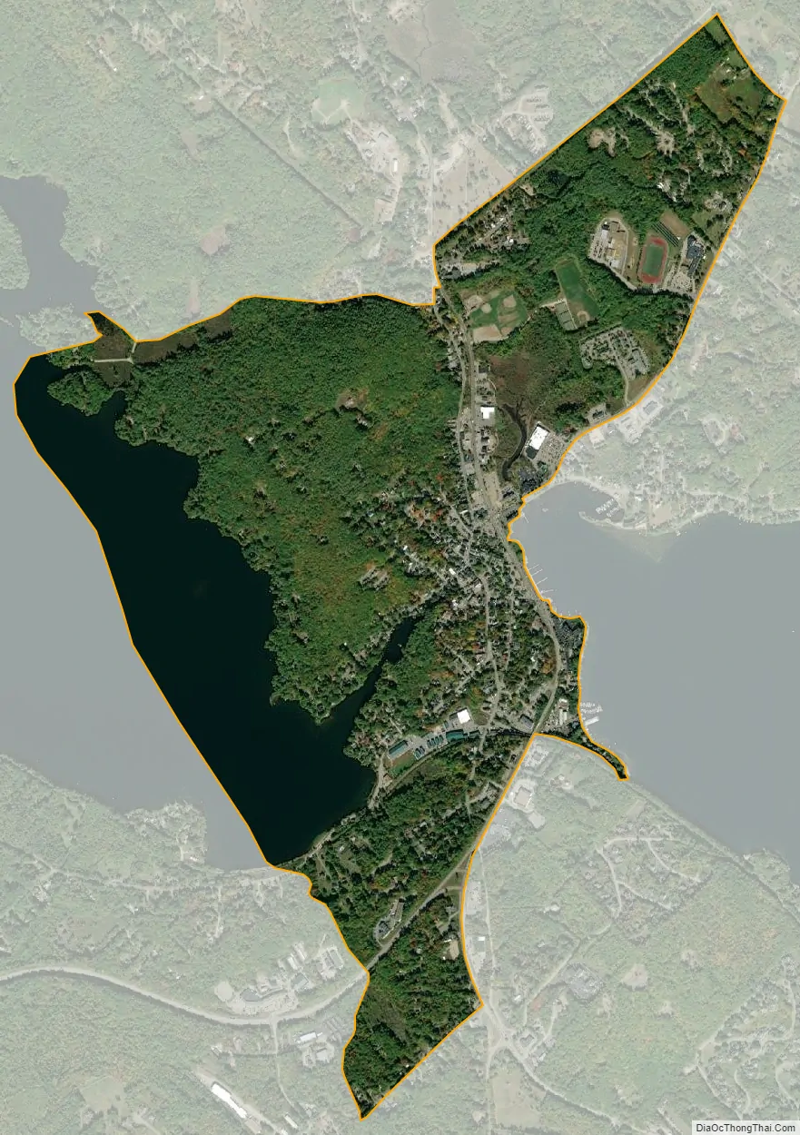
Meredith city Satellite Map
Geography
The CDP is slightly northeast of the geographic center of the town, situated between Lake Waukewan to the west and Meredith Bay on Lake Winnipesaukee to the east. The CDP extends north to Philbrook Avenue and the southern edge of the Meredith Village Cemetery, and northeast to Keyser Road. The CDP border then turns southwest down New Hampshire Route 25 to Barnard Ridge Road/Meredith Neck Road to an unnamed brook leading south into Meredith Bay. The CDP border extends further south along the bay to an unnamed brook north of Neal Shore Road, heading west to Westbury Road and then U.S. Route 3, which it then follows north to Reservoir Road. The CDP border follows Reservoir Road, Hemlock Drive, NH Route 104, Birch Hill Road, and Waukewan Street to Lake Waukewan.
U.S. Route 3 and New Hampshire Route 25 intersect on the eastern side of the CDP at the north end of Meredith Bay. US 3 and NH 25 together lead north 8 miles (13 km) to Holderness at the outlet of Squam Lake. US 3 leads south 5 miles (8 km) to Weirs Beach and 11 miles (18 km) to the center of Laconia, while NH 25 leads northeast 5 miles (8 km) to Center Harbor and 9 miles (14 km) to Moultonborough. New Hampshire Route 104 leaves US 3 in the south part of the CDP, leading west 8 miles (13 km) to Interstate 93 in New Hampton. New Hampshire Route 106 leaves US 3 just south of the CDP border, providing a direct route to the center of Laconia, 10 miles (16 km) south of Meredith.
According to the United States Census Bureau, the Meredith CDP has a total area of 4.2 square miles (10.9 km), of which 2.9 square miles (7.6 km) are land and 1.3 square miles (3.4 km), or 30.83%, are water.
See also
Map of New Hampshire State and its subdivision: Map of other states:- Alabama
- Alaska
- Arizona
- Arkansas
- California
- Colorado
- Connecticut
- Delaware
- District of Columbia
- Florida
- Georgia
- Hawaii
- Idaho
- Illinois
- Indiana
- Iowa
- Kansas
- Kentucky
- Louisiana
- Maine
- Maryland
- Massachusetts
- Michigan
- Minnesota
- Mississippi
- Missouri
- Montana
- Nebraska
- Nevada
- New Hampshire
- New Jersey
- New Mexico
- New York
- North Carolina
- North Dakota
- Ohio
- Oklahoma
- Oregon
- Pennsylvania
- Rhode Island
- South Carolina
- South Dakota
- Tennessee
- Texas
- Utah
- Vermont
- Virginia
- Washington
- West Virginia
- Wisconsin
- Wyoming