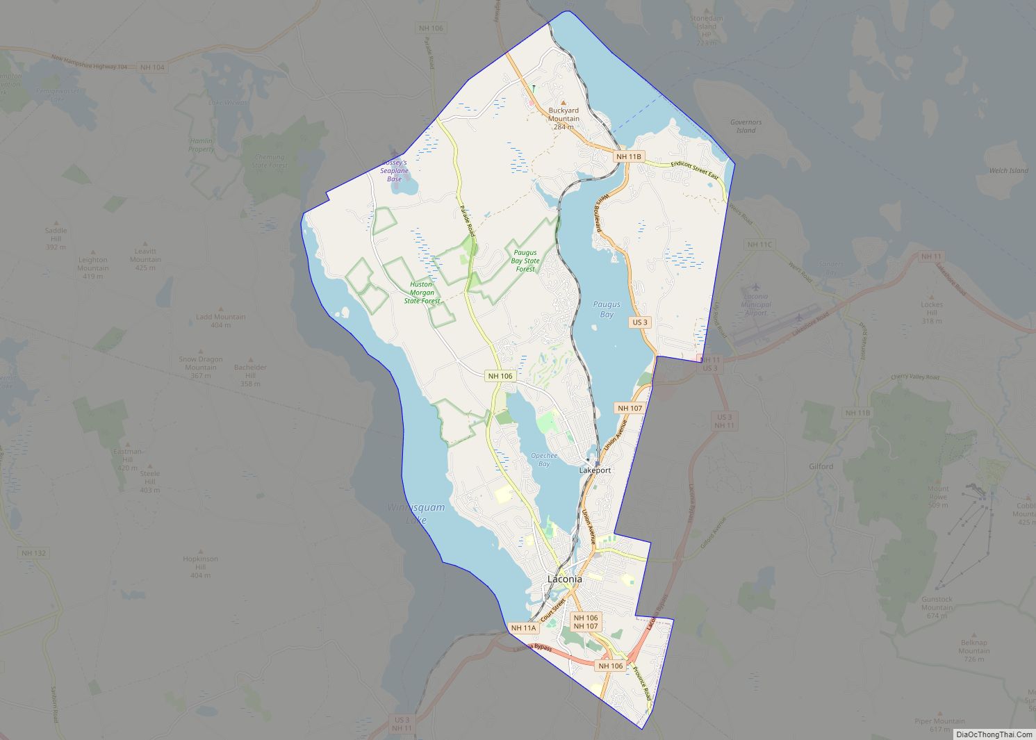
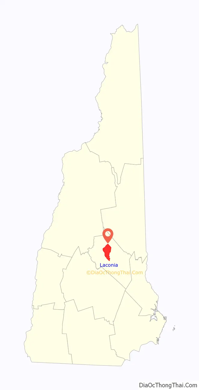
Laconia is a city in Belknap County, New Hampshire, United States. The population was 16,871 at the 2020 census, up from 15,951 at the 2010 census. It is the county seat of Belknap County. Laconia, situated between Lake Winnipesaukee and Lake Winnisquam, includes the villages of Lakeport and Weirs Beach. Each June, the city hosts Laconia Motorcycle Week, also more simply known as “Bike Week”, one of the country’s largest rallies.
| Name: | Laconia city |
|---|---|
| LSAD Code: | 25 |
| LSAD Description: | city (suffix) |
| State: | New Hampshire |
| County: | Belknap County |
| Incorporated: | 1855 |
| Elevation: | 502 ft (153 m) |
| Total Area: | 26.08 sq mi (67.55 km²) |
| Land Area: | 19.84 sq mi (51.38 km²) |
| Water Area: | 6.24 sq mi (16.17 km²) 23.93% |
| Total Population: | 16,871 |
| Population Density: | 850.44/sq mi (328.35/km²) |
| Area code: | 603 |
| FIPS code: | 3340180 |
| GNISfeature ID: | 0867917 |
| Website: | www.cityoflaconianh.org |
Online Interactive Map
Click on ![]() to view map in "full screen" mode.
to view map in "full screen" mode.
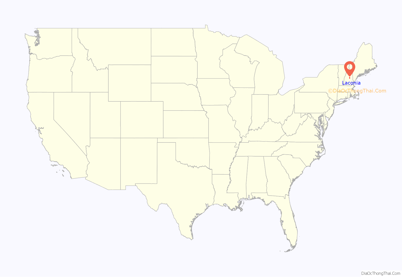
Laconia location map. Where is Laconia city?
History
A large Abenaki Indian settlement called Aquadoctan once existed at the point now known as The Weirs, named by colonists for fishing weirs discovered at the outlet of the Winnipesaukee River. Early explorers had hoped to follow the Piscataqua River north to Lake Champlain in search of the great lakes and rivers of Canada mentioned in Indian folklore. About 1652, the Endicott surveying party visited the area, an event commemorated by Endicott Rock, a local landmark. A fort would be built at Laconia in 1746. But ongoing hostilities between the English, French, and their respective Native American allies prevented settlement until 1761, after which it remained for many years a part of Meredith and Gilford called Meredith Bridge.
Beginning in 1765, lumber and grist mills were established on Mill Street, with taverns built soon thereafter on Parade Street. About 1822, the courthouse was built, which would become county seat at the creation of Belknap County in 1840. In 1823, the Belknap Mill was built to manufacture textiles; in operation by 1828, the structure is today a museum listed on the National Register of Historic Places and is the oldest unaltered brick textile mill in the country. Local industry produced lumber, textiles, shoes, hosiery, knitting machinery and needles. But the city’s largest employer would be the Laconia Car Company, builder of rail, trolley and subway cars. Started in 1848, it lasted until the 1930s. The railroad entered town in 1849, carrying both freight and an increasing number of summer tourists to popular Weirs Beach.
In 1855, Laconia was incorporated as a town from land in Meredith Bridge, Lakeport, Weirs and part of Gilmanton. The name was probably derived from the old Laconia Company, formed by Captain John Mason and the Masonian Proprietors to sell parcels of land during the colonial era. The Great Fire of 1860 destroyed most of Main Street from Mill to Water streets, followed by the Great Lakeport Fire of 1903, a blaze so fierce that fire companies were brought by train from as far away as Dover. Laconia was incorporated as a city in 1893.
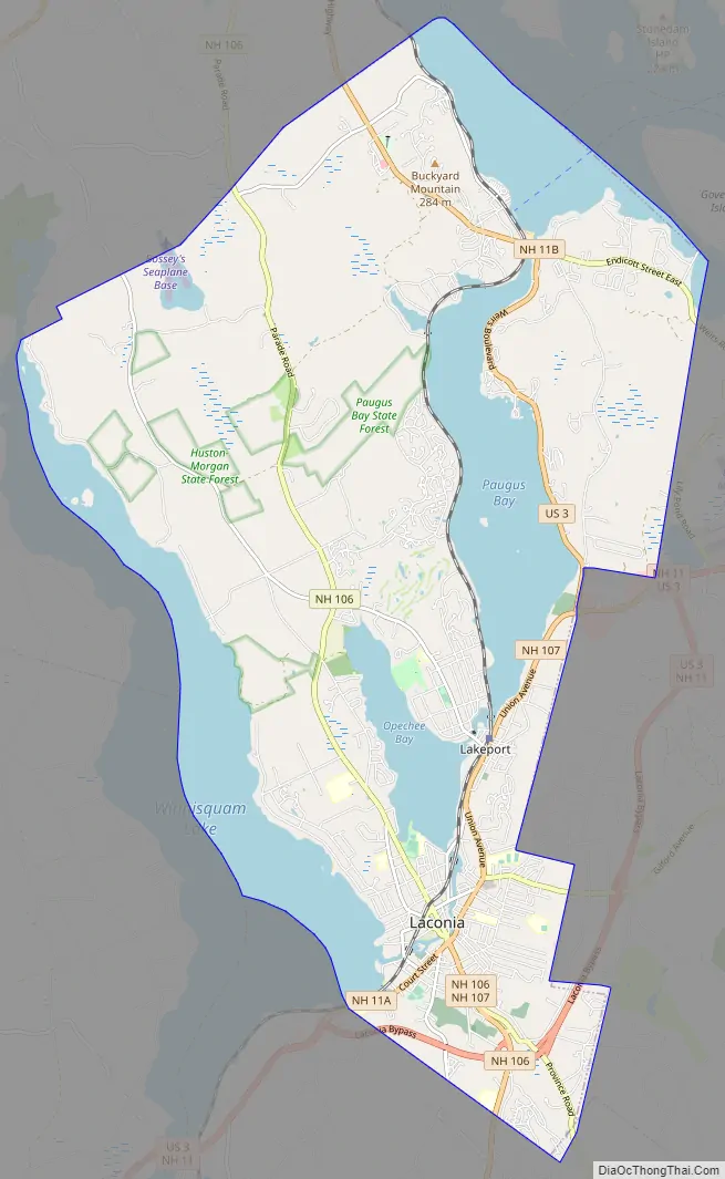
Laconia Road Map
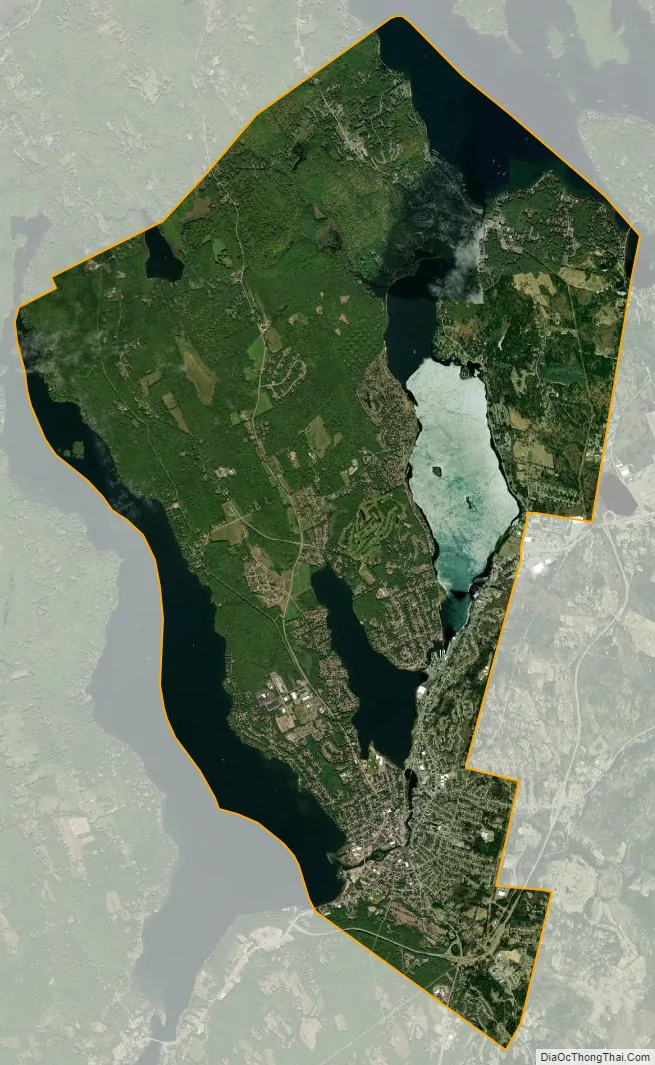
Laconia city Satellite Map
Geography
Laconia is located northwest of the geographic center of Belknap County. The city lies at the center of New Hampshire‘s Lakes Region, and all or part of four major bodies of water lie within its limits: Lake Winnipesaukee, Lake Winnisquam, Opechee Bay and Paugus Bay (sometimes counted as an arm of Winnipesaukee, but historically a separate body of water).
Laconia contains three main villages. Downtown Laconia, where the Belknap County Courthouse is located, can be found in the southern tip of the city, along the Winnipesaukee River between Opechee Bay to the north and Lake Winnisquam to the southwest. Lakeport, located between Opeechee Bay and Paugus Bay, is near the geographic center of the city. Weirs Beach, around the channel connecting Paugus Bay with Lake Winnipesaukee, lies at the northern edge of the city.
U.S. Route 3 passes through parts of the city, bypassing downtown but passing through Weirs Beach. New Hampshire Route 11 bypasses the city in a concurrency with US 3. The two highways lead southwest from Laconia to Tilton and Franklin. New Hampshire Route 11A represents the old routes 11 and 3 through downtown as Court Street and Union Avenue, but then turns east on Gilford Avenue to lead to Gilford and West Alton. New Hampshire Route 106 runs north-south through downtown, leading south to Concord and north to Meredith. New Hampshire Route 107 leads southeast from downtown towards Gilmanton and Pittsfield. Route 107 turns north in downtown and follows Union Avenue (former Route 3) to a junction with US 3 near the north end of the Laconia Bypass. US 3 continues north along the east shore of Paugus Bay, through Weirs Beach and into Meredith. Route 11 leads east from the Laconia Bypass past Glendale and into Alton. New Hampshire Route 11B leads east from Weirs Beach into Gilford.
The former Boston and Maine Railroad White Mountain Branch, originally built as the Boston, Concord & Montreal Railroad, enters Laconia at the Belmont town line near Lake Winnisquam and runs north through the city, through Lakeport and along Paugus Bay to Weirs Beach and Meredith. Purchased by the State of New Hampshire in 1975, the tracks are actively used for freight purposes by the New England Southern Railroad and for tourist train service by the Plymouth & Lincoln Railroad between Meredith and Lakeport, with occasional service out of Laconia. The line is also a vital active link to the National rail network for the tourist operator to ship and receive equipment for their own use and also to perform contract work at the railroad’s Lincoln repair shops.
Laconia Municipal Airport is located just east of the city limits in Gilford.
A recreational trail called the W.O.W. Trail (Winnipesaukee–Opechee–Winnisquam) links several parts of the city, following the railroad tracks from Lake Winnisquam, skirting the downtown area, and running to Lakeport. A desire to extend the trail to Weirs Beach has been contested by residents in private communities abutting the rail corridor. The proposed removal of active rail for said extension is contested also by railroad companies actively using the tracks and the State of New Hampshire Bureau of Rail and Transit.
According to the United States Census Bureau, the city has a total area of 26.1 square miles (67.6 km), of which 19.8 square miles (51.4 km) are land and 6.3 square miles (16.2 km) are water, comprising 23.93% of the city. Laconia is drained by the Winnipesaukee River. It is bounded in the southwest by Lake Winnisquam, and by Lake Winnipesaukee in the northeast. Laconia lies fully within the Merrimack River watershed. The highest point in Laconia is a 960-foot (290 m) hill in the northern part of the city, west of Paugus Bay’s Pickerel Cove and just east of Route 106.
Adjacent municipalities
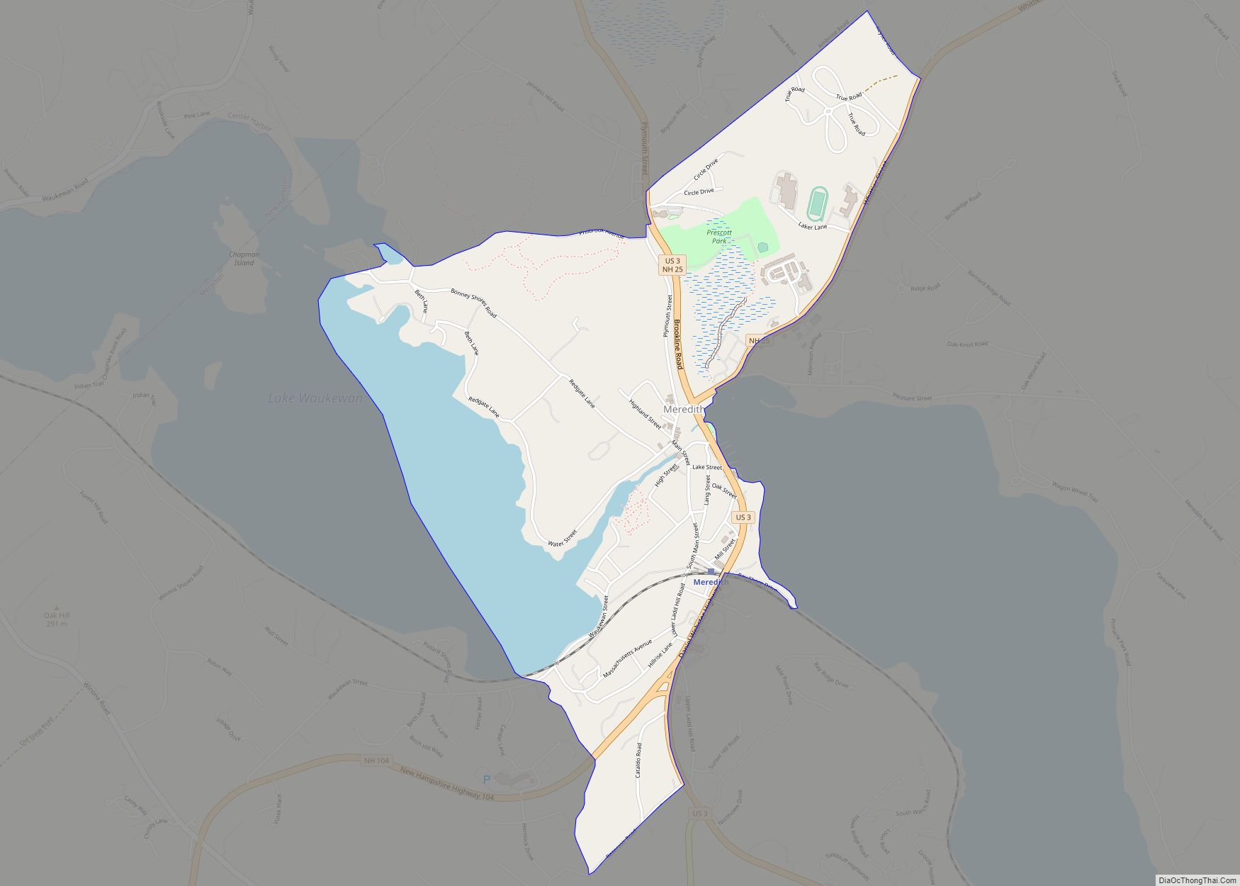
- Meredith (north)
- Gilford (east)
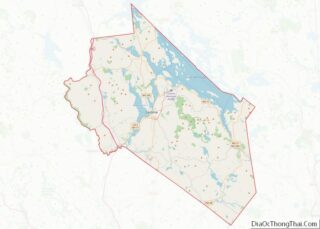
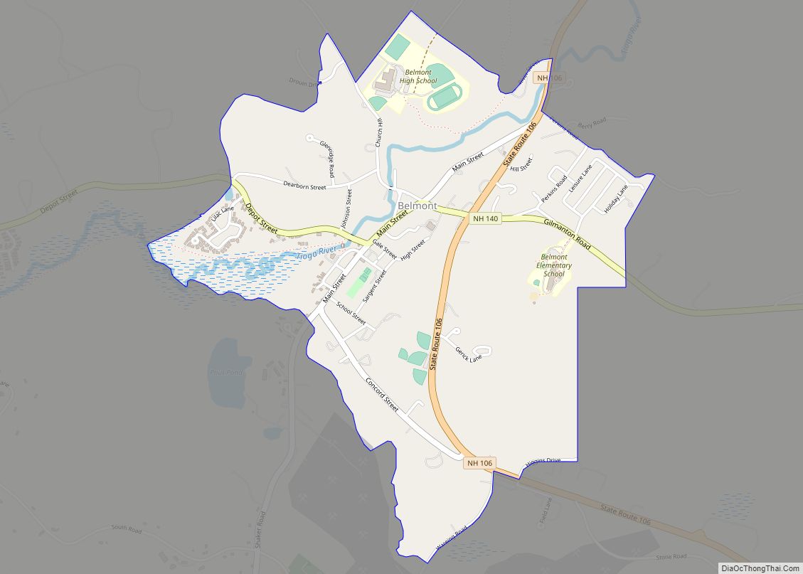
- Belmont (south)
- Sanbornton (west)
See also
Map of New Hampshire State and its subdivision: Map of other states:- Alabama
- Alaska
- Arizona
- Arkansas
- California
- Colorado
- Connecticut
- Delaware
- District of Columbia
- Florida
- Georgia
- Hawaii
- Idaho
- Illinois
- Indiana
- Iowa
- Kansas
- Kentucky
- Louisiana
- Maine
- Maryland
- Massachusetts
- Michigan
- Minnesota
- Mississippi
- Missouri
- Montana
- Nebraska
- Nevada
- New Hampshire
- New Jersey
- New Mexico
- New York
- North Carolina
- North Dakota
- Ohio
- Oklahoma
- Oregon
- Pennsylvania
- Rhode Island
- South Carolina
- South Dakota
- Tennessee
- Texas
- Utah
- Vermont
- Virginia
- Washington
- West Virginia
- Wisconsin
- Wyoming