Newport is a census-designated place (CDP) comprising the main village and surrounding rural land in the town of Newport, Sullivan County, New Hampshire, United States. The population of the CDP was 4,735 at the 2020 census, out of 6,299 in the entire town.
| Name: | Newport CDP |
|---|---|
| LSAD Code: | 57 |
| LSAD Description: | CDP (suffix) |
| State: | New Hampshire |
| County: | Sullivan County |
| Elevation: | 817 ft (249 m) |
| Total Area: | 14.11 sq mi (36.54 km²) |
| Land Area: | 14.11 sq mi (36.54 km²) |
| Water Area: | 0.00 sq mi (0.00 km²) |
| Total Population: | 4,735 |
| Population Density: | 335.63/sq mi (129.59/km²) |
| ZIP code: | 03773 |
| Area code: | 603 |
| FIPS code: | 3352500 |
| GNISfeature ID: | 2378084 |
Online Interactive Map
Click on ![]() to view map in "full screen" mode.
to view map in "full screen" mode.
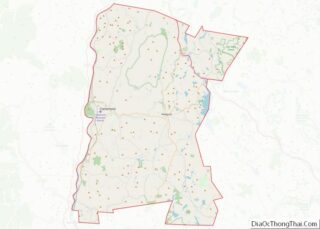
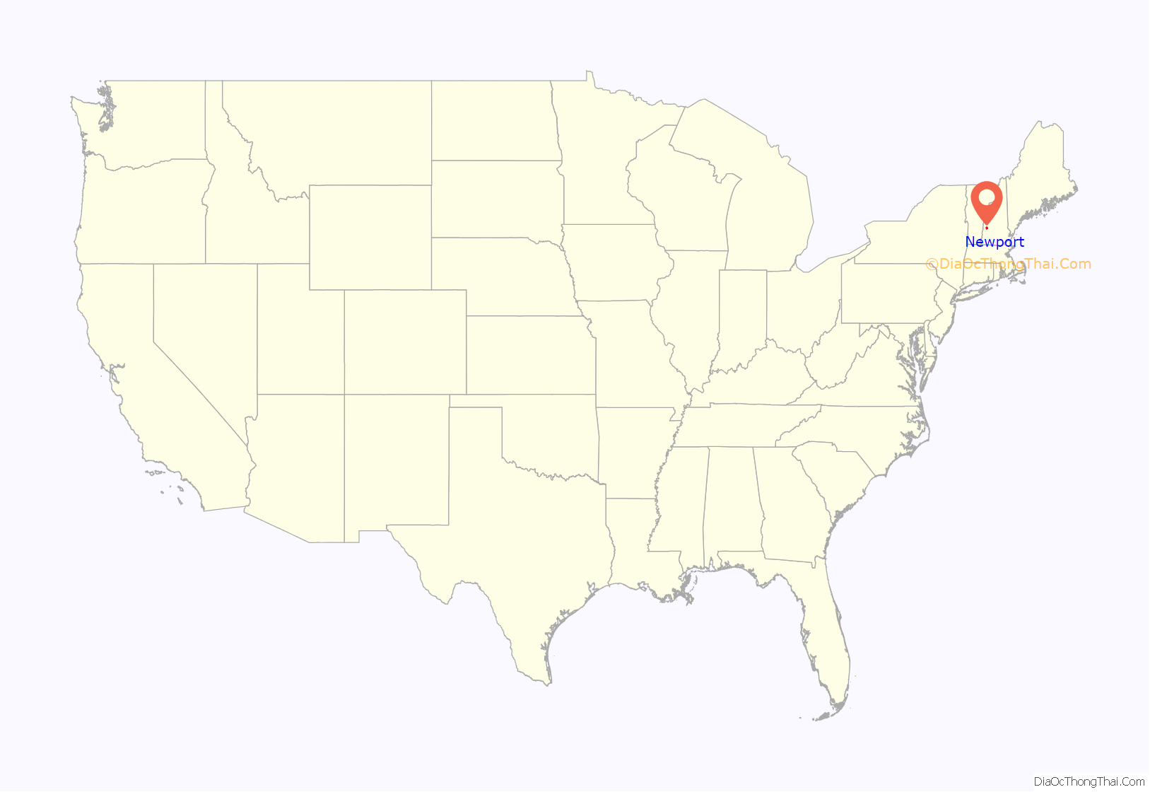
Newport location map. Where is Newport CDP?

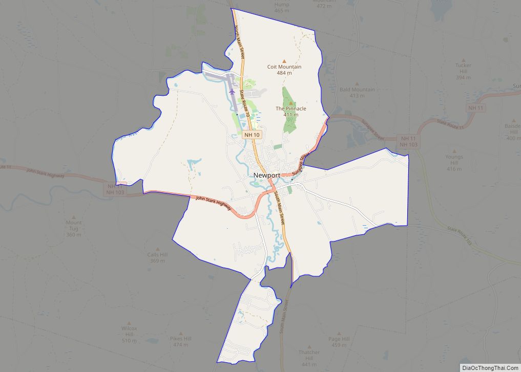
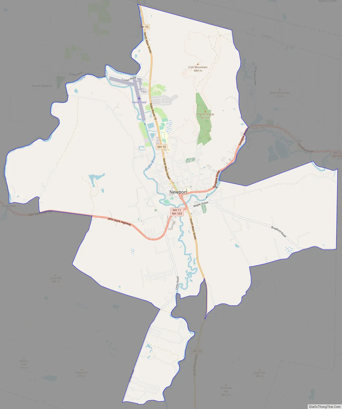
Newport Road Map
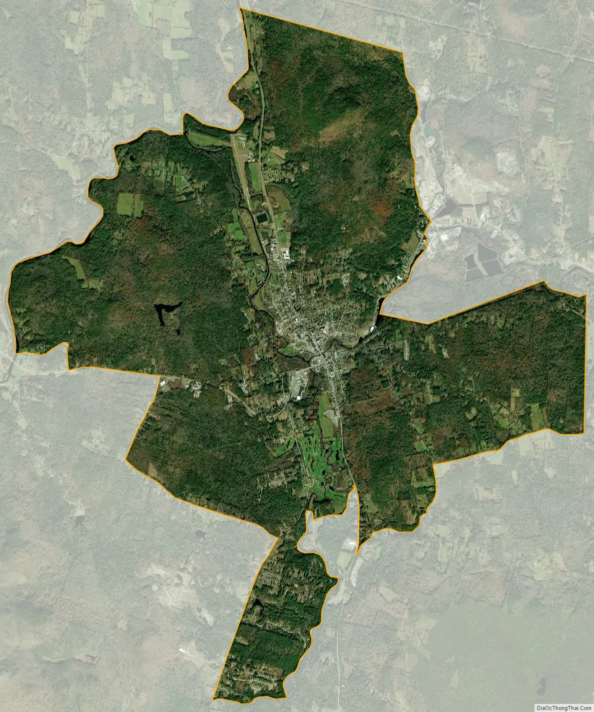
Newport city Satellite Map
Geography
The CDP is in the eastern part of the town of Newport, with the village of Newport in the center of the CDP at the junction of the Sugar River with its South Branch. The CDP extends north to the Croydon town line, east to the Sunapee line, and south to the Unity line. From the Croydon line, the CDP border follows the North Branch of the Sugar River and then the main stem of the Sugar River southwest to New Hampshire Routes 11 and 103 in Kellyville. The border then follows NH 11/103, Whitcher Road, Bascom Road, and Unity Road to the Unity town line. A short distance to the east the CDP border follows Spring Brook east to the South Branch of the Sugar River, then turns south up the South Branch to Coon Brook Road and New Hampshire Route 10, which it follows north to Page Hill Road. It follows an unnamed stream north to Blaisdell Road, then follows East Mountain Road, Schoolhouse Road, and Bradford Road east to the Sunapee town line. The CDP runs north along the town line to Maple Street south of Wendell, then turns west on an abandoned railroad line and a power line to the Sugar River at the east edge of the urban center of Newport. Turning back to the east, the border follows the river upstream to Long Pond Brook, where it turns north, follows Routes 11/103 briefly, then takes Sand Hill Road north back to the Croydon line.
New Hampshire Route 10 is Newport’s Main Street, leading north 10 miles (16 km) to Interstate 89 in Grantham and south 35 miles (56 km) to Keene. Routes 11/103 lead west together 9 miles (14 km) to Claremont. The two highways lead east out of town as Sunapee Street, splitting 3 miles (5 km) east of the center of Newport in the village of Wendell. Route 11 leads northeast 5.5 miles (8.9 km) from Newport to Sunapee village, while Route 103 leads southeast 9.5 miles (15.3 km) to Newbury Harbor on Lake Sunapee.
According to the U.S. Census Bureau, the Newport CDP has a total area of 14.1 square miles (36.5 km), all of it recorded as land.
See also
Map of New Hampshire State and its subdivision: Map of other states:- Alabama
- Alaska
- Arizona
- Arkansas
- California
- Colorado
- Connecticut
- Delaware
- District of Columbia
- Florida
- Georgia
- Hawaii
- Idaho
- Illinois
- Indiana
- Iowa
- Kansas
- Kentucky
- Louisiana
- Maine
- Maryland
- Massachusetts
- Michigan
- Minnesota
- Mississippi
- Missouri
- Montana
- Nebraska
- Nevada
- New Hampshire
- New Jersey
- New Mexico
- New York
- North Carolina
- North Dakota
- Ohio
- Oklahoma
- Oregon
- Pennsylvania
- Rhode Island
- South Carolina
- South Dakota
- Tennessee
- Texas
- Utah
- Vermont
- Virginia
- Washington
- West Virginia
- Wisconsin
- Wyoming