Claremont is the only city in Sullivan County, New Hampshire, United States. The population was 12,949 at the 2020 census.
| Name: | Claremont city |
|---|---|
| LSAD Code: | 25 |
| LSAD Description: | city (suffix) |
| State: | New Hampshire |
| County: | Sullivan County |
| Incorporated: | 1764 (town), 1947 (city) |
| Elevation: | 551 ft (168 m) |
| Total Area: | 44.05 sq mi (114.09 km²) |
| Land Area: | 43.15 sq mi (111.77 km²) |
| Water Area: | 0.90 sq mi (2.32 km²) 2.04% |
| Total Population: | 12,949 |
| Population Density: | 300.07/sq mi (115.86/km²) |
| ZIP code: | 03743 |
| Area code: | 603 |
| FIPS code: | 3312900 |
| GNISfeature ID: | 866173 |
| Website: | www.claremontnh.com |
Online Interactive Map
Click on ![]() to view map in "full screen" mode.
to view map in "full screen" mode.
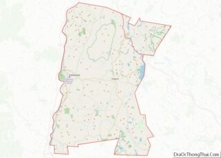
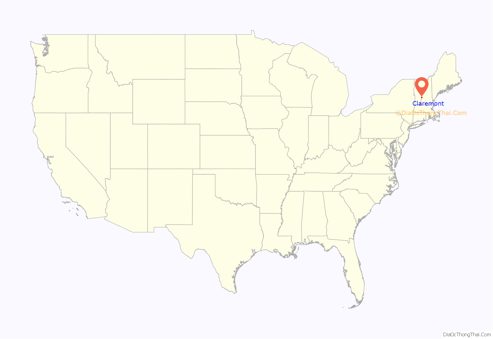
Claremont location map. Where is Claremont city?

History
Pre-colonial native populations
Before colonial settlement, the Upper Connecticut River Valley was home to the Pennacook and Western Abenaki (Sokoki) peoples, later merging with members of other Algonquin tribes displaced by the wars and famines that accompanied the European settling of the region. The Hunter Archeological Site, located near the bridge connecting Claremont with Ascutney, Vermont, is a significant prehistoric Native American site that includes seven levels of occupational evidence, including evidence of at least three longhouses. The oldest dates recorded from evidence gathered during excavations in 1967 were to 1300 CE.
Colonial settlement
The city was named after Claremont, the country mansion of Thomas Pelham-Holles, Earl of Clare. On October 26, 1764, colonial governor Benning Wentworth granted the township to Josiah Willard, Samuel Ashley and 67 others. Although first settled in 1762 by Moses Spafford and David Lynde, many of the proprietors arrived in 1767, with a large number from Farmington, Hebron and Colchester, Connecticut. The undulating surface of rich, gravelly loam made agriculture an early occupation. Spafford was deeded land from Col. Samuel Ashley, who was given a charter to establish a ferry across the Connecticut River in 1784, the location of which is still known as Ashley’s Ferry landing. Spafford was also the first man to marry in Claremont, and his son, Elijah, was the first white child to be born in the town.
The Union Episcopal Church in West Claremont was built in 1773, and is the oldest surviving Episcopal church building in New Hampshire and the state’s oldest surviving building built exclusively for religious purposes. The parish was organized in 1771 and chartered by the New Hampshire legislature in 1794 as Union Church Parish. Located across the street, Old St. Mary’s Church, built in 1823 mostly in the Federal style, was the first Roman Catholic church in New Hampshire. It was discontinued in 1870 in favor of the new St. Mary’s Church in the Lower Village District.
During the American Revolution, Claremont had a large number of Loyalists, who used a small wooded valley in West Claremont called the “Tory Hole” to hide from the Patriots. In 1777, when the New Hampshire Grants declared their own sovereignty as the Vermont Republic, Claremont was one of sixteen New Hampshire towns inclined to join them, and made multiple attempts to do so.
Industry
Claremont’s first millwright was Col. Benjamin Tyler, who arrived in the area from Farmington, Connecticut, in the spring of 1767. Tyler built mills using stone quarried from his land on nearby Mount Ascutney, and built Claremont’s first mill on the Sugar River on the site of the Coy Paper Mill. Tyler also invented the wry-fly water wheel, which was the subject of the Supreme Court case Tyler v. Tuel. His grandson John Tyler evolved the technology to create the Tyler Water Wheel and the Tyler Turbine. John Tyler’s grandson was Benjamin Tyler Henry, inventor of the Henry Repeating rifle, manufactured in neighboring Windsor, Vermont, and used in the Civil War.
The water power harnessed from the Sugar River brought the town prosperity during the Industrial Revolution. Large brick factories were built along the stream, including the Sunapee Mills, Monadnock Mills, Claremont Machine Works, Home Mills, Sanford & Rossiter, and Claremont Manufacturing Company. Principal products were cotton and woolen textiles, lathes and planers, and paper. Although like other New England mill towns, much industry moved away or closed in the 20th century, the city’s former prosperity is evident in some fine Victorian architecture, including the 1897 city hall and opera house.
In 1874, businesses in Claremont included Monadnock Mills, manufacturing cotton cloths from one to three yards wide, Marseilles quilts, union flannels, and lumber, and employing 125 males and 225 females; Home Mill (A. Briggs & Co.) producing cotton cloth and employing 8 males and 20 females; Sullivan Machine Co., manufacturing Steam Dimond Drill Machinery for quarrying rock, turbine water wheels, cloth measuring machines, and doing general machine and mill work, employing 56 males; Sugar River Paper Mill Co., manufacturing printing paper and employing 30 males and 20 females; Claremont Manufacturing Co., manufacturing paper and books, and doing stereotyping and book and job printing, employing 34 males and 34 females; Russell Jarvis, manufacturing hanging paper and employing 7 males and 2 females; John S. Farrington, manufacturing straw wrapping paper and employing 5 males and 1 female; Sullivan Mills (George L. Balcom), manufacturing black doeskins and employing 20 males and 18 females; Charles H. Eastman, in the leather business and employing 4 males; Sugar River Mill Co., manufacturing flour, feed, and doing custom grinding, and employing 8 males; three saw mills employing a part of the year, 10 males; Blood & Woodcock, in the business of monuments and grave stones and employing 8 males; and Houghton, Bucknam & Co., in the business of sashes, doors and blinds, employing 8 males.
The Monadnock Mills Co. and Sullivan Mills Co. were responsible for the two most prominent collections of manufacturing structures in the Lower Village District. Monadnock Mills’ textile operations began with its founding in 1842, and lasted through 1932, shuttering operations following the decline of the textile industry in New England during the 1920s. By the 1920s, Sullivan Mills Co. had become New Hampshire’s largest machining company, as well as Claremont’s largest employer. Sullivan’s Machinery division merged with Joy Mining Machinery in 1946, becoming Joy Manufacturing Co. Its founder, inventor Joseph Francis Joy, stayed on as general manager of the facility, which remained the dominant employer in Claremont through the 1970s, when manufacturing technology had advanced sufficiently to hamper sales and productivity. Parts of the campus suffered fires in 1979 and 1981, and the branch was closed in 1983 and sold in 1984.
Statue and memorial to Civil War dead
32-pounder (6.5″) Dahlgren naval guns
Educational history
In the 1850s, the city of Claremont approached the state legislature asking permission to build a public high school. At the time, public high schools did not exist in New Hampshire. The state agreed, and decided to offer permission to every town in the state so that every town could establish public high schools. Claremont native and hotelier Paran Stevens then made an offer to fund 50% of the $20,000 cost of development, resulting in Stevens High School.
In March 1989, the Claremont School Board voted to initiate a lawsuit against the State of New Hampshire, claiming that the state’s primary reliance upon local property taxes for funding education resulted in inequitable educational opportunities among children around the state and a violation of their constitutional rights. Following a lawsuit and a series of landmark decisions, the New Hampshire Supreme Court agreed. Known as the “Claremont Decision”, the suit continues to drive the statewide debate on equitable funding for education, and Claremont continues to play a primary role in this legal challenge.
Namesakes
The cities of Claremont, California, Claremont, Minnesota, and Claremont Township, Minnesota, were named for Claremont, New Hampshire.
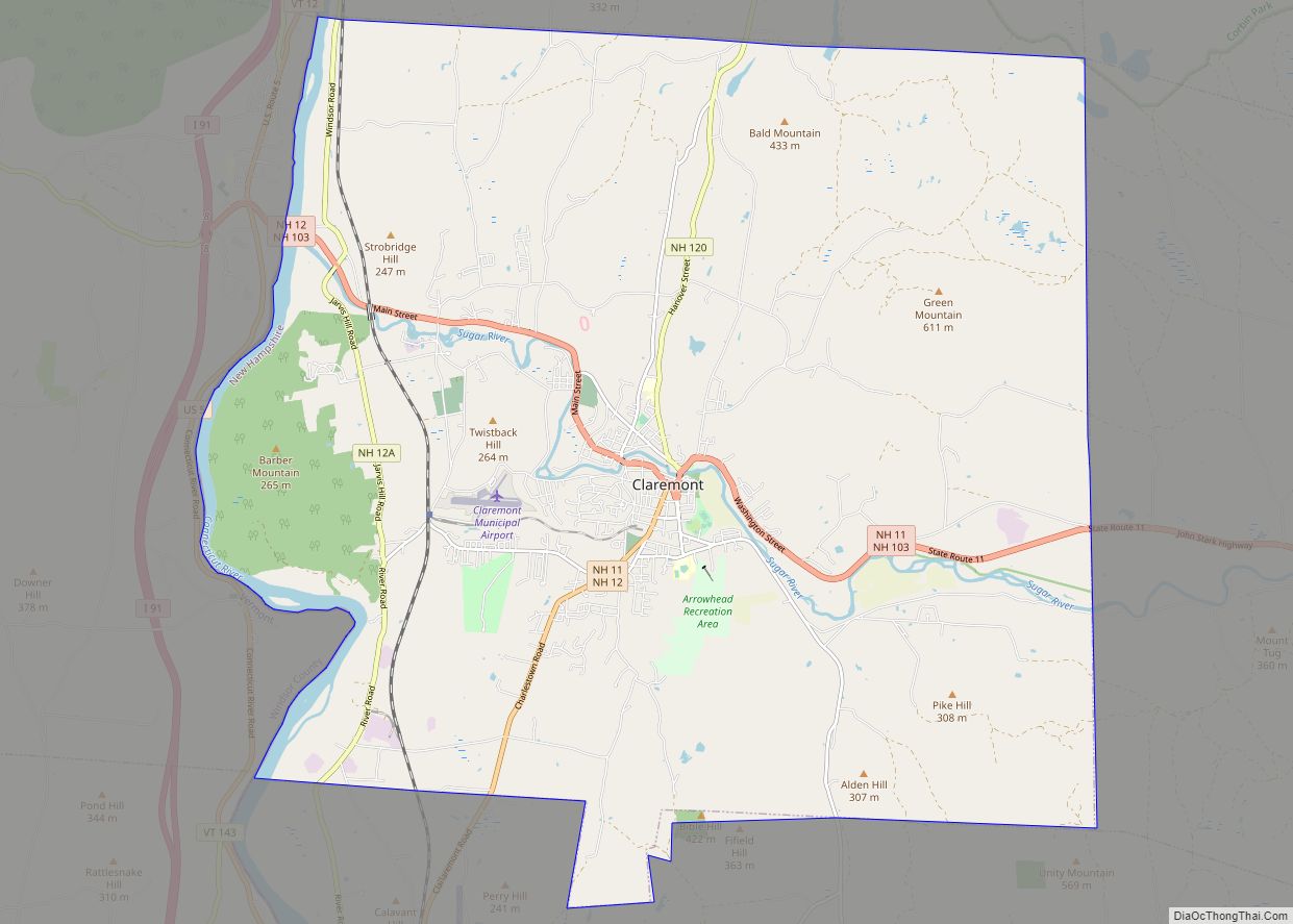
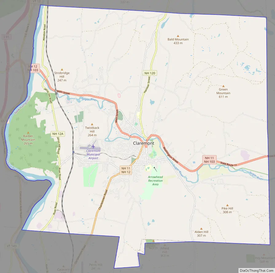
Claremont Road Map
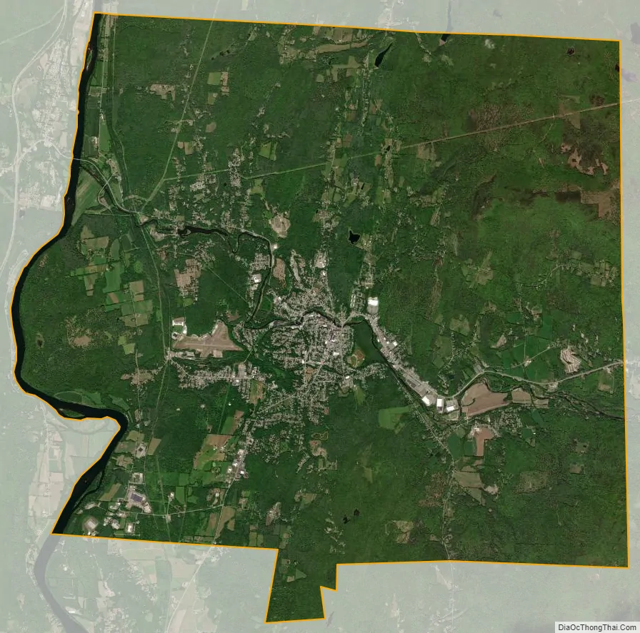
Claremont city Satellite Map
Geography
The city is in western Sullivan County and is bordered to the west by the Connecticut River, the boundary between New Hampshire and Vermont. According to the United States Census Bureau, the city has a total area of 44.1 square miles (114.1 km), of which 43.2 square miles (111.8 km) are land and 0.89 square miles (2.3 km) are water, comprising 2.04% of the town. The Sugar River flows from east to west through the center of Claremont, descending 150 feet (46 m) in elevation through the downtown, and empties into the Connecticut. The highest point in the city is the summit of Green Mountain, at 2,018 feet (615 m) above sea level in the northeastern part of the city. Claremont lies fully within the Connecticut River watershed.
Adjacent municipalities
- Cornish, New Hampshire (north)
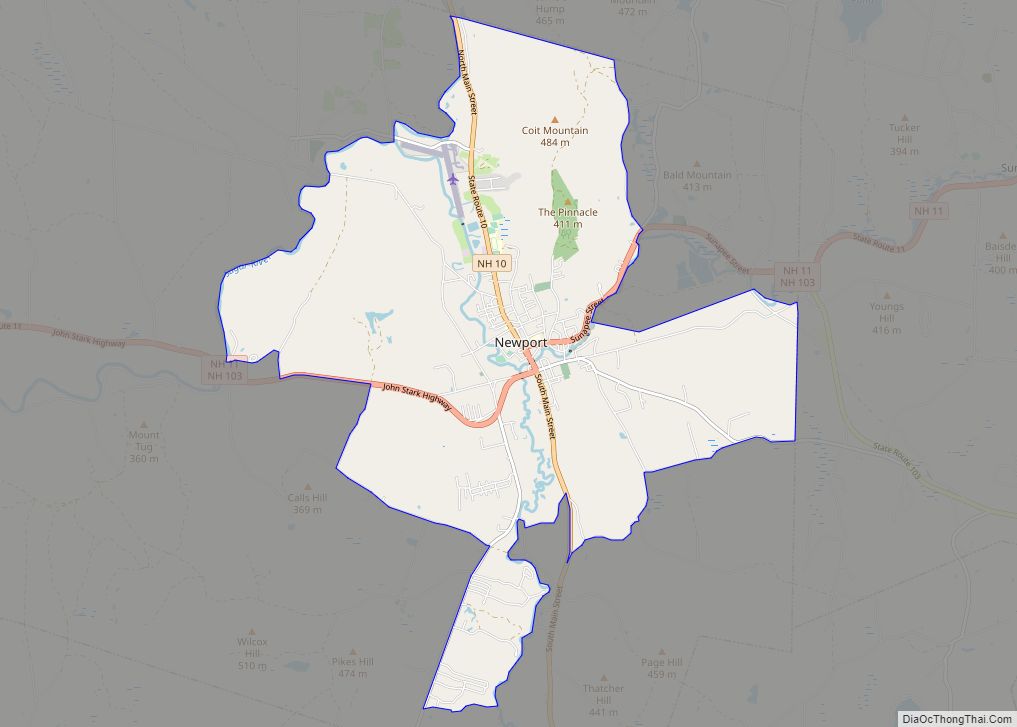
- Newport, New Hampshire (east)
- Unity, New Hampshire (southeast)
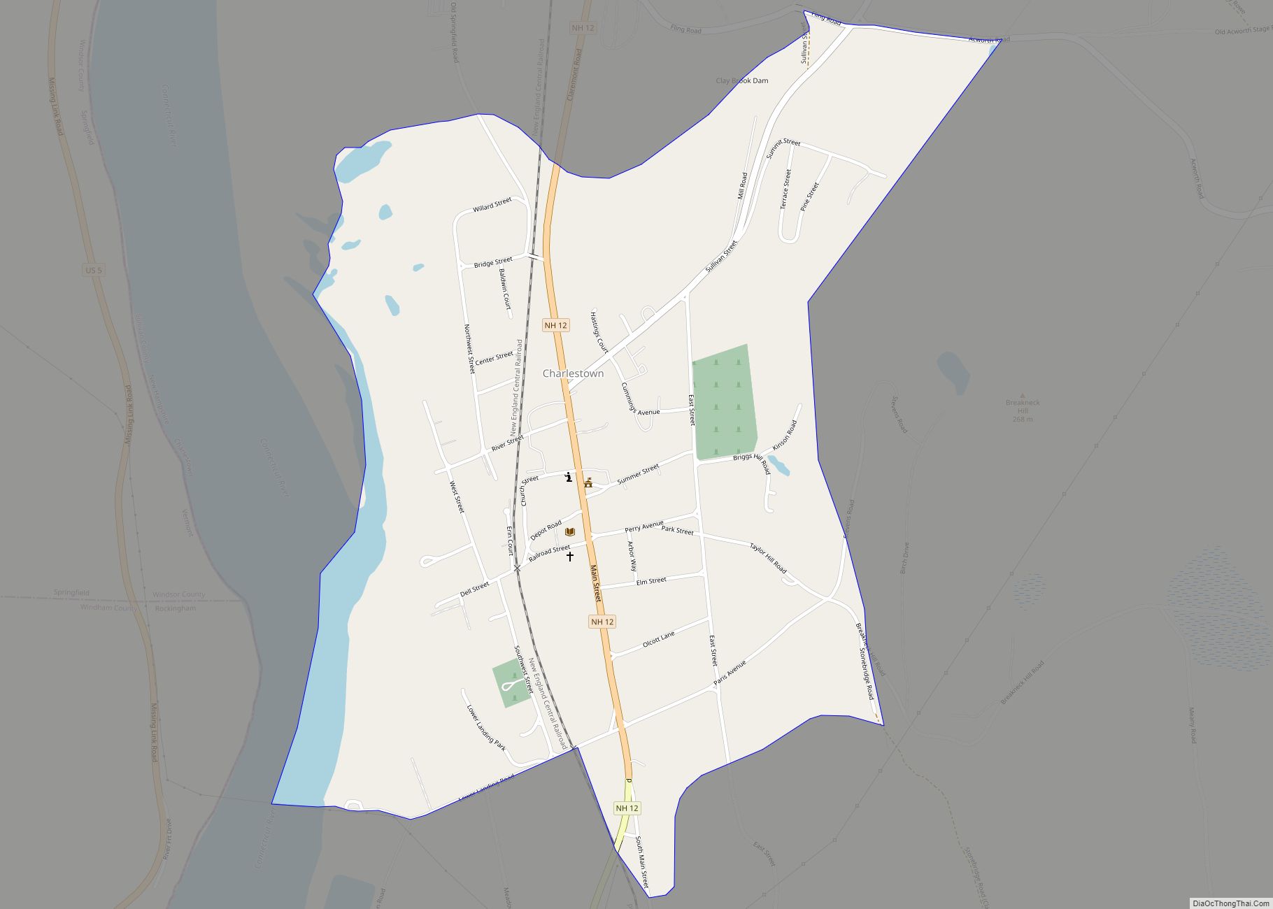
- Charlestown, New Hampshire (southwest)
- Weathersfield, Vermont (west)
See also
Map of New Hampshire State and its subdivision: Map of other states:- Alabama
- Alaska
- Arizona
- Arkansas
- California
- Colorado
- Connecticut
- Delaware
- District of Columbia
- Florida
- Georgia
- Hawaii
- Idaho
- Illinois
- Indiana
- Iowa
- Kansas
- Kentucky
- Louisiana
- Maine
- Maryland
- Massachusetts
- Michigan
- Minnesota
- Mississippi
- Missouri
- Montana
- Nebraska
- Nevada
- New Hampshire
- New Jersey
- New Mexico
- New York
- North Carolina
- North Dakota
- Ohio
- Oklahoma
- Oregon
- Pennsylvania
- Rhode Island
- South Carolina
- South Dakota
- Tennessee
- Texas
- Utah
- Vermont
- Virginia
- Washington
- West Virginia
- Wisconsin
- Wyoming