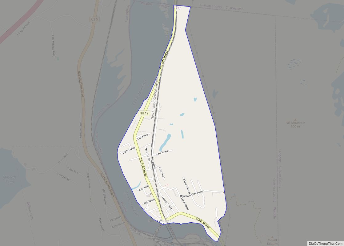
North Walpole is a census-designated place (CDP) in the town of Walpole in Cheshire County, New Hampshire, United States. It had a population of 785 at the 2020 census, making it the largest village in the town of Walpole.
It is located along New Hampshire Route 12 directly across the Connecticut River from the village of Bellows Falls, Vermont. North Walpole has a separate ZIP code (03609) from the rest of Walpole.
| Name: | North Walpole CDP |
|---|---|
| LSAD Code: | 57 |
| LSAD Description: | CDP (suffix) |
| State: | New Hampshire |
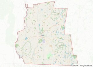
| County: | Cheshire County |
| Elevation: | 308 ft (94 m) |
| Total Area: | 0.70 sq mi (1.81 km²) |
| Land Area: | 0.69 sq mi (1.80 km²) |
| Water Area: | 0.00 sq mi (0.01 km²) |
| Total Population: | 785 |
| Population Density: | 1,131.12/sq mi (436.64/km²) |
| ZIP code: | 03609 |
| Area code: | 603 |
| FIPS code: | 3356420 |
| GNISfeature ID: | 0868821 |
Online Interactive Map
Click on ![]() to view map in "full screen" mode.
to view map in "full screen" mode.
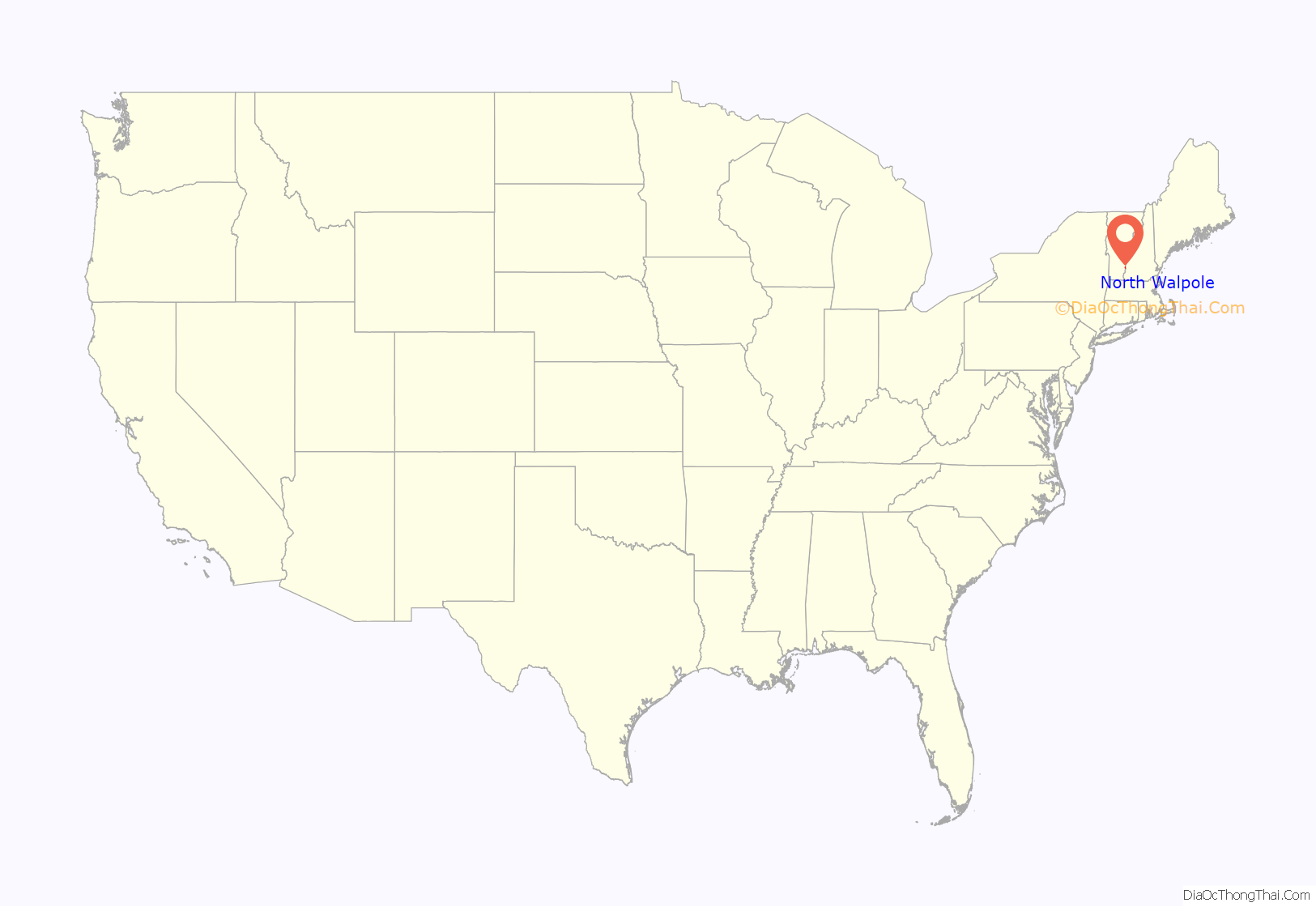
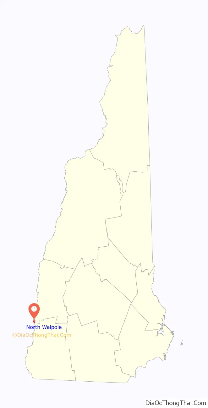
North Walpole location map. Where is North Walpole CDP?
History
Spring snowmelt brought log drives down the Connecticut River. Log drivers were stationed to guide logs through a sluice over the dam at Bellows Falls. North Walpole offered twelve to eighteen saloons to quench log drivers’ thirst. These spring drives were stopped after 1915, when pleasure boat owners complained about the hazards to navigation.
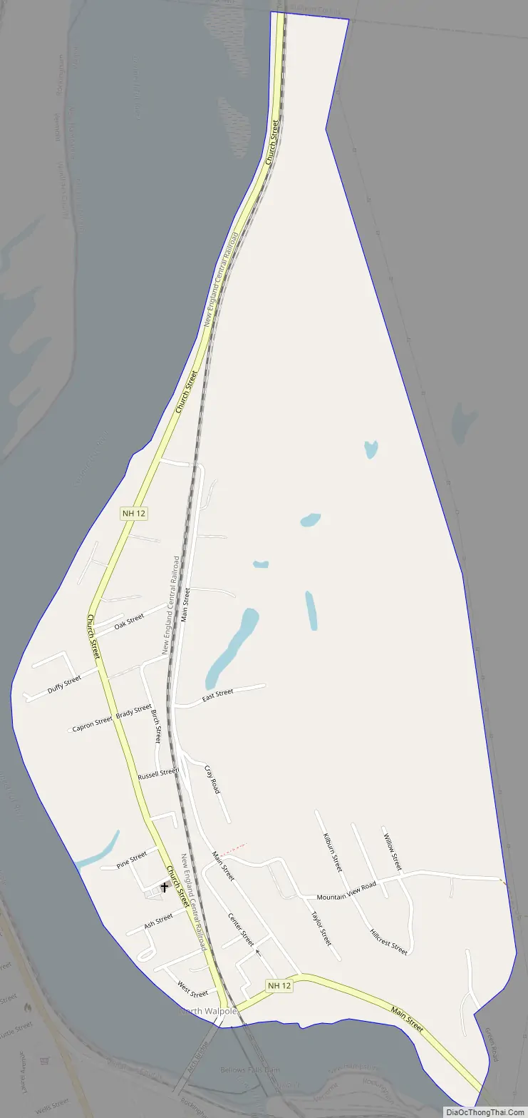
North Walpole Road Map
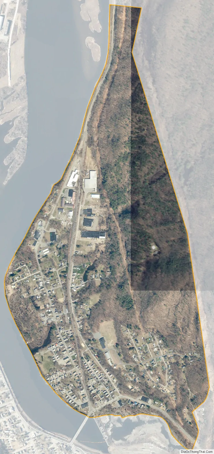
North Walpole city Satellite Map
Geography
North Walpole is in the northwest corner of the town of Walpole, bordered to the south and west by the Connecticut River and to the north by the town of Charlestown in Sullivan County. New Hampshire Route 12 passes through the center of the village as Main Street and Church Street; it leads north 7 miles (11 km) to Charlestown and 20 miles (32 km) to Claremont, while to the south it leads 4.5 miles (7.2 km) to Walpole village and 21 miles (34 km) to Keene. The Arch Bridge leads from North Walpole across the Connecticut River to the village of Bellows Falls in Vermont.
According to the U.S. Census Bureau, the North Walpole CDP has a total area of 0.7 square miles (1.8 km), of which 2.24 acres (9,081 m), or 0.51%, are water.
See also
Map of New Hampshire State and its subdivision: Map of other states:- Alabama
- Alaska
- Arizona
- Arkansas
- California
- Colorado
- Connecticut
- Delaware
- District of Columbia
- Florida
- Georgia
- Hawaii
- Idaho
- Illinois
- Indiana
- Iowa
- Kansas
- Kentucky
- Louisiana
- Maine
- Maryland
- Massachusetts
- Michigan
- Minnesota
- Mississippi
- Missouri
- Montana
- Nebraska
- Nevada
- New Hampshire
- New Jersey
- New Mexico
- New York
- North Carolina
- North Dakota
- Ohio
- Oklahoma
- Oregon
- Pennsylvania
- Rhode Island
- South Carolina
- South Dakota
- Tennessee
- Texas
- Utah
- Vermont
- Virginia
- Washington
- West Virginia
- Wisconsin
- Wyoming