Peterborough is a census-designated place (CDP) and the main village in the town of Peterborough, Hillsborough County, New Hampshire, United States. The population of the CDP was 3,090 at the 2020 census, out of 6,418 in the entire town.
| Name: | Peterborough CDP |
|---|---|
| LSAD Code: | 57 |
| LSAD Description: | CDP (suffix) |
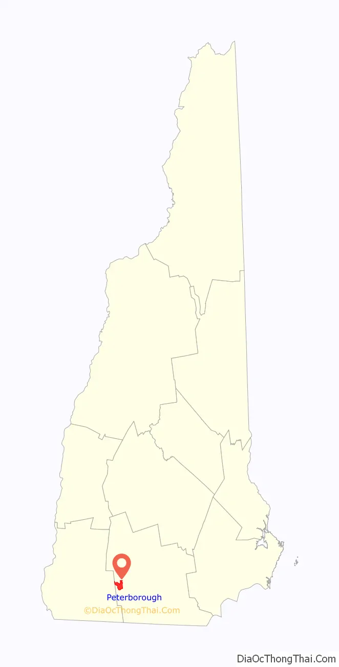
| State: | New Hampshire |
| County: | Hillsborough County |
| Elevation: | 730 ft (220 m) |
| Total Area: | 4.79 sq mi (12.41 km²) |
| Land Area: | 4.77 sq mi (12.35 km²) |
| Water Area: | 0.03 sq mi (0.06 km²) |
| Total Population: | 3,090 |
| Population Density: | 648.21/sq mi (250.25/km²) |
| ZIP code: | 03458 |
| Area code: | 603 |
| FIPS code: | 3360500 |
| GNISfeature ID: | 2378086 |
Online Interactive Map
Click on ![]() to view map in "full screen" mode.
to view map in "full screen" mode.
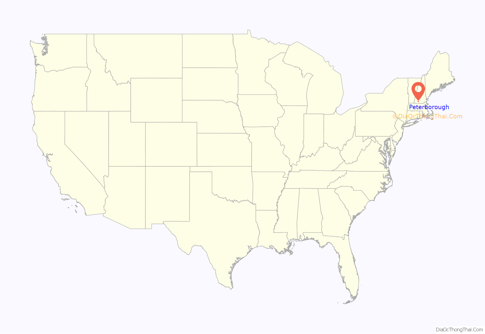
Peterborough location map. Where is Peterborough CDP?
Peterborough Road Map
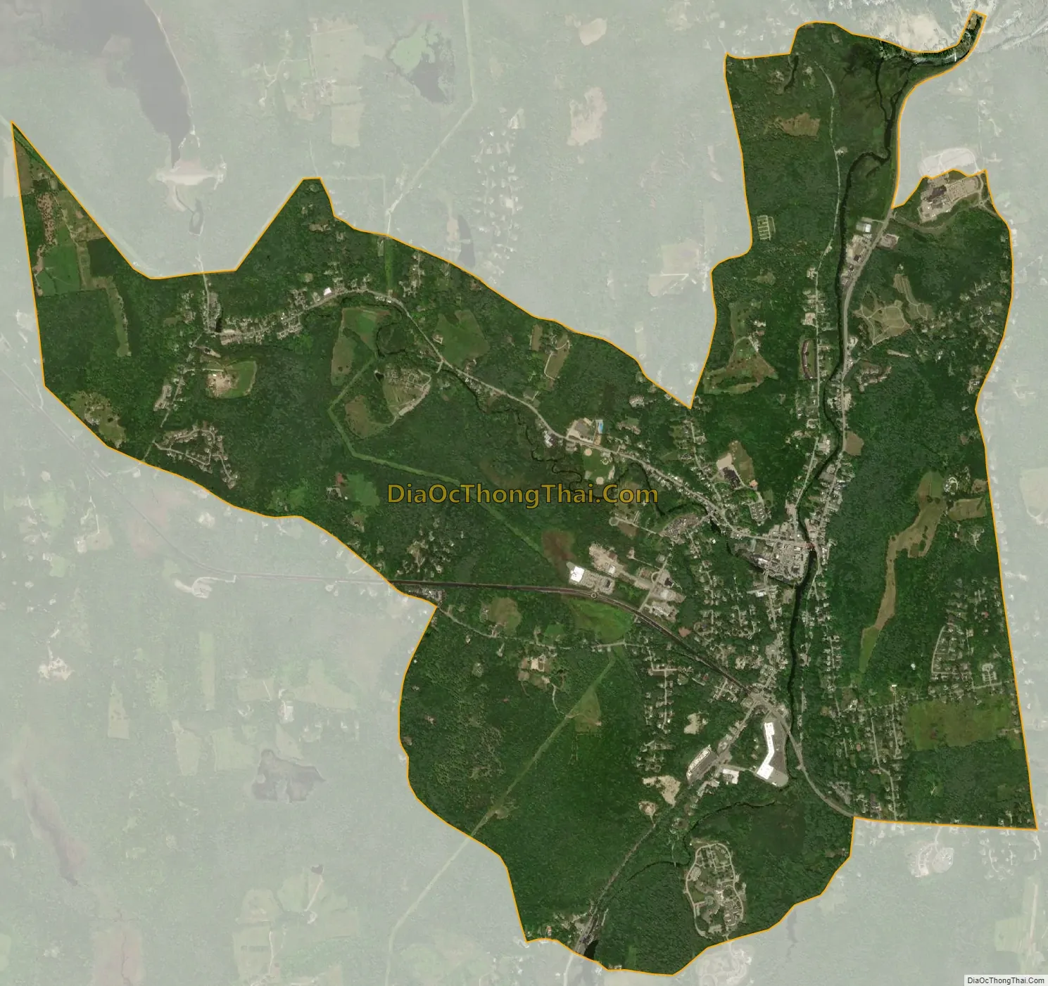
Peterborough city Satellite Map
Geography
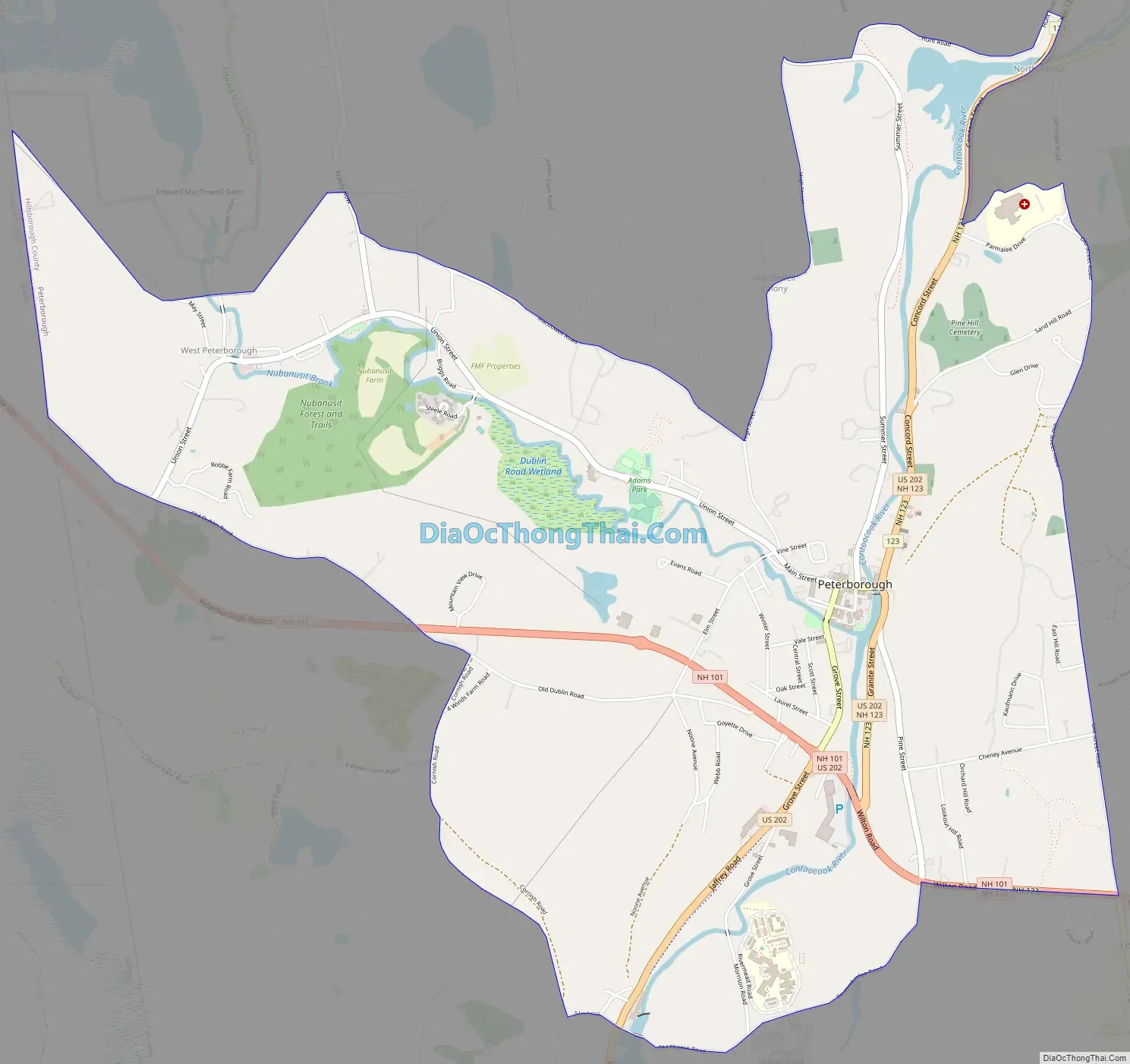
The CDP occupies the central to west-central part of the town of Peterborough, along both sides of the Contoocook River where it is joined from the west by Nubanusit Brook. The CDP includes the Peterborough town center and extends west up Nubanusit Brook to encompass the village of West Peterborough. The CDP extends north, down the Contoocook River, as far as the area known as North Village, and it extends south, upriver, to the 19th-century factory complex known as Noone.
U.S. Route 202 runs through the east side of the CDP, following the Contoocook River. It leads north 19 miles (31 km) to Hillsborough and south 16 miles (26 km) to Winchendon, Massachusetts. New Hampshire Route 101 crosses US 202 south of the village center, leading east 17 miles (27 km) to Milford and west 19 miles (31 km) to Keene.
According to the U.S. Census Bureau, the Peterborough CDP has a total area of 4.8 square miles (12.4 km), of which 0.02 square miles (0.06 km), or 0.51%, are water.
See also
Map of New Hampshire State and its subdivision: Map of other states:- Alabama
- Alaska
- Arizona
- Arkansas
- California
- Colorado
- Connecticut
- Delaware
- District of Columbia
- Florida
- Georgia
- Hawaii
- Idaho
- Illinois
- Indiana
- Iowa
- Kansas
- Kentucky
- Louisiana
- Maine
- Maryland
- Massachusetts
- Michigan
- Minnesota
- Mississippi
- Missouri
- Montana
- Nebraska
- Nevada
- New Hampshire
- New Jersey
- New Mexico
- New York
- North Carolina
- North Dakota
- Ohio
- Oklahoma
- Oregon
- Pennsylvania
- Rhode Island
- South Carolina
- South Dakota
- Tennessee
- Texas
- Utah
- Vermont
- Virginia
- Washington
- West Virginia
- Wisconsin
- Wyoming