Suissevale is a private subdivision in the town of Moultonborough in Carroll County, New Hampshire, United States. It is located between New Hampshire Route 109 and Moultonborough Bay, an arm of Lake Winnipesaukee. The subdivision is listed as a census-designated place (CDP) and had a year-round population of 328 as of the 2020 census.
| Name: | Suissevale CDP |
|---|---|
| LSAD Code: | 57 |
| LSAD Description: | CDP (suffix) |
| State: | New Hampshire |
| County: | Carroll County |
| Elevation: | 640 ft (200 m) |
| Total Area: | 1.18 sq mi (3.05 km²) |
| Land Area: | 1.17 sq mi (3.04 km²) |
| Water Area: | 0.01 sq mi (0.01 km²) |
| Total Population: | 328 |
| Population Density: | 279.62/sq mi (107.94/km²) |
| Area code: | 603 |
| FIPS code: | 3374780 |
| GNISfeature ID: | 0871237 |
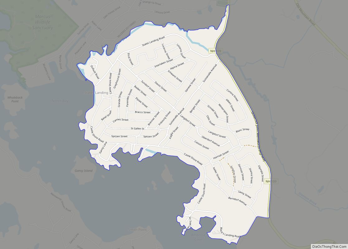
Online Interactive Map
Click on ![]() to view map in "full screen" mode.
to view map in "full screen" mode.
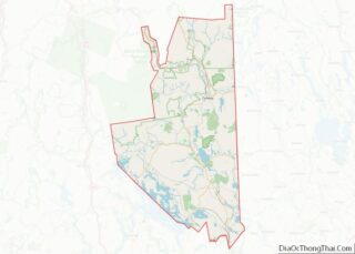
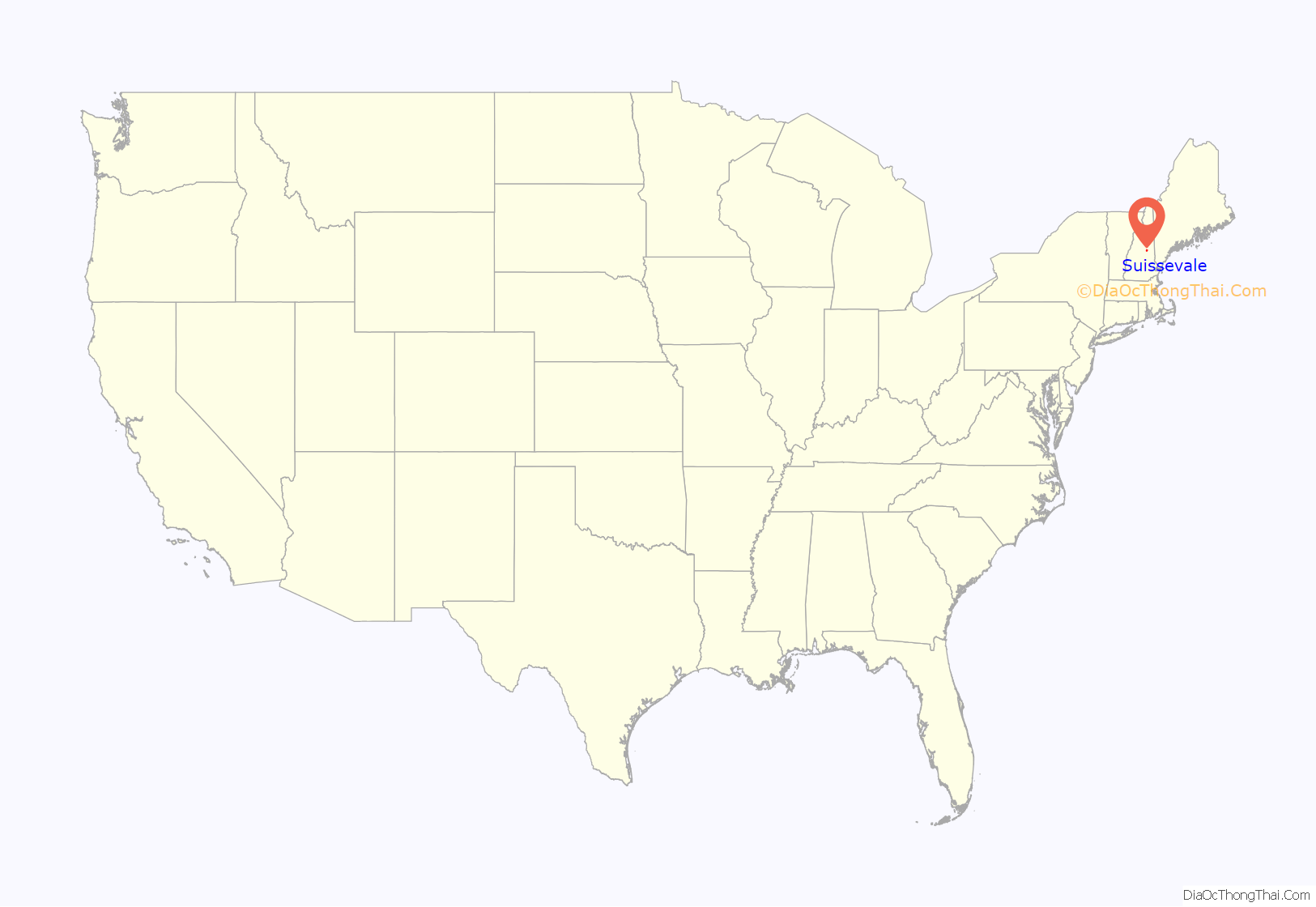
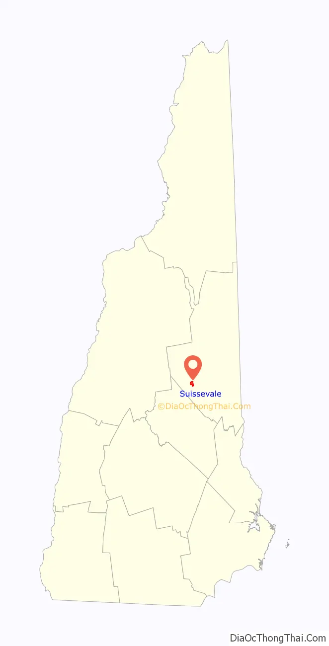
Suissevale location map. Where is Suissevale CDP?
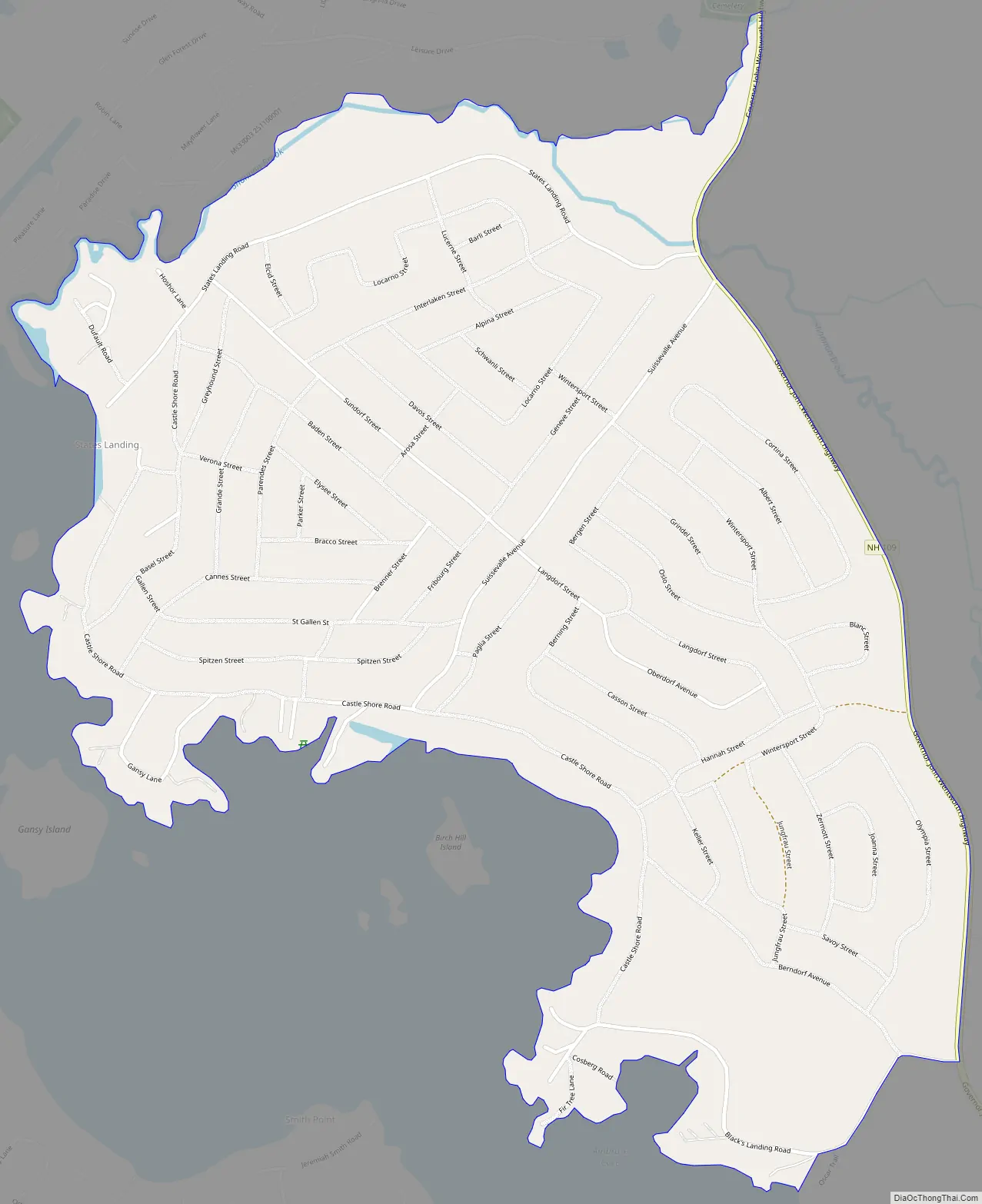
Suissevale Road Map
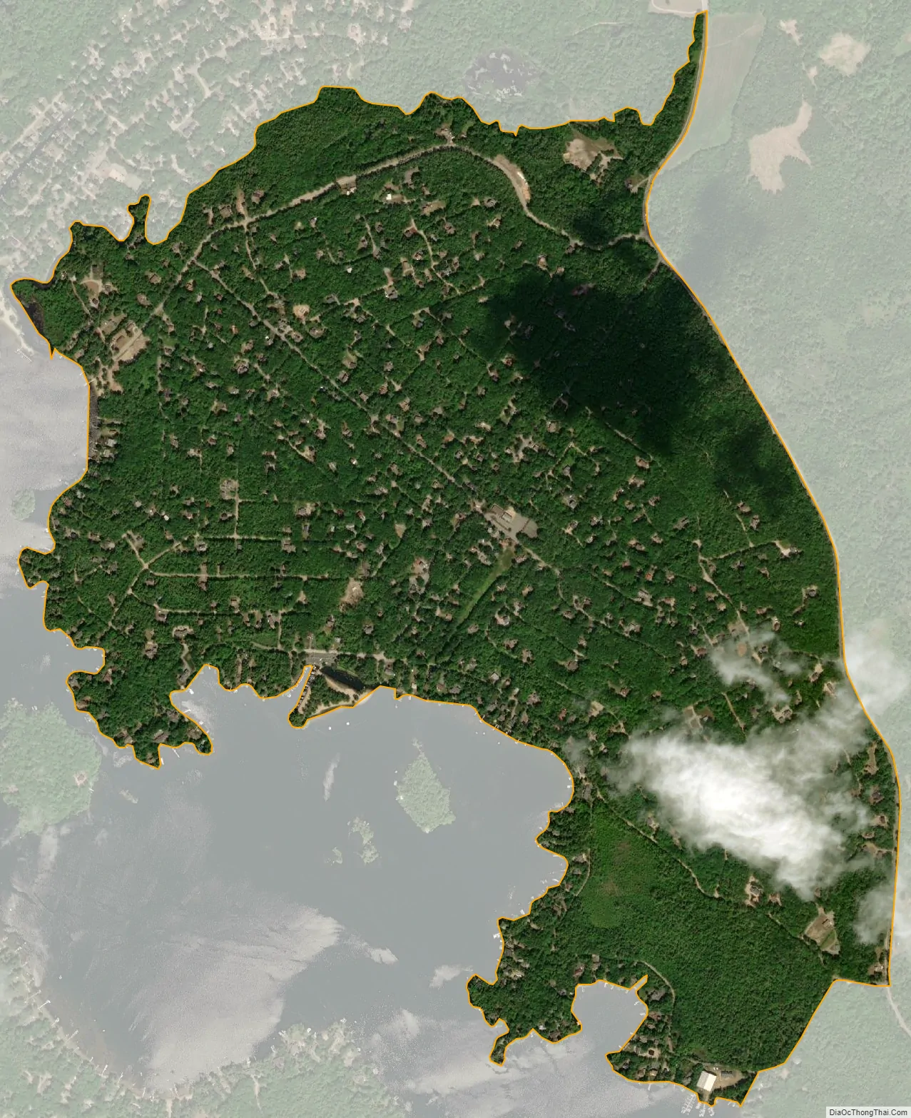
Suissevale city Satellite Map
Geography
Suissevale is in the east-central part of the town of Moultonborough, built on Birch Hill, which rises 180 feet (55 m) above Moultonborough Bay to an elevation of 692 feet (211 m) above sea level. Route 109 runs along the eastern edge of the community, leading northwest 3 miles (5 km) to Moultonborough village and southeast 14 miles (23 km) to Wolfeboro.
According to the U.S. Census Bureau, the Suissevale CDP has a total area of 1.2 square miles (3.1 km), of which 0.004 square miles (0.01 km), or 0.40%, are water.
See also
Map of New Hampshire State and its subdivision: Map of other states:- Alabama
- Alaska
- Arizona
- Arkansas
- California
- Colorado
- Connecticut
- Delaware
- District of Columbia
- Florida
- Georgia
- Hawaii
- Idaho
- Illinois
- Indiana
- Iowa
- Kansas
- Kentucky
- Louisiana
- Maine
- Maryland
- Massachusetts
- Michigan
- Minnesota
- Mississippi
- Missouri
- Montana
- Nebraska
- Nevada
- New Hampshire
- New Jersey
- New Mexico
- New York
- North Carolina
- North Dakota
- Ohio
- Oklahoma
- Oregon
- Pennsylvania
- Rhode Island
- South Carolina
- South Dakota
- Tennessee
- Texas
- Utah
- Vermont
- Virginia
- Washington
- West Virginia
- Wisconsin
- Wyoming