Union is a village and census-designated place (CDP) in the town of Wakefield, Carroll County, New Hampshire, United States. It had a population of 196 at the 2020 census.
Union has a separate ZIP code (03887) from the rest of the town of Wakefield.
| Name: | Union CDP |
|---|---|
| LSAD Code: | 57 |
| LSAD Description: | CDP (suffix) |
| State: | New Hampshire |
| County: | Carroll County |
| Elevation: | 486 ft (148 m) |
| Total Area: | 0.31 sq mi (0.81 km²) |
| Land Area: | 0.31 sq mi (0.81 km²) |
| Water Area: | 0.00 sq mi (0.00 km²) |
| Total Population: | 196 |
| Population Density: | 630.23/sq mi (243.47/km²) |
| ZIP code: | 03887 |
| Area code: | 603 |
| FIPS code: | 3377780 |
| GNISfeature ID: | 0870569 |
Online Interactive Map
Click on ![]() to view map in "full screen" mode.
to view map in "full screen" mode.
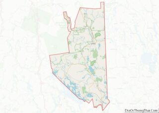
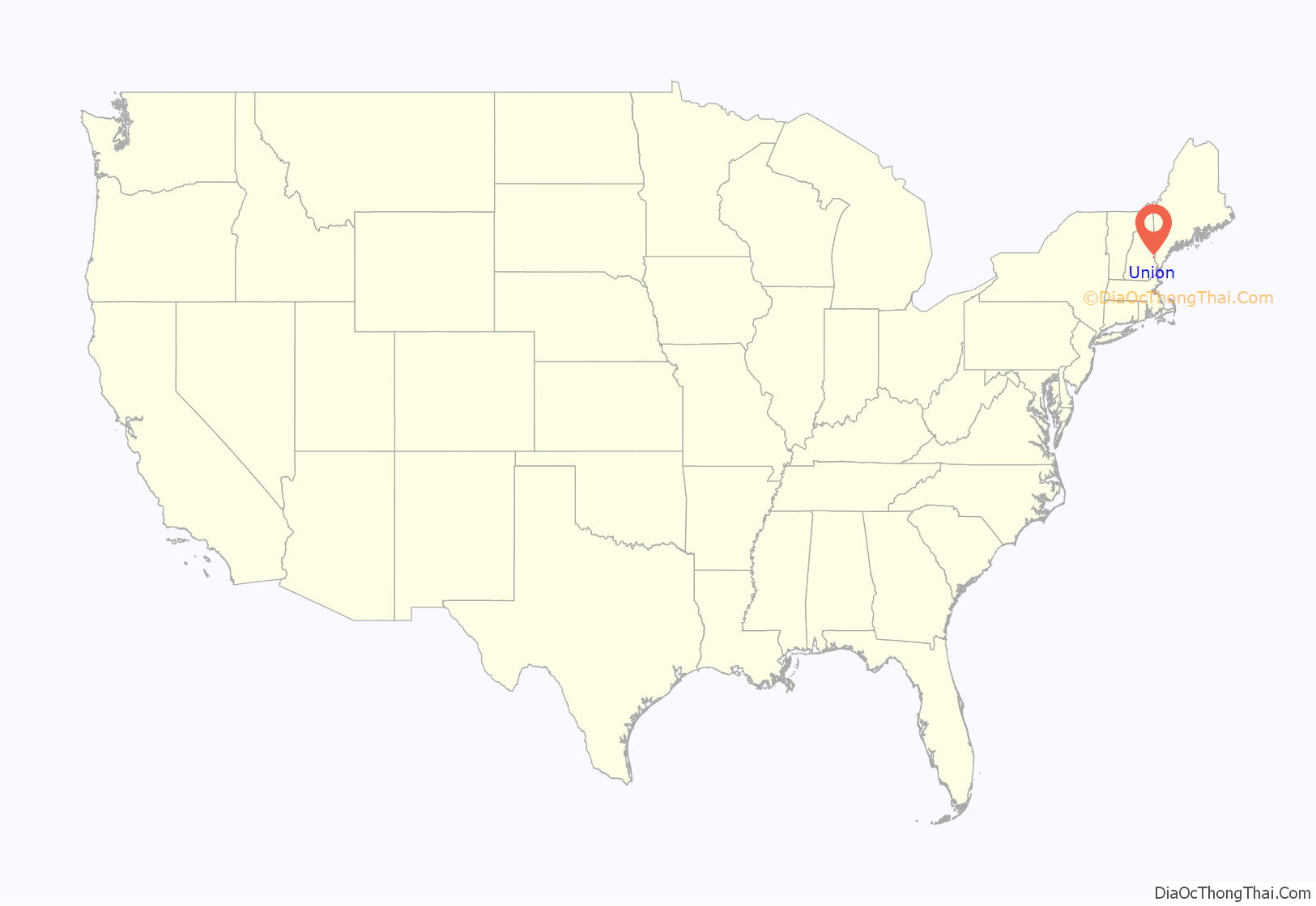
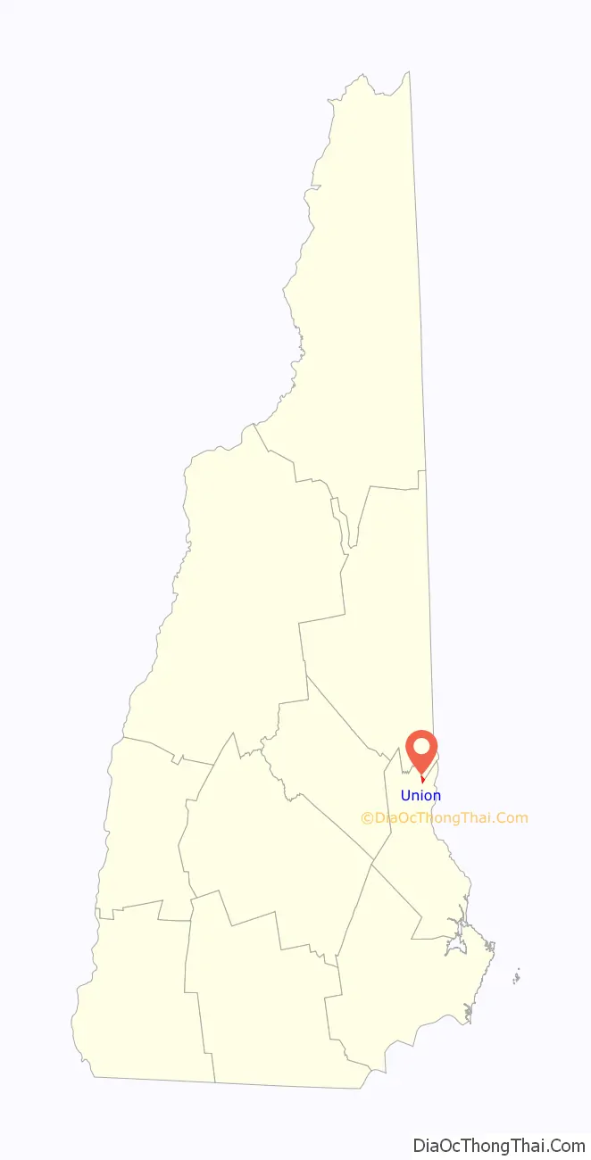
Union location map. Where is Union CDP?
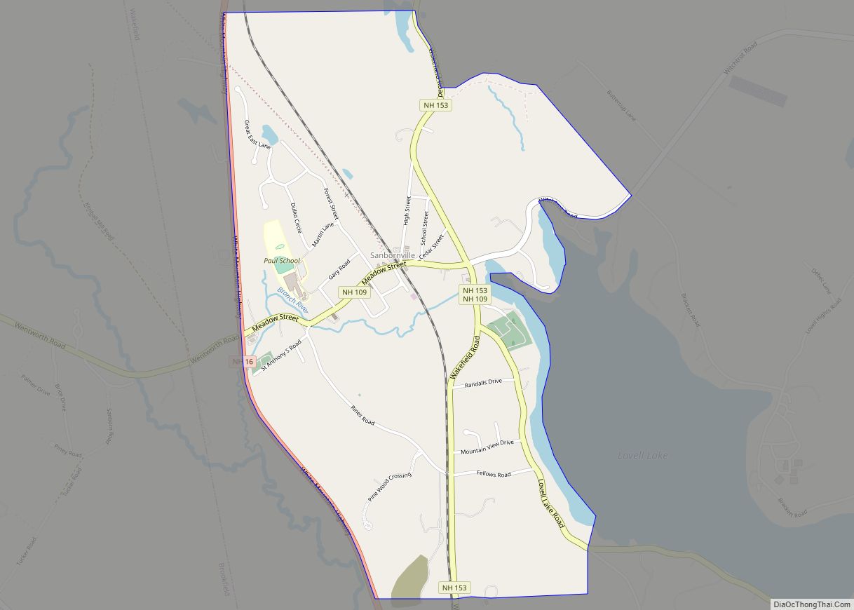
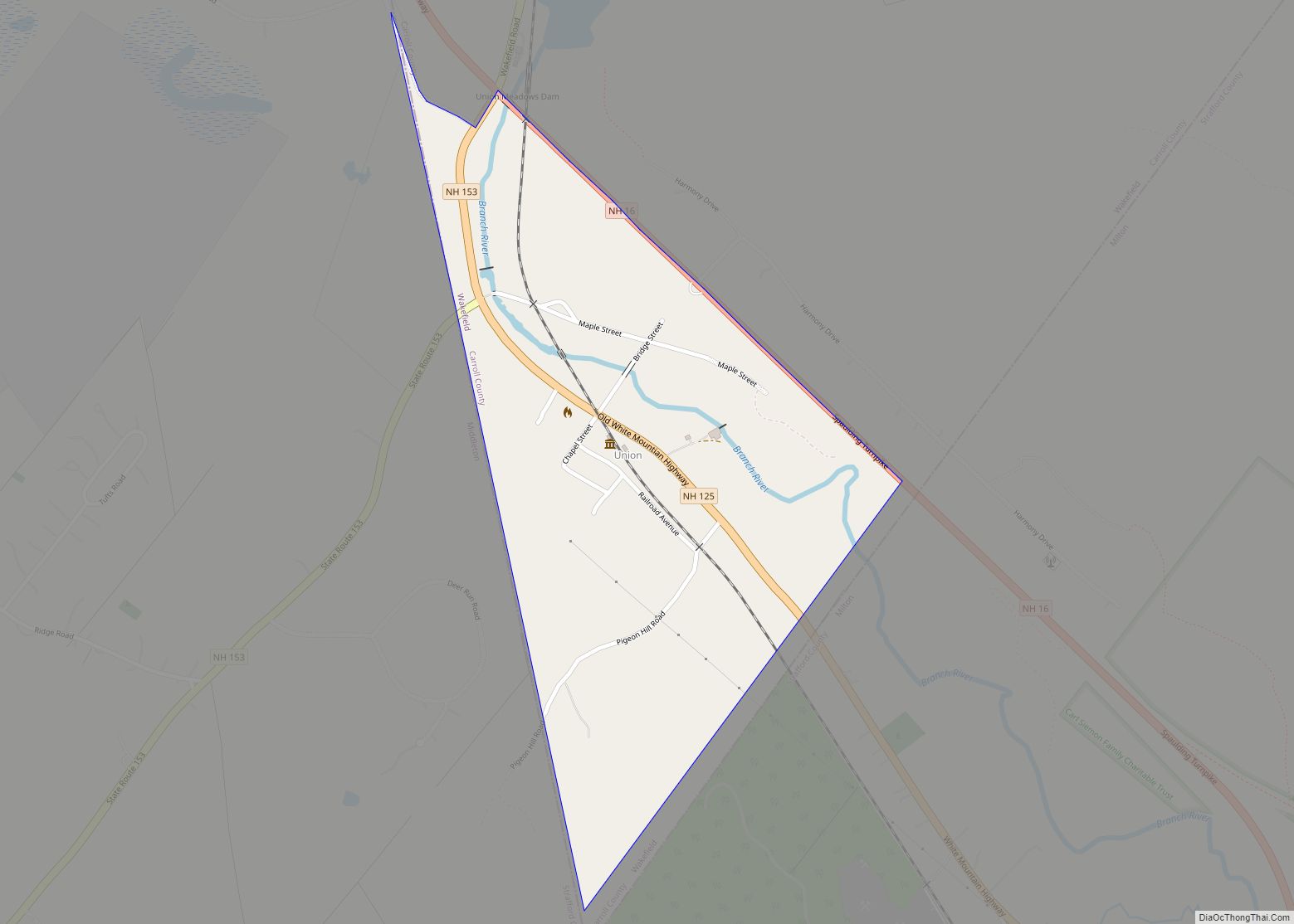
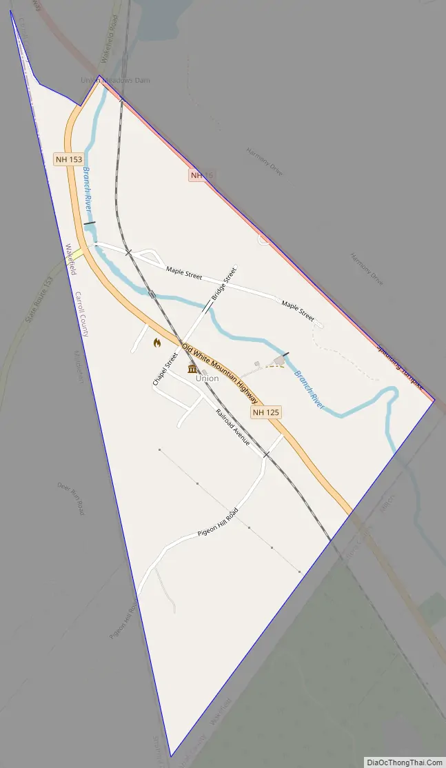
Union Road Map
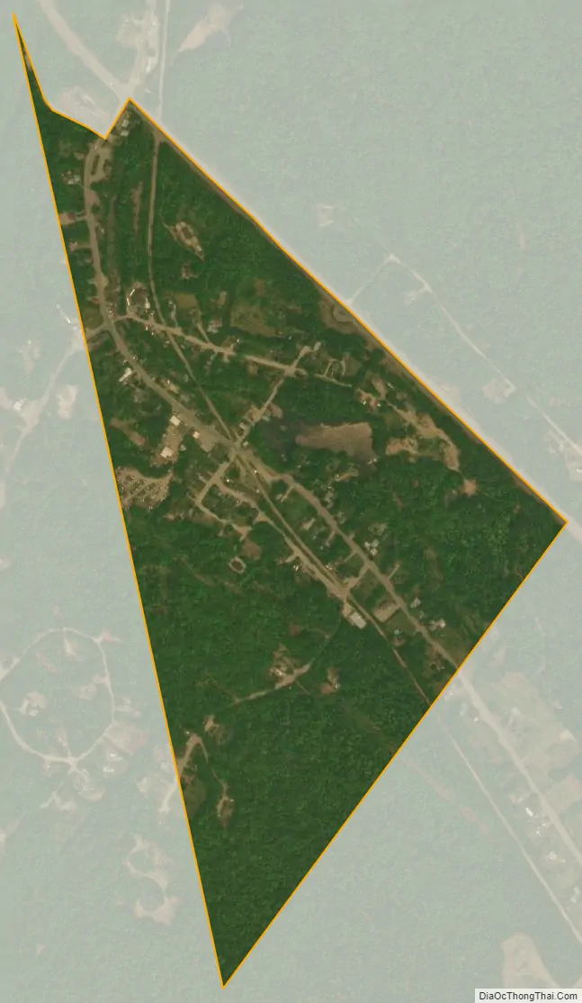
Union city Satellite Map
Geography
Union is in the southern corner of the town of Wakefield, along the Branch River, a tributary of the Salmon Falls River. It is bordered to the west by the town of Middleton and to the southeast by the town of Milton, both in Strafford County. New Hampshire Route 16 forms the northeastern edge of the CDP; the highway leads north 16 miles (26 km) to Ossipee and south 15 miles (24 km) to Rochester. New Hampshire Route 153 passes through the northern part of the village, leading north 4.5 miles (7.2 km) to Sanbornville and southwest 8 miles (13 km) to Farmington. New Hampshire Route 125 has its northern terminus in Union at Route 16, and leads southeast 5 miles (8 km) to Milton.
According to the U.S. Census Bureau, the Union CDP has a total area of 0.31 square miles (0.81 km), all of it recorded as land.
See also
Map of New Hampshire State and its subdivision: Map of other states:- Alabama
- Alaska
- Arizona
- Arkansas
- California
- Colorado
- Connecticut
- Delaware
- District of Columbia
- Florida
- Georgia
- Hawaii
- Idaho
- Illinois
- Indiana
- Iowa
- Kansas
- Kentucky
- Louisiana
- Maine
- Maryland
- Massachusetts
- Michigan
- Minnesota
- Mississippi
- Missouri
- Montana
- Nebraska
- Nevada
- New Hampshire
- New Jersey
- New Mexico
- New York
- North Carolina
- North Dakota
- Ohio
- Oklahoma
- Oregon
- Pennsylvania
- Rhode Island
- South Carolina
- South Dakota
- Tennessee
- Texas
- Utah
- Vermont
- Virginia
- Washington
- West Virginia
- Wisconsin
- Wyoming