Wilton is a census-designated place (CDP) and the main village in the town of Wilton, Hillsborough County, New Hampshire, United States. The CDP extends east into the town of Milford as well. The population of the CDP was 1,324 at the 2020 census, up from 1,163 at the 2010 census.
| Name: | Wilton CDP |
|---|---|
| LSAD Code: | 57 |
| LSAD Description: | CDP (suffix) |
| State: | New Hampshire |
| County: | Hillsborough County |
| Elevation: | 380 ft (120 m) |
| Total Area: | 2.11 sq mi (5.46 km²) |
| Land Area: | 2.11 sq mi (5.46 km²) |
| Water Area: | 0.00 sq mi (0.00 km²) |
| Total Population: | 1,324 |
| Population Density: | 628.08/sq mi (242.54/km²) |
| ZIP code: | 03086 (Wilton) 03055 (Milford) |
| Area code: | 603 |
| FIPS code: | 3385140 |
| GNISfeature ID: | 2378096 |
Online Interactive Map
Click on ![]() to view map in "full screen" mode.
to view map in "full screen" mode.
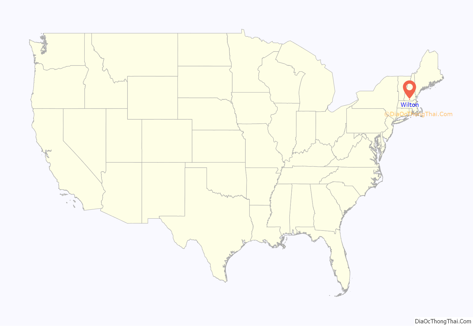
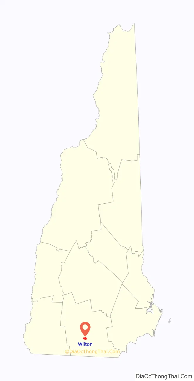
Wilton location map. Where is Wilton CDP?
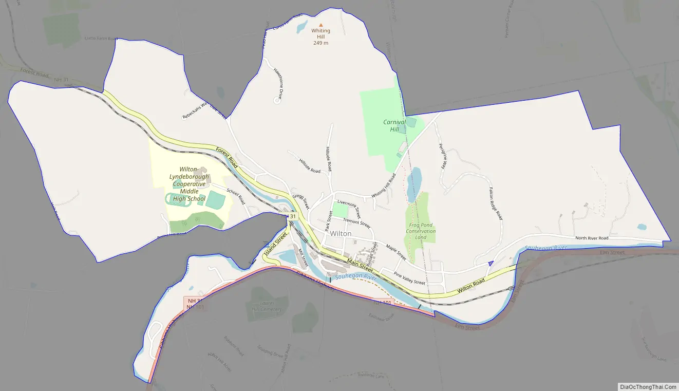
Wilton Road Map
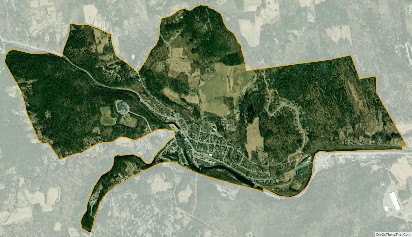
Wilton city Satellite Map
Geography
The CDP occupies the northeast part of the town of Wilton, along the Souhegan River where it is joined from the northwest by Stony Brook. It extends west out Sand Hill Road as far as Holt Road and is bordered to the north in Wilton by Curtis Farm Road, Dale Street, and Pead Hill Road. The CDP extends east into the northwest corner of the town of Milford, where it is bordered to the north by the town of Lyndeborough and to the south by the Souhegan River. It extends east as far as the former bridge across the Souhegan near Jones Road.
New Hampshire Route 101 runs along the southern edge of the CDP, leading east and northeast 18 miles (29 km) to Bedford and west 13 miles (21 km) to Peterborough. New Hampshire Route 31 passes through the center of the village, leading northwest up the Stony Creek valley 10 miles (16 km) to Greenfield, and southwest up the Souhegan River valley 7 miles (11 km) to Greenville. The city of Nashua is 15 miles (24 km) to the east via Routes 101 and 101A.
According to the U.S. Census Bureau, the Wilton CDP has a total area of 2.1 square miles (5.5 km), all of it recorded as land.
See also
Map of New Hampshire State and its subdivision: Map of other states:- Alabama
- Alaska
- Arizona
- Arkansas
- California
- Colorado
- Connecticut
- Delaware
- District of Columbia
- Florida
- Georgia
- Hawaii
- Idaho
- Illinois
- Indiana
- Iowa
- Kansas
- Kentucky
- Louisiana
- Maine
- Maryland
- Massachusetts
- Michigan
- Minnesota
- Mississippi
- Missouri
- Montana
- Nebraska
- Nevada
- New Hampshire
- New Jersey
- New Mexico
- New York
- North Carolina
- North Dakota
- Ohio
- Oklahoma
- Oregon
- Pennsylvania
- Rhode Island
- South Carolina
- South Dakota
- Tennessee
- Texas
- Utah
- Vermont
- Virginia
- Washington
- West Virginia
- Wisconsin
- Wyoming