Wolfeboro is a census-designated place (CDP) in the town of Wolfeboro in Carroll County, New Hampshire, United States. It consists of the main village of Wolfeboro within the town, as well as the smaller village of Wolfeboro Falls. The population of the CDP was 3,300 at the 2020 census, out of 6,416 in the entire town of Wolfeboro.
| Name: | Wolfeboro CDP |
|---|---|
| LSAD Code: | 57 |
| LSAD Description: | CDP (suffix) |
| State: | New Hampshire |
| County: | Carroll County |
| Elevation: | 545 ft (166 m) |
| Total Area: | 8.19 sq mi (21.21 km²) |
| Land Area: | 7.86 sq mi (20.36 km²) |
| Water Area: | 0.33 sq mi (0.85 km²) |
| Total Population: | 3,300 |
| Population Density: | 419.79/sq mi (162.08/km²) |
| ZIP code: | 03894 (Wolfeboro) 03896 (Wolfeboro Falls) |
| Area code: | 603 |
| FIPS code: | 3386340 |
| GNISfeature ID: | 2378098 |
Online Interactive Map
Click on ![]() to view map in "full screen" mode.
to view map in "full screen" mode.
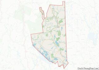
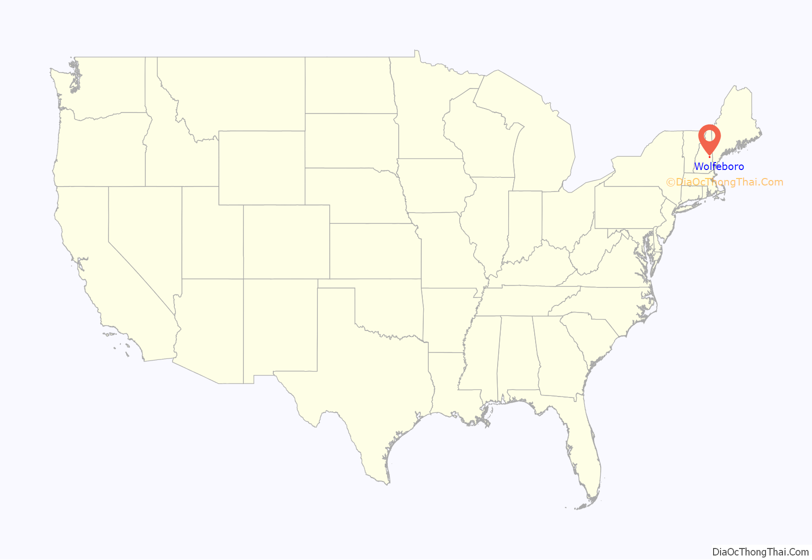
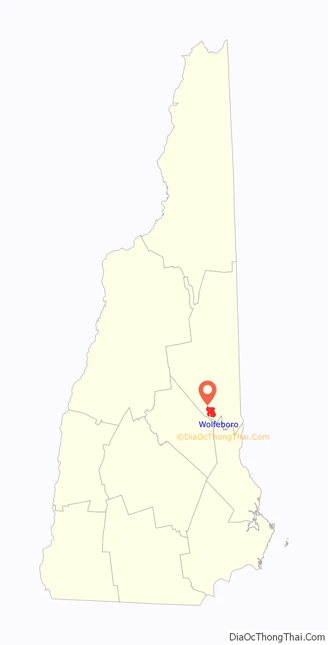
Wolfeboro location map. Where is Wolfeboro CDP?
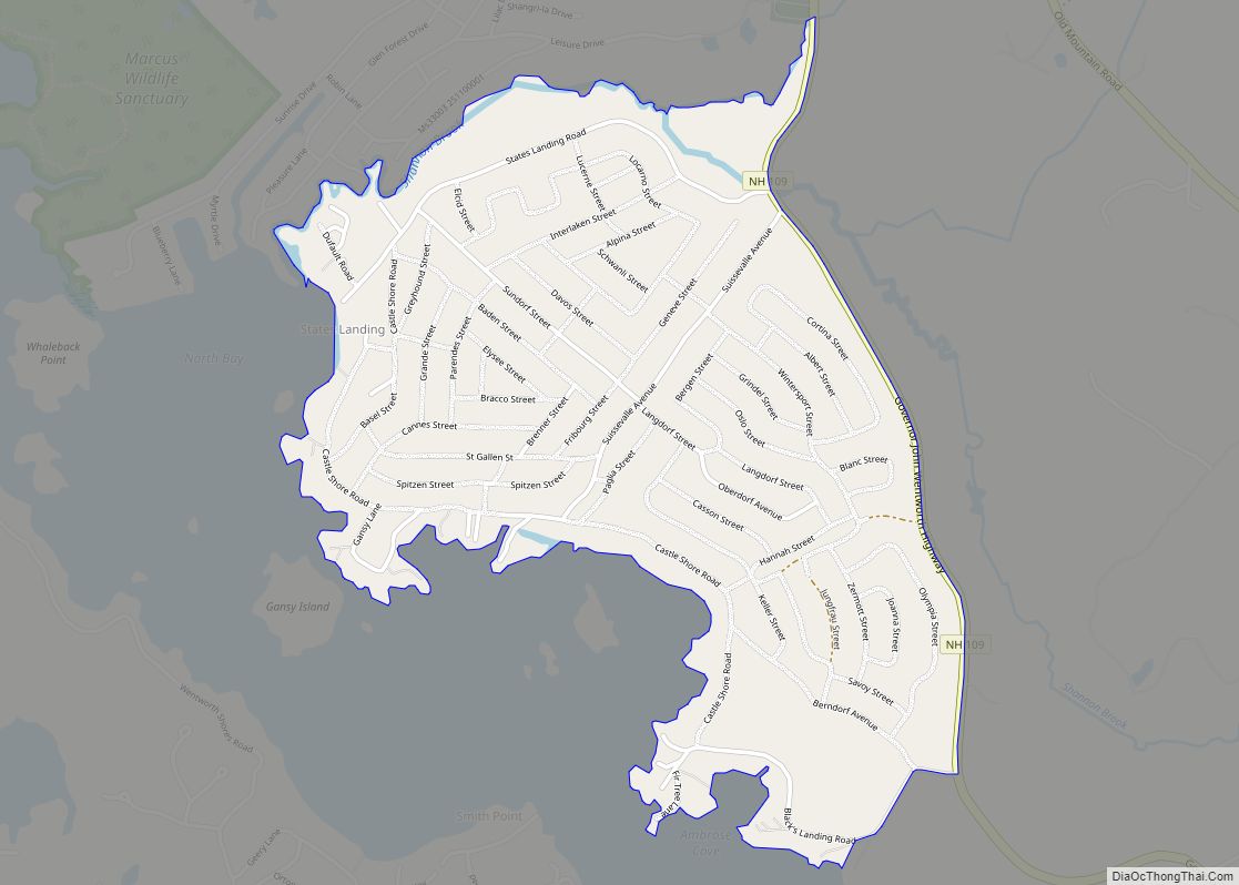
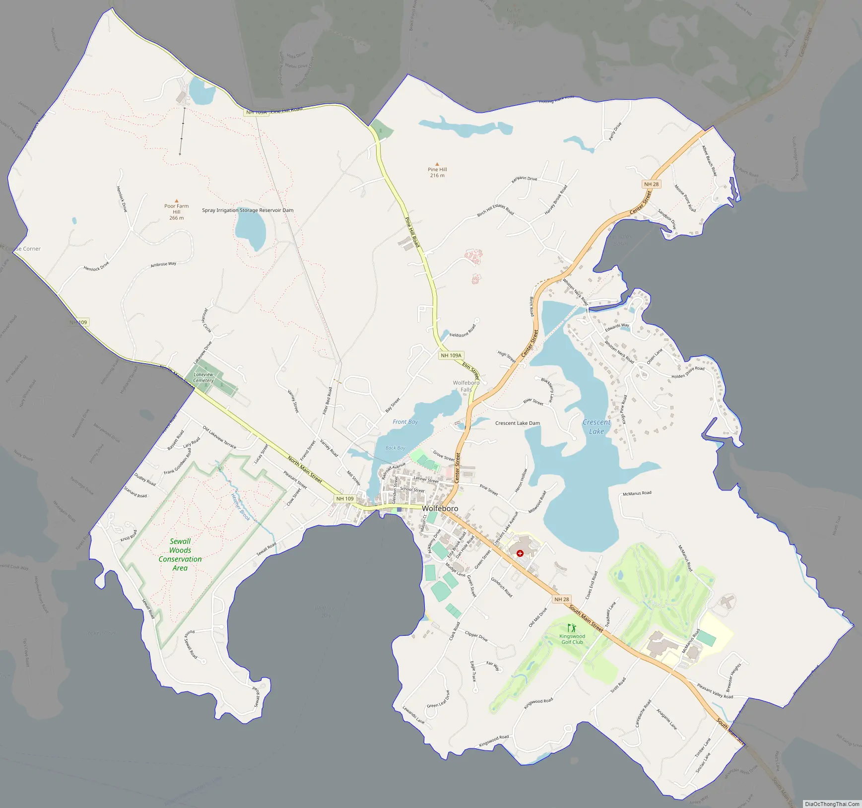
Wolfeboro Road Map
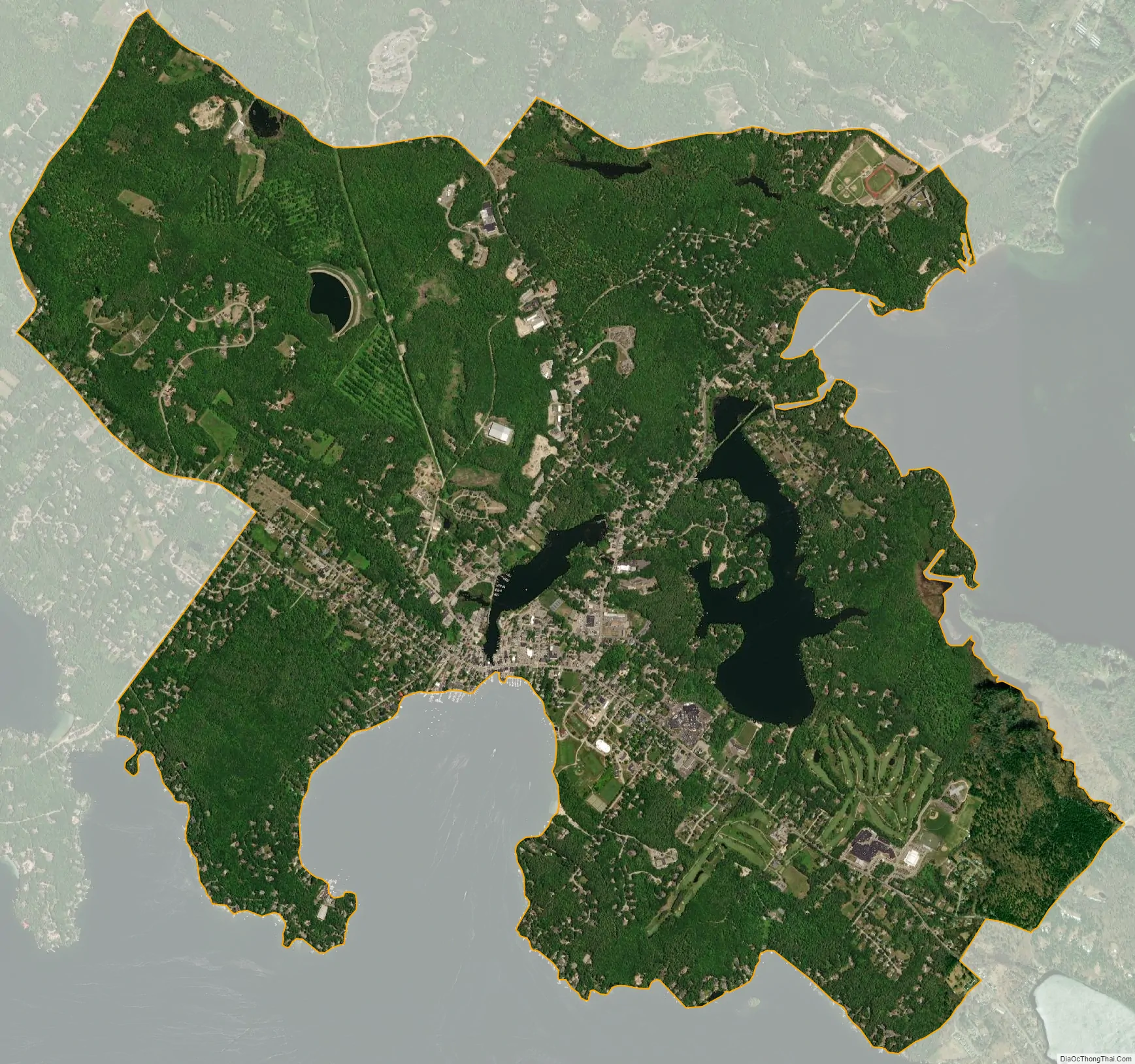
Wolfeboro city Satellite Map
Geography
The CDP is in the southern part of the town of Wolfeboro, between Lake Winnipesaukee to the south and Lake Wentworth to the northeast. New Hampshire Route 28 is the main highway through the village, entering from the southeast as Tuftonboro Road, then turning northeast on Center Street. NH 28 leads south 11 miles (18 km) to Alton and northeast 9 miles (14 km) to Ossipee. New Hampshire Route 109 enters Wolfeboro village from the west on North Main Street, then joins NH 28 to leave to the northeast on Center Street. NH 109 leads northwest 10 miles (16 km) to Melvin Village in the town of Tuftonboro and east 12 miles (19 km) to Sanbornville in the town of Wakefield. New Hampshire Route 109A (Elm Street) departs from NH 28/109 in Wolfeboro Falls, leading northwest 17 miles (27 km) to Moultonborough.
The Wolfeboro CDP is bordered to the south by Winter Harbor and Wolfeboro Bay of Lake Winnipesaukee, from Keewaydin Road in the west to a line between Sinclair Lane and Mountain West Drive in the east. The eastern edge of the CDP follows Cross Road and Pleasant Valley Road northeast to Heath Brook, then follows the brook northwest downstream to Lake Wentworth. The CDP border follows the western shore of Lake Wentworth north to Hodges Road, then follows Trotting Track Road west to Beach Pond Road, and south to NH 109A. The western edge of the CDP is Waumbeck Road from NH 109A south to a brook just north of NH 109, then follows the brook west to Keewaydin Road.
According to the U.S. Census Bureau, the Wolfeboro CDP has a total area of 8.2 square miles (21.2 km), of which 7.9 square miles (20.4 km) are land and 0.3 square miles (0.9 km), or 4.02%, are water.
See also
Map of New Hampshire State and its subdivision: Map of other states:- Alabama
- Alaska
- Arizona
- Arkansas
- California
- Colorado
- Connecticut
- Delaware
- District of Columbia
- Florida
- Georgia
- Hawaii
- Idaho
- Illinois
- Indiana
- Iowa
- Kansas
- Kentucky
- Louisiana
- Maine
- Maryland
- Massachusetts
- Michigan
- Minnesota
- Mississippi
- Missouri
- Montana
- Nebraska
- Nevada
- New Hampshire
- New Jersey
- New Mexico
- New York
- North Carolina
- North Dakota
- Ohio
- Oklahoma
- Oregon
- Pennsylvania
- Rhode Island
- South Carolina
- South Dakota
- Tennessee
- Texas
- Utah
- Vermont
- Virginia
- Washington
- West Virginia
- Wisconsin
- Wyoming