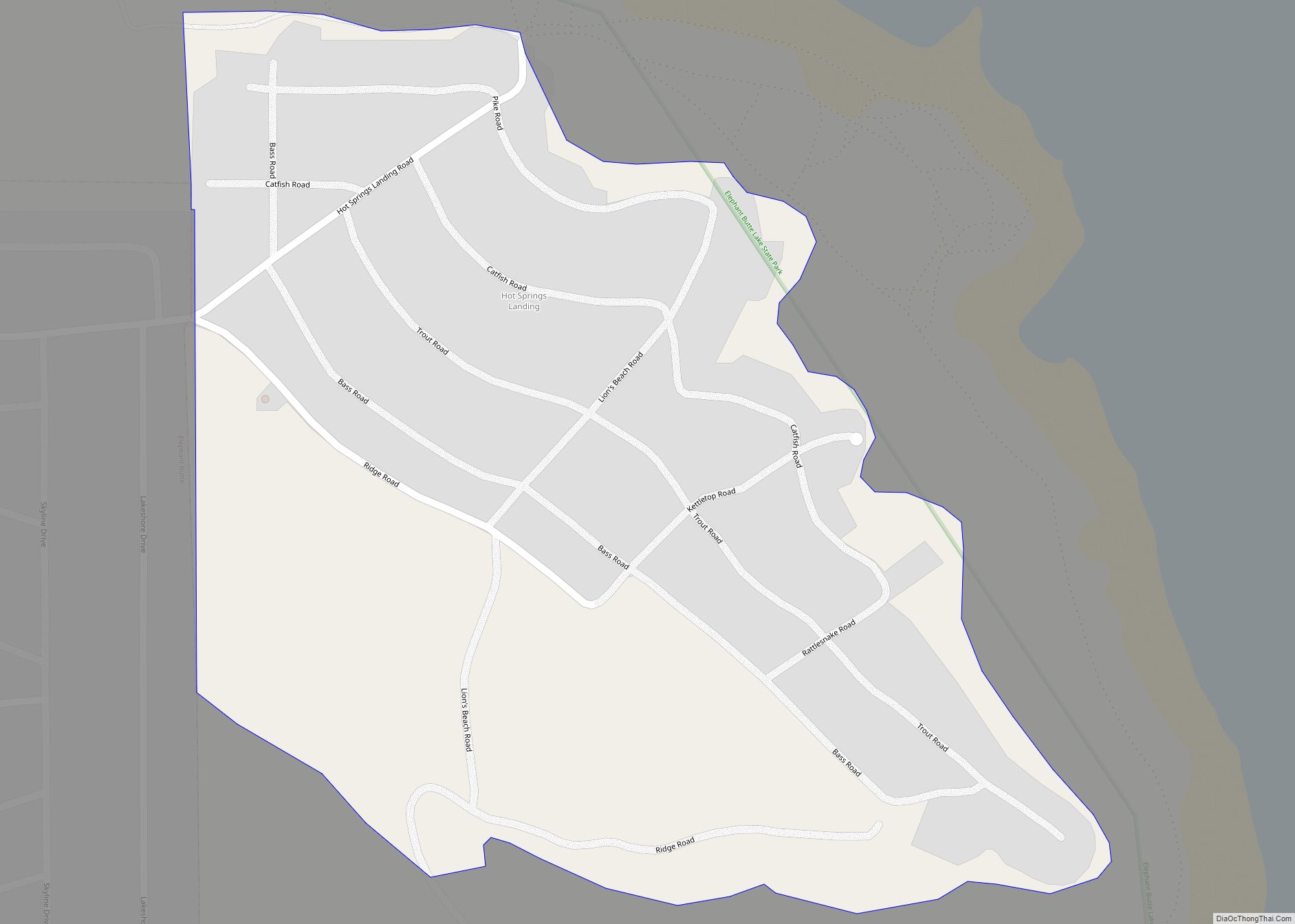
Elephant Butte is a city in Sierra County, New Mexico, United States, located near Elephant Butte Reservoir and Elephant Butte Lake State Park. The population was 1,431 at the time of the 2010 census.
| Name: | Elephant Butte city |
|---|---|
| LSAD Code: | 25 |
| LSAD Description: | city (suffix) |
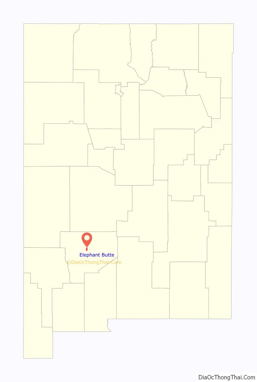
| State: | New Mexico |
| County: | Sierra County |
| Elevation: | 4,465 ft (1,361 m) |
| Total Area: | 4.19 sq mi (10.85 km²) |
| Land Area: | 4.18 sq mi (10.82 km²) |
| Water Area: | 0.01 sq mi (0.03 km²) |
| Total Population: | 1,447 |
| Population Density: | 346.26/sq mi (133.69/km²) |
| ZIP code: | 87935 |
| Area code: | 575 |
| FIPS code: | 3522720 |
| GNISfeature ID: | 0898770 |
| Website: | http://cityofelephantbutte.com/ |
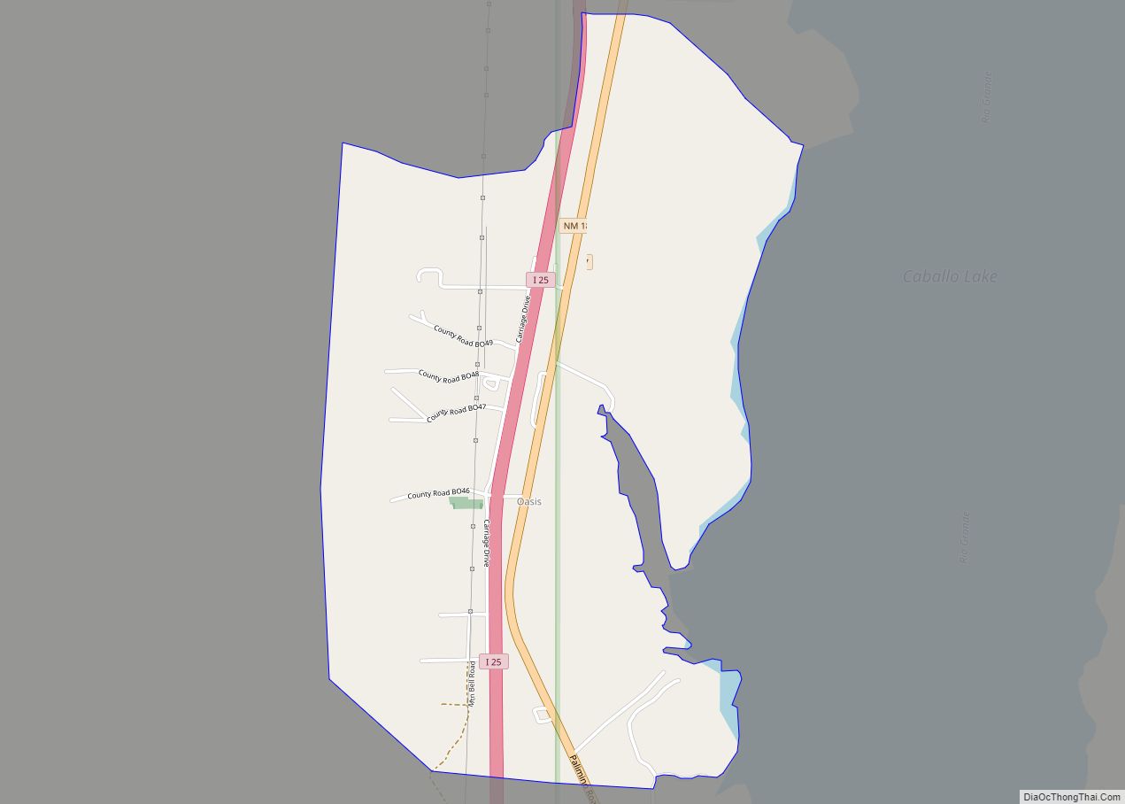
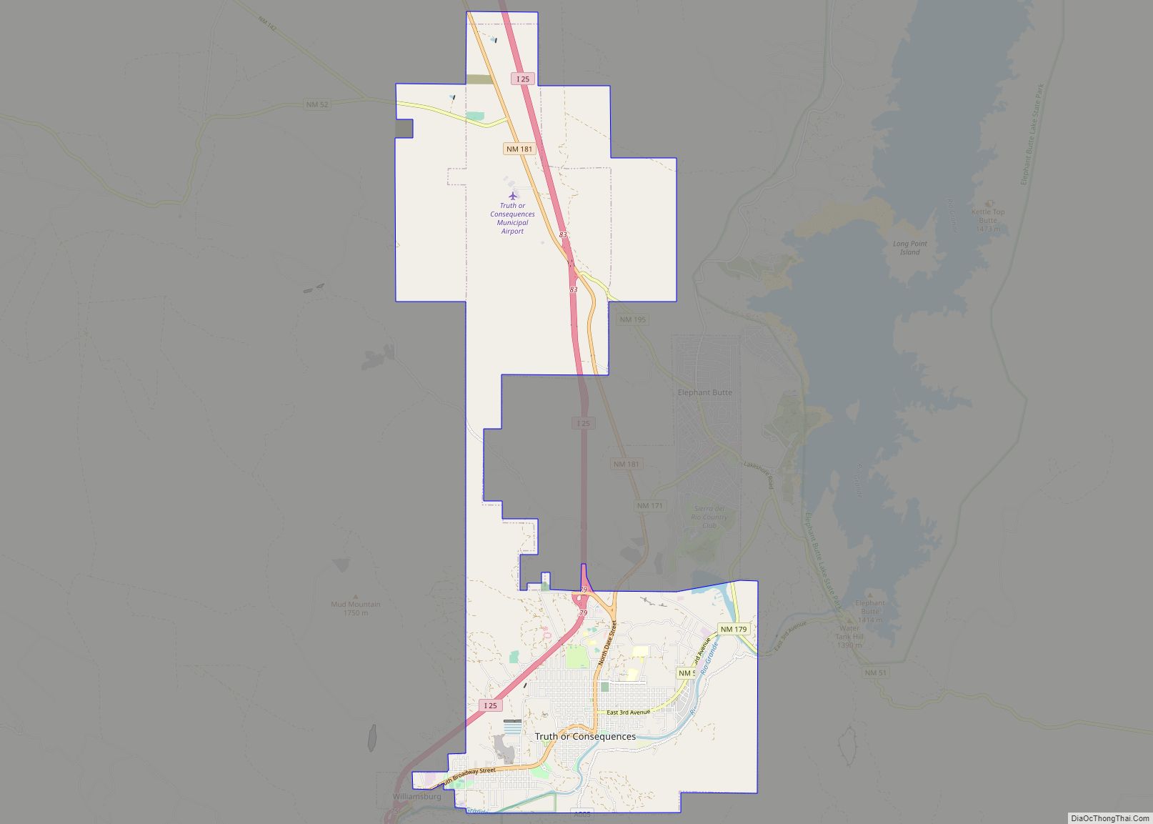
Online Interactive Map
Click on ![]() to view map in "full screen" mode.
to view map in "full screen" mode.
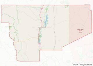
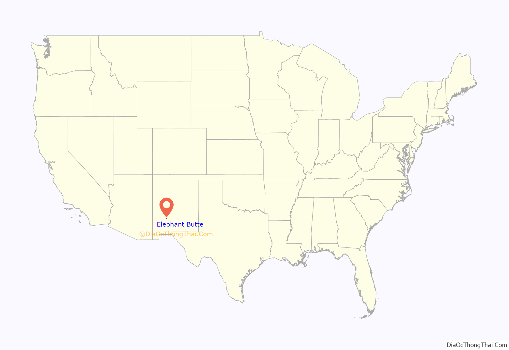
Elephant Butte location map. Where is Elephant Butte city?
History
Elephant Butte was named from Elephant Butte, a butte nearby thought to resemble an elephant.
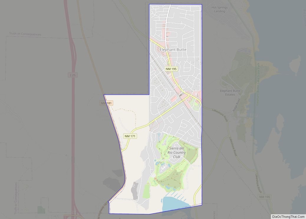
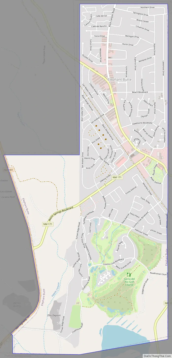
Elephant Butte Road Map
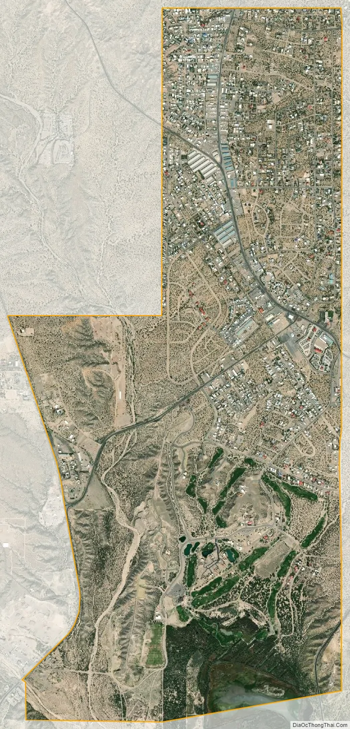
Elephant Butte city Satellite Map
Geography
Elephant Butte is located at 33°11′23″N 107°13′22″W / 33.18972°N 107.22278°W / 33.18972; -107.22278 (33.189809, -107.222873).
According to the United States Census Bureau, the city has a total area of 3.0 square miles (7.8 km), all land.
See also
Map of New Mexico State and its subdivision: Map of other states:- Alabama
- Alaska
- Arizona
- Arkansas
- California
- Colorado
- Connecticut
- Delaware
- District of Columbia
- Florida
- Georgia
- Hawaii
- Idaho
- Illinois
- Indiana
- Iowa
- Kansas
- Kentucky
- Louisiana
- Maine
- Maryland
- Massachusetts
- Michigan
- Minnesota
- Mississippi
- Missouri
- Montana
- Nebraska
- Nevada
- New Hampshire
- New Jersey
- New Mexico
- New York
- North Carolina
- North Dakota
- Ohio
- Oklahoma
- Oregon
- Pennsylvania
- Rhode Island
- South Carolina
- South Dakota
- Tennessee
- Texas
- Utah
- Vermont
- Virginia
- Washington
- West Virginia
- Wisconsin
- Wyoming