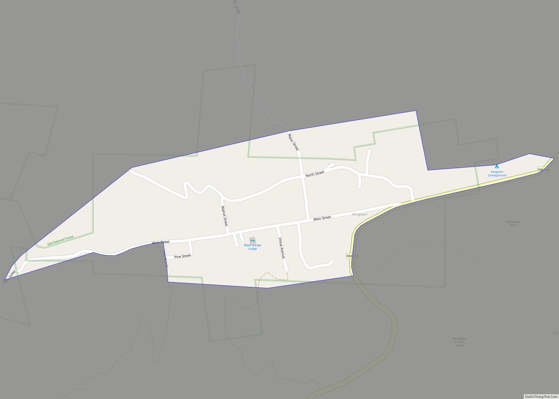
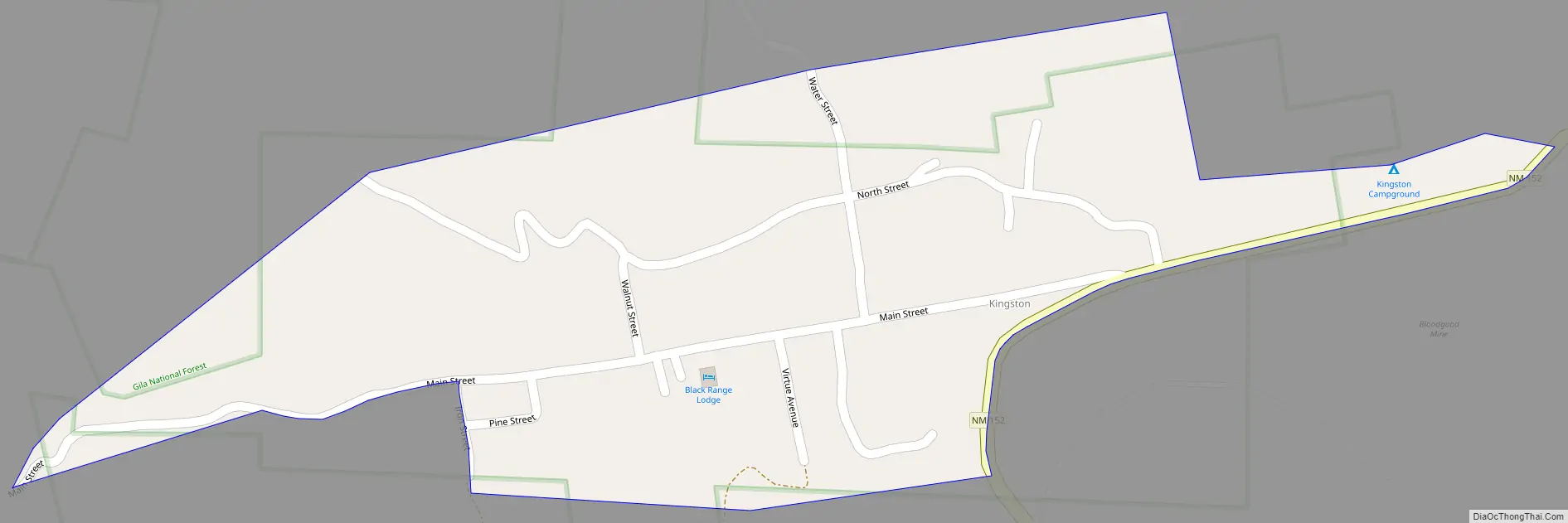
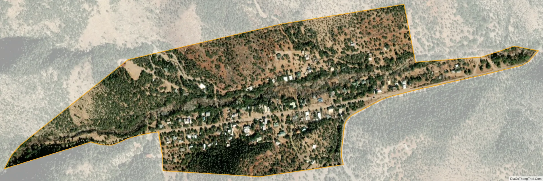
Kingston is a census-designated place (CDP) in Sierra County, New Mexico, United States. Its population was 32 as of the 2010 census. The community is located in the Black Range along New Mexico State Road 152.
| Name: | Kingston CDP |
|---|---|
| LSAD Code: | 57 |
| LSAD Description: | CDP (suffix) |
| State: | New Mexico |
| County: | Sierra County |
| Elevation: | 6,224 ft (1,897 m) |
| Total Area: | 0.20 sq mi (0.52 km²) |
| Land Area: | 0.20 sq mi (0.52 km²) |
| Water Area: | 0.00 sq mi (0.00 km²) |
| Total Population: | 50 |
| Population Density: | 251.26/sq mi (96.98/km²) |
| Area code: | 575 |
| FIPS code: | 3536090 |
| GNISfeature ID: | 907558 |
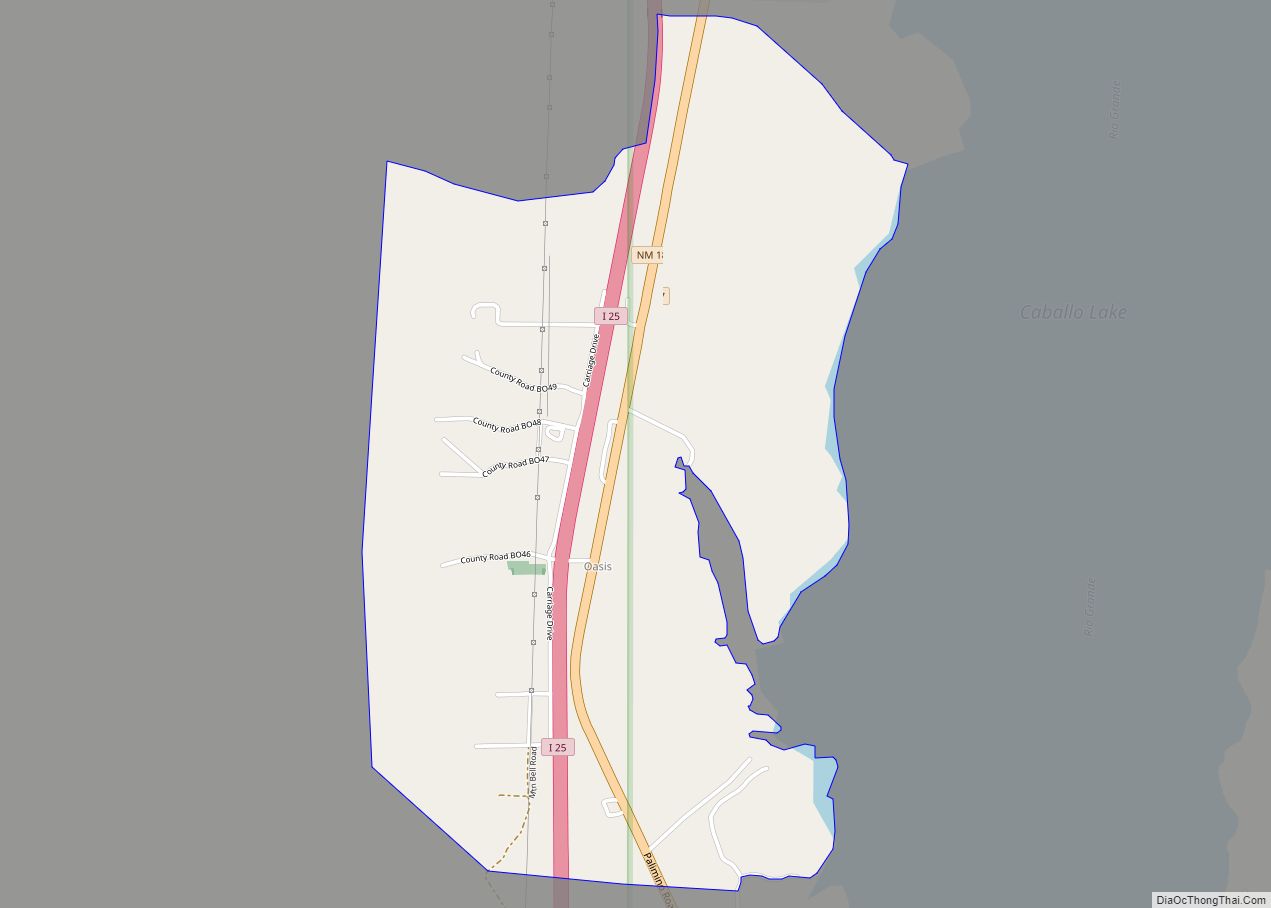
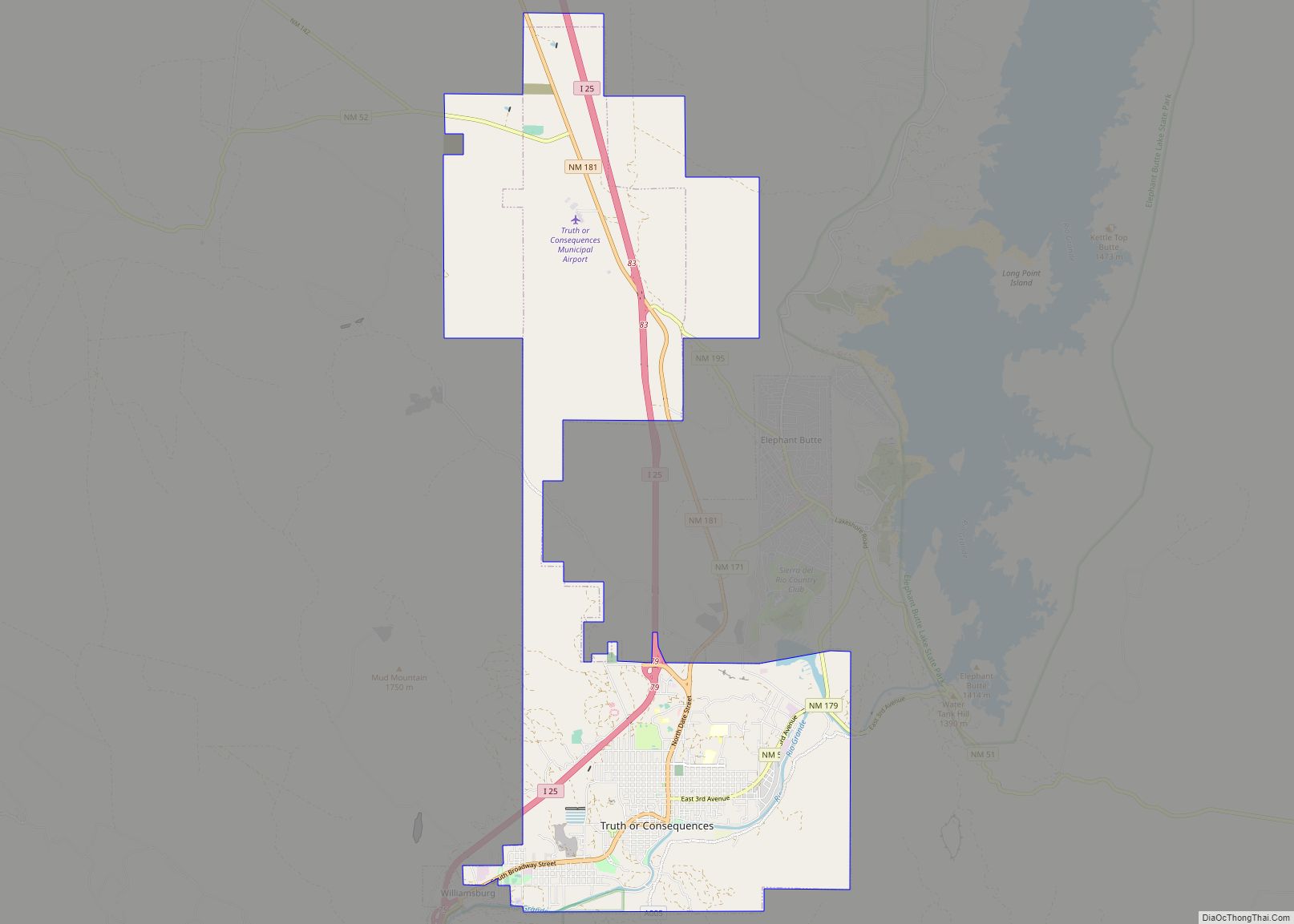
Online Interactive Map
Click on ![]() to view map in "full screen" mode.
to view map in "full screen" mode.
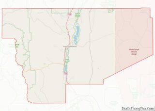
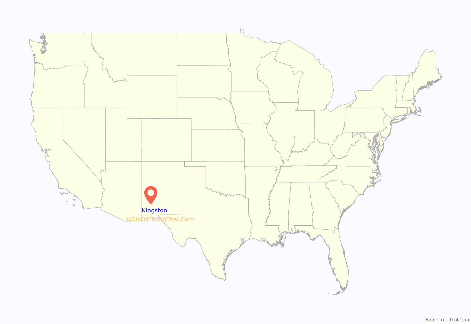
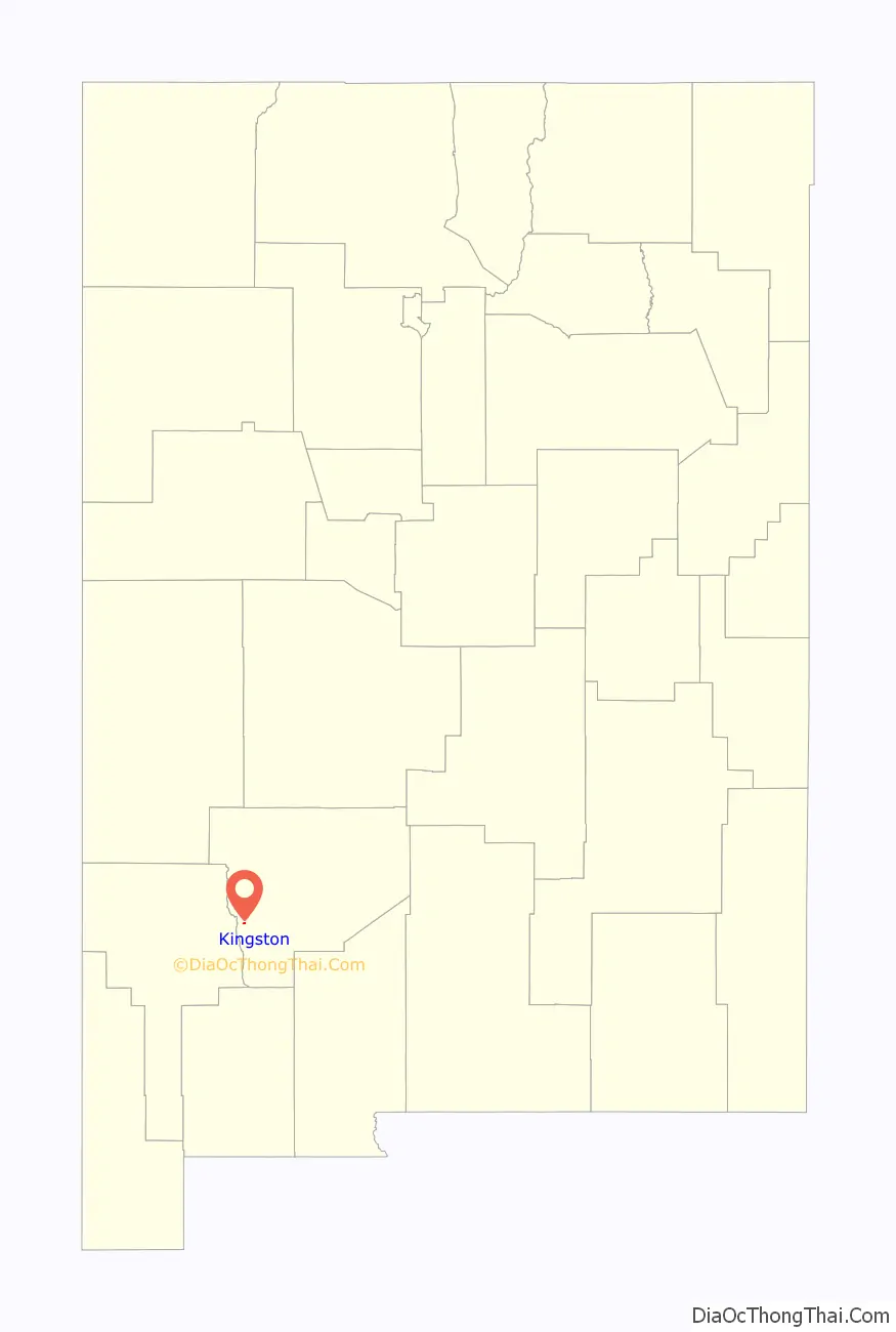
Kingston location map. Where is Kingston CDP?
History
Jack Sheddon discovered silver in what would become the Solitaire Mine in 1882. Originally called Percha City, Kingston was surveyed the same year and soon had a population of 1800. Lillian Russell once performed here.
The Depression of 1893 curtailed mining activities in the area, though there was a brief resurgence during World War II. By 1952 however, most production had ceased.
Kingston Road Map
Kingston city Satellite Map
Geography
Kingston is located at 32°55′02″N 107°42′34″W / 32.917334°N 107.709559°W / 32.917334; -107.709559. According to the U.S. Census Bureau, the community has an area of 0.199 square miles (0.52 km), all land.
See also
Map of New Mexico State and its subdivision: Map of other states:- Alabama
- Alaska
- Arizona
- Arkansas
- California
- Colorado
- Connecticut
- Delaware
- District of Columbia
- Florida
- Georgia
- Hawaii
- Idaho
- Illinois
- Indiana
- Iowa
- Kansas
- Kentucky
- Louisiana
- Maine
- Maryland
- Massachusetts
- Michigan
- Minnesota
- Mississippi
- Missouri
- Montana
- Nebraska
- Nevada
- New Hampshire
- New Jersey
- New Mexico
- New York
- North Carolina
- North Dakota
- Ohio
- Oklahoma
- Oregon
- Pennsylvania
- Rhode Island
- South Carolina
- South Dakota
- Tennessee
- Texas
- Utah
- Vermont
- Virginia
- Washington
- West Virginia
- Wisconsin
- Wyoming