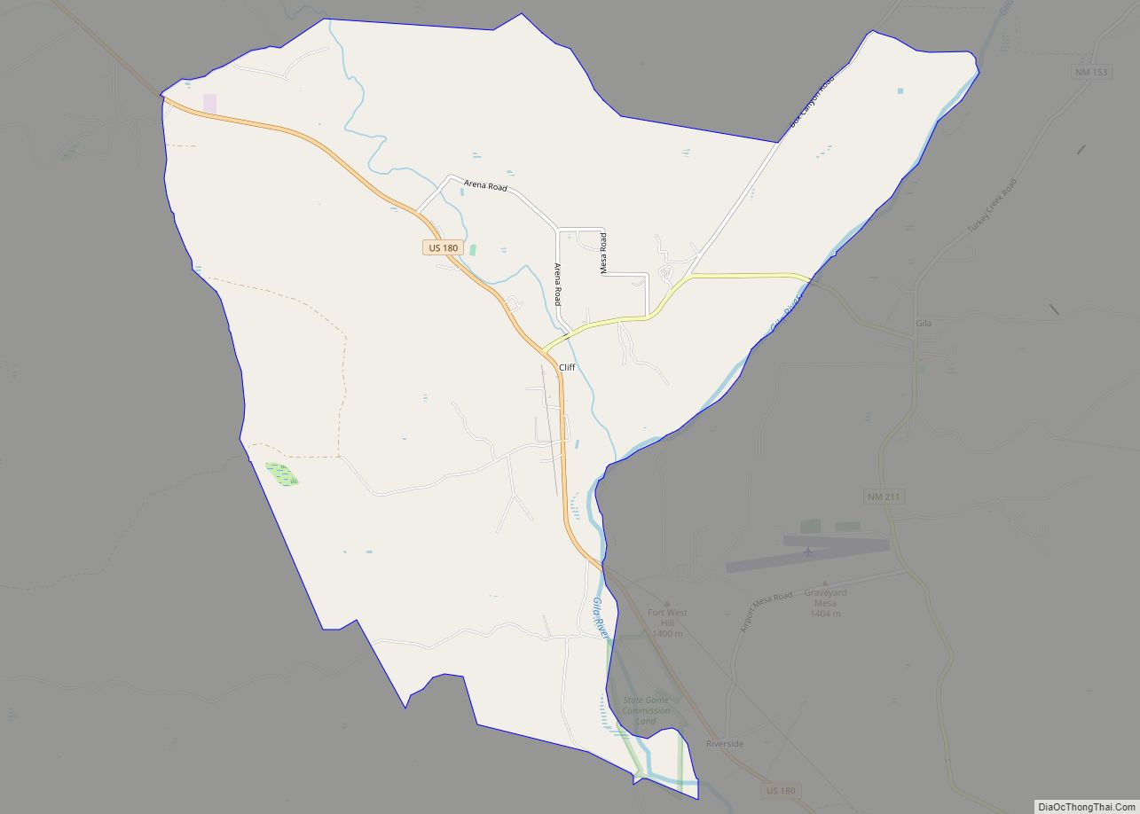
San Lorenzo is a census-designated place in Grant County, New Mexico, United States. San Lorenzo is 13 miles (21 km) east-northeast of Bayard. Its population was 97 as of the 2010 census. A post office operated from 1886 to 1963.
| Name: | San Lorenzo CDP |
|---|---|
| LSAD Code: | 57 |
| LSAD Description: | CDP (suffix) |
| State: | New Mexico |
| County: | Grant County |
| Elevation: | 5,732 ft (1,747 m) |
| Total Area: | 1.749 sq mi (4.53 km²) |
| Land Area: | 1.747 sq mi (4.52 km²) |
| Water Area: | 0.002 sq mi (0.005 km²) |
| Total Population: | 97 |
| Population Density: | 55/sq mi (21/km²) |
| Area code: | 575 |
| FIPS code: | 3568920 |
| GNISfeature ID: | 920693 |
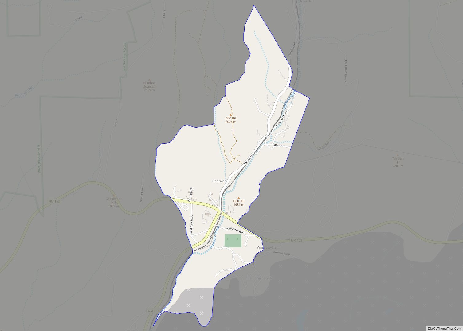
Online Interactive Map
Click on ![]() to view map in "full screen" mode.
to view map in "full screen" mode.
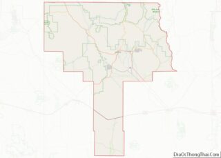
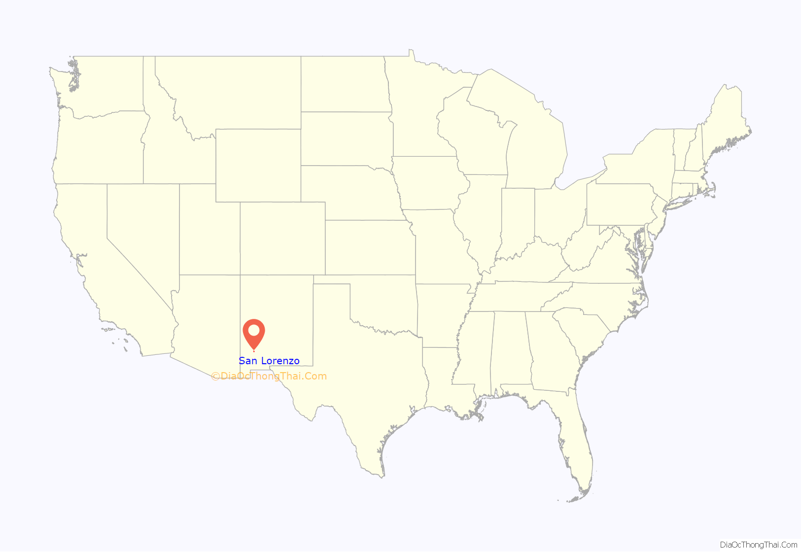
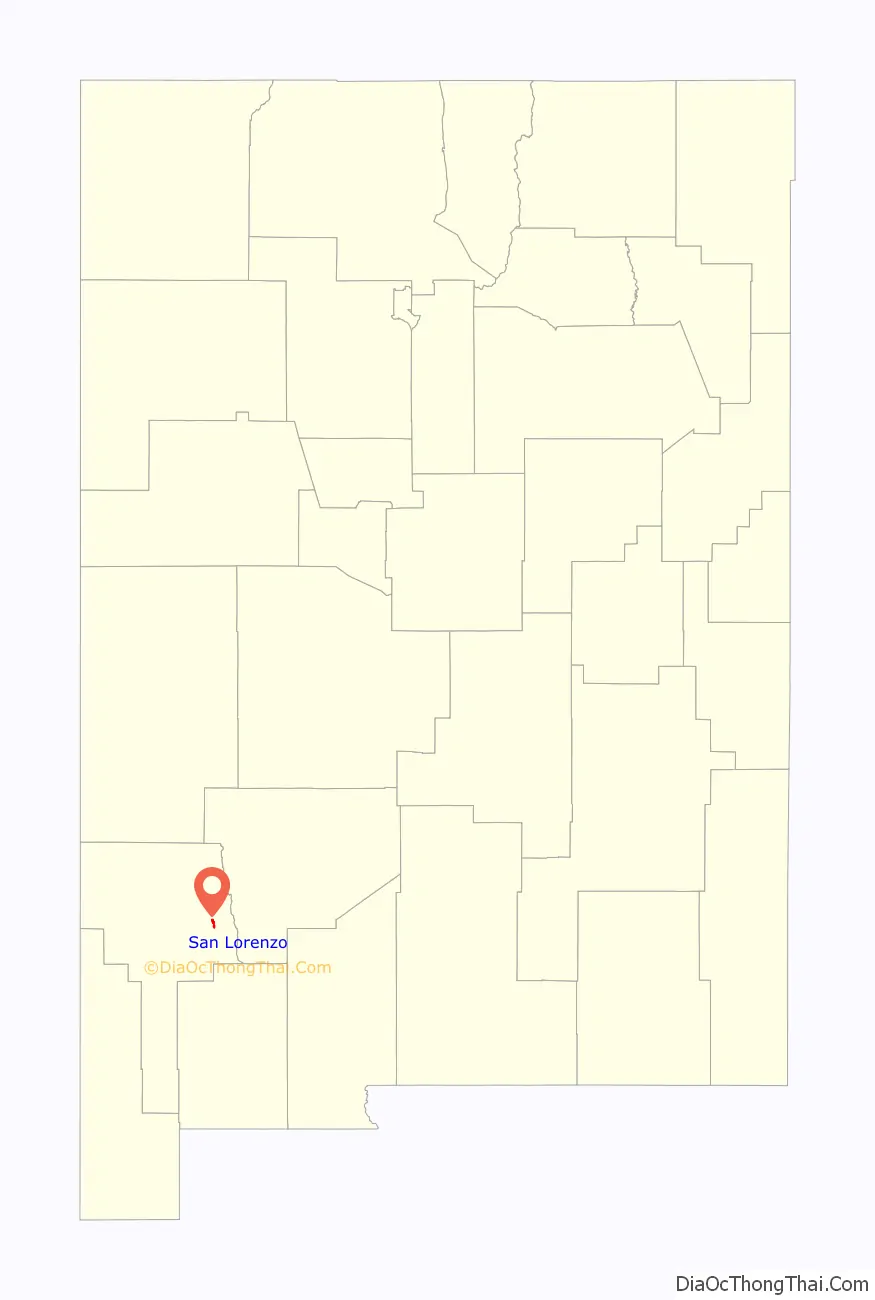
San Lorenzo location map. Where is San Lorenzo CDP?
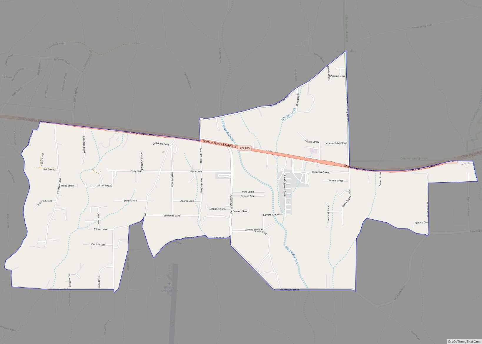
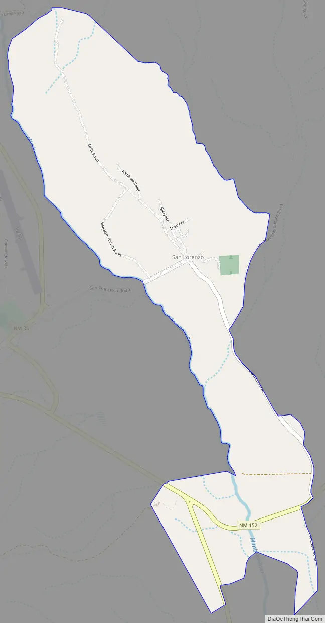
San Lorenzo Road Map
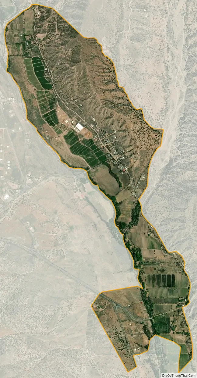
San Lorenzo city Satellite Map
See also
Map of New Mexico State and its subdivision: Map of other states:- Alabama
- Alaska
- Arizona
- Arkansas
- California
- Colorado
- Connecticut
- Delaware
- District of Columbia
- Florida
- Georgia
- Hawaii
- Idaho
- Illinois
- Indiana
- Iowa
- Kansas
- Kentucky
- Louisiana
- Maine
- Maryland
- Massachusetts
- Michigan
- Minnesota
- Mississippi
- Missouri
- Montana
- Nebraska
- Nevada
- New Hampshire
- New Jersey
- New Mexico
- New York
- North Carolina
- North Dakota
- Ohio
- Oklahoma
- Oregon
- Pennsylvania
- Rhode Island
- South Carolina
- South Dakota
- Tennessee
- Texas
- Utah
- Vermont
- Virginia
- Washington
- West Virginia
- Wisconsin
- Wyoming