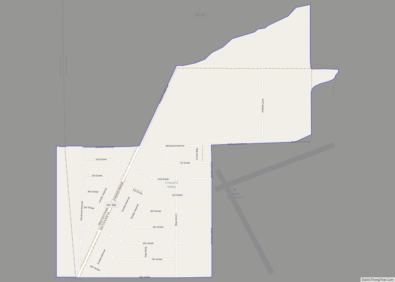
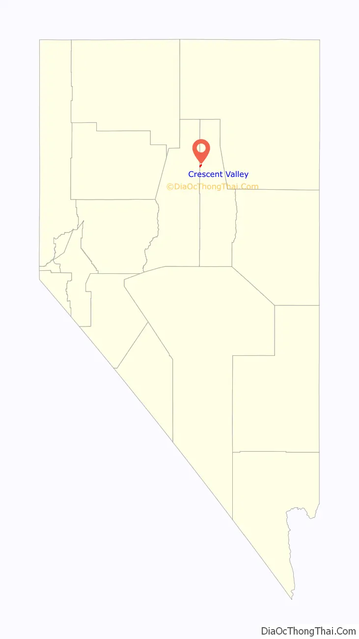
Crescent Valley is a census-designated place (CDP) in Eureka County, Nevada, United States, directly off Nevada State Route 306. It is the site of Crescent Valley Elementary School, Crescent Valley Fair Grounds, and Crescent Valley Community Park. The census-designated place (CDP) of Crescent Valley had a population of 483 as of the 2020 census.
Crescent Valley is part of the Elko Micropolitan Statistical Area.
| Name: | Crescent Valley CDP |
|---|---|
| LSAD Code: | 57 |
| LSAD Description: | CDP (suffix) |
| State: | Nevada |
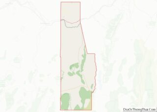
| County: | Eureka County |
| Elevation: | 4,810 ft (1,470 m) |
| Total Area: | 2.23 sq mi (5.78 km²) |
| Land Area: | 2.23 sq mi (5.78 km²) |
| Water Area: | 0.00 sq mi (0.00 km²) |
| Total Population: | 512 |
| Population Density: | 229.60/sq mi (88.66/km²) |
| ZIP code: | 89821 |
| Area code: | 775 |
| FIPS code: | 3216300 |
| GNISfeature ID: | 2583914 |
Online Interactive Map
Click on ![]() to view map in "full screen" mode.
to view map in "full screen" mode.
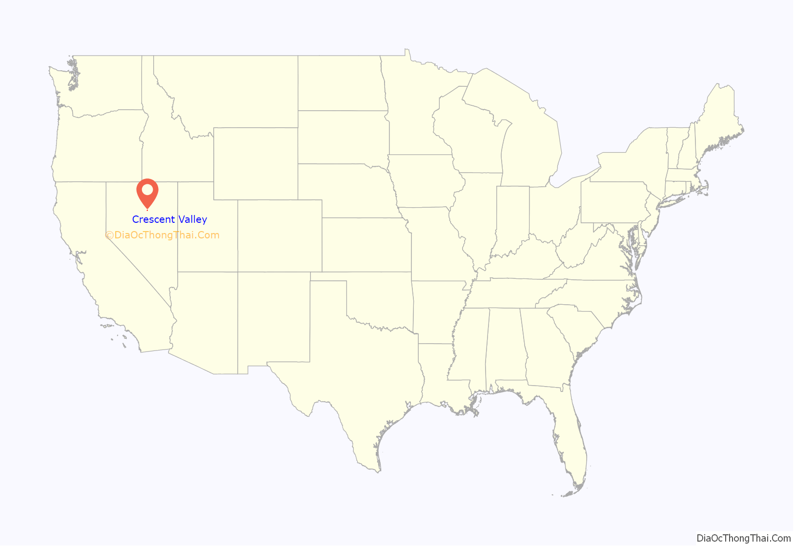
Crescent Valley location map. Where is Crescent Valley CDP?
History
A post office had been in operation at Crescent Valley since 1963, closing in 2008. A small store at the SE corner of 2nd street and SR306 has one of the only “Village Post Offices” in the state of Nevada. Postal boxes to receive mail were installed at the Fairgrounds. Mail is delivered from the Post Office in Carlin, NV by auto.
The community takes its name from the valley in which it is located, which in turn was named on account of its crescent shape.
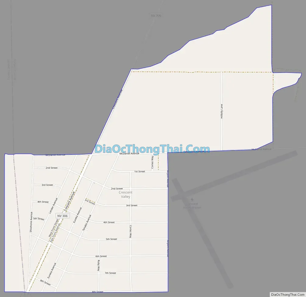
Crescent Valley Road Map
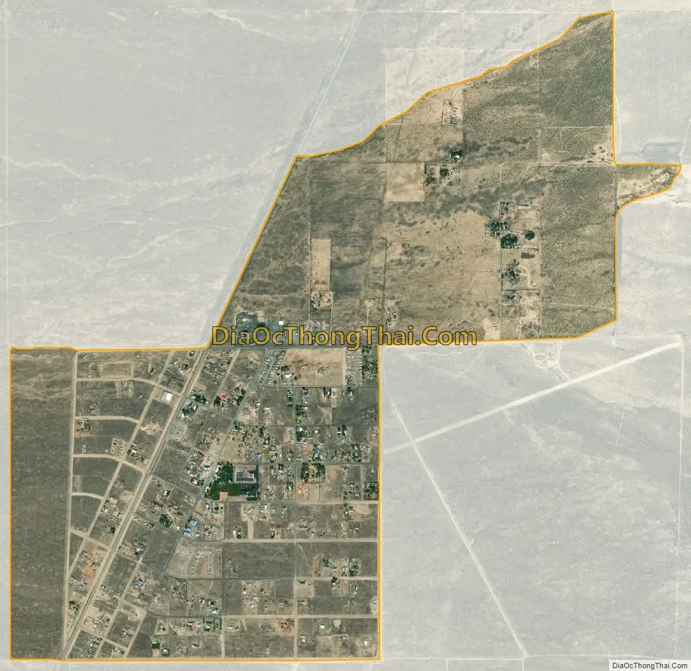
Crescent Valley city Satellite Map
Geography
Crescent Valley is located along the western border of Eureka County, 19 miles (31 km) south of Interstate 80 and 87 miles (140 km) north of Austin. According to the U.S. Census Bureau, the Crescent Valley CDP has an area of 2.2 square miles (5.8 km), all of it land. The town itself is about 1 mile in length and width with houses and streets on the outskirts reaching as far as 2 miles south and .6 miles north.
See also
Map of Nevada State and its subdivision: Map of other states:- Alabama
- Alaska
- Arizona
- Arkansas
- California
- Colorado
- Connecticut
- Delaware
- District of Columbia
- Florida
- Georgia
- Hawaii
- Idaho
- Illinois
- Indiana
- Iowa
- Kansas
- Kentucky
- Louisiana
- Maine
- Maryland
- Massachusetts
- Michigan
- Minnesota
- Mississippi
- Missouri
- Montana
- Nebraska
- Nevada
- New Hampshire
- New Jersey
- New Mexico
- New York
- North Carolina
- North Dakota
- Ohio
- Oklahoma
- Oregon
- Pennsylvania
- Rhode Island
- South Carolina
- South Dakota
- Tennessee
- Texas
- Utah
- Vermont
- Virginia
- Washington
- West Virginia
- Wisconsin
- Wyoming