Verdi (/ˈvɜːrdaɪ/ VUR-dye) is a census-designated place (CDP) in Washoe County, Nevada, United States. It is on the western side of the Reno–Sparks Metropolitan Statistical Area, near Interstate 80. The CDP of Verdi, California lies immediately adjacent across the state line. Both are in the shadow of California’s Verdi Range. In 2010, the population was 1,415. Prior to 2010, the community was listed by the U.S. Census Bureau as part of the Verdi-Mogul CDP.
| Name: | Verdi CDP |
|---|---|
| LSAD Code: | 57 |
| LSAD Description: | CDP (suffix) |
| State: | Nevada |
| County: | Washoe County |
| Elevation: | 4,899 ft (1,493 m) |
| Total Area: | 3.43 sq mi (8.89 km²) |
| Land Area: | 3.31 sq mi (8.58 km²) |
| Water Area: | 0.12 sq mi (0.30 km²) |
| Total Population: | 1,396 |
| Population Density: | 421.24/sq mi (162.63/km²) |
| ZIP code: | 89439 |
| FIPS code: | 3279400 |
| GNISfeature ID: | 0861844 |
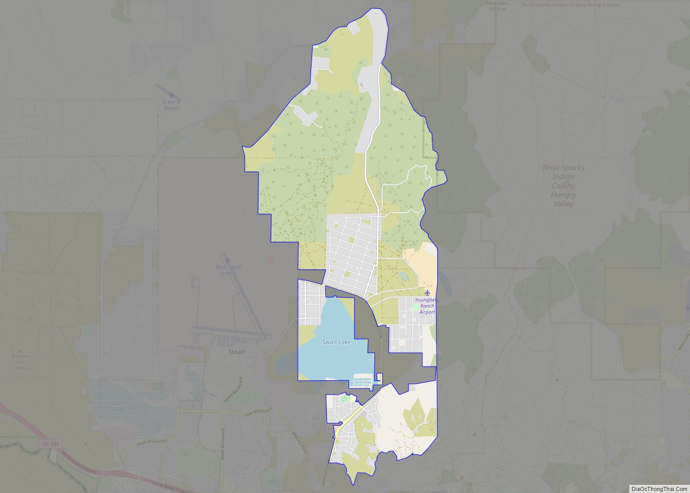
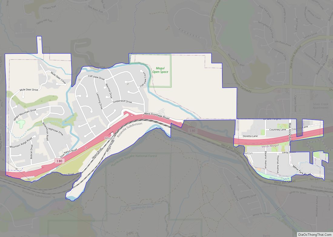
Online Interactive Map
Click on ![]() to view map in "full screen" mode.
to view map in "full screen" mode.
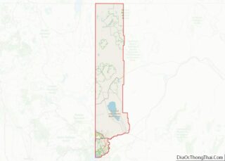
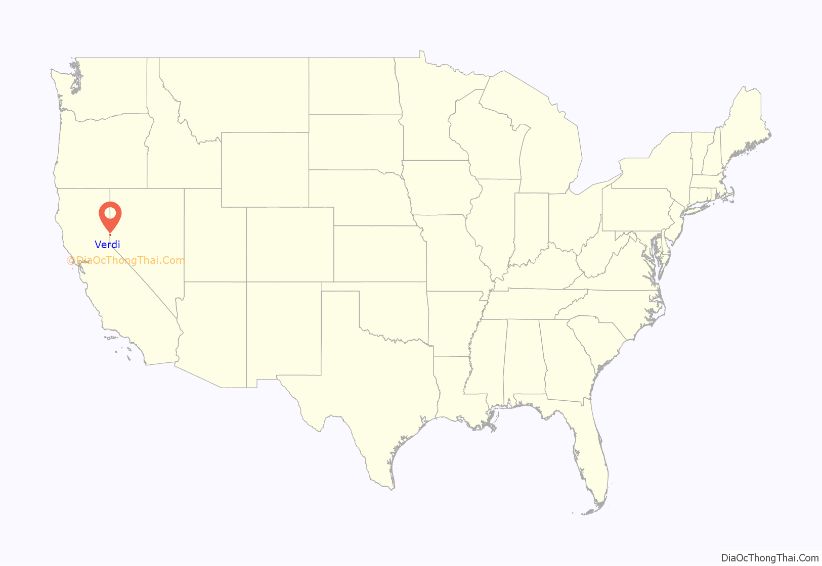
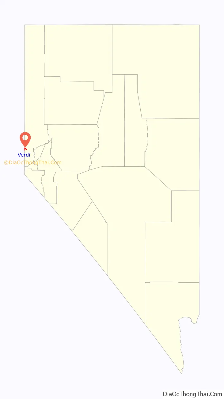
Verdi location map. Where is Verdi CDP?
History
Originally known as O’Neils Crossing, for the man who built a bridge there in 1860.
Name
The town of Verdi was named after Giuseppe Verdi by Charles Crocker, founder of the Central Pacific Railroad, when he pulled a slip of paper from a hat and read the name of the Italian opera composer in 1868. The name is pronounced by the local population as VUR-dye.
1870 train robbery
On the 4th of November 1870, five men robbed a train travelling from San Francisco to Virginia City near Verdi after blocking the track. The train was carrying approximately $60,000 of gold and silver, and the robbers were able to get away with approximately $41,000. The same train was robbed for a second time near Pequop, Nevada in Elko County.
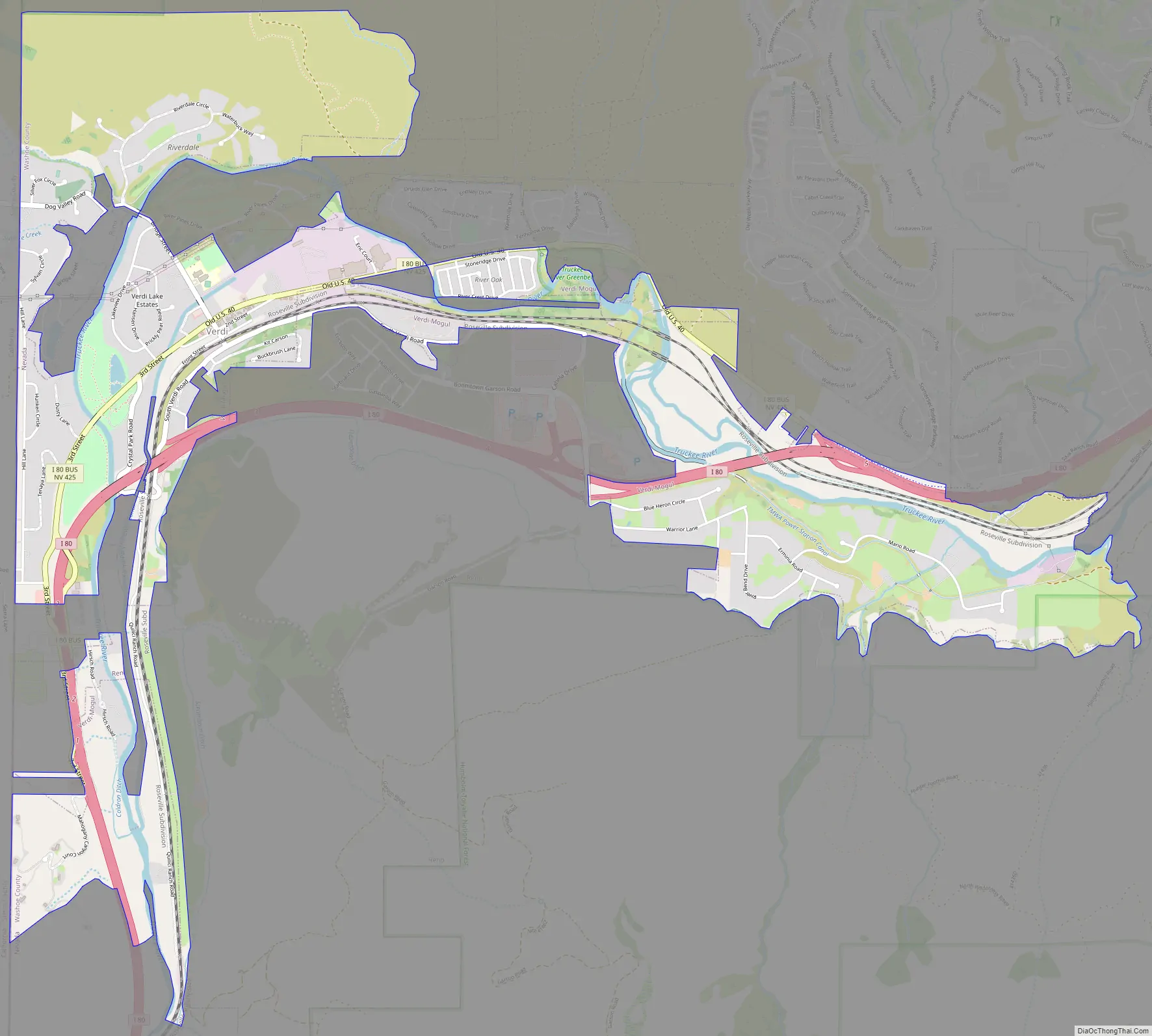
Verdi Road Map
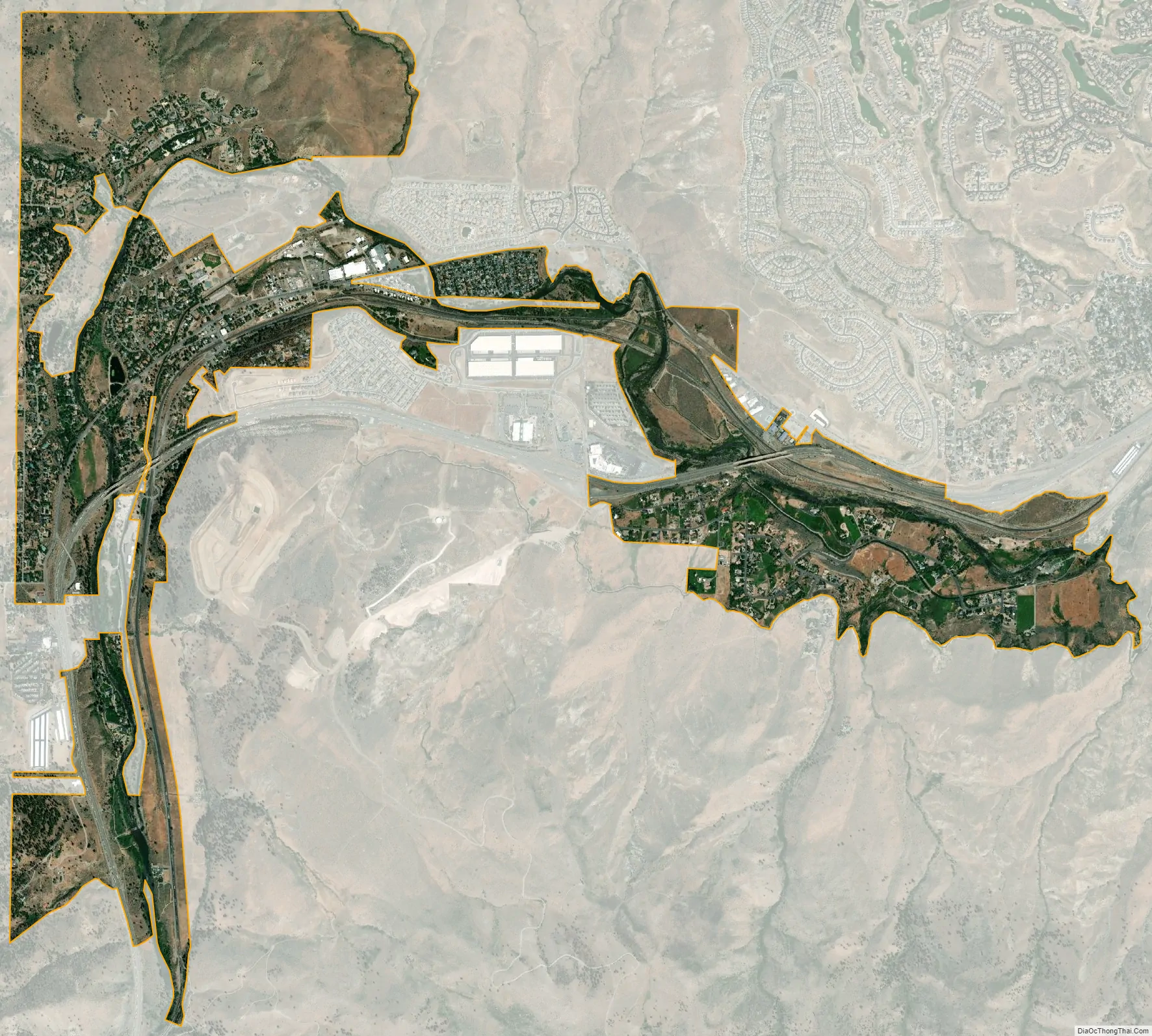
Verdi city Satellite Map
Geography
Verdi is located at 39°31′6″N 119°59′19″W / 39.51833°N 119.98861°W / 39.51833; -119.98861 (39.5183, -119.9887) on the western border of Nevada, adjacent to the California state line.
The CDP has a total area of 3.5 square miles (9.0 km), of which 3.4 square miles (8.7 km) is land and 0.12 square miles (0.3 km), or 3.35%, is water.
2008 earthquake swarm
In February 2008 an earthquake swarm began, and ended in June 2008. The total number of earthquakes in the census-designated place reached over 5,000 and ranged in magnitude from 0.7 to 4.7 on the Richter magnitude scale.
See also
Map of Nevada State and its subdivision: Map of other states:- Alabama
- Alaska
- Arizona
- Arkansas
- California
- Colorado
- Connecticut
- Delaware
- District of Columbia
- Florida
- Georgia
- Hawaii
- Idaho
- Illinois
- Indiana
- Iowa
- Kansas
- Kentucky
- Louisiana
- Maine
- Maryland
- Massachusetts
- Michigan
- Minnesota
- Mississippi
- Missouri
- Montana
- Nebraska
- Nevada
- New Hampshire
- New Jersey
- New Mexico
- New York
- North Carolina
- North Dakota
- Ohio
- Oklahoma
- Oregon
- Pennsylvania
- Rhode Island
- South Carolina
- South Dakota
- Tennessee
- Texas
- Utah
- Vermont
- Virginia
- Washington
- West Virginia
- Wisconsin
- Wyoming