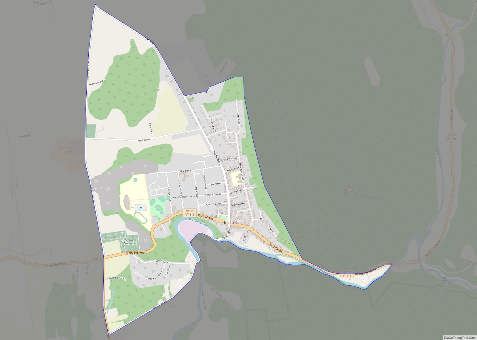
Bristol is the main settlement in the town of Bristol in Addison County, Vermont, United States, and a census-designated place (CDP). The population was 1,936 at the 2020 census, out of a total population of 3,782 in the town of Bristol.
| Name: | Bristol CDP |
|---|---|
| LSAD Code: | 57 |
| LSAD Description: | CDP (suffix) |
| State: | Vermont |
| County: | Addison County |
| Elevation: | 571 ft (174 m) |
| Total Area: | 2.15 sq mi (5.58 km²) |
| Land Area: | 2.13 sq mi (5.51 km²) |
| Water Area: | 0.03 sq mi (0.07 km²) |
| Total Population: | 1,936 |
| Population Density: | 900/sq mi (350/km²) |
| ZIP code: | 05443 |
| Area code: | 802 |
| FIPS code: | 5008950 |
| GNISfeature ID: | 1460661 |
Online Interactive Map
Click on ![]() to view map in "full screen" mode.
to view map in "full screen" mode.
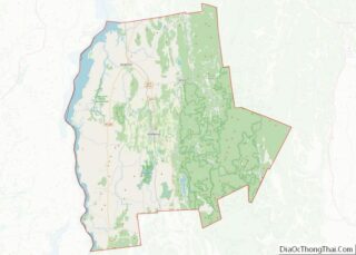
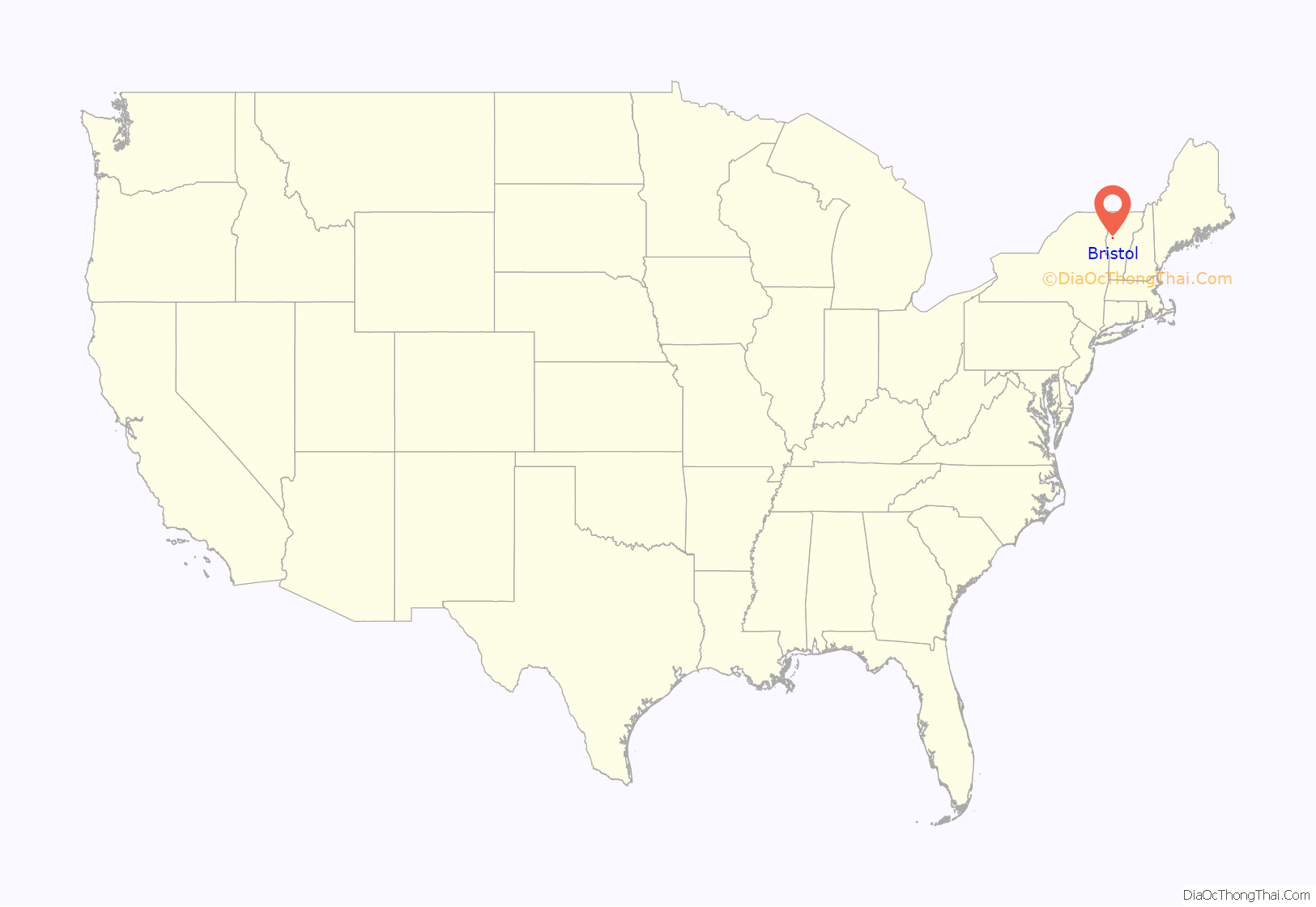
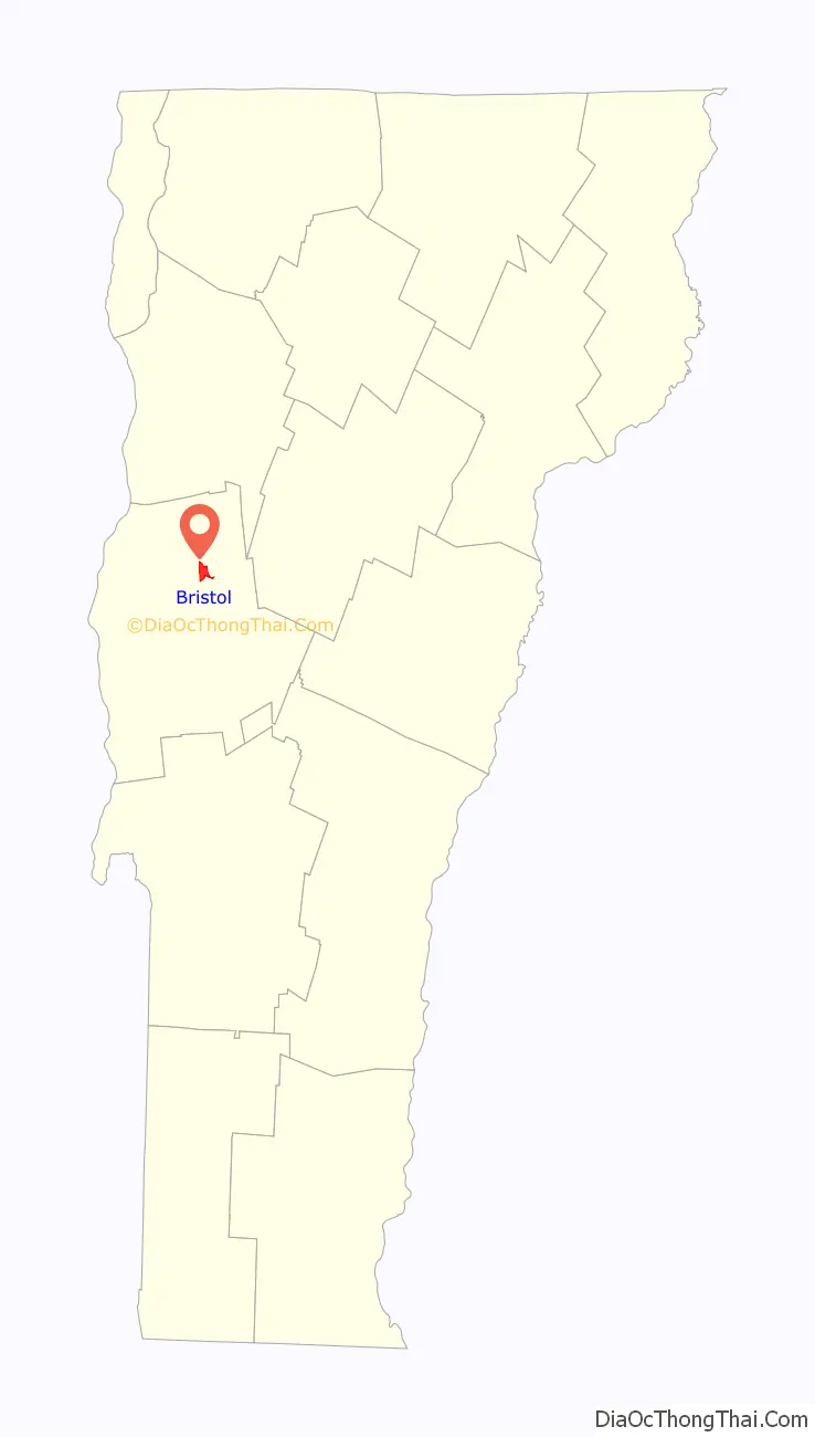
Bristol location map. Where is Bristol CDP?
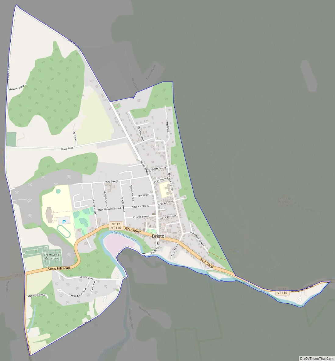
Bristol Road Map
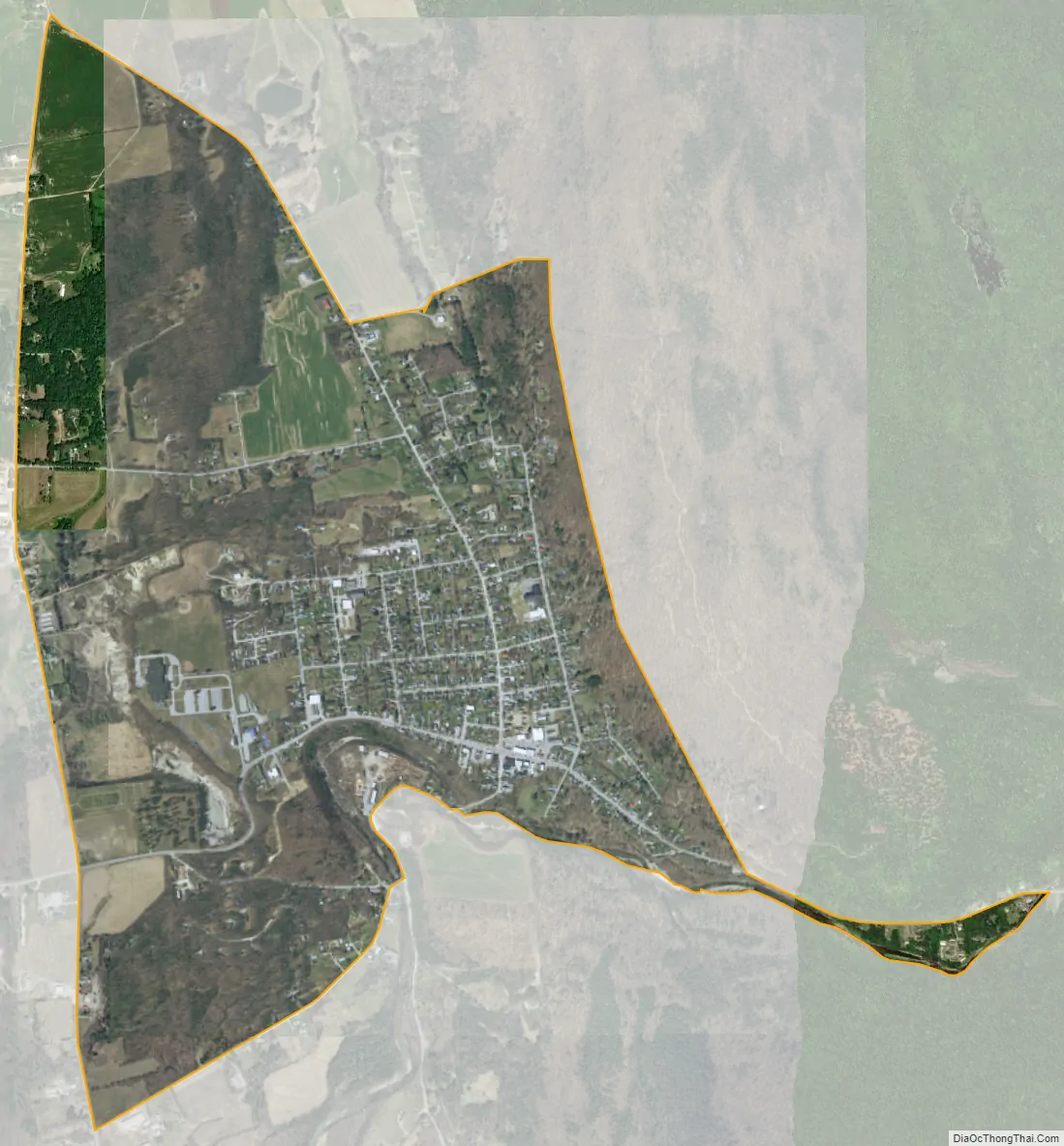
Bristol city Satellite Map
Geography
The Bristol CDP is located in the northwest part of the town of Bristol, on the north side of the New Haven River as it exits the Green Mountains to the east. Vermont Route 17 passes through the community, leading west 5 miles (8 km) to U.S. Route 7 at New Haven Junction and east across the Green Mountains through Appalachian Gap 20 miles (32 km) to Waitsfield. Vermont Route 116 runs with VT 17 through Bristol but leads north 8 miles (13 km) to Starksboro and south 12 miles (19 km) to East Middlebury.
According to the United States Census Bureau, the Bristol CDP has a total area of 2.15 square miles (5.58 km), of which 2.13 square miles (5.51 km) is land and 0.03 square miles (0.07 km), or 1.24%, is water.
See also
Map of Vermont State and its subdivision: Map of other states:- Alabama
- Alaska
- Arizona
- Arkansas
- California
- Colorado
- Connecticut
- Delaware
- District of Columbia
- Florida
- Georgia
- Hawaii
- Idaho
- Illinois
- Indiana
- Iowa
- Kansas
- Kentucky
- Louisiana
- Maine
- Maryland
- Massachusetts
- Michigan
- Minnesota
- Mississippi
- Missouri
- Montana
- Nebraska
- Nevada
- New Hampshire
- New Jersey
- New Mexico
- New York
- North Carolina
- North Dakota
- Ohio
- Oklahoma
- Oregon
- Pennsylvania
- Rhode Island
- South Carolina
- South Dakota
- Tennessee
- Texas
- Utah
- Vermont
- Virginia
- Washington
- West Virginia
- Wisconsin
- Wyoming