Concord is a census-designated place comprising the main settlement in the town of Concord, Essex County, Vermont, United States. As of the 2010 census, it had a population of 271, out of a total town population of 1,235.
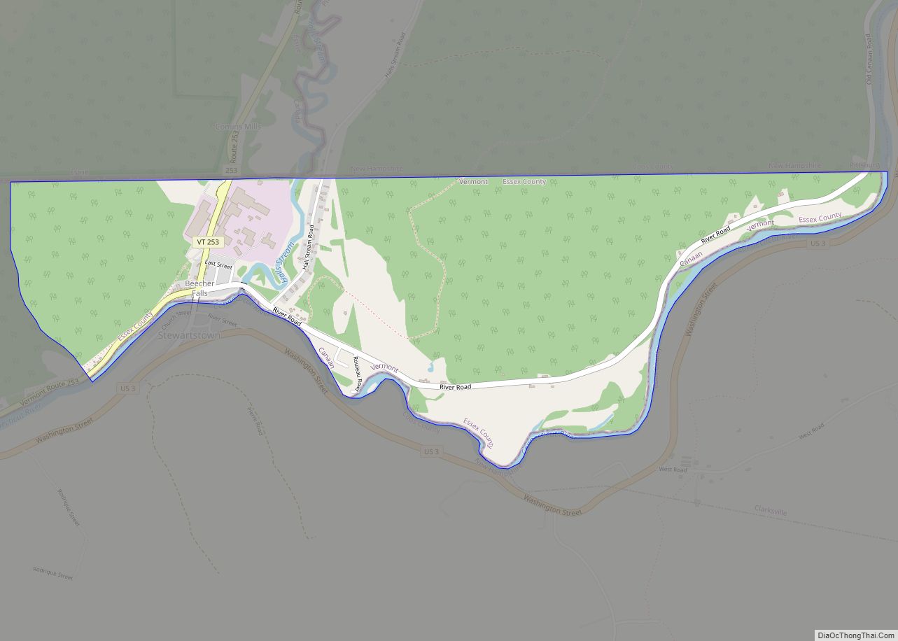
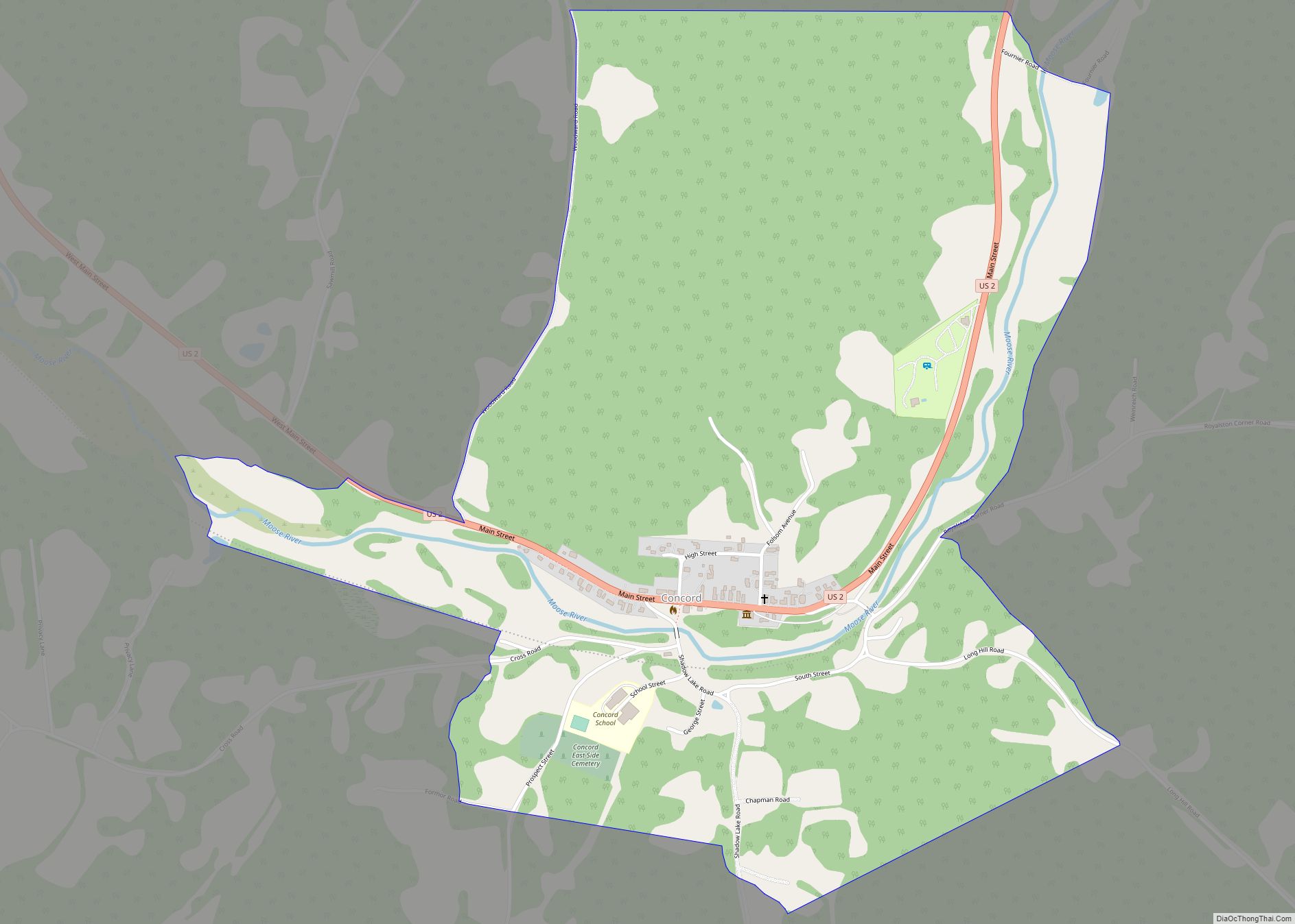
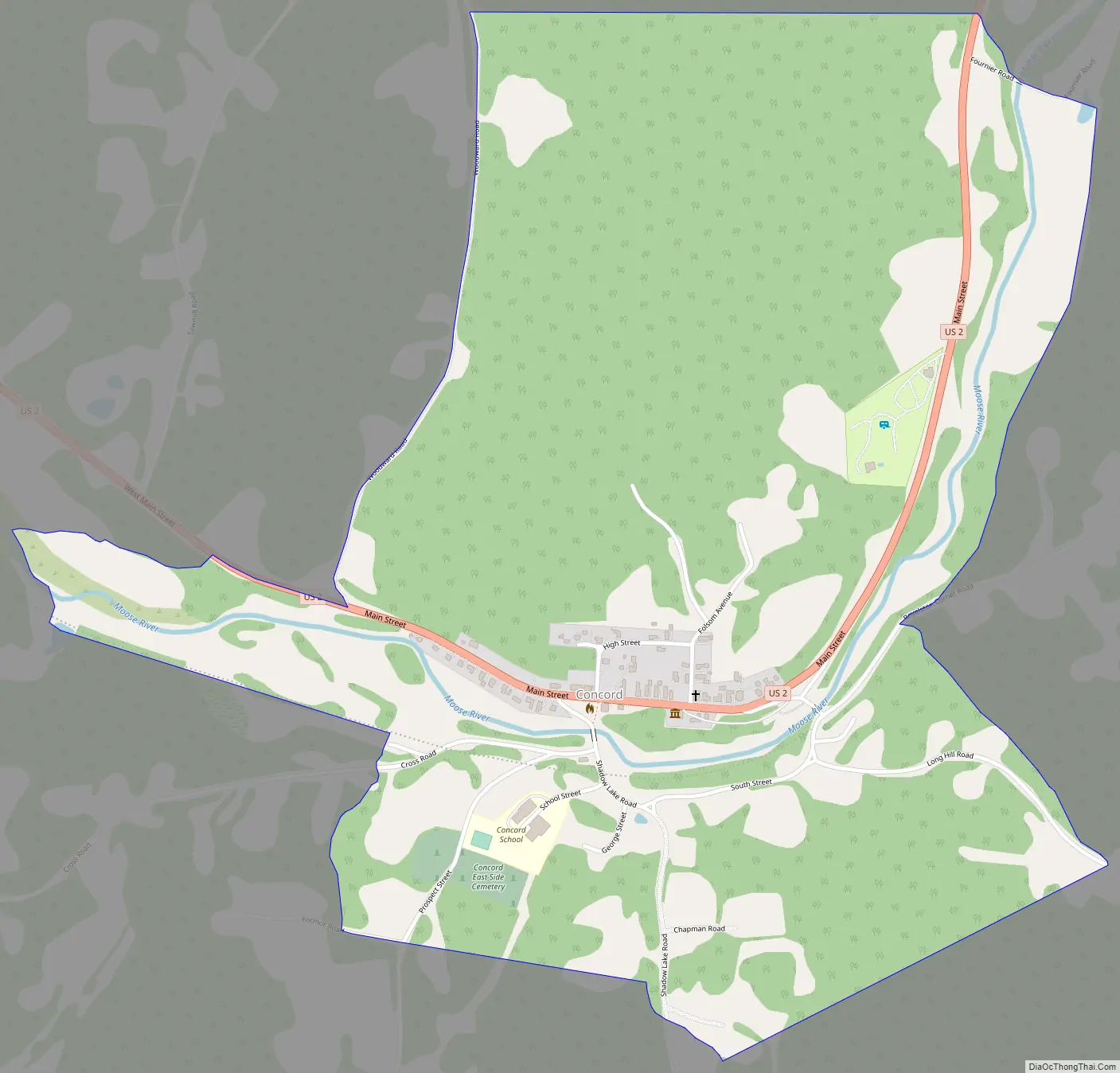
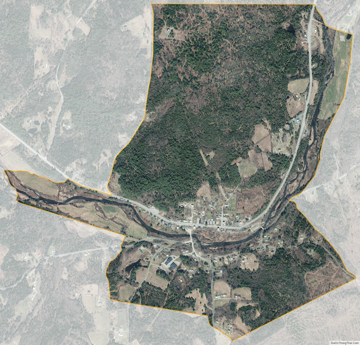
The Concord CDP is in the western part of the town of Concord, along the Moose River, a west-flowing tributary of the Passumpsic River and part of the Connecticut River basin. U.S. Route 2 passes through the center of the CDP, leading west 8 miles (13 km) to St. Johnsbury and east 20 miles (32 km) to Lancaster, New Hampshire.
The Concord CDP has a total area of 1.1 square miles (2.9 km), of which 0.027 square miles (0.07 km), or 2.50%, is water.
| Name: | Concord CDP |
|---|---|
| LSAD Code: | 57 |
| LSAD Description: | CDP (suffix) |
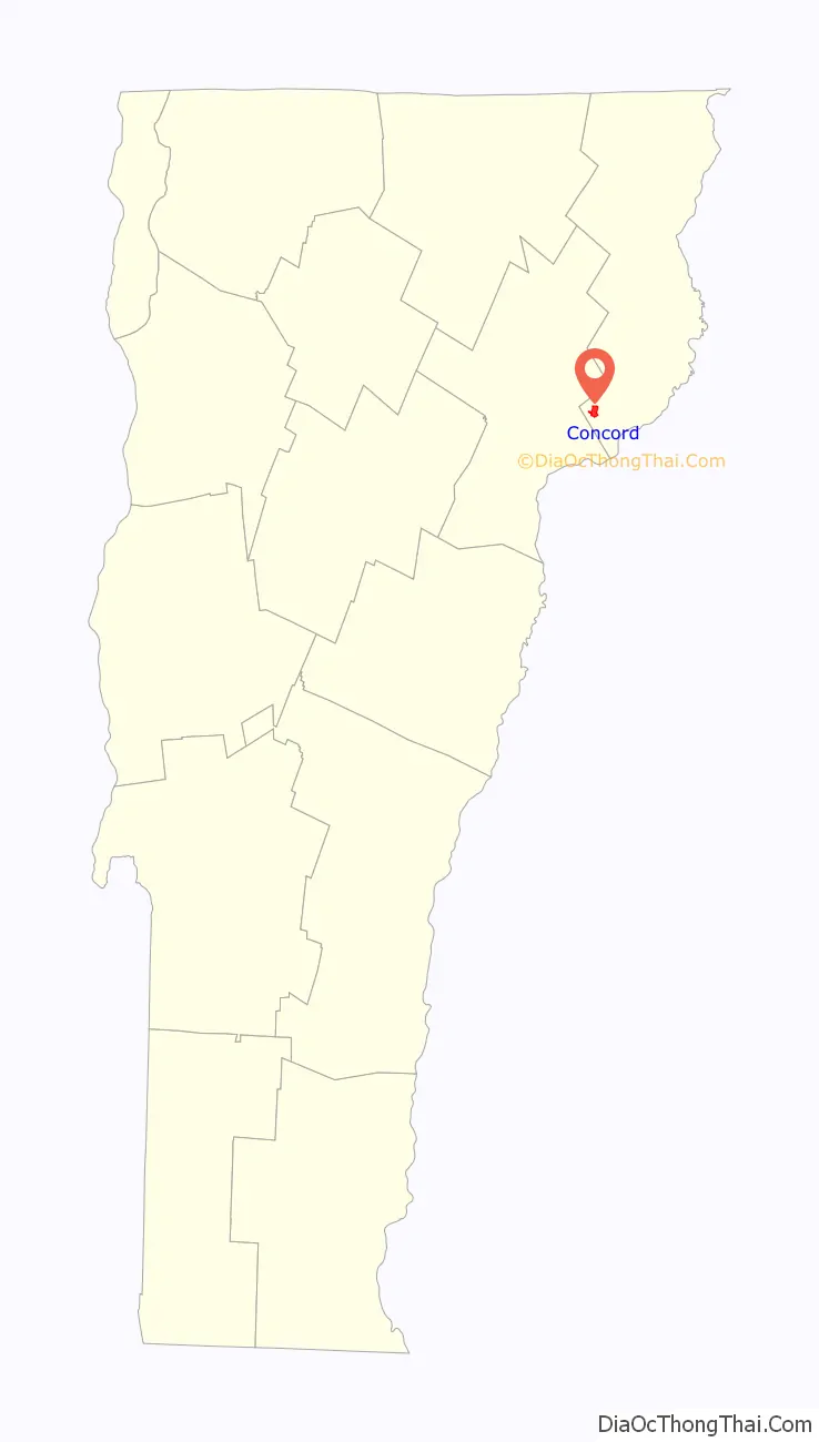
| State: | Vermont |
| County: | Essex County |
| Elevation: | 880 ft (270 m) |
| Total Area: | 1.13 sq mi (2.92 km²) |
| Land Area: | 1.10 sq mi (2.85 km²) |
| Water Area: | 0.03 sq mi (0.07 km²) |
| Total Population: | 271 |
| Population Density: | 247/sq mi (95.2/km²) |
| ZIP code: | 05824 |
| Area code: | 802 |
| FIPS code: | 5015175 |
| GNISfeature ID: | 1456992 |
Online Interactive Map
Click on ![]() to view map in "full screen" mode.
to view map in "full screen" mode.
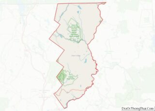
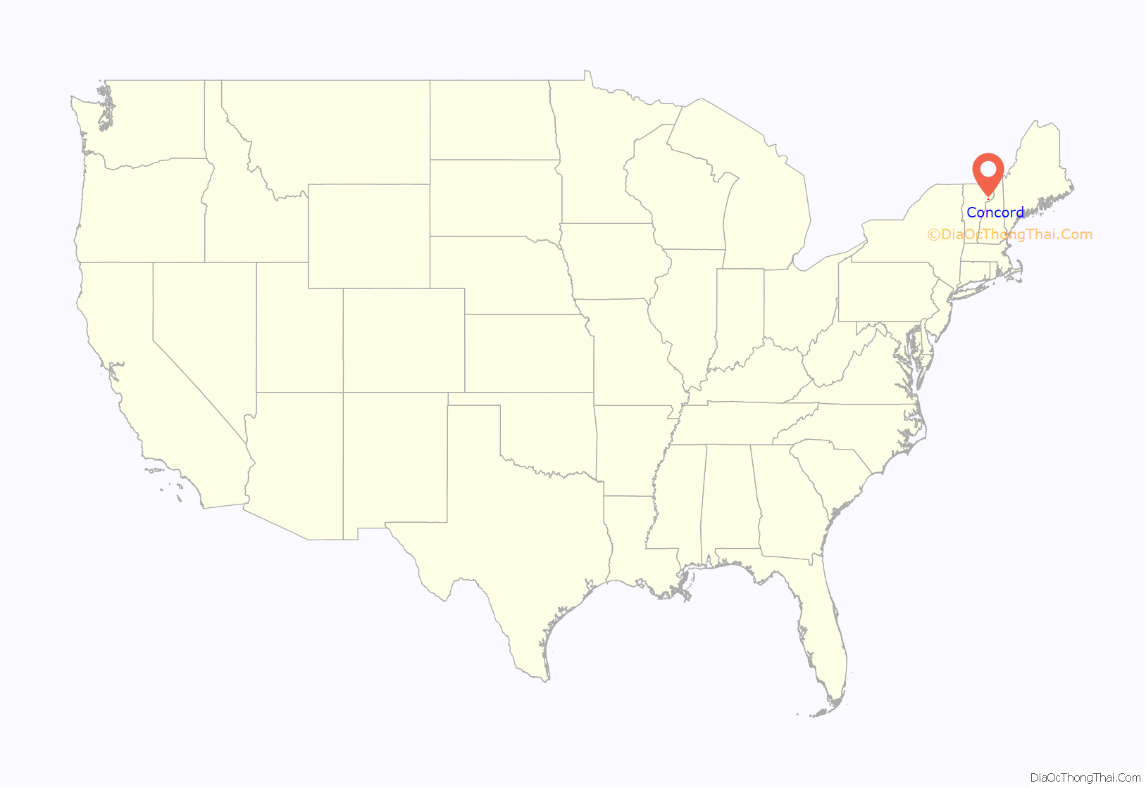
Concord location map. Where is Concord CDP?
Concord Road Map
Concord city Satellite Map
See also
Map of Vermont State and its subdivision: Map of other states:- Alabama
- Alaska
- Arizona
- Arkansas
- California
- Colorado
- Connecticut
- Delaware
- District of Columbia
- Florida
- Georgia
- Hawaii
- Idaho
- Illinois
- Indiana
- Iowa
- Kansas
- Kentucky
- Louisiana
- Maine
- Maryland
- Massachusetts
- Michigan
- Minnesota
- Mississippi
- Missouri
- Montana
- Nebraska
- Nevada
- New Hampshire
- New Jersey
- New Mexico
- New York
- North Carolina
- North Dakota
- Ohio
- Oklahoma
- Oregon
- Pennsylvania
- Rhode Island
- South Carolina
- South Dakota
- Tennessee
- Texas
- Utah
- Vermont
- Virginia
- Washington
- West Virginia
- Wisconsin
- Wyoming