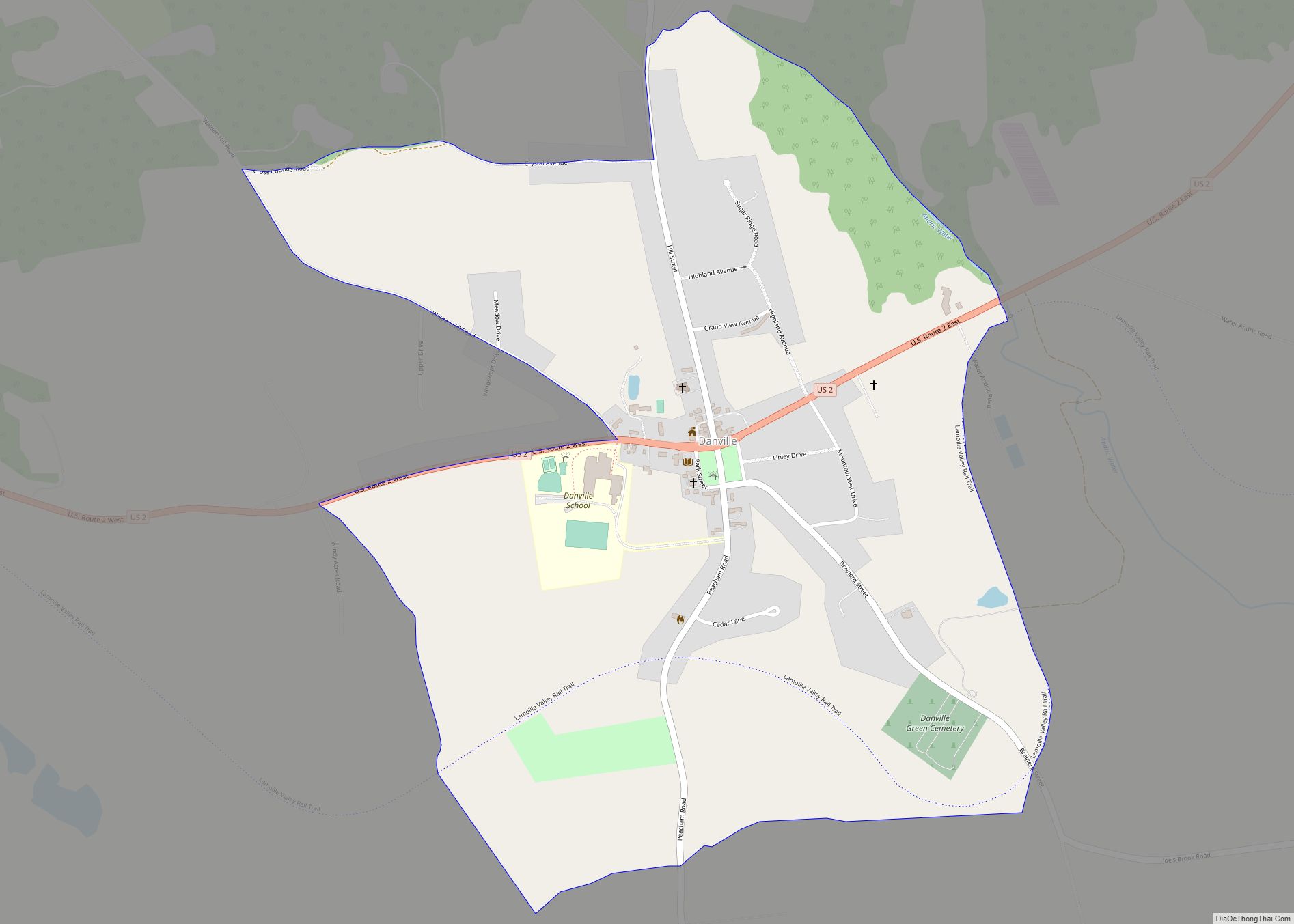
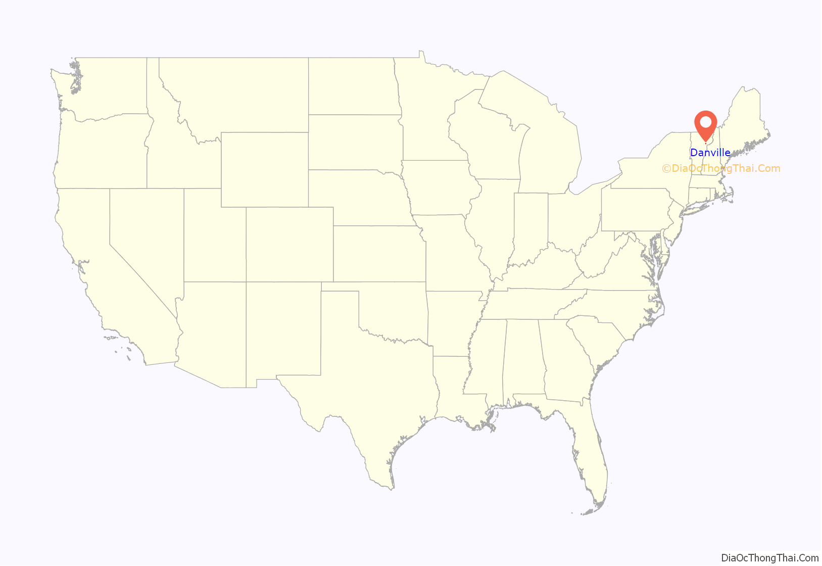
Danville is the primary village and a census-designated place (CDP) in the town of Danville, Caledonia County, Vermont, United States. As of the 2020 census, the CDP had a population of 385, out of 2,335 in the entire town of Danville.
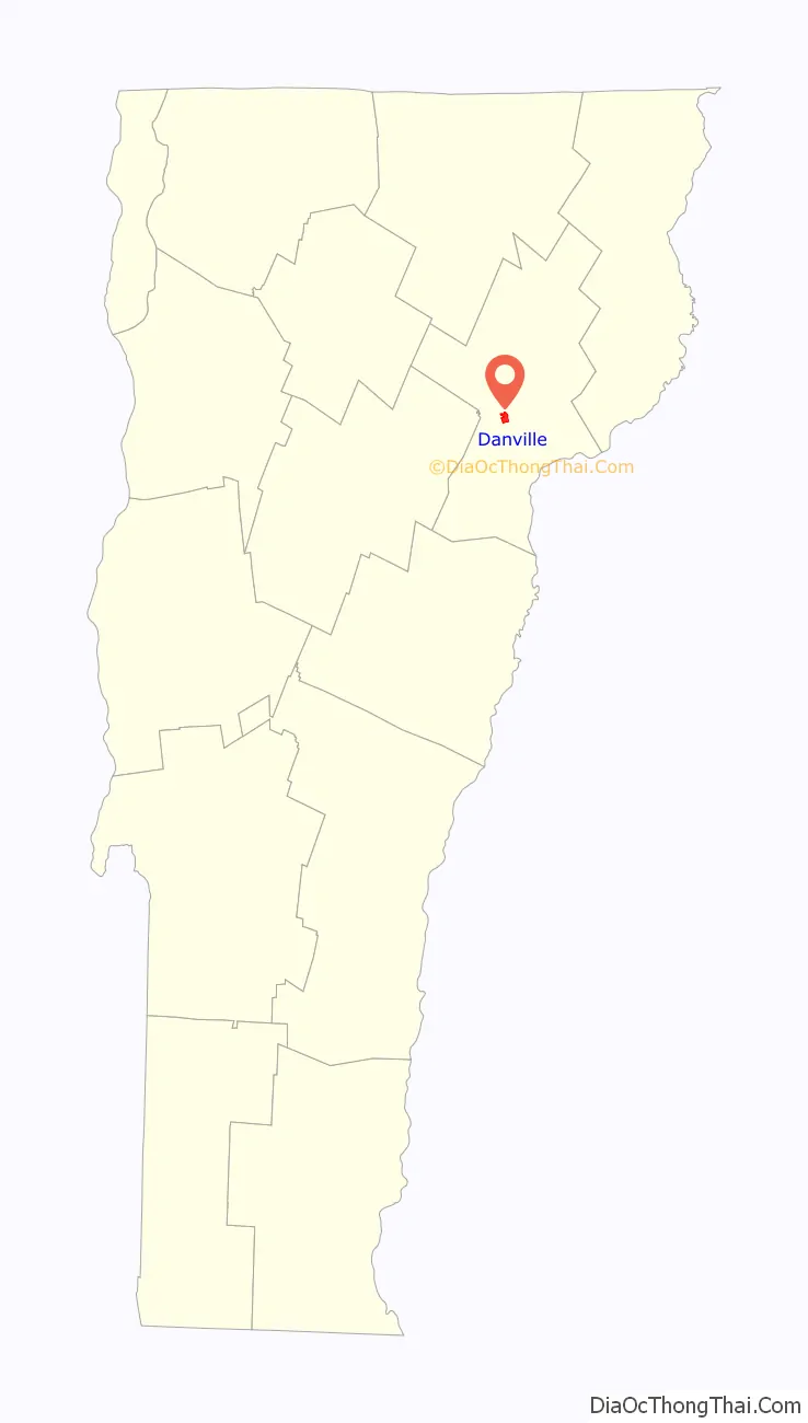
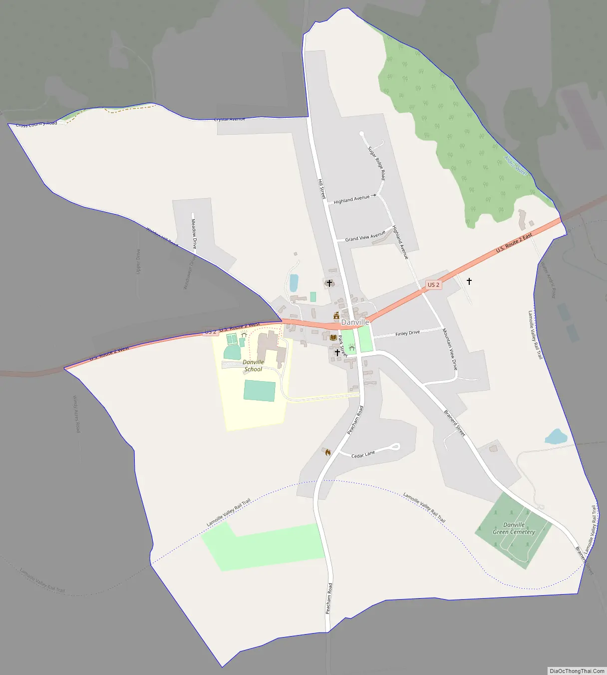
The village is in west-central Caledonia County, south of the center of the town of Danville. U.S. Route 2 passes through the village, leading east 8 miles (13 km) to St. Johnsbury and southwest 27 miles (43 km) to Montpelier, the state capital. The village drains south to Brown Brook, a tributary of Joes Brook, and east to Water Andric. Joes Brook and Water Andric both flow southeast to the Passumpsic River, a south-flowing tributary of the Connecticut River.
| Name: | Danville CDP |
|---|---|
| LSAD Code: | 57 |
| LSAD Description: | CDP (suffix) |
| State: | Vermont |
| County: | Caledonia County |
| Elevation: | 1,421 ft (433 m) |
| Total Area: | 1.03 sq mi (2.66 km²) |
| Land Area: | 1.02 sq mi (2.65 km²) |
| Water Area: | 0.00 sq mi (0.00 km²) |
| ZIP code: | 05828 |
| Area code: | 802 |
| FIPS code: | 5017050 |
| GNISfeature ID: | 2586626 |
Online Interactive Map
Click on ![]() to view map in "full screen" mode.
to view map in "full screen" mode.
Danville location map. Where is Danville CDP?
Danville Road Map
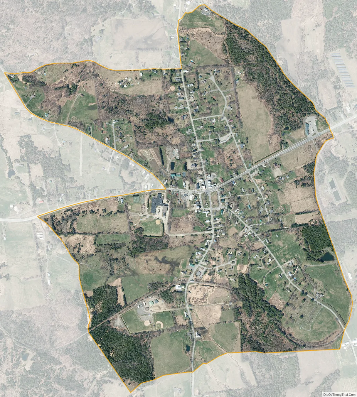
Danville city Satellite Map
See also
Map of Vermont State and its subdivision: Map of other states:- Alabama
- Alaska
- Arizona
- Arkansas
- California
- Colorado
- Connecticut
- Delaware
- District of Columbia
- Florida
- Georgia
- Hawaii
- Idaho
- Illinois
- Indiana
- Iowa
- Kansas
- Kentucky
- Louisiana
- Maine
- Maryland
- Massachusetts
- Michigan
- Minnesota
- Mississippi
- Missouri
- Montana
- Nebraska
- Nevada
- New Hampshire
- New Jersey
- New Mexico
- New York
- North Carolina
- North Dakota
- Ohio
- Oklahoma
- Oregon
- Pennsylvania
- Rhode Island
- South Carolina
- South Dakota
- Tennessee
- Texas
- Utah
- Vermont
- Virginia
- Washington
- West Virginia
- Wisconsin
- Wyoming